Santa Rosa Xtampak, Mexico.
Finding the Elusive Chenes Capital in the Campeche Forest.
Looking for concrete details and tips? Go straight to the Practical Information section.
I was alone. Around me, I could hear nothing but the forest. Between the trees appeared ancient walls, there for more than a thousand years. It was late afternoon and the dense canopy above me was preventing most of the sunlight from coming through.
This made the settings even more mysterious. I stood in the middle of the forest, at least ninety minutes away from the nearest human settlement, among quiet ruins, and the lack of light meant I couldn’t see much further than a hundred feet away.
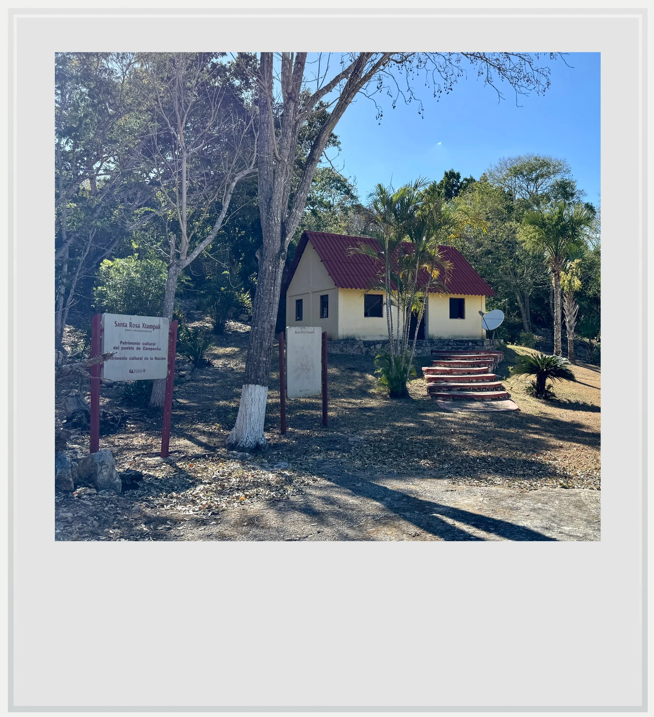
Although I could only see fragments through the forest, they aligned into something coherent: this was not a scattering of buildings, but a city. I was in Santa Rosa Xtampak, one of the most remote Maya sites in Mexico, once the capital of the Chenes region. Walking along the massive buildings, I could tell it had once been a powerful city, its scale suggesting regional dominance.
While not as obvious a projection of strength as the massive pyramids of Calakmul or Chichen Itza, the buildings at Santa Rosa Xtampak clearly suggested a center of authority. In fact, although the site main’s occupation is understood to have lasted 600 years, during the peak of the Maya civilization (400 to 1000 AD), there are signs the settlement was inhabited as early as a thousand years before the Current Era.
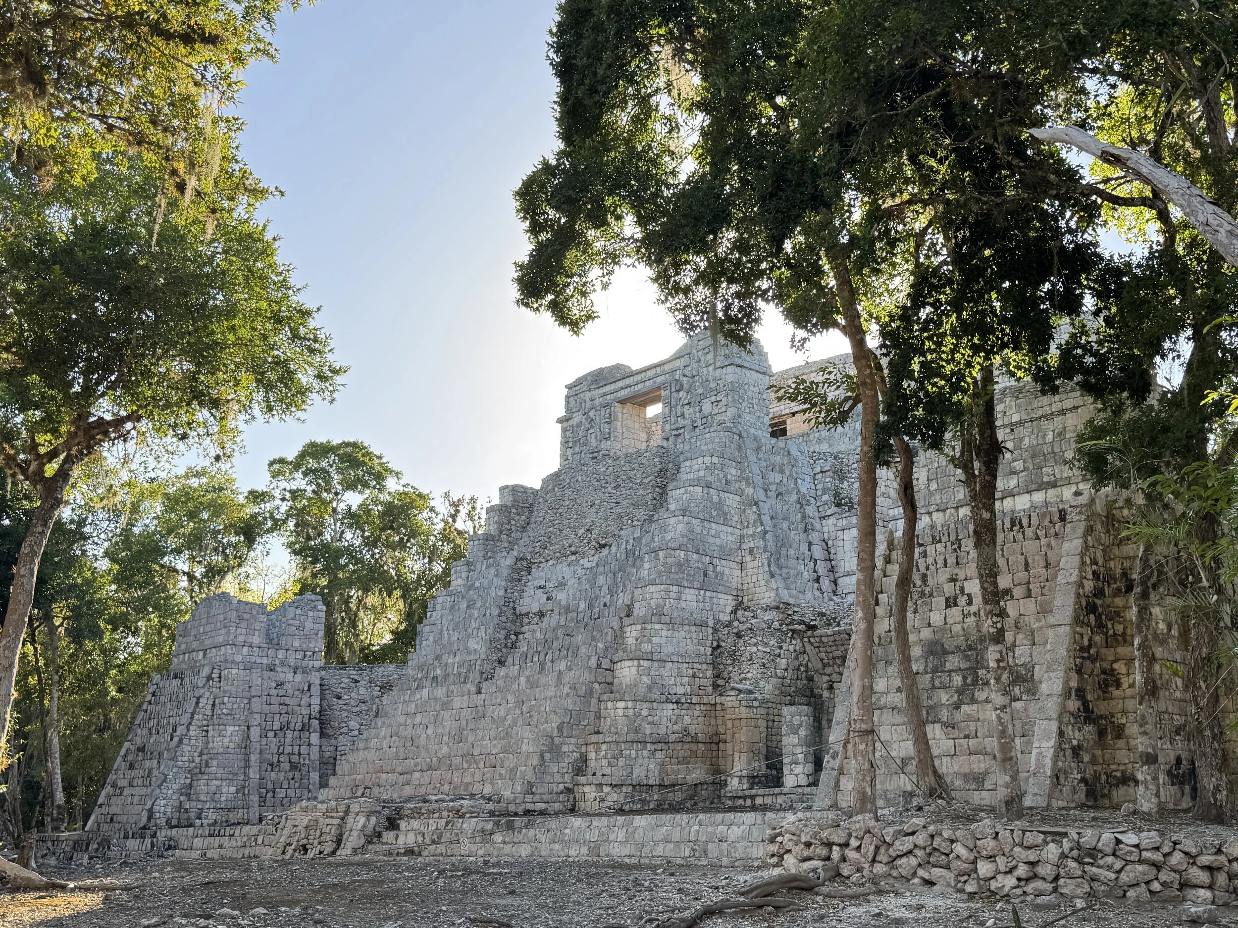
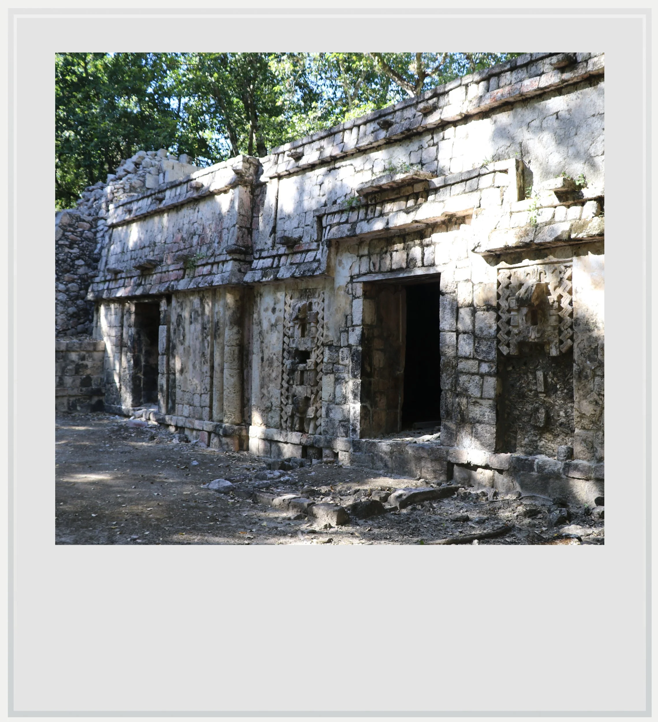
El Cuartel in Santa Rosa Xtampak.
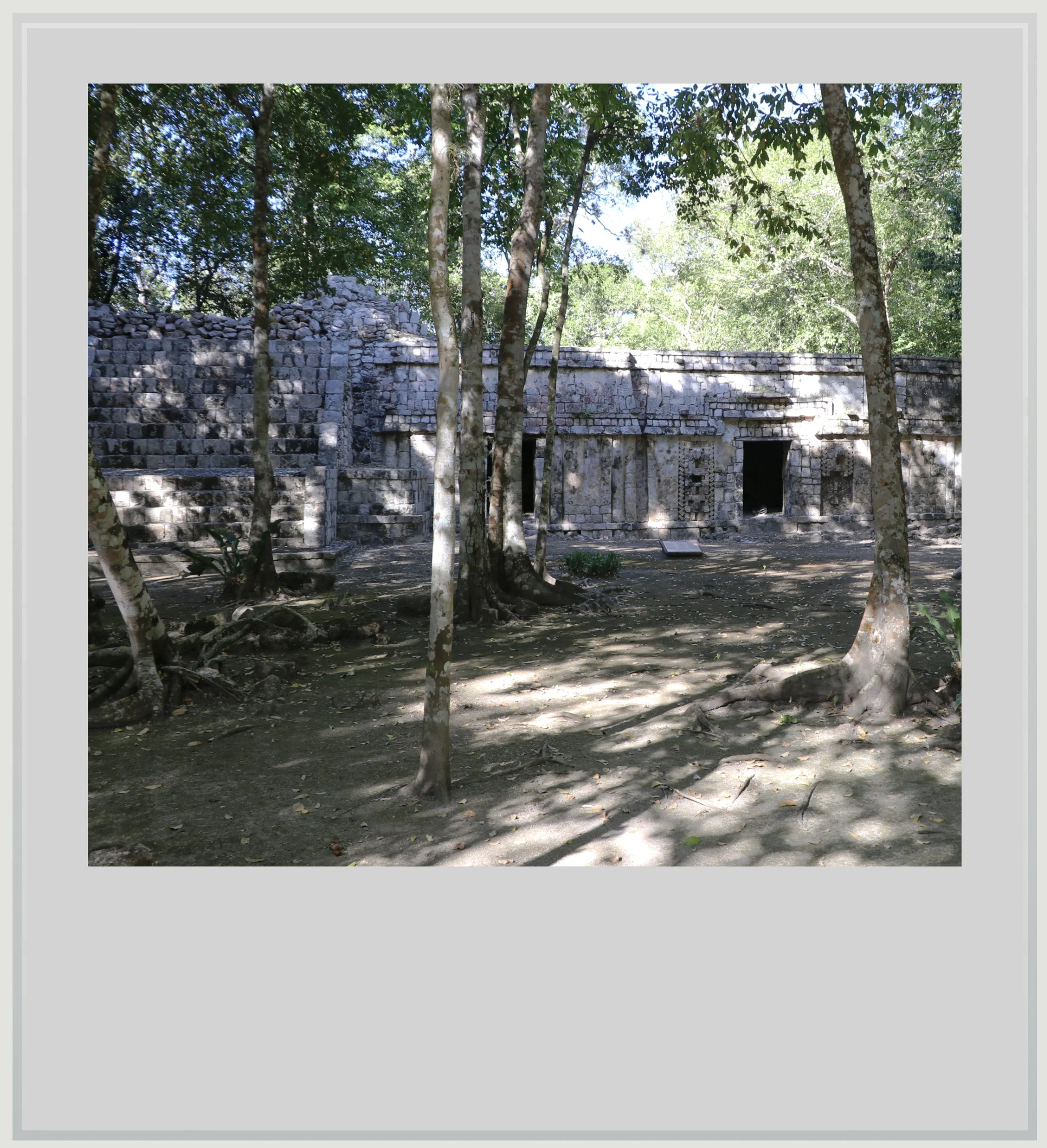
Coming up on the site, I first saw an immense wall, that seemed part of a fortified compound, whose height felt humbling. It was erroneously nicknamed The Barracks (El Cuartel), but it had no military use. It was in fact a residence for Xtampak’s elite. This became obvious once I entered the central plaza it anchored. It felt like a more complete versions of Chenes-style plazas I would see a few days later in Hochob or El Tabasqueño.
Several one-story buildings, most likely houses, encircled a rather intimate inner court now taken over by trees. At first glance, the space felt flat. Only after a moment did I notice stairs leading to what must have been second-floor structures atop some of the buildings.
A few of the buildings featured nicely sculpted doors with carved masks, typical of the Chenes architecture, although most on this plaza weren’t extremely well preserved. It was still stunning to see several of them in close succession.
Exiting the Cuartel, the path divided and the only reason I turned right was that I could discern additional buildings in the forest in that direction. After a minute, I arrived in front of the most important building on site, the Palace. At the western end of a wider plaza, and somewhat hidden by trees, the structure was strikingly different from other Maya temples or palaces. Where I expected to see a grand ceremonial edifice meant to impress stood a beautiful construction that felt much harder to immediately comprehend.
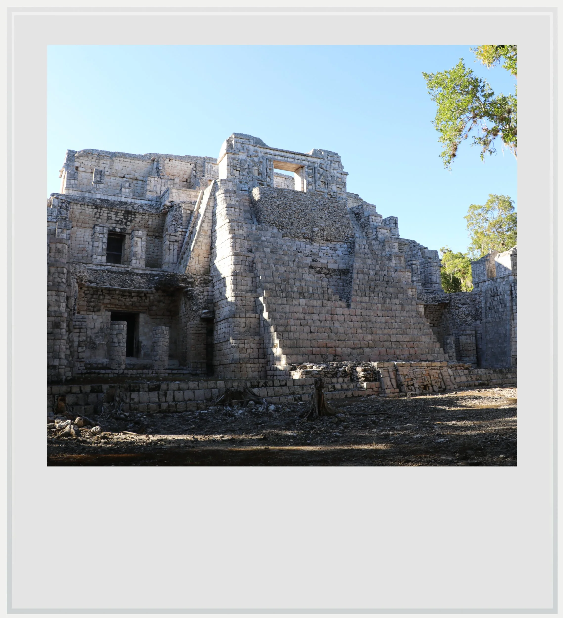
The front façade of the Palace.
There were not many windows on the façade facing the plaza, but a Chenes-style door at the top of very steep stairs. Yet the building felt that it was more than a ceremonial center. The answer lay on the back: when I walked around the building, I noticed, behind the imposing façade, that there were whole floors of living quarters, seemingly hidden.
The palace actually had forty-two rooms with multiple staircases and hallways connecting all of them, mostly away from view, a clear break from traditional Maya architecture. Historians understand this to show the palace was likely the residence of the rulers and their court, not just a ceremonial building.
This was not a scattering of buildings, but a city.
Another aspect of the palace I found initially disconcerting was how it mixed Maya design styles. The temple at the very top was a clear execution of a beautiful serpent-mouth door, in pure Chenes style. The building’s façade borrowed elements of the Rio Bec design with steep, unusable stairs carved for decoration and impact. Masonry precision, a staple of the Puuc region architecture, was also notable. I had become so used to seeing these elements separate in other sites that it took me a while to accept that, mixed, they could actually project beauty.
Beyond the palace, the entire area immediately around it was worth more than a cursory look. Especially interesting was the Building with the Serpent Mouth. Named as such by explorer Teobert Maler, it showcased another elaborate Chenes-style serpent-mouth door, where the whole façade was carved into the zoomorphic head of a snake, the doorway serving as its mouth. The serpent, sometimes also understood as being an iguana, was the representation of god Itzamna, the creator god of all things, according to the Maya world vision. Entering through the door meant getting symbolical access to the underworld.
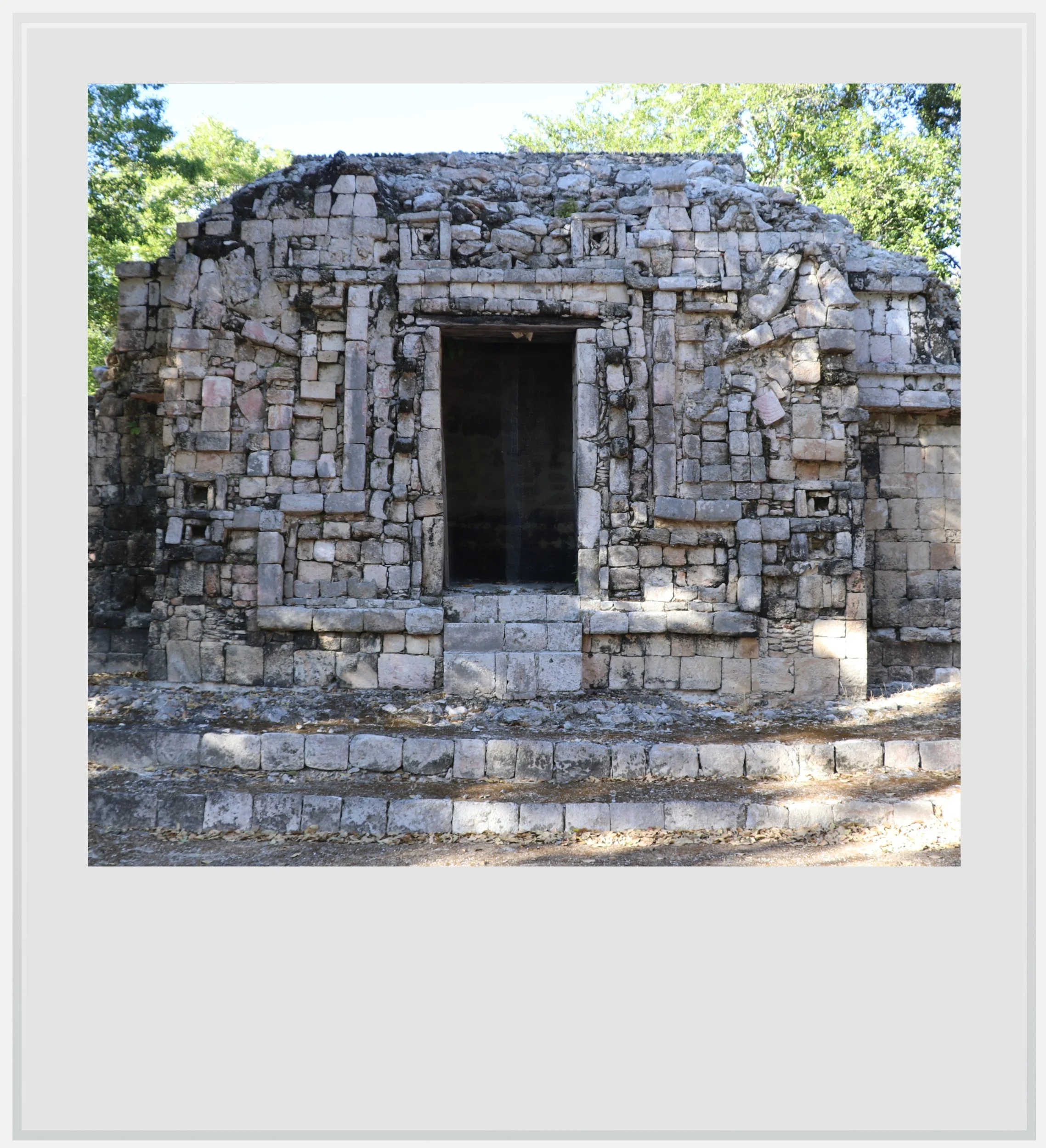
The Building with the Serpent Mouth, on the same plaza as the Palace.
As I walked further into the site, I couldn’t help but think there was a powerful contrast between how the site must have looked then and how it did today. Xtampak was built on top of a hill that was leveled to allow for the construction of several plazas and a few grand buildings. It included chultunes, these underground reservoirs where ancient Mayas stored rainwater to use during the dry season. These enabled Xtampak dwellers to live there year-round, and supported a large population.
Today, the site sits in the middle of the Campeche forests, far from the closest sign of human civilization: the nearest town, Hopelchen, barely 7,000-people strong, is ninety-minutes away on a dirt road full of deep holes, that makes the most motivated traveler think twice about intending a trip there.

I wished I could climb a top one of the biggest structures of the site, what LiDAR reports show could be an immense pyramid, still buried under the jungle, to check if I could see Hopelchen, or any other sign of human activity in the distance, but the terrain looked treacherous, and I stayed on the path.
The rest of the Xtampak site was less visually strong than the Cuartel and the Palace, but still a beautiful walk in a dense forest, with birds as my only companions, letting me stumble upon isolated residential complexes throughout the area.
Chenes doors in El Cuartel.
Santa Rosa Xtampak made a strong impression on me because of what the site meant, and where it was located. It was both a very important site, as the capital of the Chenes regions for centuries, and one that is extremely hard to get to, much more so than other, smaller Chenes sites in the area.
This wasn’t a site for a casual stroll. It required time and intention to even reach. But once there, it felt like a real city. For the first time, I could see how people had lived there: the scale, the layout, the forest all holding together as a coherent whole.
Santa Rosa Xtampak may have been hard to reach, but the visual reward made it worth it.

Practical information
(Everything you could possibly want to know about Santa Rosa Xtampac - updated March 2026)
In a nutshell
Remote and difficult to access, Santa Rosa Xtampak was once the capital of the Chenes region. Reaching it requires a car and patience, but the site’s scale and layout make it feel like a real Maya city rather than a scattering of structures. Allow around two hours to explore it.
Getting to Santa Rosa Xtampac
How to get to Santa Rosa Xtampac from the United States: Santa Rosa Xtampac, in central Campeche, isn’t easy to reach from the US. The closest airport to the site is Campeche (CPE), 3 hours to the west. Campeche is only served by one or two flights a day from Mexico City (MEX) so it isn’t the best airport to consider. Merida (MID) can be a good alternative. Travel time to Santa Rosa Xtampac is 3h30, and Merida sees a lot more frequent flights to Mexico City (14 on a random day in March 2026) as well as non-stop flights to the US (AA flies daily to and from Dallas (DFW) and Miami (MIA), United daily from Houston (IAH) and Viva several times weekly to and from Orlando (MCO) and Miami (MIA).
Getting close!
For additional directions from each airport, please see below. Note that car rental is your best bet to visit the region, and both Campeche and Merida airports offer several local and international options, which were fairly priced at the time of my visit. While the ADO bus company serves the region, with frequent buses between major cities, only SUR, a regional provider, serves the rural area of central Campeche. As such, bus travel isn’t really an option.
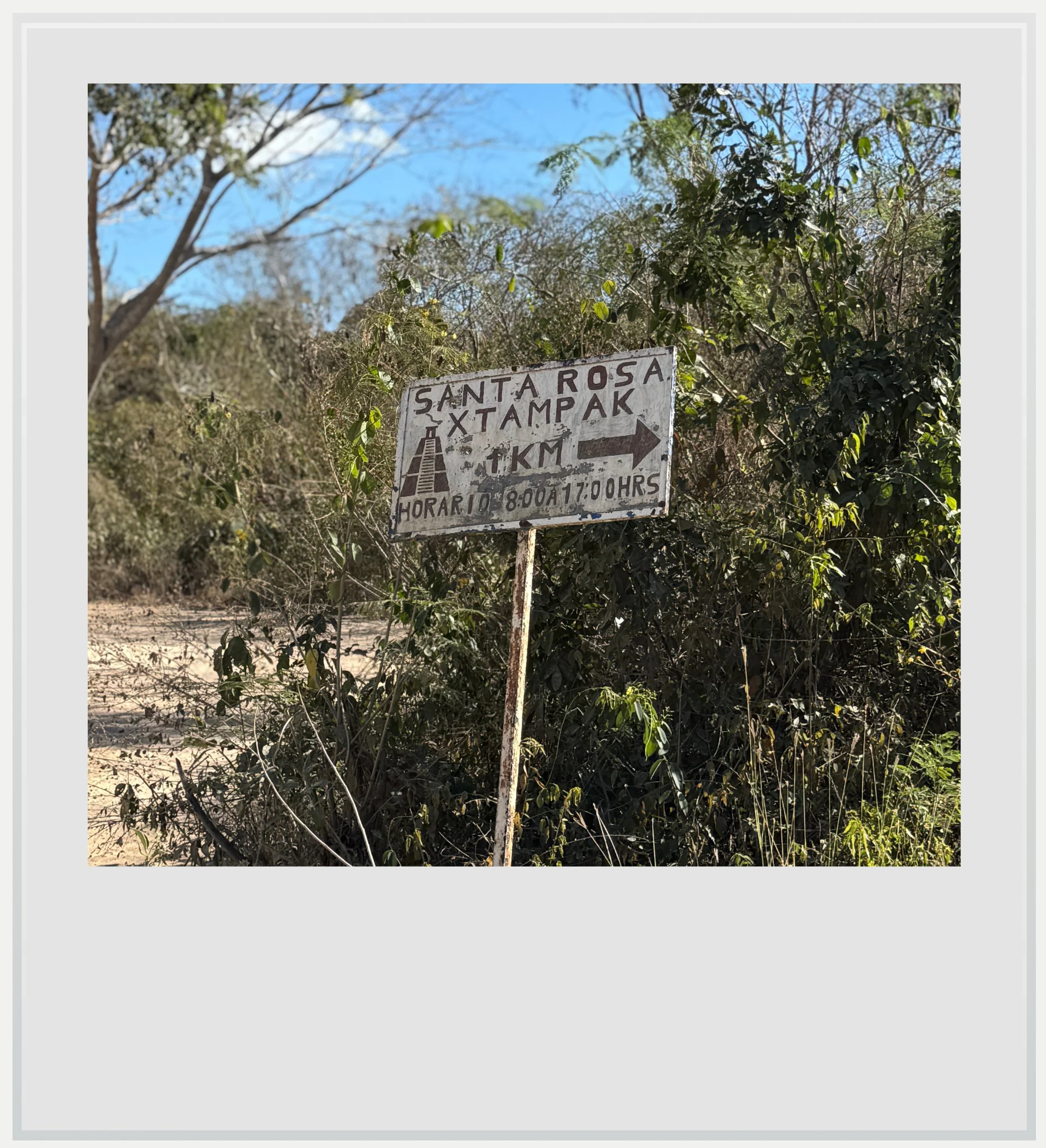
How to get to Santa Rosa Xtampac from the Campeche airport: very few people will want to visit Santa Rosa Xtampak and head back, so discovering the site assumes more visits in the area, which, given the distance from Campeche, makes sense. With a car, make a left upon exiting the airport, then another left to get on the ring road towards Merida, Stay on the ring road for about 5 minutes until you see an exit for Hopelchen. Follow the signs to Hopelchen on Highway 261. Hopelchen is the closest town to Santa Rosa Xtampac, so it is a good place to break for lunch, or grab snacks and drinks before the last stretch. In Hopelchen, enter into town (do not continue on the ring road), and right after a PEMEX gas station, make a left into calle Crecencio until you get to a T junction, when you will follow signs to Merida. Continue on highway 261 for a few miles until you see a sign on the right for Xtampac. From there, the road stops being fun, and starts becoming one of the most pothole-laden stretches of all of Yucatan. Google Maps says the distance between Hopelchen and Santa Rosa Xtampak should be done in one hour, but it took me a good ninety minutes. The road is BAD. Now, I did this with a small economy rental car during the dry season and I was fine, it was just a very slow, very bumpy crawl to the site.
How to get to Santa Rosa Xtampac from the Merida airport: assuming car rental, make a left upon exiting the airport, then another left to take the Merida ringroad at the next big intersection. Exit the ring road and follow signs to Campeche (highway 180) until you see signs for Uxmal (highway 261). Continue on highway 261 almost all the way to Hopelchen, until you see an overhead sign saying Xtampak, directing you to make a left. From there, you can follow the directions above from Campeche (this is where both routes merge).
Can I get to the Santa Rosa Xtampac archeological zone on a bus: in a nutshell, you cannot, unless we are talking about tour buses (see below). SUR, the regional bus company serving the remote region of central Campeche has service to the nearby town of Hopelchen, but there is no service to Santa Rosa Xtampac, about ninety minutes away on a good day.
Can I visit Santa Rosa Xtampac on a tour: surprisingly enough, given the site’s remoteness, tours are available to visit Santa Rosa Xtampac. None of the global platforms offer them but a quick Google search will show you available independent options. It could be a good alternative to more crowded sites if you’re vacationing in the region without a car. Guided tours will also provide useful historical context. Most of these tours depart from San Francisco de Campeche.
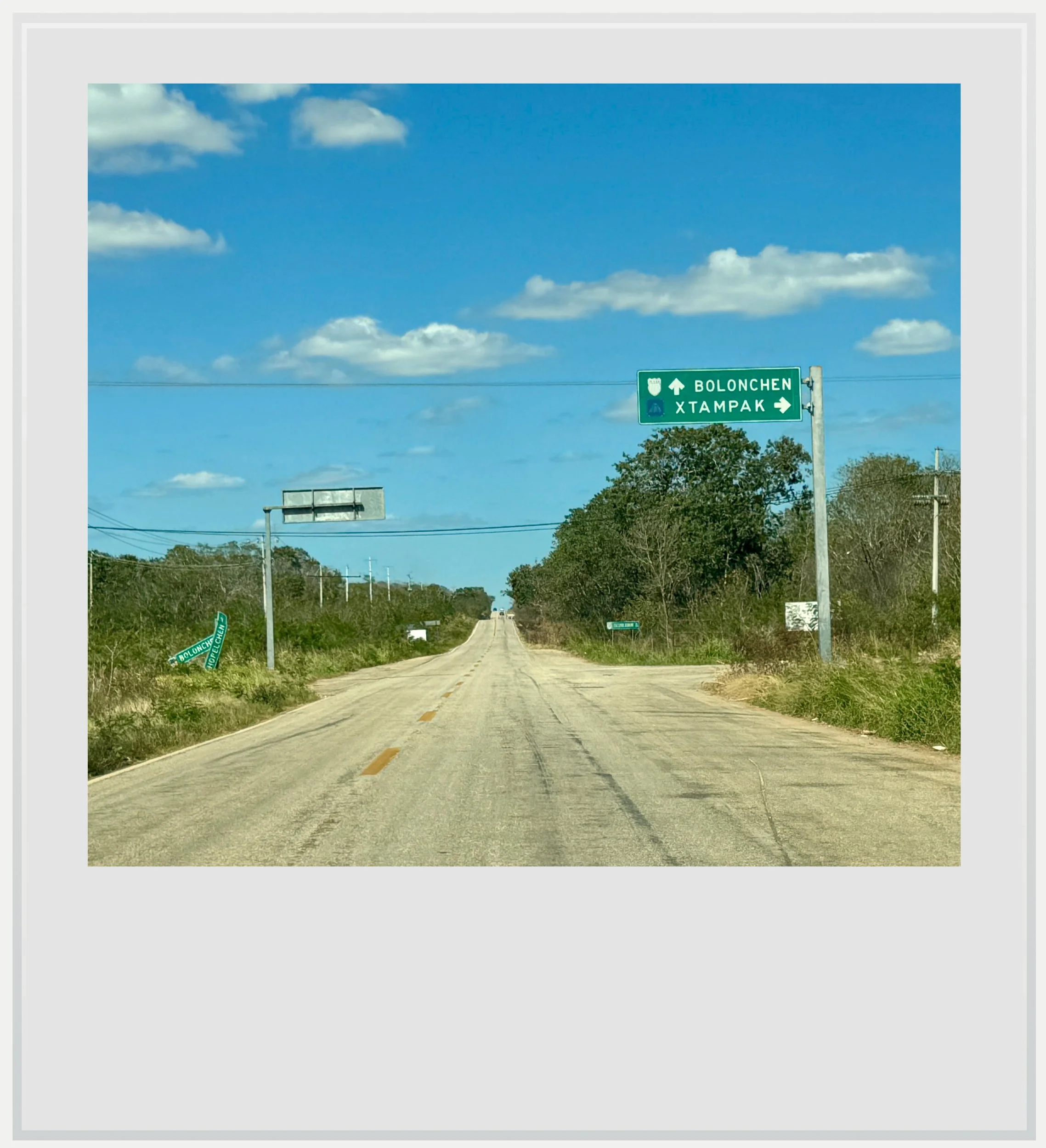
The turn off to Xtampak on highway 261 coming from Hopelchen.
When to go to Santa Rosa Xtampac
The best months weather-wise to enjoy Santa Rosa Xtampac are during the dry season, between November and April, with January and February the (relatively) coolest months. Visiting in the dry season is also critical to ensure the unpaved road is usable - it can get pretty muddy between June and October, and travel in a rental car during these months isn’t recommended.
I went to Santa Rosa Xtampac in late February. I was the only one on the site during my visit and the visitors log showed only one person had come to the site the day before.
What is the best time of the day to visit Santa Rosa Xtampac
Aim to go to the site early (it opens at 8am) or late (at the latest by 3pm, to give you two hours before they close), to avoid the hottest hours of the day. The morning light is better for photography given the site’s orientation and its situation deep the forest. It also ensures you don’t get caught by sunset and end up traveling part of the unpaved road at night.
Visiting during the day is possible, and if coming for a day trip, most likely the only option but don’t sweat it. The site is in the middle of the forest, with trees all around and sometimes inside the buildings, so there is plenty of shade to make a midday visit acceptable.
How much does it cost to visit Santa Rosa Xtampac
At the time of my visit, the price was MXN 145 for foreigners and MXN 80 for Mexican citizens and official Mexican residents, with proof of residency.
A paper guide is available for a few pesos (MXN 10, cash only) at the entrance, and features a map which proved very useful during my visit.
How long should I plan to visit Santa Rosa Xtampac
Plan to spend a good two hours on the site, as it is pretty spread out, with much to see. The whole site is located in the middle of the forest but is fairly well signposted - it’s hard to get lost. I suggest you purchase the small paper guide available at the ticket counter for MXN 10 (cash only). The text is in Spanish but it features a helpful map to orient yourself in the site.
What are the opening times of Santa Rosa Xtampac
The site is open every day from 8am to 5pm with entry allowed until 4.30pm.
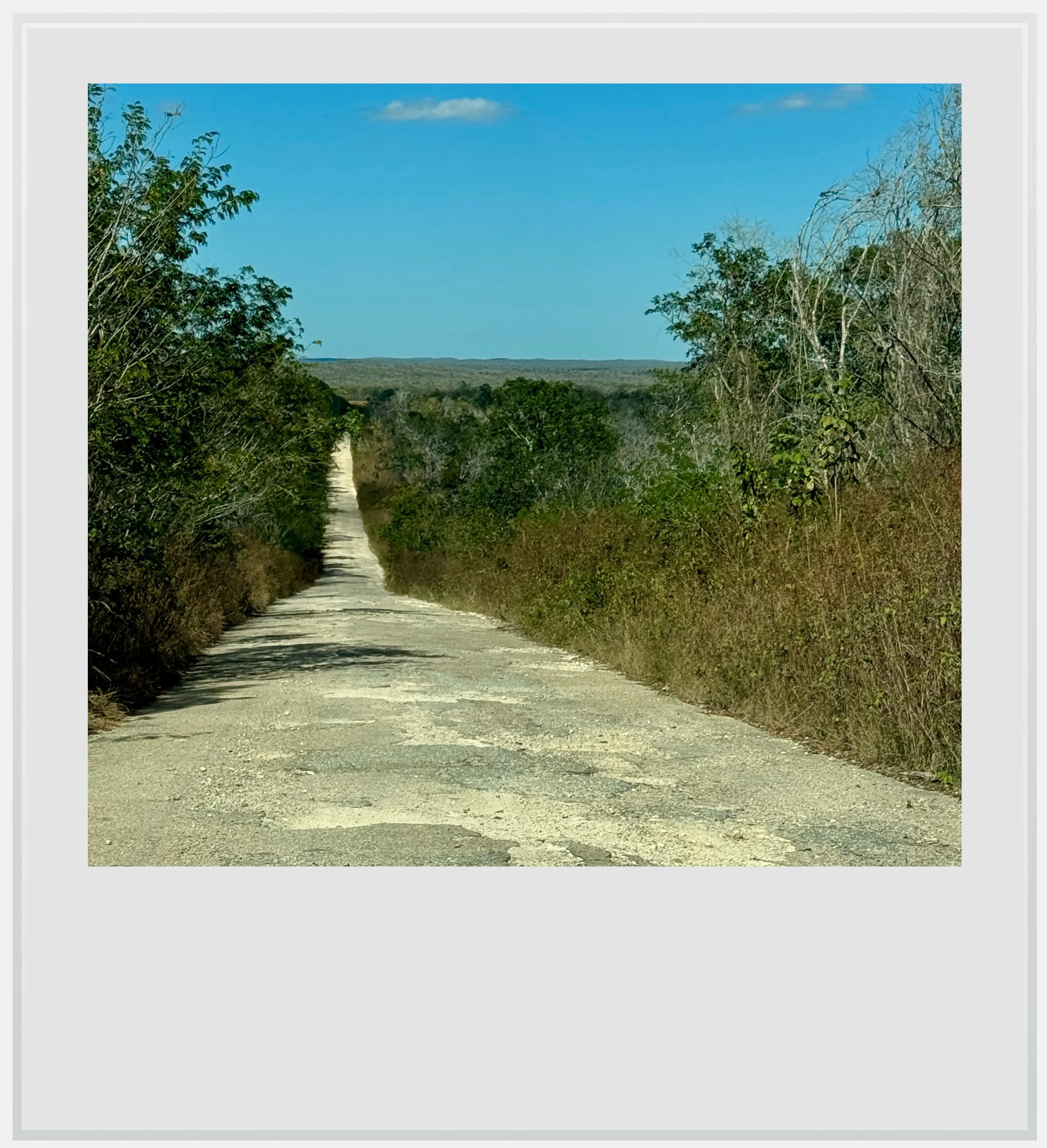
The unpaved road to Santa Rosa Xtampak.
Safety in Santa Rosa Xtampac
The State of Campeche is considered a safe state by the US Department of State, which lists the State under a Level 1 travel advisory, meaning the safety situation is similar to any US state. As such, there is no need to worry beyond taking the precautions you’d take at home.
Things to watch include having enough gas in the tank and enough water with you. There is no cell service on the site. Your main risk factor will be the remoteness of your location.
Food & lodging near Santa Rosa Xtampac
The closest town to Santa Rosa Xtampac, Hopelchen, is also today’s biggest town in the Chenes region. It is still small, with very few of the services tourists expect - which is exactly why it was charming.
Hotels in Hopelchen
I wasn’t exactly wowed by the hotel options in Hopelchen. The central hotel Los Arcos, on the main square, has very mediocre Google reviews, and the two best rated hotels, Hotel Lemar and Hotel Jaguar, were located on the main road which saw quite a bit of traffic, so I didn’t think they were good options for a restful night. In addition, they weren’t available to book on global platforms. Instead, I chose this Airbnb which, at the time of research, was the only one in Hopelchen, and which was absolutely fine (super clean, modern if a little sparse, but perfect for a peaceful night’s sleep) except for the loquacious gobblers in a nearby garden. Cost was around USD 70 for a night.
Restaurants
There are only a few restaurants available in town. My go-to restaurant was La Palapa, well-rated and clean, although fairly basic. Food was really good and portions generous, but of course, don’t expect sophisticated fare or service. I paid about USD 15 for a meal and a liter of fresh pineapple and chaya juice which was delicious. The restaurant has free WiFi, which was extremely helpful as Telcel service (the only cell network in the area) was down on my first day in town.
I enjoyed the pastries at this local panaderia, open from 4pm. Again, don’t expect fancy. Cash only.
The guard house by the car park.
Keep in mind these travel tips
Driving
The Yucatan peninsula is one of the safest regions in Mexico, and its main roads are well maintained - although that is definitely not the case for secondary roads, where you have to drive with extreme caution to avoid treacherous potholes. No matter what road you’re on, do not forget the #1 driving advice in Mexico: do not drive at night. This is especially relevant for this remote area of the state of Campeche. Driving at night, on poorly maintained roads means you won’t see the motorcycles without lights, the crazy-deep potholes and the ubiquitous topes, these notoriously hard speed bumps that seem to spring out of nowhere. You may encounter wildlife or, more prosaically street dogs crossing right in front of you. Plan your itinerary to be at your next destination before nightfall. It’s very important, and was a key criteria in how I built my itinerary around the region.
Bugs & wildlife
No matter the season, there will be bugs in Yucatan. While you may only see the gigantic Tarántula Yucateca spider on the roads leading to Calakmul, you’ll find mosquitoes pretty much everywhere, and especially in the shaded forests surrounding the Maya ruins. Be ready with repellent at any time of the day. It’s also a good idea to wear clothes that cover your limbs (pants, high socks, long sleeve T-shirts) while you’re in the jungle. Wear sturdy shoes. You’ll need it in some of the archeological zones, but I also saw a few snakes, and although they fled when they saw me approach, it’s better to be safe than sorry.
Heat & hydration
SPF will be your best friend. The UV index may be low in the morning and evening, but during the day, it gets pretty high.
Do not forget to hydrate. While OXXOs aren’t as ubiquitous in this rural region than in other ones, you’ll find plenty of abarrotes, these tiny stores selling cold water and sodas along the way. Make sure you always have water handy and drink to make the heat more bearable. Note there are no such stores once you take the turn off to Santa Rosa Xtampak, so make sure you stock up in Hopelchen.
Connectivity
Cell service is very spotty at best in central Campeche, with Telcel the only provider with decent service in some places (but service happened to be down one of the days I was in Hopelchen, so plan for this by downloading offline maps in Google Maps and knowing where you key stops of the day are). If you’re roaming, check that you can roam on Telcel, or investigate a Mexican eSIM that uses this network.
NPerf shows coverage areas in Mexico. This map shows Telcel coverage in the Chenes region. Use the drop down menu to check other providers.
There is absolutely no cell service in Santa Rosa Xtampac or on its access road, so you’re looking at about 4 hours without coverage if you venture out there. Keep this in mind if internet access is important to you.
Every photo caption appears if you hover over it (on a computer) or click on it (on a smartphone).
All photos are mine and copyrighted.