El Tabasqueño, Mexico.
Alone Among the Chenes Temples of the Maya World.
Looking for concrete details and tips? Go straight to the Practical Information section.
I parked my car in the small parking lot, a scar in the thick surrounding forest. A thought hit me. What if I were completely alone, deep in the forest, with no other human beings nearby? What would happen if I encountered a wild animal (a thought not completely irrational, since I had seen an ocelot and a snake earlier in the day).
I couldn’t hear anything except the sound of the leaves caressed by a gentle breeze and birds chirping. In front of me was a path, blocked by a cut branch, to prevent anyone from going any further. Then a fear crept in: the site is free, which probably means there is no one to oversee it. I have no cell service. I might actually be totally alone out here.
Did I really want to visit El Tabasqueño after all?
I inhaled deeply, remembered I had traveled all the way here to see the site, and started walking up the path.
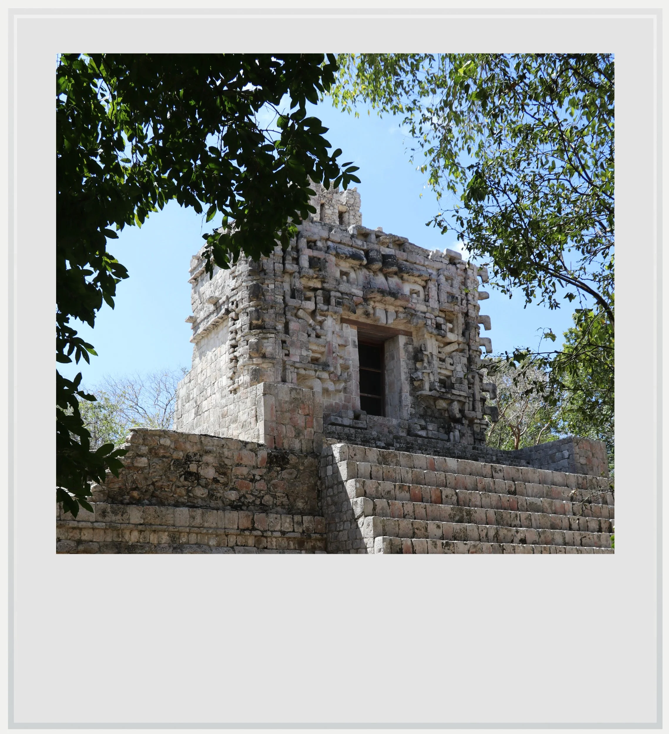
The main temple with its Chenes facade on the second floor.
Suddenly, past a few trees, a casita came into view, and I breathed a sigh of relief. There was a house. There would be someone in it. I wasn’t alone. I wouldn’t be eaten alive by a bloodthirsty creature (not today anyway).
The nice INAH employee let me in, and after he gave me a few tips on the site, I finally voiced the question I had been dying to ask: what about wild felines in this neck of the woods? He smiled gently - it must be a question he got a lot - and told me it had been a while since they had seen big cats back there. You will be safe, he said. There is nothing to fear.
I kept on being pulled between two feelings: ease and humility.
Hidden away in the forests of rural Campeche, El Tabasqueño is one of the few Maya sites open to the public showcasing the Chenes architecture, a style frequently used by the Maya in this region during the most flourishing period of their civilization, between 600 and 900 AD. Located off Highway 261 between Hopelchen and Dzibalchen, it was the last stop of my Chenes journey.
It was hard to remember if I had ever felt this far from everything anywhere else in Mexico. The Chenes region of Campeche, named after the endings of most of the villages on the map - Hopelchen, Komchen or Becanchen - seemed like it came from a parallel universe, with no cell service for hours, little villages with only the very basic shops, roads that hadn’t been redone in decades and scattered ruins from when, centuries ago, this was a very prosperous Maya region.
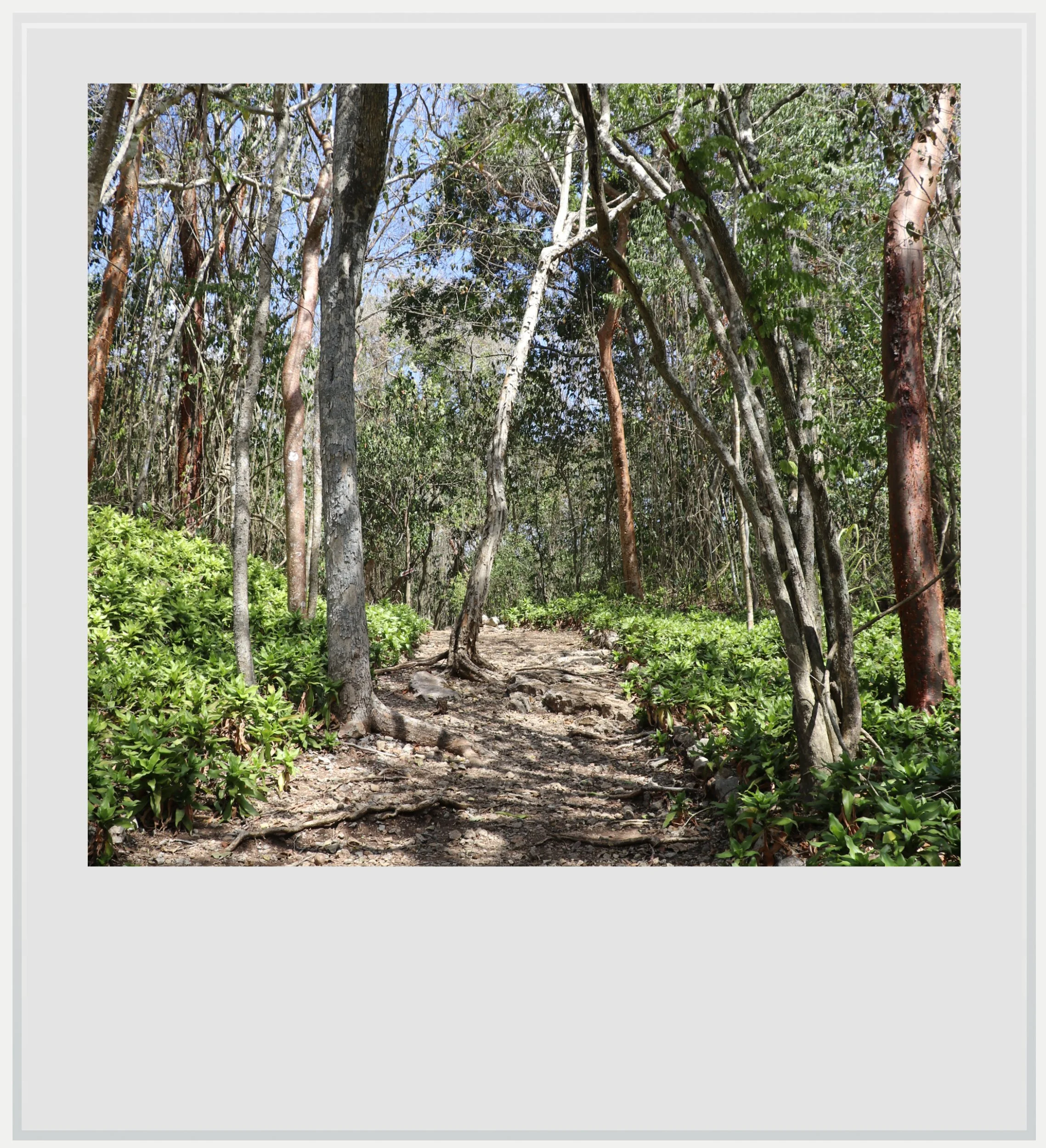
The trail leading up to platform where the structures were located.
This sense of utter isolation probably played a role in my fears, yet I also felt a freeing sense of not having to worry about anything remotely contemporaneous. Bad news couldn’t reach me. I didn’t care to hunt for the best coffee shop in town (there was no coffee shop, let alone any town).
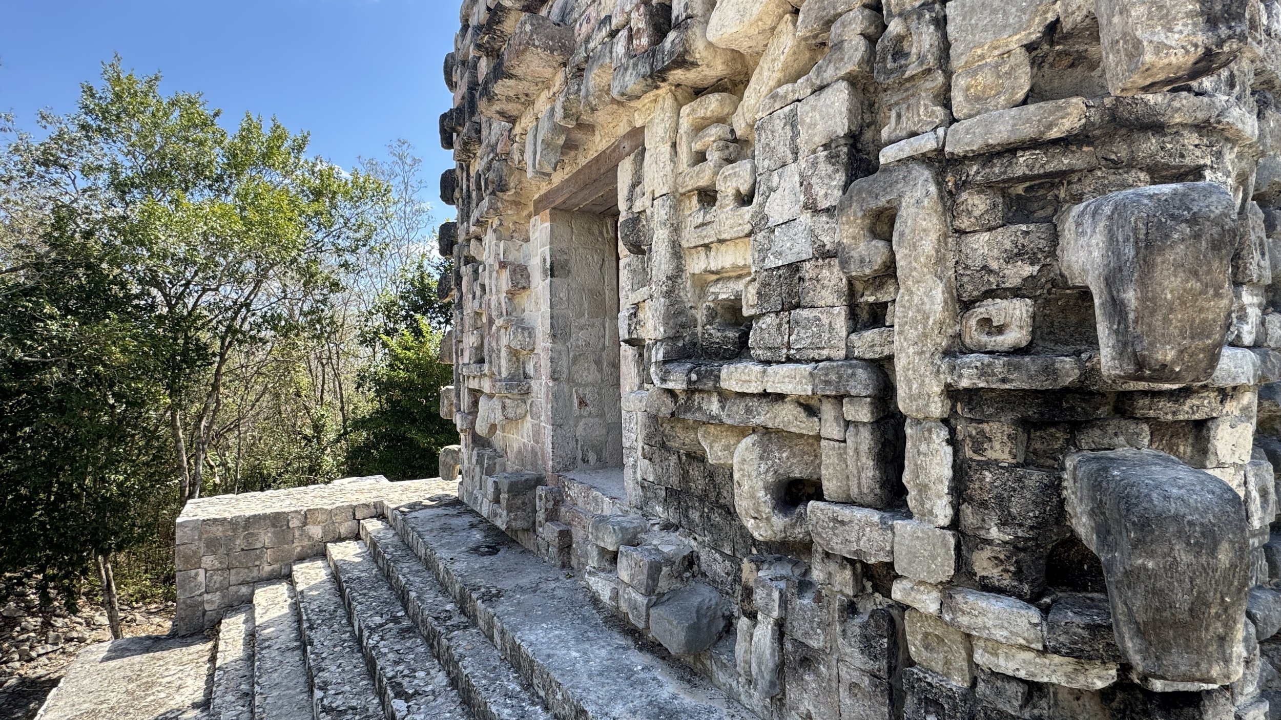
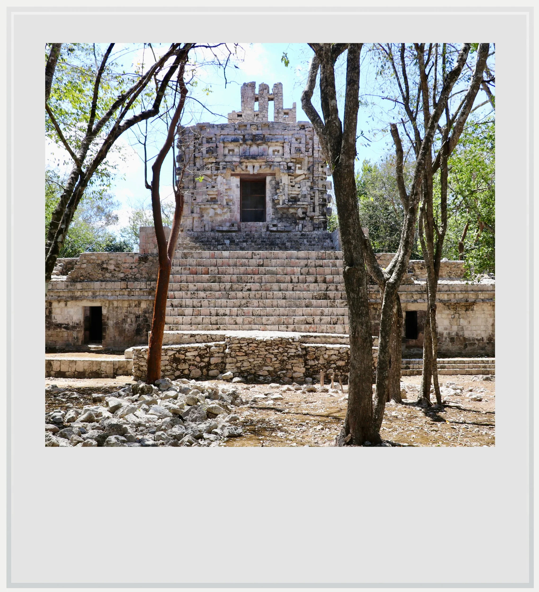
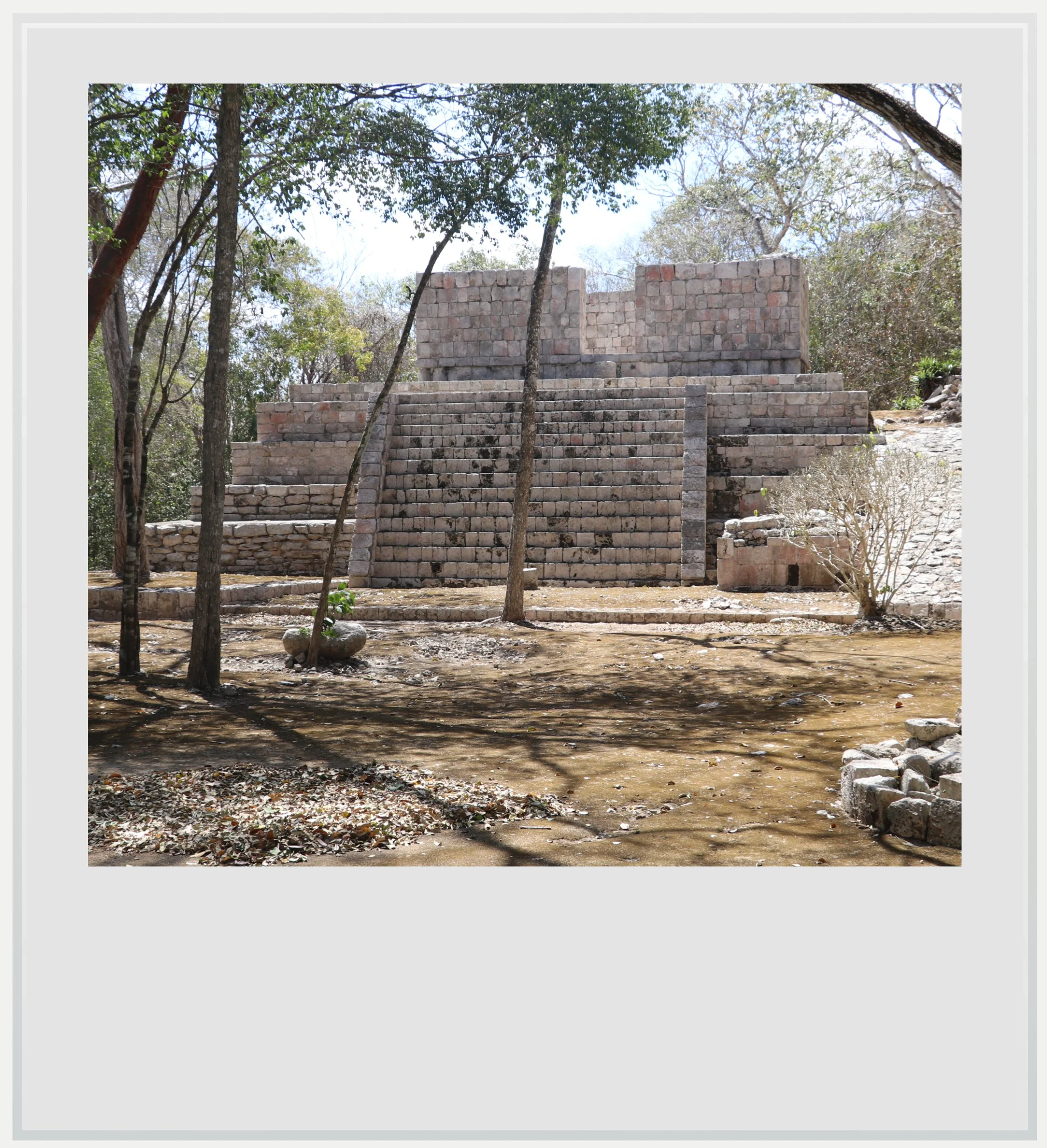
I hiked for a couple of minutes through a thick, dry forest before getting to the small platform where the ruins were located. My first impression was that they looked like a slightly altered version of Hochob. The main temple on the platform had two levels though, and the most striking visual anchor of the site, its monster door representing the head of a snake, was perched on the second level of the temple.

After a few moments, I realized it felt like a mix between Hochob and Dzibilnocac. It had the intimacy and approachability of Hochob: its small platform and the overall low height of the building made it a place I instantly felt at ease in, not a place that made me feel small. It also had a sense of power that I had noticed in Dzibilnocac a few hours before, due to the elevation of its temple, on the second floor of the main building. These characteristics were fascinating because, as I was walking through the site, I kept on being pulled between two feelings: ease and humility.
That contradiction came from this elevated serpent mouth door, a perfect example of Chenes architecture. On the ground floor, it could have felt inviting - the door was used by priests and symbolized the passage from the Underworld to Earth. Perched on the second floor, it was a sobering reminder of the power given to deities by the Maya.
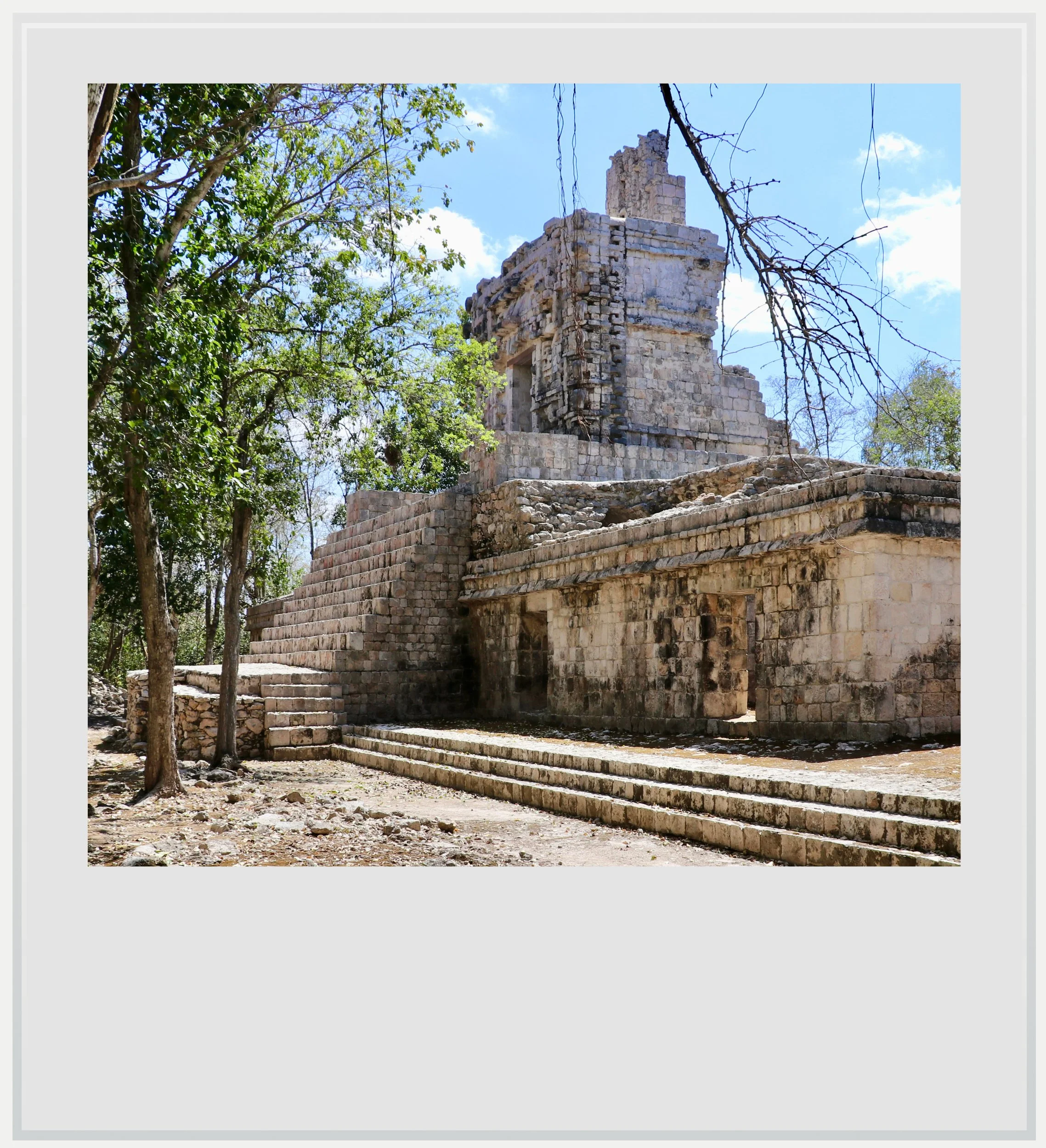
A second restored temple behind the main one.
The fact that the serpent mouth door was located on top of the main building in El Tabasqueño may have meant a lot to the Maya, and archeologists are trying to determine whether the elevated door had a different meaning or slightly different purpose than the ground floor ones, seen in sites like Santa Rosa Xtampak or Chicanna.
It is understood the site started being inhabited in the second century of our era, with its peak period coinciding with the erection of the monuments still seen on the site today, between the 7th and 10th centuries. The settlement felt a little more intimate than Hochob, with numerous trees on the platform and a thick canopy as far as the eye could see. That the forest seemed to have patiently reclaimed parts of the ruins added to the site’s charm, and softened the light that, in the early afternoon, could have flattened the buildings.
The Chenes region of Campeche seemed like it came from a parallel universe.
The original name of the settlement isn’t known. It is called El Tabasqueño today because the owner of the land on which it was discovered was from the state of Tabasco.
I was starting to feel relaxed among the beauty of the surrounding buildings, when a movement caught my eye. A shape appeared - thankfully, it was only the security guard, tasked with making sure the few visitors to the site behaved responsibly. I didn’t dare ask him how he occupied his days if only a trickle of tourists came by, but it was oddly reassuring to see another human being.
The Chenes door at top of El Tabasqueño's main temple.
There is something profoundly moving about visiting ancient Maya settlements in remote regions of the Yucatan peninsula. Unlike famous sites like Chichen Itza or Tulum, visiting El Tabasqueño, or even much bigger sites like Edzna, is usually a very solitary endeavor, and it often felt eerie to be the lone visitor in a place that must have seen thousands of people within its walls during the height of the Maya civilization.

In awe of the craftsmanship of the Chenes facade, I spent a long time looking at it from every angle before slowly heading back to my car. While El Tabasqueño may not have been my favorite site of the day, it was a great detour into the woods for a more intimate encounter with Chenes architecture, and absolutely worth it as part of a day trip into this beautiful region.
I drove back slowly onto the rocky track until I reached Highway 261. After these few bumpy miles, the road that had seemed so isolated and desolate suddenly felt like a major highway, with cars flying by. For a moment, the solitude I had feared at El Tabasqueño felt strangely appealing.
A side view of the main Maya temple in El Tabasqueño.
Practical information
(Everything you could possibly want to know about El Tabasqueño - updated March 2026)
In a nutshell
El Tabasqueño. a small, remote Maya site in central Campeche, is a great example of Chenes architecture within the Maya world. The site is small and just a few miles off the main road between Hopelchen and Dzibalchen, making it an easy stop on a day trip to the main Chenes sites in the area, alongside Hochob and Dzibilnocac.
Getting to El Tabasqueño
How to get to El Tabasqueño from the United States:El Tabasqueño, in central Campeche, isn’t easy to reach from the US. The closest airport to El Tabasqueño is Campeche (CPE), 2h to the north. Campeche is only served by one or two flights a day from Mexico City (MEX) so it isn’t the easiest airport to get into. Merida (MID) can be an alternative. Travel time to El Tabasqueño is 3h, and Merida sees a lot more frequent flights to Mexico City (14 on a random day in March 2026) as well as non-stop flights to the US: AA flies daily to and from Dallas (DFW) and Miami (MIA), United daily from Houston (IAH) and Viva several times weekly to and from Orlando (MCO) and Miami (MIA). For additional directions from each airport, please see below. Note that car rental is your best bet to visit the region, and both Campeche and Merida airports count with several local and international options, which were fairly priced at the time of my visit. While the ADO bus company is present in the region, with frequent buses between major cities, only SUR, a regional provider, serves the rural parts of central Campeche. As such, bus travel isn’t really an option. More details below.
How to get to El Tabasqueño from the Campeche airport: assuming car rental (if not, see why I don’t recommend bus travel in central Campeche below), make a left upon exiting the airport, then another left when you get to the ring road, but don’t get on it as you need to get off at the next intersection, towards Edzna. Once you get to Edzna, follow directions to Hochob, and just before getting to the village of Dzibalchen make a left at the Pemex gas station. Once you’re on that road (Highway 261), the turn off for El Tabasqueño is a few miles to the left (here) but pay attention because the sign isn’t very visible and the side road easy to miss. A couple more miles on this narrow road and you’ll get to a small parking lot in the forest where you can park your car and walk a few steps to the ticket office. The Google Maps directions are not to be followed as the software sends you on a different route that doesn’t exist. The only way to get to the site id really via the access road off Highway 261. Don’t forget to download offline maps before leaving the airport, as cellular service is very spotty past Edzna, so you can follow directions offline. The trip should last a little less than two hours.
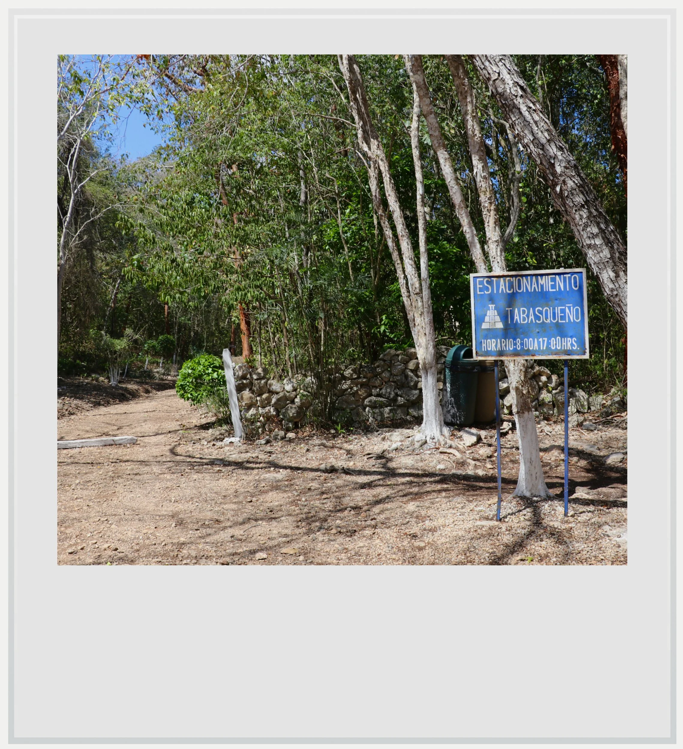
The parking lot at El Tabasqueño.
How to get to El Tabasqueño from the Merida airport: assuming car rental (if not, see why I don’t recommend bus travel in central Campeche below), make a left upon exiting the airport, then another left to take the Merida ring road at the next big intersection. Exit the ring road and follow signs to Campeche (Highway 180) until you see signs for Uxmal (Highway 261). Continue on Highway 261 all the way past Hopelchen, and a few miles before the village of Dzibalchen, you will see the turn off for El Tabasqueño on the right (be careful, it’s easy to miss, it is here). A couple more miles on this narrow road and you’ll get to a small parking lot in the forest where you can park your car a walk a few steps to the ticket office. The Google Maps directions are not to be followed as the software sends you on a different route that doesn’t exist. The only way to get to the site is really via the access road off Highway 261. Don’t forget to download offline maps before leaving the airport, as cellular service is very spotty past Edzna, so you can follow directions offline. The trip should last about three hours.
Can I get to the El Tabasqueño archeological zone on a bus: in a nutshell, I don’t recommend it. SUR, the regional bus company serving the remote region of central Campeche has service to the nearby town of Dzibalchen, a few miles away. While the bus could in theory drop you off where the access road to El Tabasqueño begins, additional walking under the punishing sun is required, and on the return, it could be a long while before another bus came by. On top of that, getting to other Chenes sites nearby on a bus will be extremely complicated.
Can I get on a tour to see El Tabasqueño: while no tours were available on global platforms such as Viator or GetYourGuide, it may be possible to find local tour groups offering the service. One place to look would be in Campeche, either by the bus station or near the Malecon (close to Puerta de Mar, here) where there is a decent tourist flow that attracts sellers. Ostensibly tours will be geared to Spanish-speaking travelers however, so it is unlikely a tour would be offered in English, but you may get lucky. As I planned my trip a few weeks in advance, I felt like having a car would be the easiest option and didn’t try to look for these options in person while in Campeche.
When to go to El Tabasqueño
The best months weather-wise to enjoy El Tabasqueño are during the dry season, between November and April, with January and February the (relatively) coolest months. This is also peak season but, given its location, the site is never actually crowded.
I went to El Tabasqueño in late February. I was the only one on the site during my visit and the visitors log showed only a couple of people had come to the site the days before.
Aim to go to the site early (it opens at 8am) or late (at the latest by 4pm, to give you an hour before they close), to avoid the hottest hours of the day, although the site has many trees which can provide cover, so, of the Chenes sites around, it is probably the easiest to check out anytime during the day.
How much does it cost to visit El Tabasqueño
Entrance was free at the time of my visit.
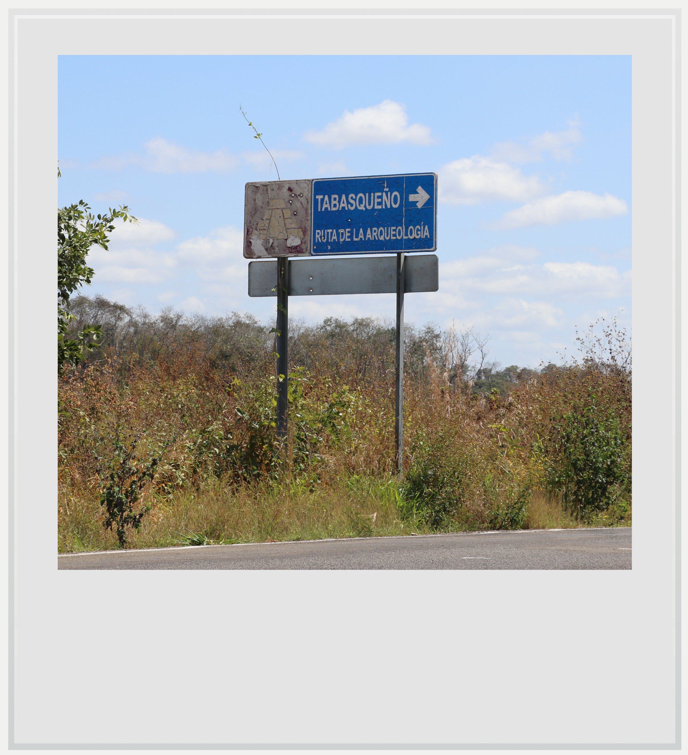
The sign for El Tabasqueño on Highway 261 going towards Dzibalchen.
How long should I plan to visit El Tabasqueño
Plan to spend 30 to 45 minutes on site, as it isn’t very big (but still worth a stop). The site is in the forest, and, like Hochob, sits at the top of a small hill, with a few buildings set up on a shaded platform.
What are the opening times of El Tabasqueño
The site is open every day from 8am to 5pm with entry allowed until 4.30pm.
Safety in El Tabasqueño
The Yucatan peninsula is very safe. The U.S. State Department lists the State of Campeche under a Level 1 travel advisory (“Exercise Increased Caution”), meaning it considers it as safe as the US as a whole. Behave as you would in a place you don’t know well, especially if you don’t speak the language, and you will be fine.
Normal precautions include having enough gas in the tank and enough water with you. There is no cell service on the site. Be on the lookout for wildlife: I saw an ocelot cross the road in front of me on the way from Dzibalchen earlier in the day, and while not daily, margay or ocelot sightings are relatively frequent (there is about zero risk of a direct animal encounter however: although big cats like jaguar and pumas are present in this remote region, they fear humans and will go to great lengths to avoid contact with us).
Food & lodging near El Tabasqueño
Although I initially wanted to make Dzibalchen my rest stop to visit the Chenes region (which not only includes El Tabasqueño but also Dzibilnocac and Hochob), I wasn’t able to find accommodation there, whether a hotel or Airbnb. Instead, I stayed in Hopelchen, about 40 minutes north, where a few hotels and Airbnbs are available.
Hotels in Hopelchen (near Dzibalchen)
I wasn’t exactly wowed by the hotel options in Hopelchen. The central hotel Los Arcos, on the main square, has very mediocre Google reviews, and the two best rated hotels, Hotel Lemar and Hotel Jaguar, were located on the main road which saw noisy traffic, so I didn’t think they were good options for a restful night. In addition, they weren’t available to book on global platforms. Instead, I chose this Airbnb which, at the time of research, was the only one in Hopelchen, and which was absolutely fine (super clean, modern if a little sparse, but perfect for a peaceful night’s sleep) except for the loquacious gobblers in a nearby garden. Cost was around USD 70 for a night.
Restaurants
I didn’t eat in Dzibalchen as my plan called for a day trip from Hopelchen. There are very few restaurants available in town, and a bakery that only opens late afternoon. You will find abarrotes, small stores selling basic necessities, cold drinks and snacks to tie you over, but I preferred my options in Hopelchen, even if that meant having lunch Mexican-style, around 4pm.
In Hopelchen, my go-to restaurant was La Palapa, well-rated and clean although fairly basic. Food was really good and portions generous, but of course, don’t expect sophisticated fare or service. I paid about USD 15 for a meal and a liter of fresh pineapple and chaya juice which was delicious. The restaurant has free WiFi, which was extremely helpful as Telcel service (the only cell network in the area) was down on my first day in town.
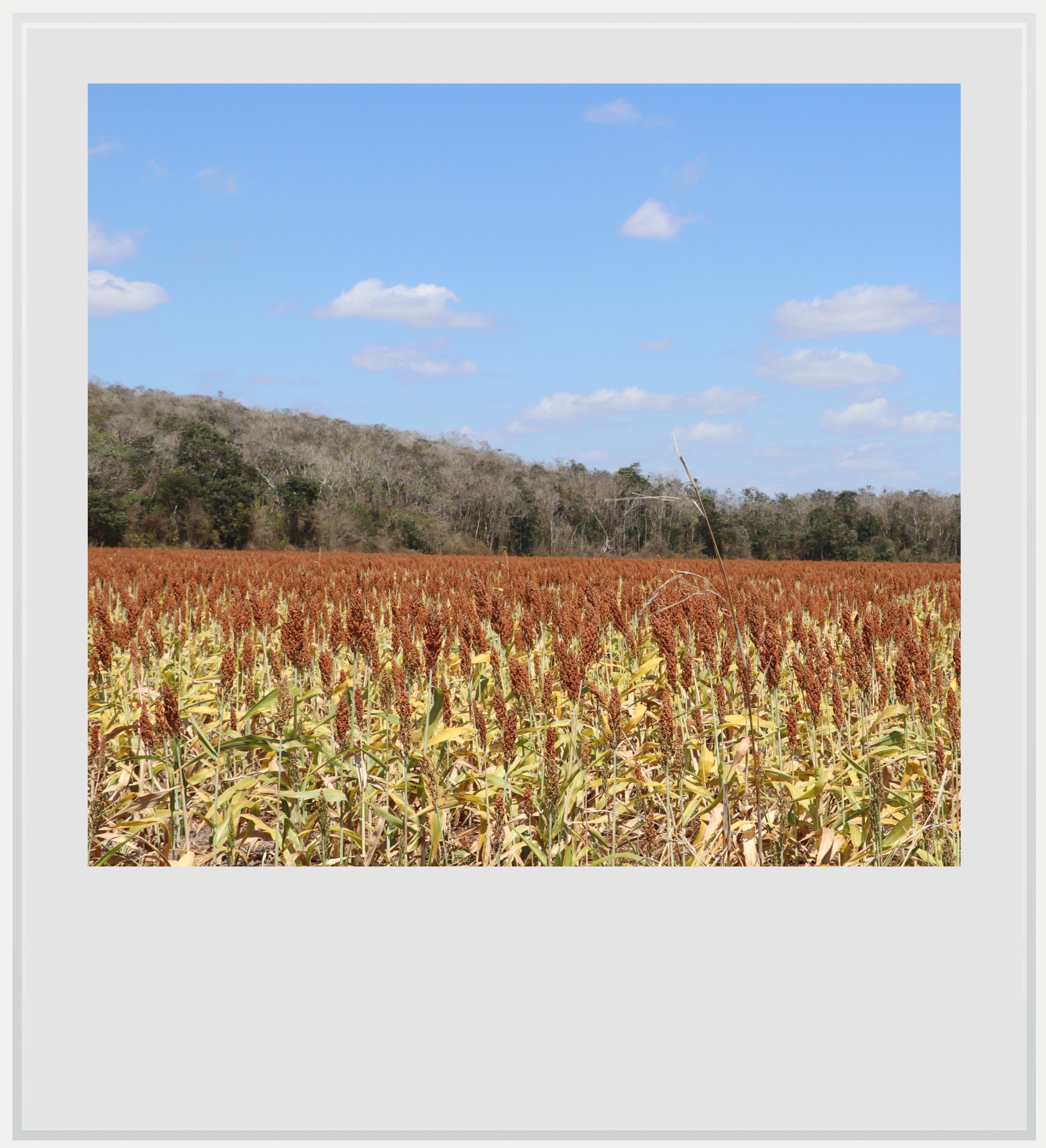
Landscape along the access road to El Tabasqueño.
Keep in mind these travel tips
The Yucatan peninsula is one of the safest regions in Mexico, and its main roads are well maintained - although that is definitely not the case for secondary roads, where you have to drive with extreme caution to avoid treacherous potholes. No matter what road you’re on, do not forget the #1 driving advice in Mexico: do not drive at night. This is especially relevant for this remote area of the state of Campeche. Driving at night, on poorly maintained roads means you won’t see the motorcycles without lights, the crazy-deep potholes and the ubiquitous topes, these notoriously hard speed bumps that seem to spring out of nowhere. You may encounter wildlife or, more prosaically street dogs crossing right in front of you. Plan your itinerary to be at your next destination before nightfall. It’s critical, and was a key criteria in how I built my itinerary around the region.
No matter the season, there will be bugs in Yucatan. While you may only see the gigantic Tarántula yucateca spider on the roads leading to Calakmul, you’ll find mosquitoes pretty much everywhere, and especially in the shaded forests surrounding the Maya ruins. Be ready with repellent at any time of the day. It’s also a good idea to wear clothes that cover your limbs (pants, high socks, long sleeve T-shirts) while you’re in the jungle. Wear sturdy shoes. You’ll need it in some of the archeological zones, but I also saw a few snakes, and although they fled when they saw me approach, it’s better to be safe than sorry.
SPF will be your best friend. The UV index may be low in the morning and evening, but during the day, it gets pretty high.
Do not forget to hydrate. While OXXOs aren’t as ubiquitous in this rural region as in other ones, you’ll find plenty of abarrotes, these tiny stores selling cold water and sodas along the way. Make sure you always have water handy and drink to make the heat more bearable.
Cell service is very spotty at best in southeastern Campeche, with Telcel the only provider with decent service in some places (but service happened to be down one of the days I was in Hopelchen, so plan for this by downloading offline maps in Google Maps and knowing where your key stops of the day are). If you’re roaming, check that you can roam on Telcel, or investigate a Mexican eSIM that uses this network.
Every photo caption appears if you hover over it (on a computer) or click on it (on a smartphone).
All photos are mine and copyrighted.