Xpujil, Mexico.
A Distilled Lesson in Rio Bec Architecture.
Looking for concrete details and tips? Go straight to the Practical Information section.
This article is part of a bigger trip through the seldom visited Maya archeological sites of the southern Yucatan peninsula. See all articles here. A curated itinerary to see the best Rio Bec Maya cities is also here.
It was close to noon now, and I had managed to visit three Maya sites in the Rio Bec region of southern Campeche: massive Becán, sophisticated Chicanná and hidden El Hormiguero. I certainly had my cup full, but there was another site I wanted to see before moving on. I needed to get into the Calakmul Biosphere Reserve before 5pm that day to make it to my hotel there before nightfall. I quickly calculated that, if I were to eat quickly, I could actually spend a little time at the Xpujil ruins.
While not the main reason to visit this part of the Yucatan peninsula, the Xpujil site was on my way from El Hormiguero, where I had just immersed myself into the jungle, to Calakmul, and as such, wouldn’t delay me too much. It felt like a waste not to check it out.
As a matter of fact, the entrance to the site sat within the town limits of Xpujil, right off Highway 186, the wide two-lane road linking Chetumal, Yucatan with Villahermosa, Tabasco, about 350 miles to the west. There were no cars in the tiny, shaded parking lot, which I took as another sign I would enjoy the site.
Unlike many archeological zones in the area, Xpujil hadn’t been touched yet by government funding to improve its infrastructure - at least it seemed so from the parking lot, from which I could see the small, humble casita serving both the park ticket office and interpretative center.
The entrance to the Xpujil archeological zone.
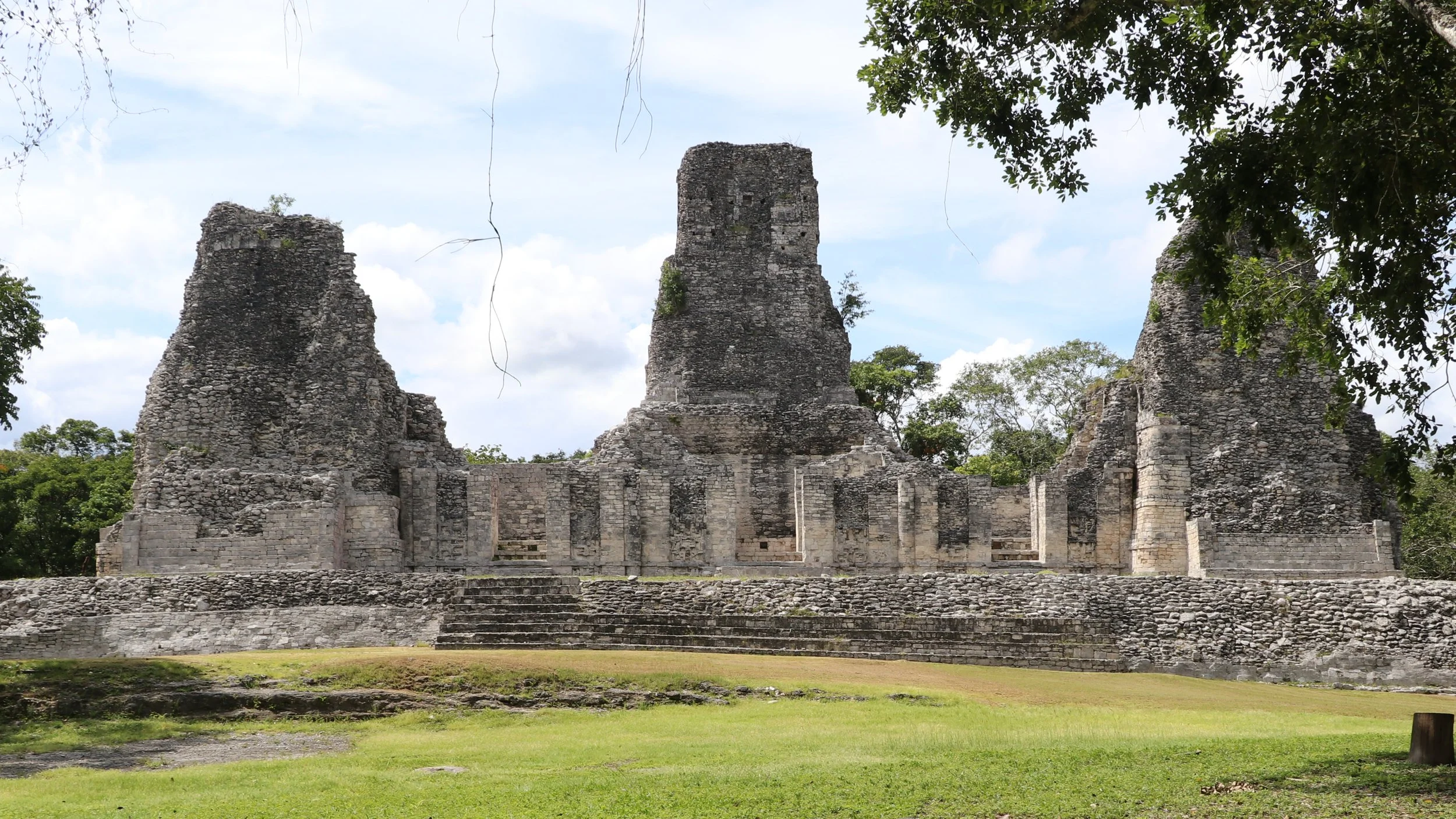
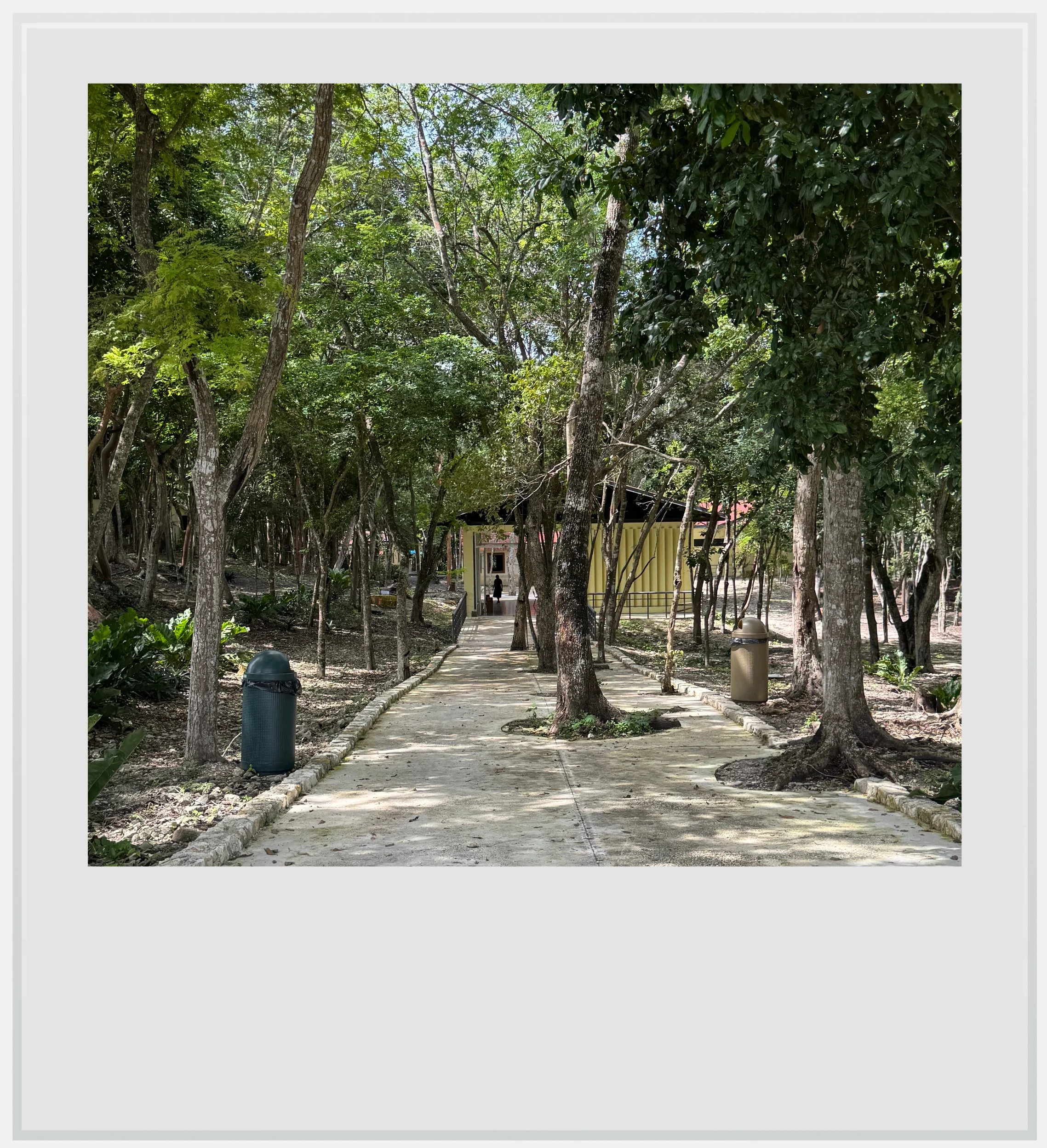
After paying the entrance fee, I started walking on a stone path through the jungle - suddenly the road noise disappeared and I felt I had jumped back centuries. The first structures started showing up on the right side of the path, and while I gave them a look, I was really interested in seeing Building 1, the main attraction.
Built during the Classic period, it is believed Xpujil’s zenith was between 750 and 900 AD, like the rest of the region. From this time is left a fantastic testament to the Rio Bec building style. Rediscovered in the 1930s, the site was christened Xpujil for the Maya name of a variety of cattail plant found nearby - the settlement’s original name is unknown.
Standing in front of Xpujil’s main structure was another experience in humility.
Rio Bec, the name of the region (Rio Bec means Bec River in Spanish), is also the modern name of a Maya site further west, that gave its name to the regional style, consisting of replicating a miniature version of the Peten architecture, symbolized by Tikal, in Guatemala, with tall towers built on top of classical Maya temples. In the Rio Bec style, these towers, usually three evenly distributed between left, front and right of the structure, are only decorative. Their extremely steep stairs aren’t usable, and the temples at the top are devoid of any religious purpose. It seemed like the Rio Bec style was aimed to inspire awe without reaching the heights of Tikal. Great examples of Rio Bec style can also be seen at nearby Becán, and, further south, in El Hormiguero.
Building 1 (Estructura 1) was built in a classical Rio Bec template, as a low temple adorned with three high towers whose purpose was only to impress. Although the building has lost some of its luster, it was fairly easy to see how grand the facade must have been like (it’s even easier with the rendering shown on site, pictured below).
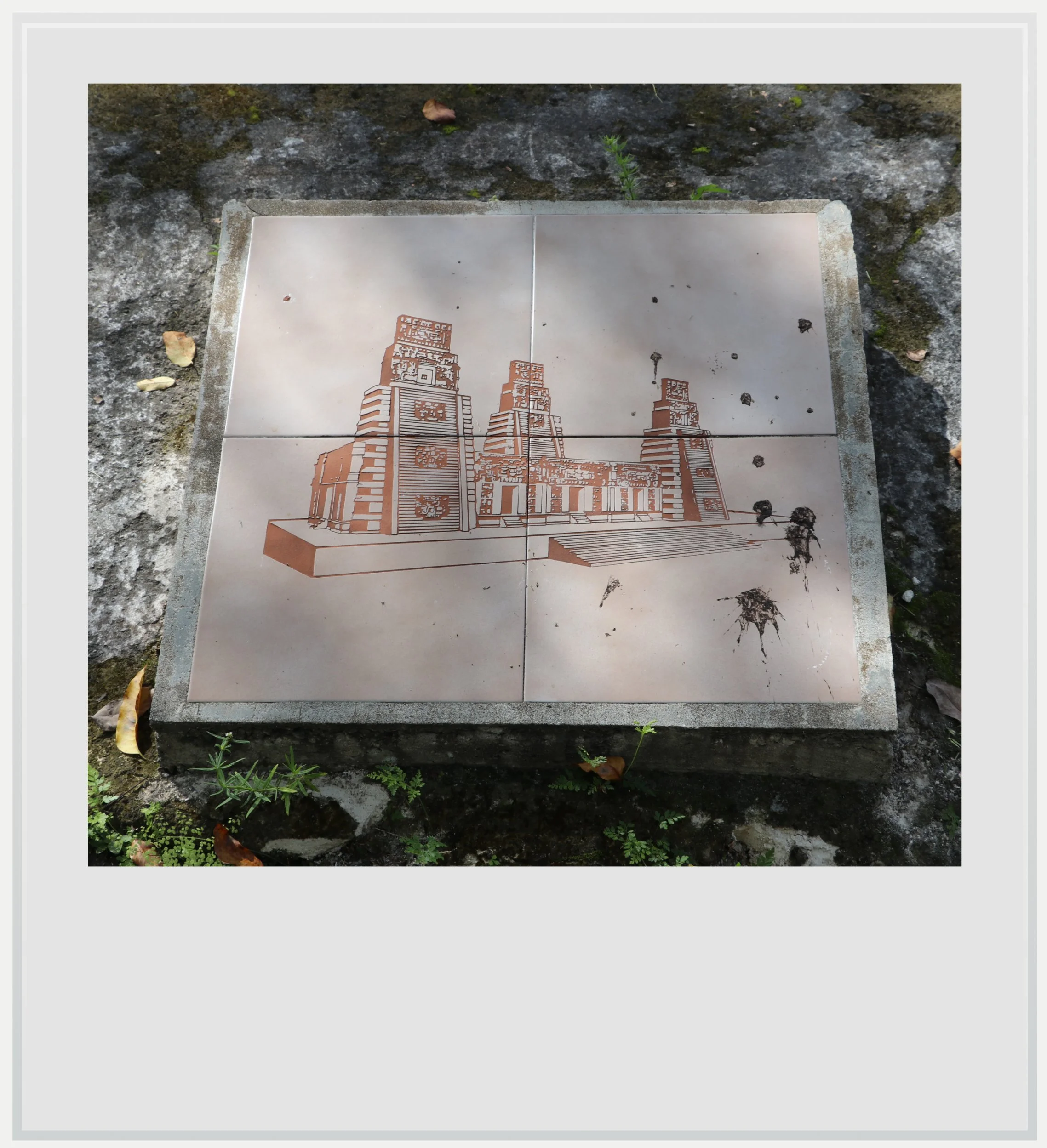
A rendering of what the Xpujil main building may have looked like in Maya times, as seen on site.
Unlike El Hormiguero, whose main building sits really close to the nearby trees, the surroundings of Xpujil’s Building 1 had been cleared, which made it stand out even more. Unfortunately, its level of conservation isn’t as good as El Hormiguero’s, as it lost the intricate stone work that must have featured on the doors between its towers (although some parts of it are still visible towards the base of the door frames).
Standing in front of Xpujil’s main structure was another experience in humility. To see Building 1, to imagine what it looked like a thousand years ago, painted in bright colors and embellished with stucco sculptures, was to acknowledge the incredible ingenuity and skills of the Maya architects and builders who erected such a beautiful temple.
I was back at my car forty-five minutes later - I had spent some time trying to locate the noisy howler monkeys shouting in the forest (and did eventually find them) before walking back to the parking lot, and beginning another journey on Highway 186, that would lead me, several hours and many animal sightings later, deep in the Maya jungle, to the incredible site of Calakmul.
Practical information
(Everything you could possibly want to know about Xpujil - updated January 2026)
In a nutshell
Xpujil, a medium-sized Maya site in the Rio Bec area of southeastern Campeche, near the small town bearing the same name, is a lovely stop to get acquainted with the very specific Rio Bec Maya architecture. It is best visited alongside other sites, in a one or two-day itinerary that should include nearby sites like Becán and Chicanná, as well as El Hormiguero.
Getting to Xpujil
How to get to Xpujil from the United States: Xpujil, in southeastern Campeche, isn’t easy to reach from the US. The closest airport to Xpujil is Chetumal (CTM), which has no direct flights to the US, making a connection in Mexico City (MEX) indispensable. Xpujil lies about 1h45 west of Chetumal airport, on Federal Highway 186, a well-maintained road with little traffic. Xpujil, the main settlement in the Rio Bec region, will likely be the base for exploring the Maya sites nearby.
Another option could be to fly into Tulum (TQO), if planning a trip spanning more of the Yucatan peninsula, as US and Canadian airlines fly non-stop to the new Tulum airport, but travel time from TQO to Xpujil is close to 4 hours.
Car rental is your best bet to visit the region, and the Chetumal airport has several local and international options, which were fairly priced at the time of my visit. While ADO and Suchaa, a colectivo service, stop in the town of Xpujil and one could conceivably walk from the bus station to the ruins (a 10-minute endeavor), it would be a shame to be in the region and only see this archeological zone, when more impressive ones, like Becán, lie a few miles away. Renting a car makes the most sense from a planning and cost perspective if planning to visit more sites.
It’s important to note Google Maps directions to the archeological site aren’t correct. Its entrance lies here, along Highway 186. This is also where the car park is located.
How to get to Xpujil from Mexico City: it is possible to take a bus from the TAPO terminal in the capital all the way to Xpujil, but it isn’t recommended. The Xpujil ruins are close by (10 minutes from the bus station by foot) but the whole trip lasts more than 18 hours, in a first-class bus that’s comfortable enough for a 3 to 4-hour ride, but we’re talking about a trip that’s more than 4 times longer. The walk-up fare is MXN 1,822 (about USD 100 at time of writing) which isn’t super competitive with flying.
The best way to reach Xpujil is indeed to fly into Chetumal airport (CTM), from Mexico City’s main airport (MEX) or its secondary airport (NLU). Aeromexico, VivaAerobus and Volaris operate once a day between MEX and CTM while Mexicana and Viva fly several days a week from NLU to CTM, with base prices starting around USD 75. Car rentals are widely available at Chetumal airport, from a variety of Mexican and international companies. Xpujil is about 1 h 45 west of the airport, along Federal Highway 186, a well-maintained, straight-through-the-jungle two-lane road.
It’s important to note Google Maps directions to the archeological site aren’t correct. Its entrance lies here, along Highway 186. This is also where the car park is located (so this is the correct entrance whether you get there by foot or by car).
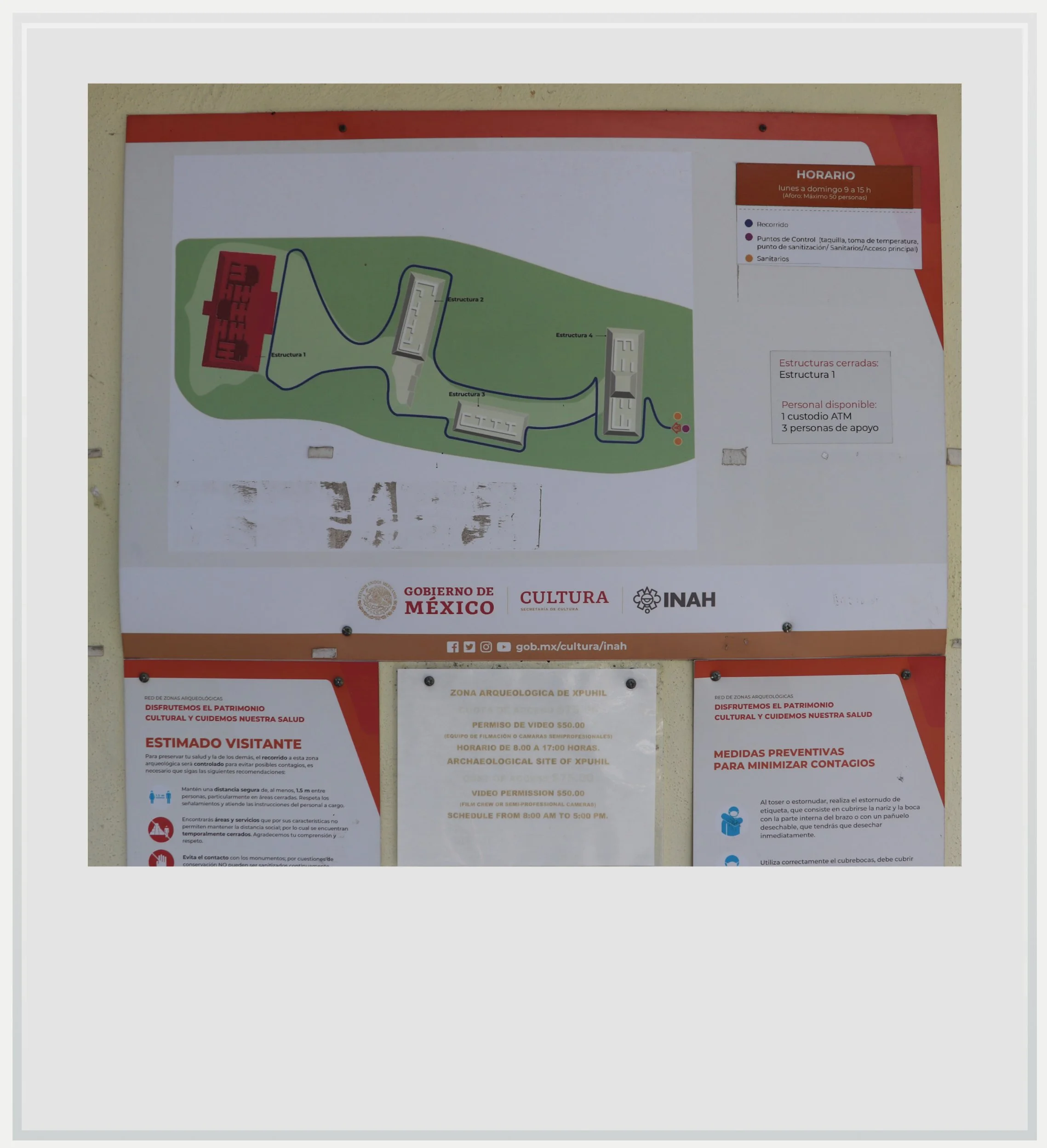
A map of the Xpujil, Campeche, Mexico archeological site.
When to go to Xpujil
The best months weather-wise to enjoy Xpujil are during the dry season, between November and April, with January and February the (relatively) coolest months. This is also peak season but, given its location, the site is never actually crowded.
I went to Xpujil in October, which is low season as the combination of possible afternoon showers and intense heat can turn off travelers. I loved it for the lack of crowds, and the slightly overcast weather which made the heat tolerable. I was the only visitor during my whole time at Xpujil, and having the site to myself was a fantastic experience.
Aim to go to the site early (they open at 8am) or late (around 3pm, to give you two hours before they close), to avoid the hottest hours of the day. While there is ample cover on the path to the ruins, the buildings themselves are pretty exposed to the sun, and a visit in the midday heat may not be the most pleasant.
How much does it cost to visit Xpujil
Entrance cost was MXN 80 at time of publishing.

How long should I plan to visit Xpujil
Plan to spend 30 minutes on site, as it isn’t very big (but impressive nonetheless).
What are the opening times of Xpujil
The site is open every day from 8am to 5pm with entry allowed until 4.45pm.
Safety in Xpujil
The Yucatán peninsula is one of the safest areas in Mexico, and Campeche is one of the few Mexican states with no specific travel advisory: it is labeled a level 1 “Exercise Normal Precautions” state by the US Department of State, just like anywhere in the US. As such, there is no need to worry beyond taking normal precautions.
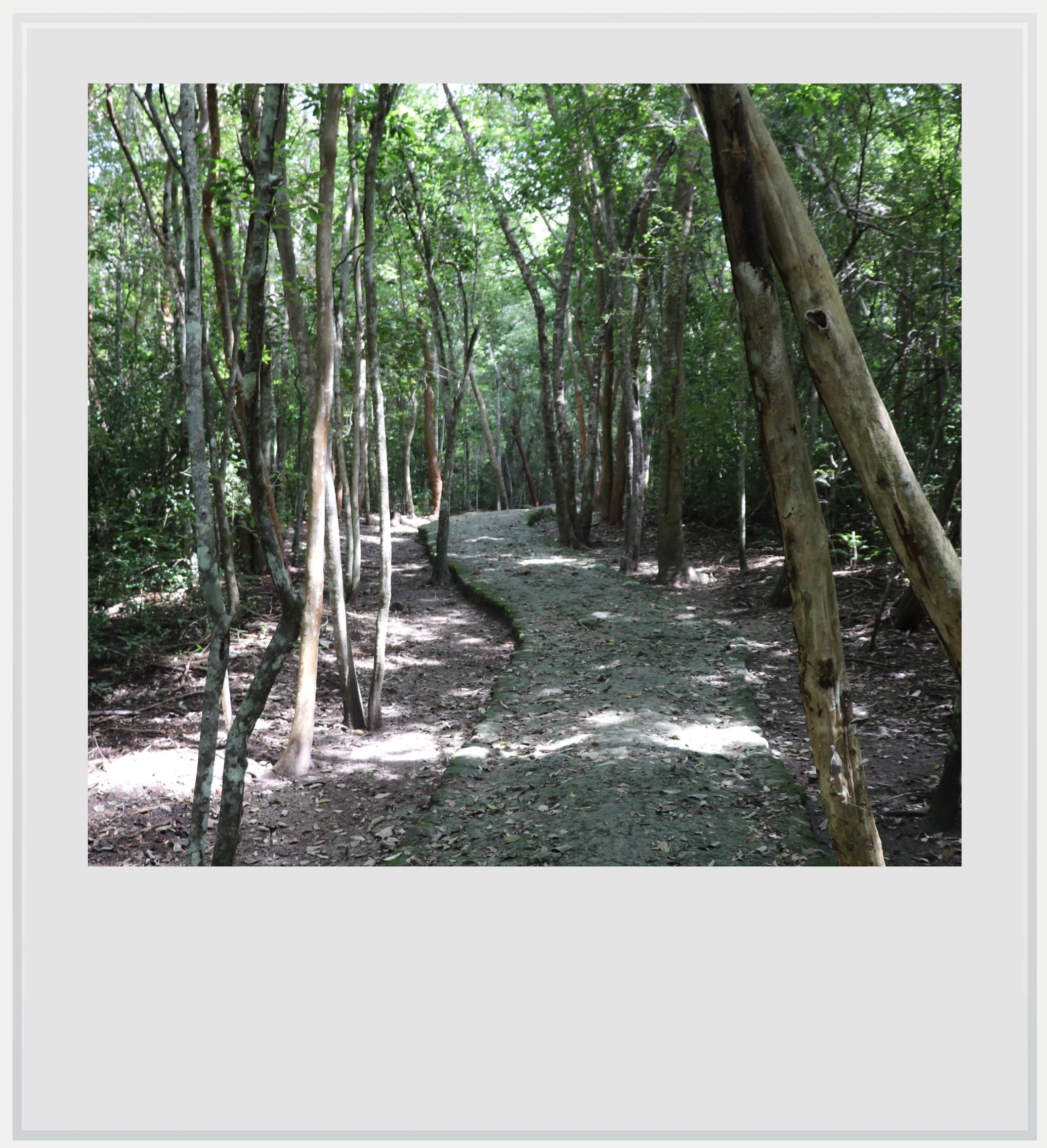
The forested path to the Maya ruins in Xpujil.
Food & lodging near Xpujil
The Xpujil Maya site is located within the small eponymous town, close to its airstrip, a 2-min car ride from the main intersection or 10-min walk from the bus station. Xpujil will likely be a base to visit other Rio Bec sites in the region. It has decent tourism infrastructure, with hotels, restaurants, gas stations and yes, three OXXOs, and at least one of which is open 24/7.
Hotels
I stayed at the highly-rated Hotel Casa Las Lolas, on the outskirts of town. The hotel is actually made up of about 10 self-contained casitas, well-appointed, with kitchenette, good WiFi and self-parking. I would definitely stay there again. Prices around $100 a night.
Locals recommended the Hotel Villa Calakmul as a more affordable option in town. It is fairly basic, but seemed clean, safe and was away from the main road so traffic noise wasn’t an issue. Price around USD 50 a night.
Restaurants
My favorite for breakfast: Antojitos Doña Evita. Good food, great service. It’s basic but super clean and affordable. Totally recommended
A good treat for dinner: Sazón Veracruz. A large menu and a choice of terrace or indoor seating at a very reasonable price, as well as excellent Google reviews make this a safe bet. I had the meat, mushroom and cheese tacos which were decent, but price to quantity ratio was incredible.
Keep in mind these travel tips
The Yucatan peninsula is one of the safest regions in Mexico, and its main roads are well maintained. This isn’t enough to forget the #1 driving advice in Mexico: do not drive at night. Driving at night, on poorly lit roads means you won’t see the motorcycles without lights, the potholes and the ubiquitous topes, these notoriously hard speed bumps that spring out of nowhere. You may encounter wildlife or, more prosaically street dogs crossing right in front of you. Plan your itinerary to be at your next destination before nightfall. It’s important.
No matter what the season, there will be bugs in Yucatan. While you may only see the gigantic Tarántula Yucateca spider on the roads leading to Calakmul, you’ll find mosquitoes pretty much everywhere, and especially in the shaded forests surrounding the Maya ruins. Be ready with repellent at any time of the day. It’s also a good idea to wear clothes that cover your limbs (pants, high socks, long sleeve T-shirts) while you’re in the jungle. Mosquito-borne diseases are fairly uncommon in the state of Campeche, but not unheard of.
SPF will be your best friend. The UV index may be low in the morning and evening, but during the day, it gets pretty high.
Do not forget to hydrate. While OXXOs aren’t as ubiquitous in this rural region than in other ones, you’ll find plenty of abarrotes, these tiny stores selling cold water and sodas along the way. Make sure you always have water handy and drink to make the heat more bearable.
Cell service is spotty at best in southeastern Campeche, with Telcel the only provider with decent service in some places. If you’re roaming, check that you can roam on Telcel, or investigate a Mexican eSIM that uses this network. If not, think about downloading maps for offline use, it may prove very useful.
Every photo’s legend will appear if you hover over it (on a computer) or click on it (on a smartphone).
All photos are mine and copyrighted.