Exploring the Puna district on Hawaii’s Big Island.
Paradise on a fault line.
Looking for concrete details and tips? Go straight to the Practical Information section.
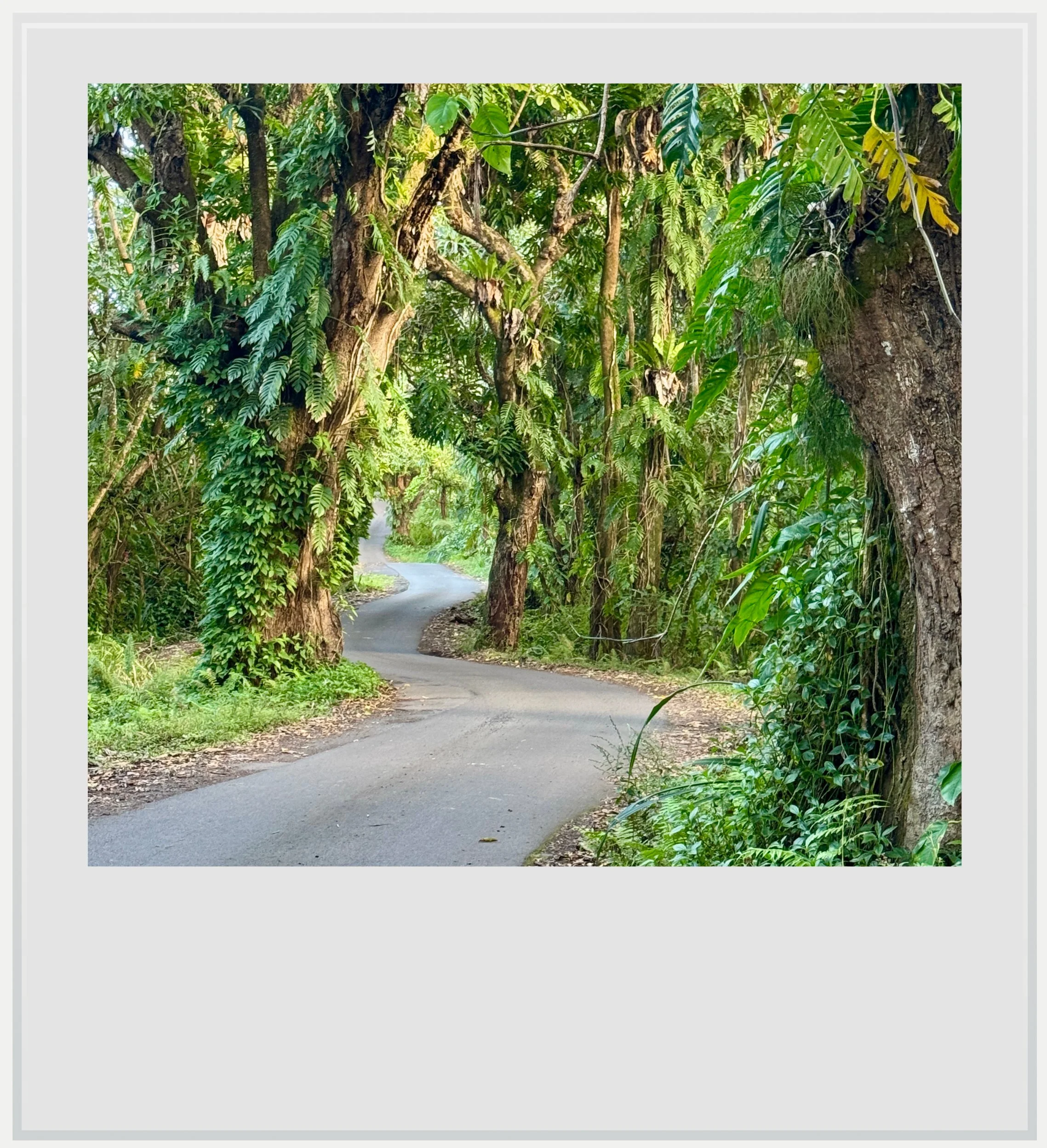
The one-lane road was meandering lazily among century-old trees, covered in epiphytes and mosses, while the sun, peeking through the canopy, was giving the asphalt a golden sheen. We were as far away from the world as could be - close to the easternmost point of the Hawaiian archipelago, on the Big Island, more than 2,200 miles away from the U.S. mainland - and I was expecting horse-drawn carriages to appear at any moment.
Yet minutes later, in front of an ominous stop sign where Government Beach Road abruptly ended, the scenery couldn’t have been any more different. A vast, barren expanse of dry volcanic rocks lay ahead of us, leaving only a few clumps of plant life in places. The devastation was almost complete, the desolate landscape harrowing.
Stretching through the southeastern part of Hawaii’s Big Island, the Puna district is a land of contrasts, encompassing some of the island’s most pristine grounds as well as some of its most recently transformed by the elements. It’s also a part of the island that hardly receives any visitors and still feels like a welcoming rural community far away from global mass tourism.
Numbers can be misleading because the Puna region is one of the most populated on the island - a feat not particularly noteworthy for the island itself is almost seven times bigger than Oahu, the capital island, and five times less populated. The Puna district actually happens to be an area of choice for people working in the island’s biggest town, Hilo, a good thirty minutes to the north.
Walking on Government Beach road near Hawaiian Shores.
People going to the world famous Hawaii Volcanoes National Park may remember passing by the district and indeed, parts of it sit on the road between Hilo and the park, but most tourists drive straight through, neglecting to stop and check out the region.
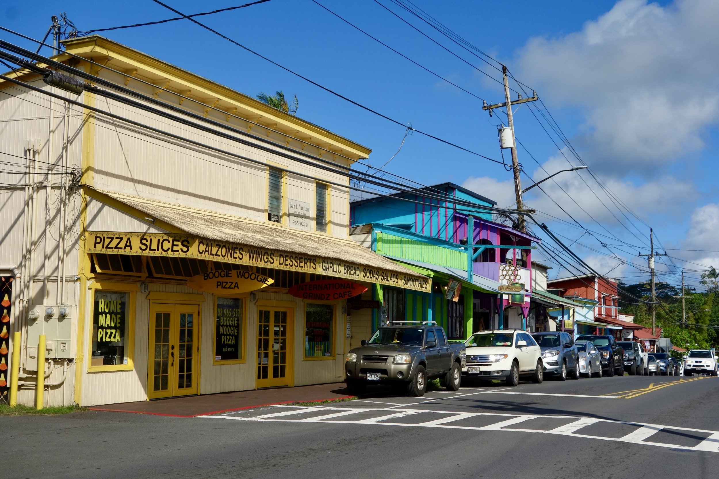
Away from state road 11, Pahoa felt like the area’s beating heart. A small village of less than 1,000 souls, the settlement is a tiny yet vibrant hub for the region, with the old route 130 as its spine, and the widest selection of restaurants in the area. Approaching from Hilo, we first encountered a newish commercial development that could have felt right in any small American town, save for the very local name of the CVS outpost (CVS drugstores in Hawaii still bear the name Longs Drugs). Once we got into town, however, it became distinctly Hawaiian.
It isn’t known when the Puna district was settled in Hawaiian times, but the richness of its soil, combined with frequent rainfall, probably made it a prime spot, and it is assumed it was populated early on. In the very late 19th century, plans were drawn to develop sugarcane as a crop, replacing coffee. At the time, making sugar was an incredibly profitable endeavor on the island, given the American demand and a Reciprocity Treaty allowing duty-free access to the US market.
A lot of what makes Pahoa’s character can be linked back to that period: the slowly decaying traditional buildings along old route 130 and a multi-ethnic population driven by the immigration of Asian workers working in the plantations, many of whom decided to stay once their contract ended.
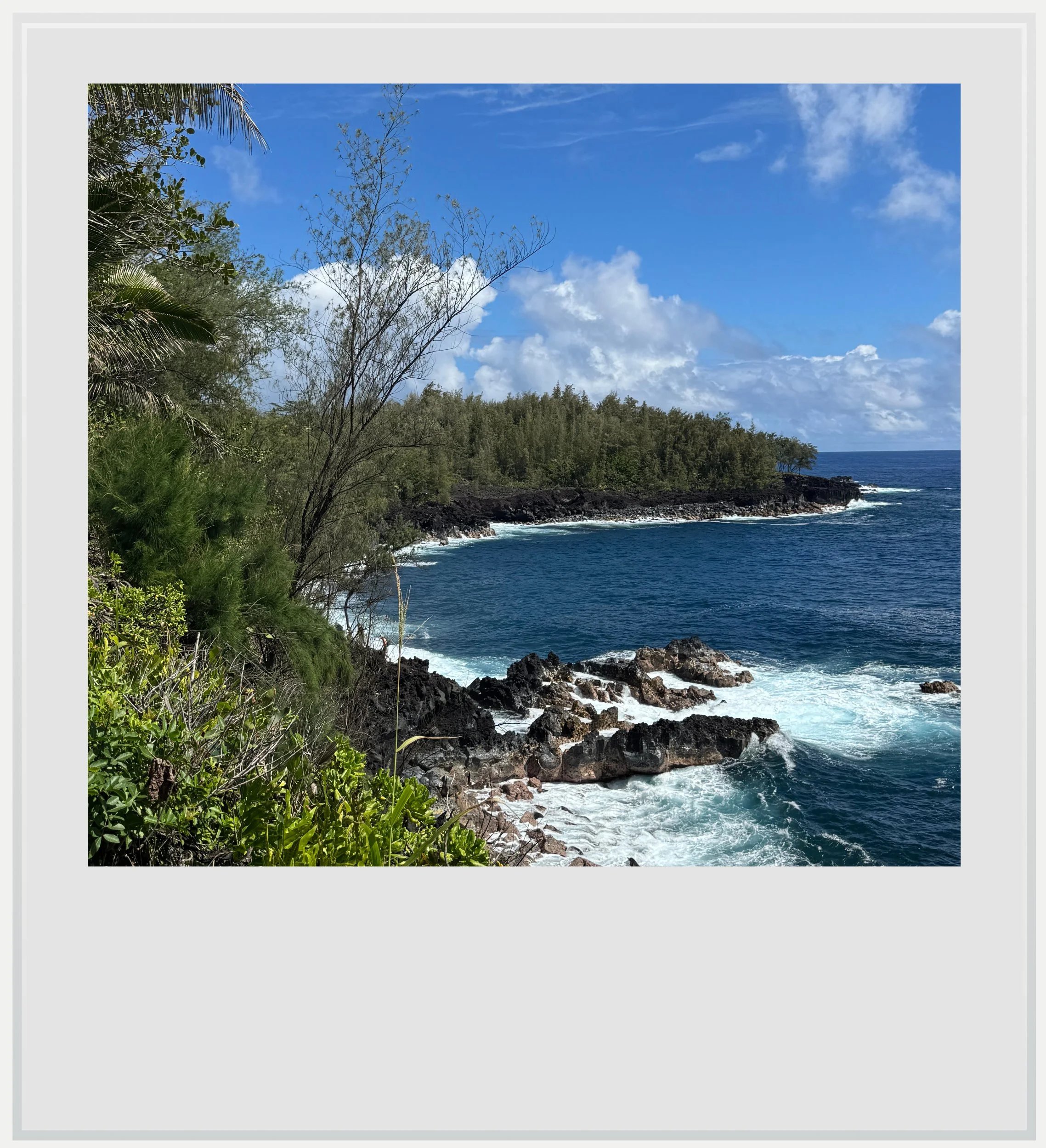
The jagged coastline on the south of Hawaii's Big Island, in the Puna district.
Walking down Pahoa’s main street, it was hard to escape the bohemian vibes that percolated from many stores stocked with locally made clothes or artisanal jewelry. The region attracted adepts of the hippie movement in the 1960s and 1970s for its remoteness, and their influence is still felt today.
Beyond the brightly painted Western-style buildings, lies a story of resilience that courses through the whole district. Being located east of the Kilauea volcano, one of the most active in the world, means the town has to live with a constant, looming threat of eruptions that could cause severe damage and disrupt life in profound ways.
Beyond the dark lava scars, a profusion of lush tropical landscapes awaited.
Look no further than the 2014 event, whose lava flow breached the perimeter of the town’s recycling facility. The most recent eruption, in 2018, wiped out an entire subdivision near Pahoa, called the Leilani estate, where it is estimated 200 homes were lost to lava. The flow reached the ocean, burying Kapoho bay, which disappeared from the map, and wiping out a whole other subdivision nearby, called Vacationland.
Today, the iconic coastal road, also known as the Red road, linking Kalapana to Hawaiian Shores is cut in the middle by the lava deposits and requires a very long detour via Kapoho road, highlighting the impermanence of the ground the district is built on.
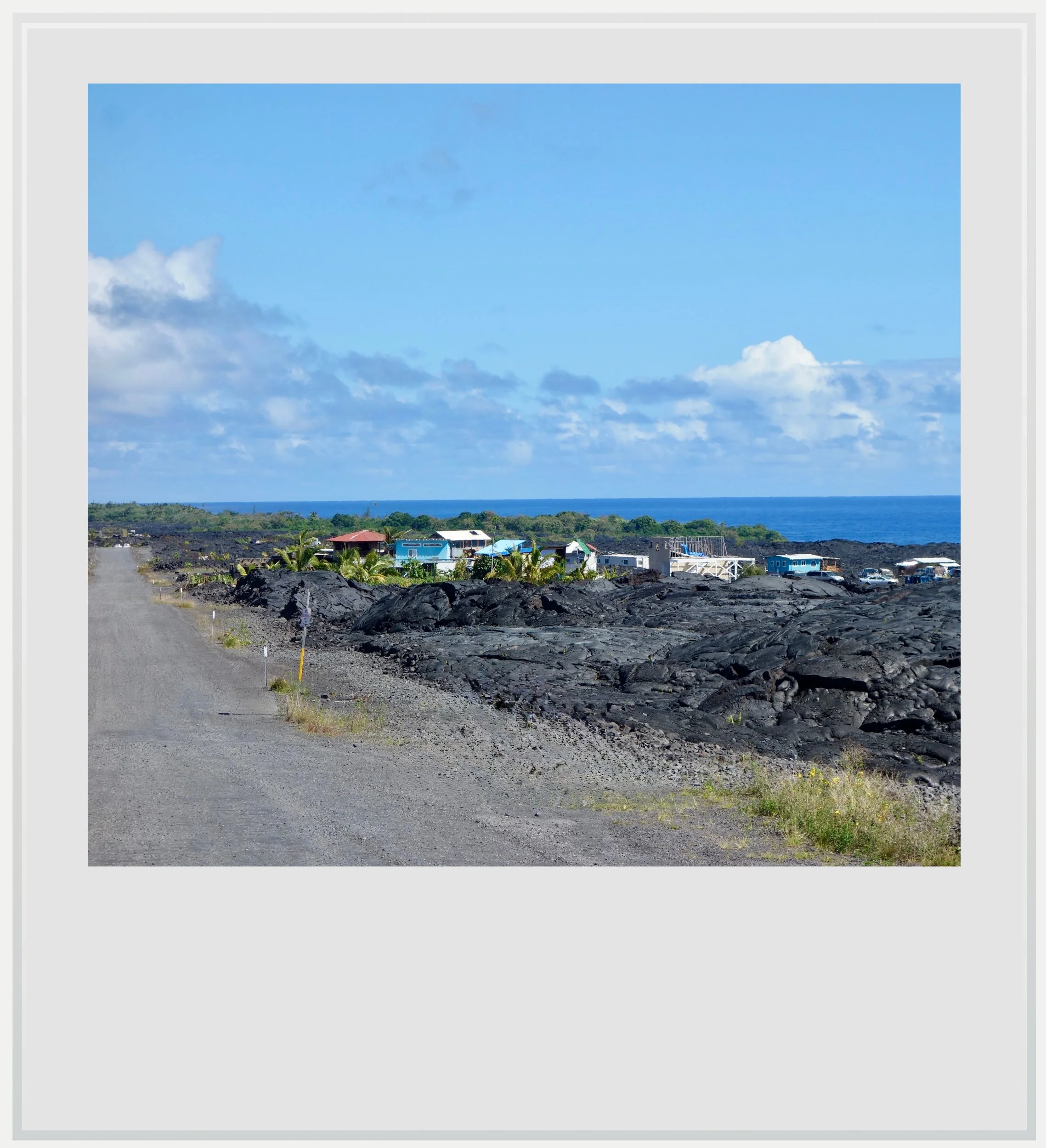
Houses built on top of dry lava flows in Kapalana.
Amidst the constant threat of devastation, the resilience of some communities seemed extraordinary. Take the settlements west of Kapalana, destroyed by several lava flows since 1960, where, among the sharp and dry volcanic stones, new houses are beginning to sprout. The scenery is both stark and full of hope. There, in the middle of what looks like a dark desert of desolation, emerge little oases of color: wooden houses built on top of dried up lava, surrounded by skimpy trees, showing that life can restart even in the least hospitable places.
It would be misleading, however, to describe the Puna district as a barren expanse of volcanic wasteland. Beyond the dark lava scars, a profusion of lush tropical landscapes awaited. My favorite was, without a doubt, the Kehena black sand beach. Located south of the district, along the still-opened part of the beautiful coastal road leading you from community to community along gently swaying palm trees, it wasn’t easy to find - the natural cove was hidden by a small forest, and the steps to get down to the beach quite steep, so getting there felt like a well-deserved reward.
Because of its relative seclusion, the beach welcomes many people frolicking in the buff - not that it’s a must, we also saw many people donning a bathing suit. On the day we were there, about forty people were enjoying the sun and the relatively calm waves, but we were told it can get crowded on weekends.
I loved that the sand was grey, more than black - it had a softness, both in touch and in tone that felt just right. Isolated from the rest of the island by the trees, it felt strangely intimate, and a great place to relax. It was hard to forget, however, that this gorgeous piece of sand was created by powerful lava flows, hundreds of thousands of years ago. It was as if the incredible beauty of the Puna district was also a testament to the fragility of its landscapes - here one day, buried under a dark volcanic crust the next.
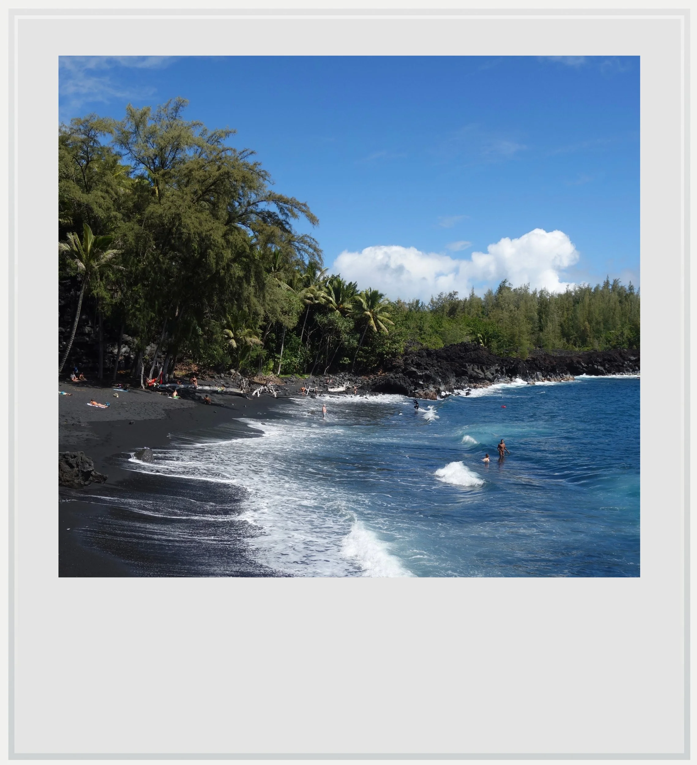
Kehena beach.
Being explorers at heart, we tried to hike past the beach, in search of even more tranquility, and found it after trekking through treacherous lava rocks (this is not a walk I would recommend in flip flops, but rather in sturdy, hiking shoes). From our new vantage point, in a small clearing, we could see the southern coast of the Big Island with its jagged, black cliffs beaten by an unrelenting ocean. Had we thought of bringing a picnic, we would certainly have stayed there a while.
Another stop I loved near Pahoa was the Lava Tree State Monument, a small, hidden park featuring beautiful lava trees. While the process of creating these is violent (lava flowing through a forest will reach the trees then cool to their contact and as such, harden before the tree collapses), the resulting vertical molds of lava scattered in the park made for a very interesting, quasi-mystical kind of forest. The trail was relatively short, devoid of crowds, and it was a wonderful way to see how the forest and the lava could connect and, through destruction, give rise to a new kind of landscape.
There were many places we tried to access in the Puna district that were off-limits because of lava flows: Cape Kumukahi, Hawaii’s easternmost point, or the Nanawale Forest Reserve, for instance. As much though I would have loved to check them out, there was a part of me that liked the fact the district wasn’t letting us access everything on our first trip - as if we needed to gain its trust and wait for nature to let us in, another time.
Finally, we spent some time watching the ocean at Waiakahiula Beach Park, in the small Hawaiian Shores community, which happened to be close to our Airbnb. A straight line down Kahakai boulevard from Pahoa, it was nestled in a quiet, compact community that oozed old Hawaiian charm, among older houses surrounded by colorful trees. It was so peaceful, so tranquil that for a moment I wished my whole Hawaiian experience could be summarized like this: authentic and quiet, between the blue ocean and the green lawns, trying to catch the last rays of the declining sun.
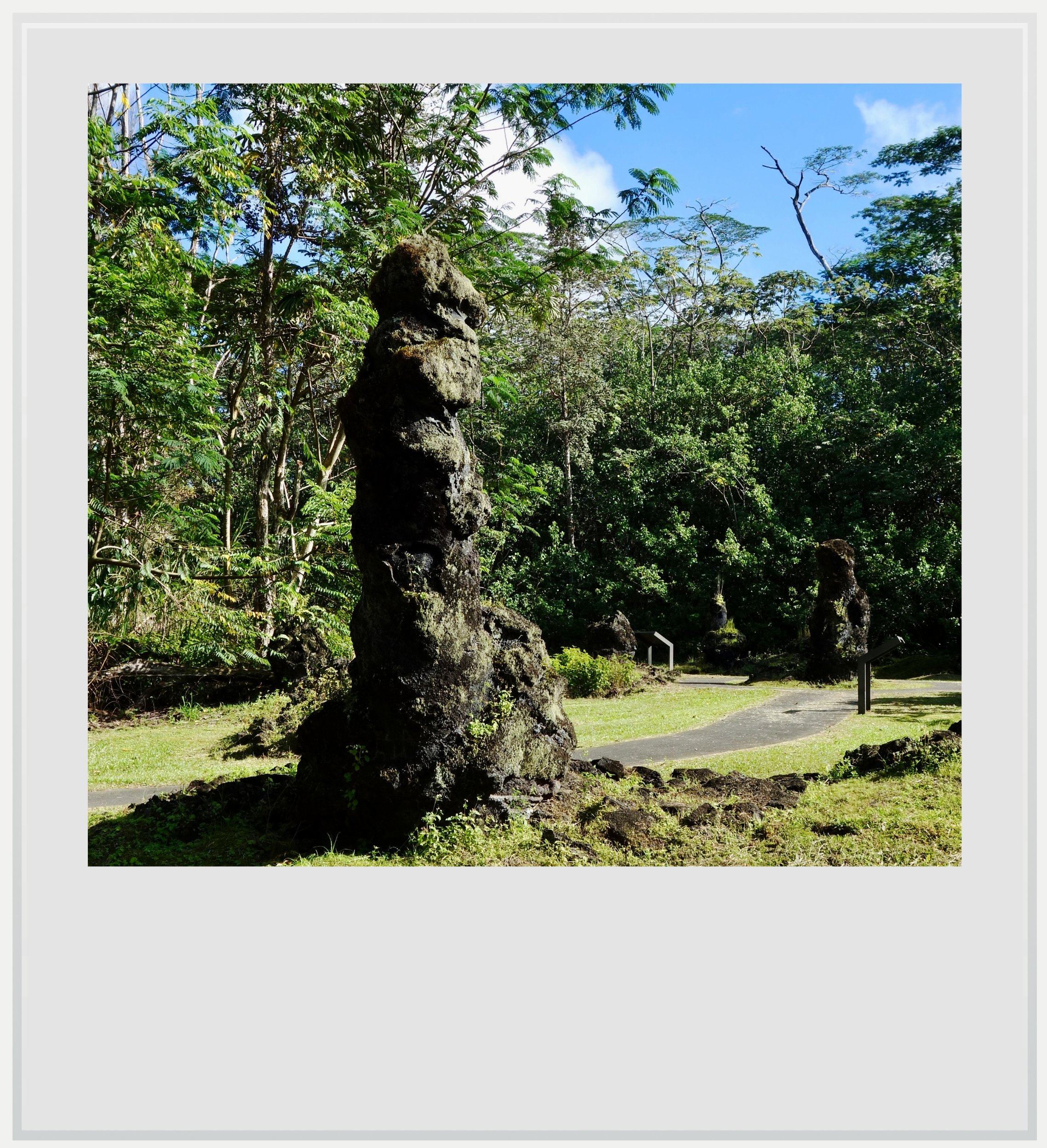
A lava tree in the Lava Tree State Monument, in the Puna district of Hawaii's Big Island.
What stayed with me
Overlooked by tourist going from Hilo to the Hawaii Volcanoes National Park, the Puna district felt like a forgotten slice of real Hawaii. The sheer beauty of its rural landscapes, alternating between lush tropical settings to volcanic deserts was a highlight of our trip on the Big Island. Nowhere else did I feel this tranquil spirit of peaceful resilience in the face of the severe natural threats that shape life there. Nowhere else was nature so obviously both paradise and peril. Only the Puna district achieved this delicate balance, and that is probably why it felt so special.
Practical information
(Everything you could possibly want to know about the Big Island’s Puna district - updated February 2026)
Getting to the Big Island’s Puna district from the United States
Though it isn’t as well served as the island of Oahu, home of such tourist magnets as Honolulu and Waikiki, the island of Hawaii, or the Big Island, counts with two main airports, Kona to the west (KOA) and Hilo to the east (ITO). Most flights from the U.S. mainland arrive in Kona, which is closer to the main tourist areas of the island. The Hilo airport is closest to the Puna district (it takes about thirty minutes to reach its capital, Pahoa without traffic), but the airport isn’t currently served from the continental U.S.. Southwest has announced a direct flight between Las Vegas (LAS) and Hilo, starting August 6, 2026, operating three times per week. Until then, the only option is to fly into Kona’s Ellison Onizuka airport (KOA). On a random day, I counted more than twenty flights departing to the continental U.S., mostly towards the West coast, but with a few going as far as Chicago and Dallas.
Given the sheer size of the island and the overall lack of public transit, renting a car makes the most sense on the Big Island, and whether you arrive in Kona or Hilo, you will find plenty of options.
The drive from Kona airport to Pahoa, in the heart of the Puna district, takes almost two hours, through well maintained and relatively straight roads that will not require any special driving skills.
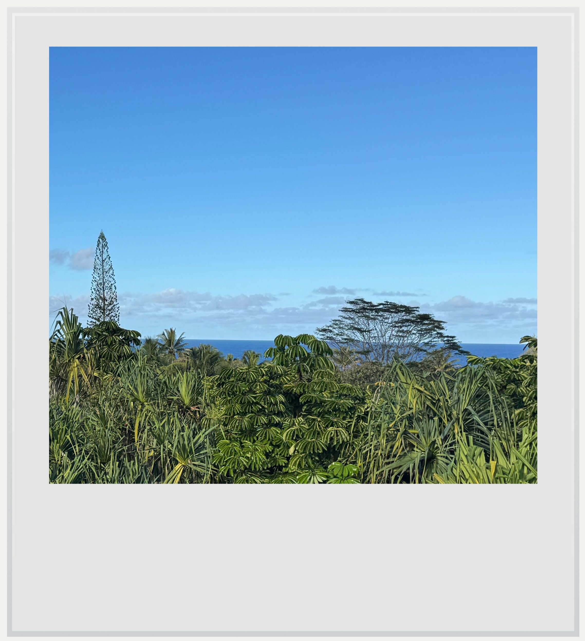
Lush vegetation with an ocean view in the Puna district of Hawaii's Big Island.
When to go to the Puna district
I am a big believer in shoulder season travel - the period just before or after the peak of the tourist season, when most people haven't arrived or have already left, but the weather is still pleasant, and the prices a little lower.
Shoulder season on the Big Island includes the months of April, May, September and October. Although relative given the size of the island, the busiest months in terms of arrival are June, July and December. For comparison, September, the month with the least amount of visitors, is about thirty per-cent less crowded than July, the busiest.
The Puna district is one of the least touristy area of the island, and as such, coming in any month of the year will not change your experience dramatically.
Note that the best month to see whales are between January and March, but this is also the rainiest period in the Hilo area. We visited the Big Island in late January and never experienced more than a few minutes of light rain on any given day, so don’t let that deter you from coming in the Northern winter.
How long should I plan to visit the Big island’s Puna district
Plan for a minimum of two days, with three days being ideal. Anymore days and you can start exploring beyond the district.
A trip to the Puna district only makes sense as part of a bigger trip to the Hawaiian islands. The Big Island is a great place to spend more days, with lots of nature to explore, especially along the Hamakua coast but also within the Hawaii Volcanoes National Park.

A colorful house in Pahoa.
Safety on Hawaii’s Big Island
Isolated, sparsely populated and not super touristy, the Big Island is a fairly safe destination to visit. Violent crime is close to non-existent, especially against tourists. Just watch for petty theft and car break-ins, which can happen, especially on beach parking lots or at trailheads. Do not leave any valuable in the rental car, or anything in sight.
The main hazard on the island is probably nature. Swimming in the ocean can be treacherous with strong rip currents, and hiking on lava fields an exercise in balance. Beyond that, you can enjoy the Aloha spirit without a worry.
Food & lodging in the Puna district
Accommodation
Given the area’s residential focus, accommodation options tend towards Airbnbs more than hotels, but a few are available. I recommend looking for a place near Pahoa or on the coast nearby and not along the main highway between Hilo and the Volcanoes National Park, which is a little bit busier.
We stayed in this AirBnb, in a residential area close to the ocean. In keeping with the area’s undeveloped vibe, the house was off-grid and relying on solar energy and Starlink internet. It was perfect for two people, and surrounded by a lush forest full of coqui frogs.
Restaurants
Plenty of restaurants are available in Pahoa, but my favorite was Ning’s Thai Cuisine, a no-frills Asian place with delicious and copious dishes, in an airy setting. It’s worth checking out.
Keep in mind these travel tips
With the rain and humidity, it can get a bit chilly at night in the Puna district, so don’t forget to bring layers.
The area’s climate is perfect for all sorts of bugs and small creatures. Be ready for harmless encounters and have bug spray available. Note there are no snakes on the island.
SPF will be your best friend. The UV index may be low in the morning and evening, but during the day, it gets pretty high.
Do not forget to hydrate. Always have a bottle of water with you, especially on long hikes where cell service may be spotty.
Take hiking shoes, even if you don’t plan to hike. There will come a time when you’ll want to walk on a lava field, and doing so without proper shoes is asking for trouble.
Cell service is pretty good on the island overall, no matter your provider. It isn’t always the case in more remote areas. Pahoa will have 5G service, but some areas along the coast do not, so plan accordingly.
Every photo’s legend will appear if you hover over it (on a computer) or click on it (on a smartphone).
All photos are mine and copyrighted.