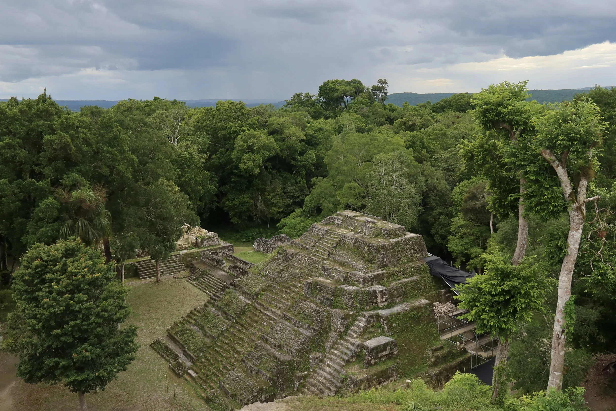
A Maya City Named for the Lake It Keeps Out of Sight.
Looking for directions, opening hours, or where to stay and eat? Head straight to the Practical Information section.
The road to Yaxha skirts several lakes on the way: Lake Peten Itza, Lake Salpeten and Lake Macanche among them. In fact, a string of lakes extends from Laguna Perdida all the way to Lake Sacnab, part of an east–west belt of faults in the limestone terrain, which explains why the lakes cluster here.
While many ancient Maya cities of the Peten were built away from lakes, easy access to water was always a key requirement for any Maya settlement. The Peten has few permanent water sources¹, and a nearby lake could help provide that supply.
Yaxha, often described as the third-largest Maya site in Guatemala after Tikal and El Mirador, was built along the eponymous lake. Water was so important in the city’s history that its original Maya name, Yaxha, still used today, means “blue-green water”. In Maya languages, yax meant blue-green, but it also carried a sense of ‘new’ or ‘first’. The sacred ceiba tree was the yaxche, the green tree or the first tree. I like to think the link is that new plant growth is often a vibrant blue-green, but I couldn't find anything to confirm it.
I only briefly glimpsed the lake before getting to Yaxha. Past the Yaxha-Nakum-Naranjo National Park entrance, the forest opens up for a brief moment to let the lake appear. The road hugs it for a few hundred feet before being swallowed by the jungle. It would be a while before I saw the lake again. If it hadn’t been for these fleeting seconds, I might never have noticed we were so close to a big body of water.
Yaxha is one of four Maya settlements scattered in the Yaxha-Nakum-Naranjo National Park, and it is the easiest to reach. Once you leave the main road between Flores and the Belize border, a dirt track of 7 miles (11 km) leads to the park’s entrance and its visitor center. From there, Yaxha lies about 1.2 miles (2 km) further, on a road that’s mostly passable year round.
By the time I got to the parking lot, by the site’s first pyramid, I had forgotten all about the lake. The rocky path, the lush forest around me and the lack of cell service had conspired to make me feel utterly isolated. There were only a small tour bus and a couple of rental cars parked there. My visit would most likely be quiet.
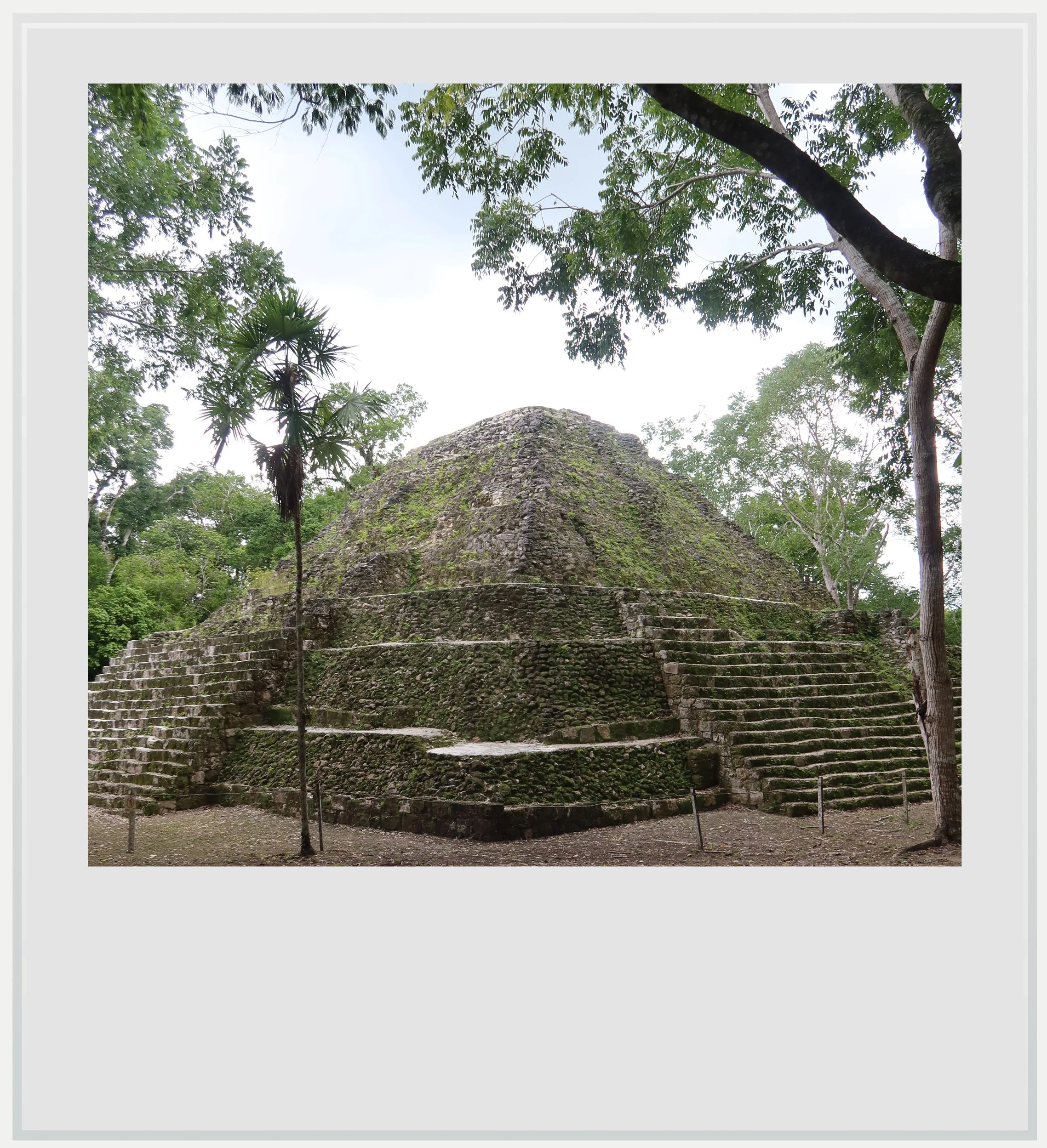
Structure 152 at Yaxha.
That first pyramid was unexpectedly imposing. Structure 152, as it is called, is a massive pyramid that seemed out of place, away from the main acropolises and out of line with the city grid. It was in fact one of the city's first buildings, likely built before Yaxha organized itself along a north–south axis, and it was oriented to the sun.
Yaxha was built on a ridge overlooking the lake, yet the terrain was so uneven that the water stayed hidden from view. I was used to Maya cities laid out on flat expanses of man-made platforms. I started walking up toward the East Acropolis, the highest building group in the city, hoping to see the lake again.
At the foot of the stairway to the East Acropolis stands a replica of Stela 11, Yaxha's most famous monument. The ruler carved on it wears the costume of a warrior from Teotihuacan, the great city that stood near present-day Mexico City. That same morning I had been at Tikal, where Teotihuacan's intervention in 378 AD changed the course of the city's history. Finding the same imagery here, 19 miles (30 km) away, showed how far that influence had reached.
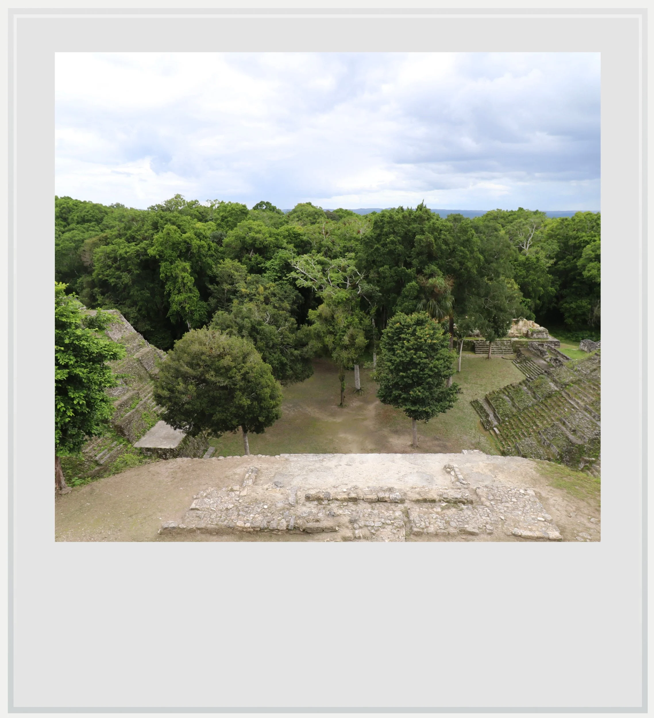
The North Acropolis at Yaxha.
The acropolis itself and its most iconic building, Temple 216, were off-limits. The temple was being restored, as a study had found cracks in its south and west facades, caused by excess load. As the highest point on the site, the summit of Temple 216 was the best place to watch Yaxha's famous sunset, but it has been closed since February 2025. It is understood that the work may take several years, and there is no confirmation as to whether public access will be allowed again.
I continued on to the Twin-Pyramid Complex, then the ball court, walking among tall trees with hardly anyone around, and finally to what I knew would be the highlight of my visit, the North Acropolis. This acropolis is a closed plaza of eleven buildings, dominated by a triadic group: three restored pyramids standing on its north, east and west sides.
Unfortunately, the forest blocked the view of Lake Yaxha.
These three buildings (Structures 137, 142 & 144) and their placement on one elevated platform are a great example of Preclassic architecture (before 250 AD), and form one of the earliest sacred centers built at Yaxha.
The biggest and tallest pyramid, Structure 142, was in front of me, on the northern side of the plaza, facing south. Its current restored shape hides several layers of older construction phases. It is 87 feet (27 m) tall and is climbable, which meant I had to get up there, hoping that, from a higher vantage point, I could finally see the lake.
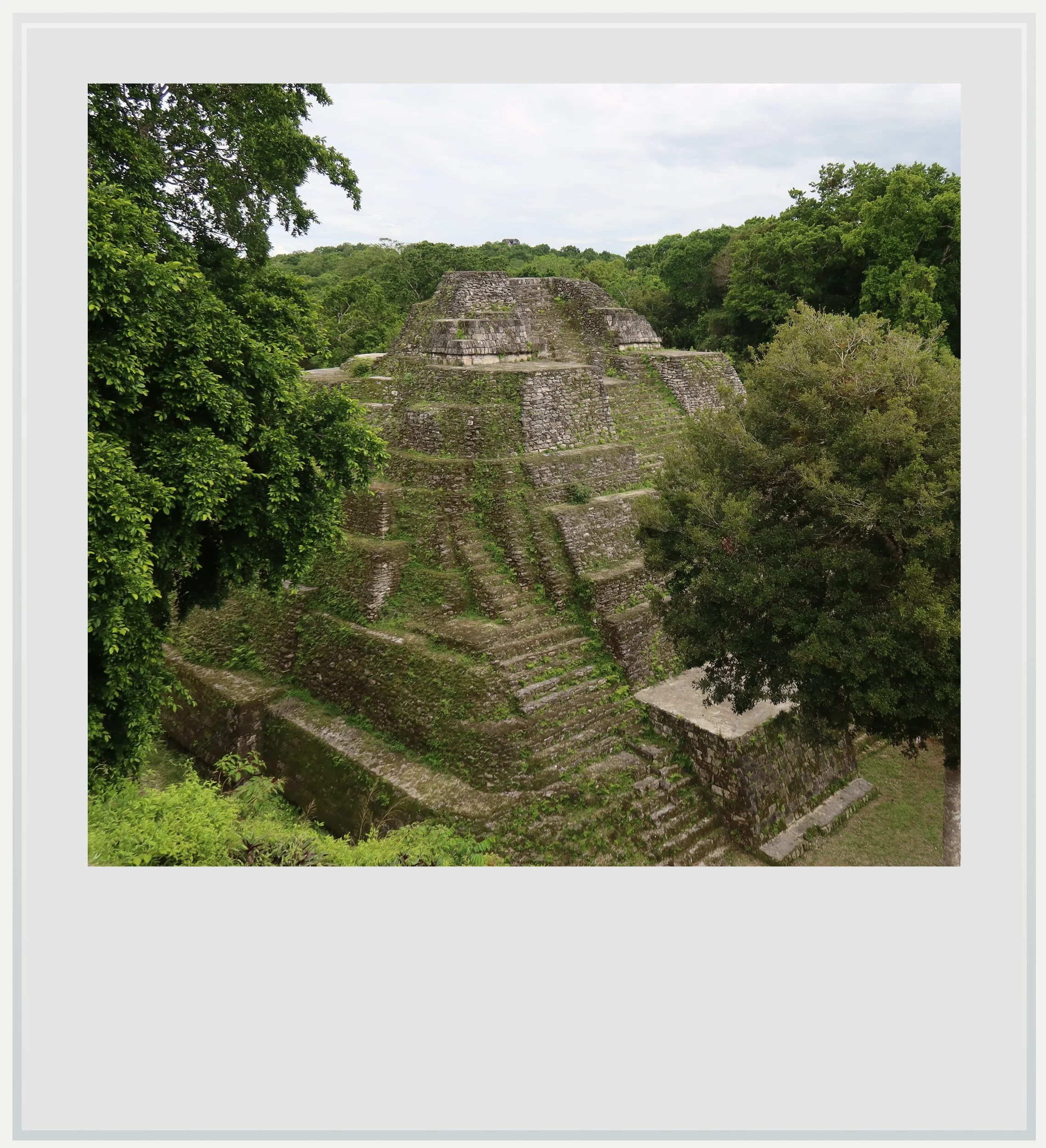
Structure 137 in Yaxha’s North Acropolis
From the top, the view over its slightly smaller sister pyramids is stunning, and is one of the signature images of the Yaxha archeological zone. I sensed how important this complex must have been. There was something about its layout, the grandeur of the pyramid, perhaps also their closeness, that communicated power and strength. I stayed a while at the top, taking it all in, chatting with the few visitors who made it up after me. Unfortunately, the forest blocked the view of Lake Yaxha.
Coming down, I figured I would try to get close to the lake. If I couldn’t see it from the top of a pyramid, at least I could walk to it. I had seen a way to get down to it on the map at the entrance of the site, so I hiked around until I got to a crossroads where a wide sacbe (Maya for sacred causeway) was sloping down toward the water.
I had expected a grand entrance lined with ancient buildings, but the Calzada del Lago was nothing of the sort. Instead, it looked abandoned, almost like an afterthought. The contrast with the North Acropolis I had just visited was striking.
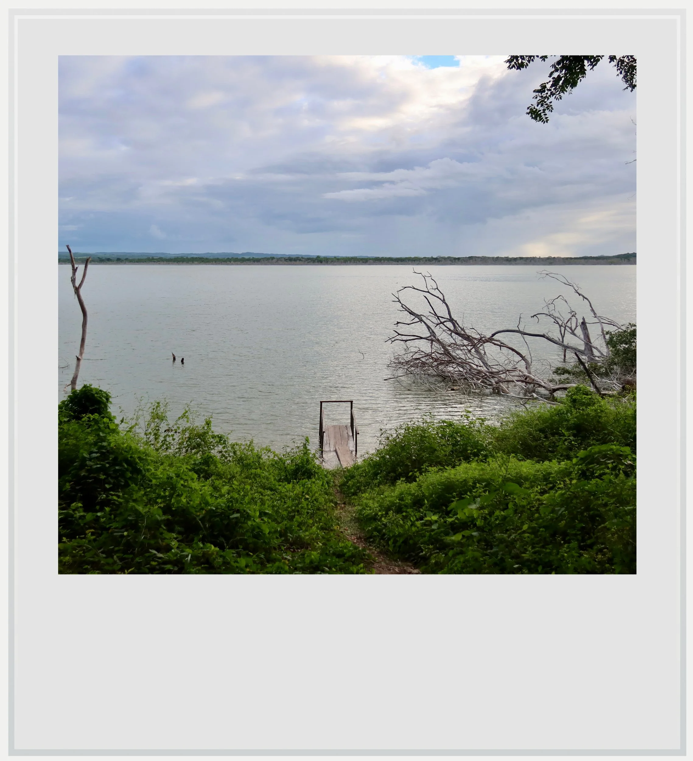
Lake Yaxha at the end of Calzada del Lago.
From the bottom of the causeway, the whole of Lake Yaxha opened up in front of me. I could make out Topoxte Island to the west, home to another archeological zone I would discover a couple of days later.
In Yaxha’s golden days, the lake of the same name played a critical role in the life of the city. Fed by several streams and connected to nearby Lake Sacnab in periods of high water, Lake Yaxha was part of a regional exchange route that the city could control². Today, it was hard to imagine that the neglected causeway and the placid lake had ever been so instrumental in securing Yaxha’s power.
The reward was a view I hadn’t imagined I could get.
I walked back up and, as I lingered by the path, checked the map on my phone to decide where to go next. That’s when I realized the Calzada del Lago formed the southern half of the main axis running through Yaxha from north to south. On the map, it was clearly a major entrance to the city; walking on it today, you would never guess.
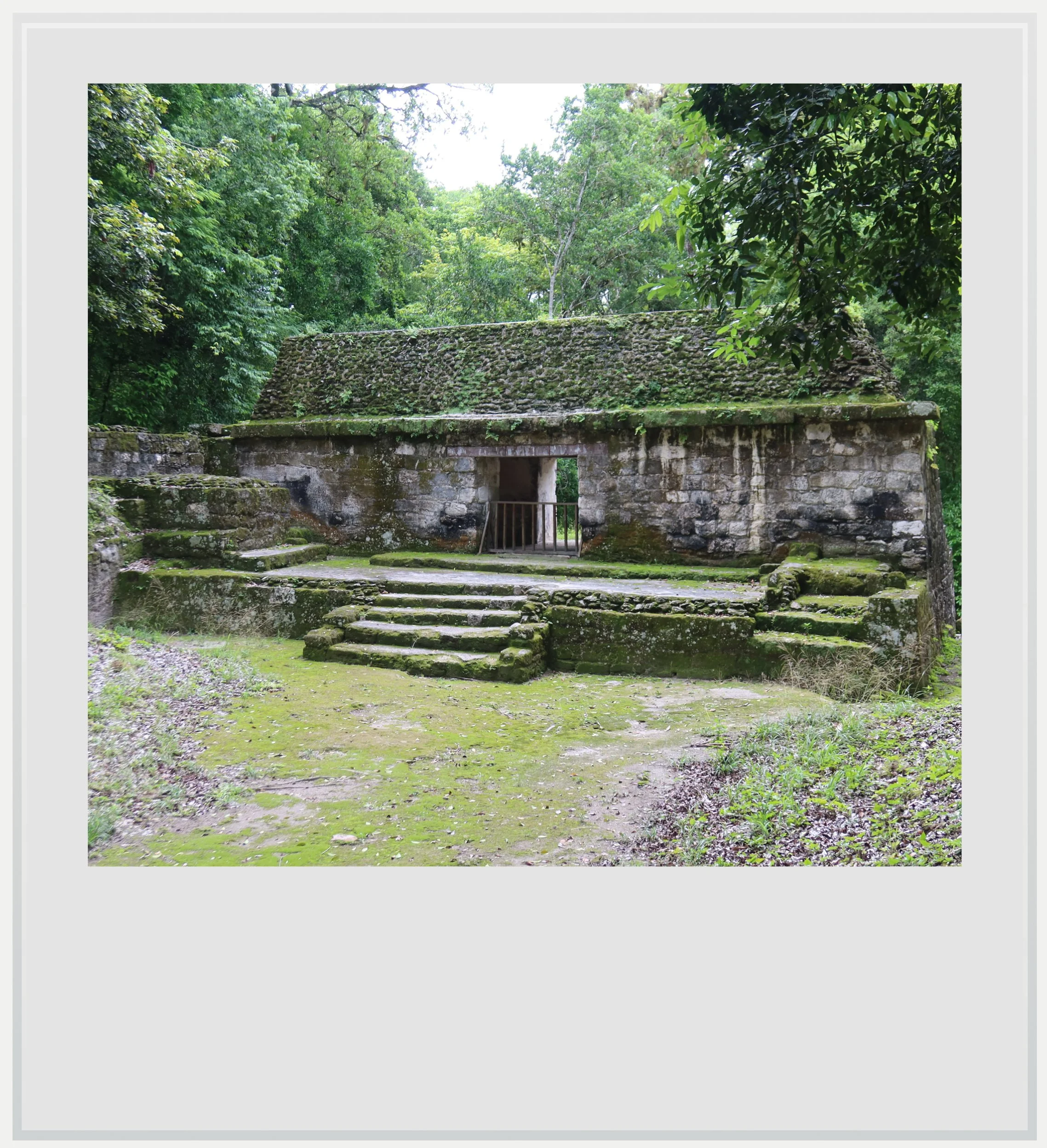
Palace 375 in the South Acropolis.
I promised myself I would walk the causeway all the way to the north, but before that, I continued west until I reached a huge mound, the Major Astronomical Complex. Like Structure 152, the first pyramid I had seen when I arrived, it belonged to a group of buildings built to follow the course of the sun. The two were a pair, in fact: the complex at the entrance was a smaller replica of this one, and both were among the oldest monuments in the city. I quickly noticed wooden stairs leading to its summit and climbed them to enjoy another view of the jungle.
This pyramid is one of the tallest buildings on the site, and getting to the top wasn't easy, but the reward was a view I had been looking for since I arrived. In front of me was the landscape I had been missing from the top of the North Acropolis’ tallest pyramid: Lake Yaxha in its full glory, surrounded by thick tropical forest.
Looking around, I could make out the top of Temple 216 and the very top of the North Acropolis pyramid I had climbed a few minutes earlier.
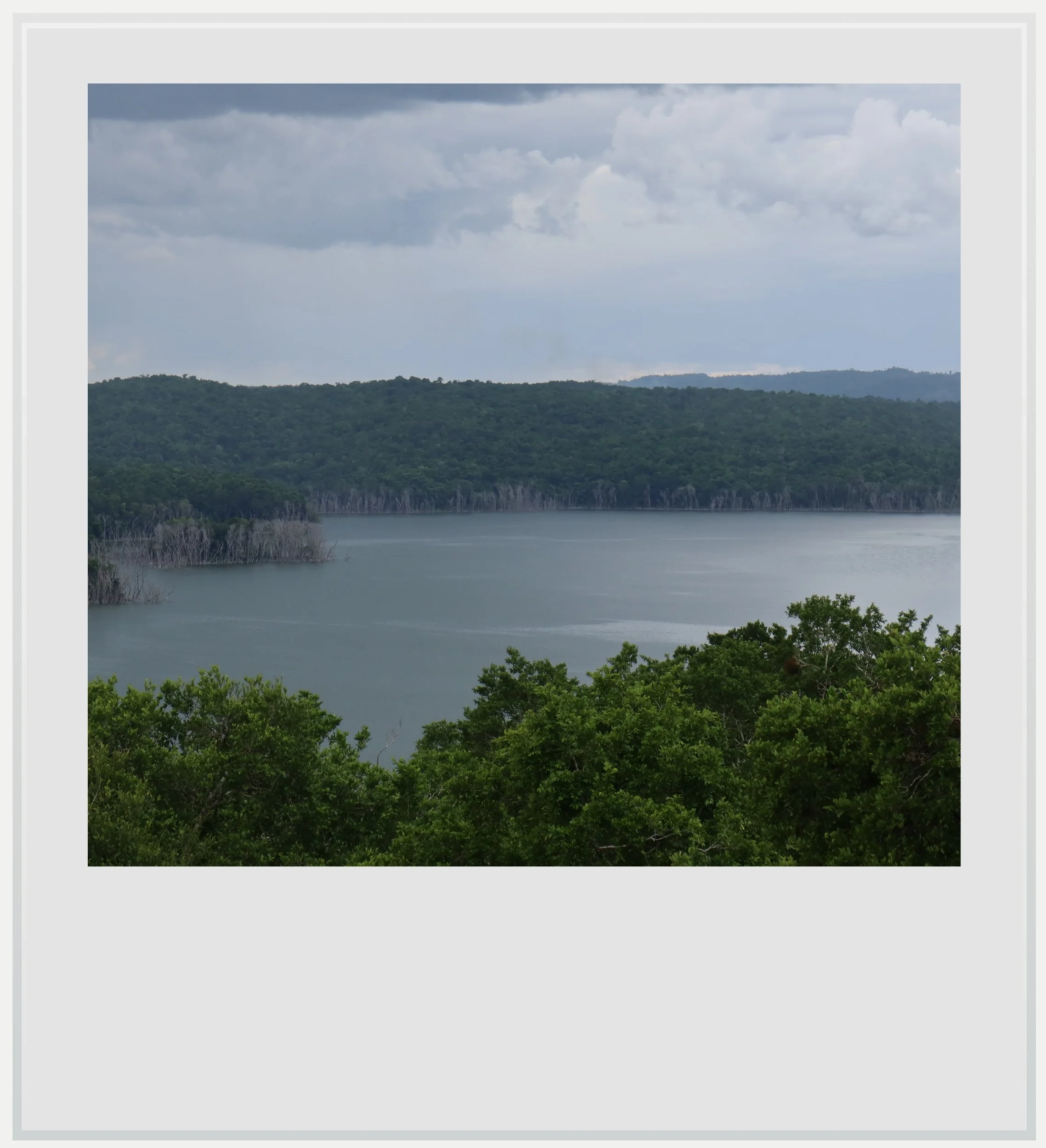
Lake Yaxha from the top of the Major Astronomical Complex pyramid.
Little by little, more people started to arrive, and I understood that, with the closure of Temple 216, this pyramid was now the best spot to enjoy a stunning sunset over the lake. By 5pm, the top platform was fairly full, but that day, the sun stayed hidden under a thick cloud cover, and we left without seeing what most tourists had come to Yaxha for (the sunset is one of the key selling points for tours to the area).
The weather on the second day looked much more promising.
Night started falling fairly quickly and we all walked back to the parking lot. It was already dark by the time I reached my accommodation, the only hotel on the outskirts of the park, El Sombrero lodge.
The next day, I had planned an excursion to Nakum, another Maya city within the Yaxha-Nakum-Naranjo National Park that was much harder to reach (it was an incredible journey, which I wrote about here). My guide and I came back from Nakum around 2pm, and although I had very little strength left, I decided to give the Yaxha sunset another try.
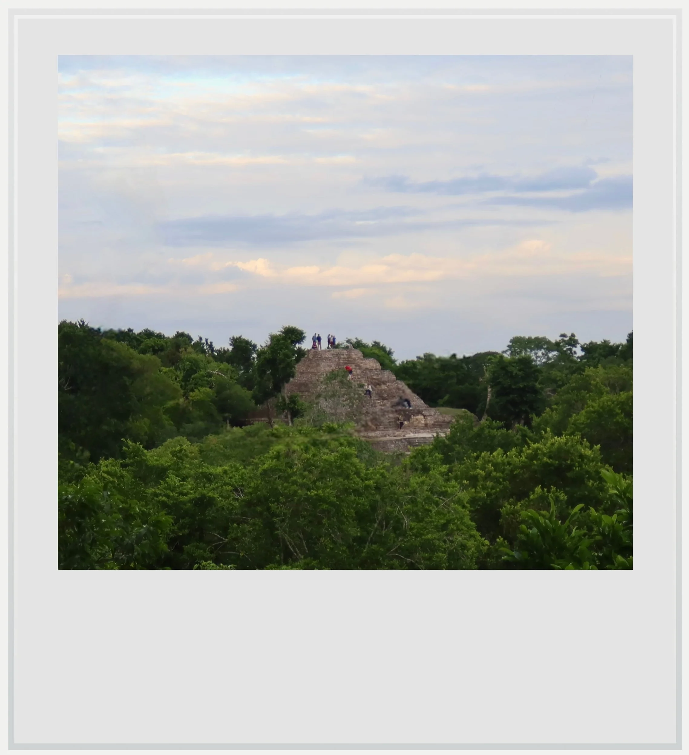
The top of Structure 142 from the Major Astronomical Complex pyramid.
I had also realized I had missed the northernmost building cluster at Yaxha, the Maler Group, and that was another reason to head back.
The weather on the second day looked much more promising. The sky was much less cloudy, and I hoped I would finally see the famous sunset.
The Maler Group is located at the end of a causeway that forms the northern half of the settlement's main axis. Walking up this broad sacbe toward the Maler Group's pyramids, I found it much easier to imagine the power of Yaxha's rulers.
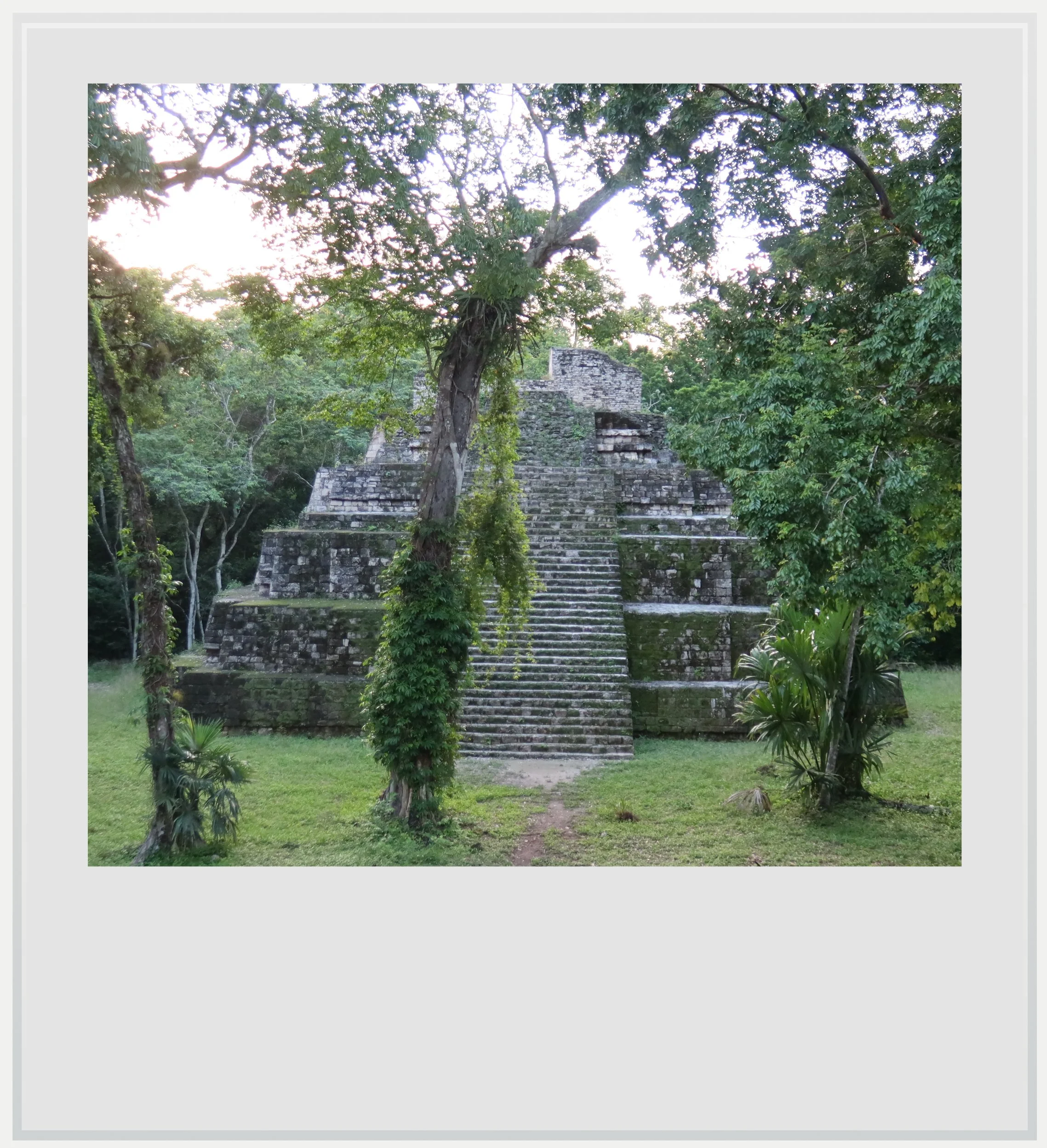
Structure 1 in the Maler Group at Yaxha.
The Maler Group is named after Teobert Maler, the Austrian explorer who first surveyed the site in 1904. The three main buildings, Structures 1, 4 & 6, are elegant pyramids showcasing different architectural styles. One of the tallest, Structure 4, frames the main plaza. Initially built in the Late Preclassic, it was remodeled several times until reaching its final height of more than 26 feet (8 m). Structure 1, built later in the Late Classic (after AD 600), faces it from the opposite side, while Structure 6 stands apart on its own raised platform.
Very few people ever make it to the Maler Group, and its location, at the end of Yaxha’s most important causeway, made me feel like I had arrived somewhere. With its three main pyramids excavated and most of the trees cleared, the group made an unexpected high point to my visit.
It was now time to head back to the top of the Major Astronomical Complex pyramid. I trotted toward the building and made it to the top just as the sun was beginning to disappear behind the trees. There were about thirty people with me, but you couldn’t hear a sound. The sun had become a fiery golden disk, and its orange glow was reflected on the sparse clouds ahead of us. The forest, which had turned a warm shade of green a few minutes earlier, was now dark, almost menacing. And the lake, a muted blue-green all afternoon, was glowing red, like embers about to die out.
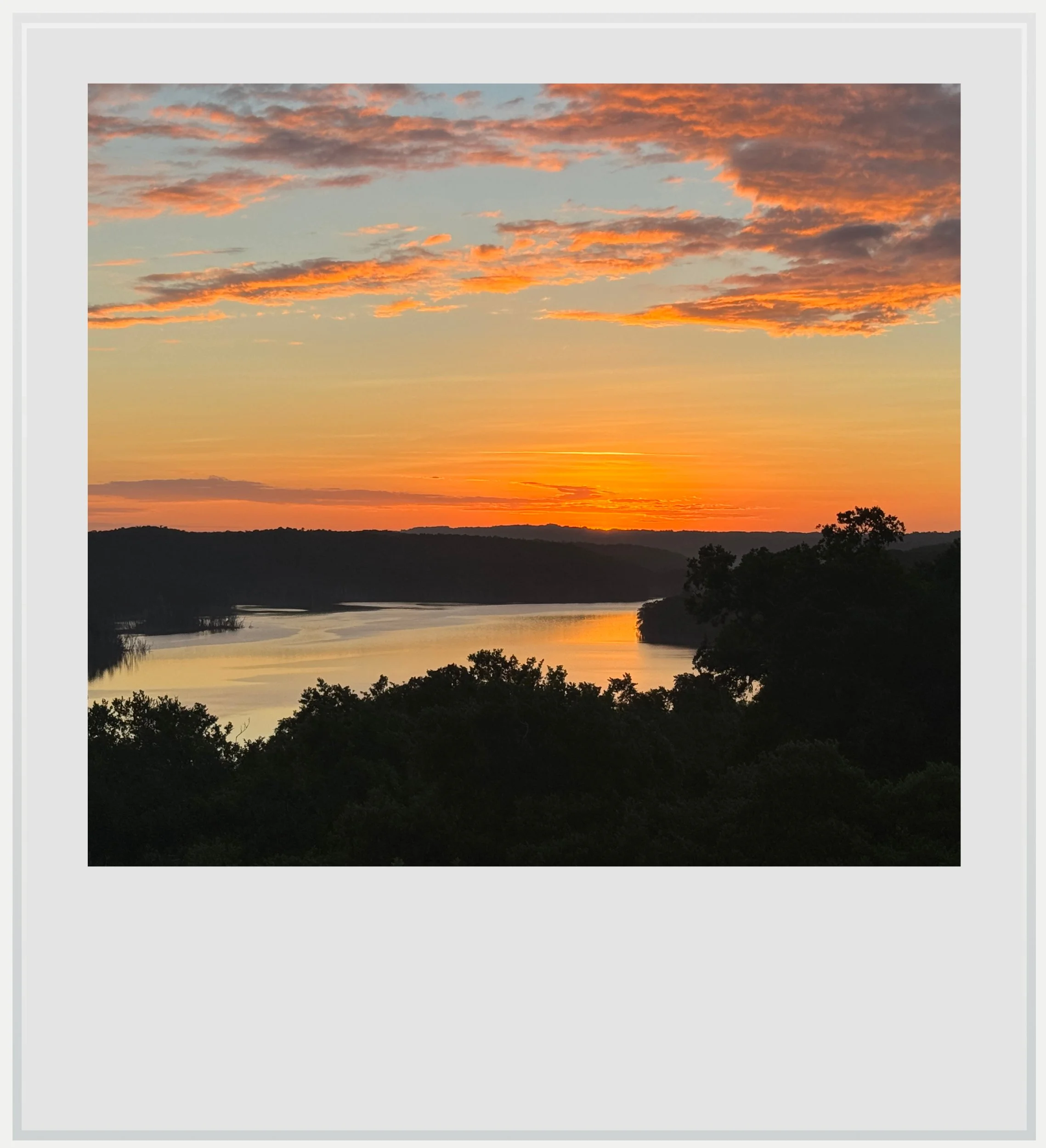
The sunset view from the top of the Major Astronomical Complex pyramid.
For a few minutes, Yaxha’s blue-green water was neither blue nor green. I thought of the first Maya who settled on this shore more than 2,500 years ago and gave the lake its name. They named it for its everyday color, but they must have stood on these hills and watched it burn like this at the end of the day too. I like to think it was part of why they stayed.
Notes
Practical information
(last updated November 2026)
At a glance
Name: Yaxha, usually translated as "blue-green water." Unusually, the ancient name of the city has survived and is still in use.
Location: Yaxha-Nakum-Naranjo National Park, in northeastern Peten, Guatemala, inside the Maya Biosphere Reserve. The city sits on a ridge above Lake Yaxha. The park was created in 2003 and covers about 143 square miles (372 km²). It contains four ancient cities: Yaxha, Nakum, Naranjo and Topoxte.
Getting there: by rental car, about 1 hour 15 minutes from Flores. That's 38 miles (62 km) of paved road toward Melchor de Mencos as far as La Maquina, then 7 miles (11 km) of dirt road. Shared and private tours also run daily from Flores.
Hours: CONAP lists the park as open 8am–5pm daily. I was able to stay past 5pm, along with tourist groups, to see the sunset. I was advised to exit the park before dark, though, which meant before 6pm in late October.
Fees: GTQ 80 per person for foreigners (about USD 10), paid at the visitor center. Unlike at Tikal, there's no extra ticket for sunset. The park requires an official ID to be shown with payment. It wasn’t enforced when I got my tickets but bring one just in case.
Time needed: two to three hours for the main site. Add about two hours for the boat trip to Topoxte (more information in the Topoxte article).
Best season: dry season (January–April). The site is open year round and it is possible to visit any month of the year. The rainy season, especially between May and October, makes the gravel road between La Maquina and the park entrance more difficult to drive on. A 4x4 vehicle with high clearance is recommended during that period.
Services: the visitor center offers bathrooms. Water and snacks are available for sale by the Yaxha archeological zone entrance, about 1.2 miles (2 km) north of the visitor center.
Mobile signal: I was able to pick up a few bars of LTE service at the top of the main pyramid in the North Acropolis, but service is unreliable otherwise.
Where to stay: Flores, El Remate or El Sombrero lodge, a lakeside hotel near the park entrance. I stayed at El Sombrero for two nights. The room was very basic but clean and well cared for, and the hotel itself was well designed. Location plus ease of access to the park were unbeatable.
Nearby Maya sites to consider: Topoxte (by boat across the lake), Nakum (11 miles (17 km) of jungle track, guide officially needed), Naranjo, and, further northwest, Tikal
Last checked: Visited October 2026. Last updated November 2026.
Getting to Yaxha
How to get to Yaxha from the United States or Mexico City: Fly to Guatemala City (GUA), then take a one-hour domestic flight to Flores (FRS) with Avianca or TAG Airlines. From Mexico City there are no non-stop flights to Flores, so connect in Guatemala City (Aeromexico or Volaris).
How to get to Yaxha from Belize: Yaxha is even closer to Belize than Tikal. The turn-off at La Maquina is on the highway between Flores and the Melchor de Mencos border crossing. It's about 20 miles (33 km) from the border to La Maquina, plus 7 miles (11 km) of dirt road, roughly an hour in total. If you're driving a rental car, check that your rental company allows border crossings, since a lot of them don’t. Tourist shuttle companies offer services between Belize and Flores, some even include a stop in Yaxha along the way.
How to get to Yaxha from Flores airport: rent a car and head east on the paved road toward Melchor de Mencos, through Ixlu. After 38 miles (62 km), at the community of La Maquina, turn north onto 7 miles (11 km) of dirt road. The dirt road was in good condition when I went. It is graveled and well graded so I wouldn’t worry about access except maybe after an intense period of rain. I drove an SUV with good ground clearance, which proved useful to access the El Sombrero lodge, but unnecessary to drive to Yaxha proper. Allow about 1 hour 15 minutes in total.
How to get to Yaxha from Tikal: retrace the Tikal road south to Ixlu, then turn east toward Melchor de Mencos. Allow about 1 hour 30 minutes. Some tour operators combine Tikal and Yaxha in one long day, Tikal in the morning and Yaxha for sunset.
Can I visit Yaxha on a scheduled tour: yes. Shared tours leave Flores every day. The most popular is the sunset tour, which leaves around noon, includes the boat to Topoxte as an option, and ends on top of the highest accessible pyramid to see the sunset. Currently, the pyramid in the Major Astronomical Complex is the highest open viewpoint, since Yaxha’s tallest building, Temple 216, is closed for renovations. Most tours do not include the GTQ 80 entrance fee, so bring cash in quetzals.
Do I need a guide at Yaxha: not for the main site. The paths are signposted and you can explore on your own. Officially, park rules require a local guide for sunset viewing; when I visited in October 2026, this wasn't enforced.
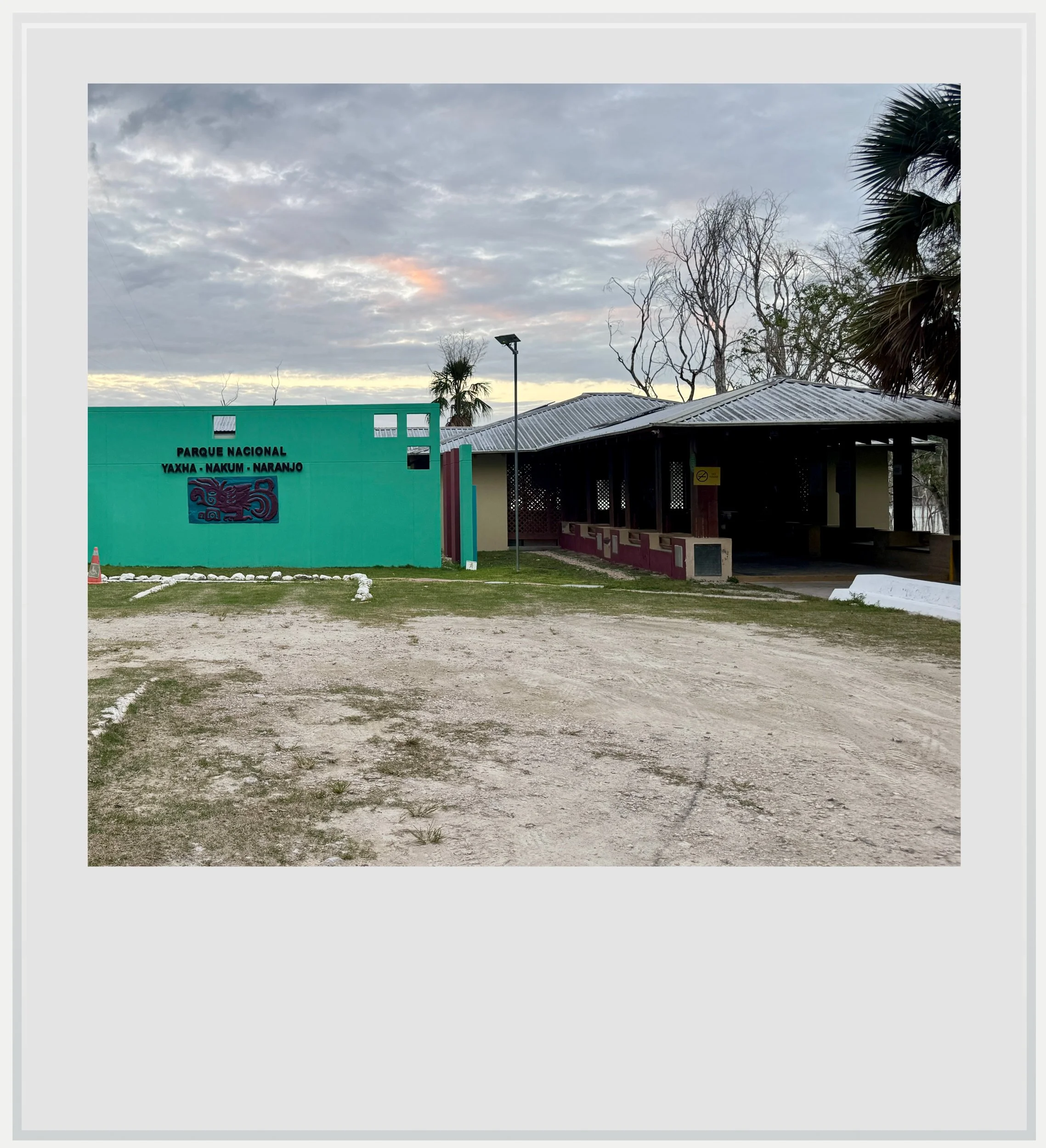
The Visitor Center at the entrance of the Yaxha-Nakum-Naranjo National Park
When to go to Yaxha
The best months for weather are in the dry season, between January and April. The tail end of the rainy season (November to December) is another good period, with less frequent rain showers than between May and October. The Yaxha-Nakum-Naranjo National Park is open year-round, and because only the last 7 miles (11 km) of the drive are unpaved, the rainy season makes the dirt road a less pleasant experience, but rarely cuts off access.
What's the best time of day to visit Yaxha
The afternoon. Yaxha is known for its sunset: from the top of the pyramid at the Major Astronomical Complex, the sun goes down over Lake Yaxha with the forest all around. Unlike at Tikal, you don’t need an extra ticket to stay for it, although park rules require a local guide for sunset viewing. When I visited, this wasn't enforced. The site is also much quieter than Tikal at any hour, so you don't need to arrive at opening to avoid crowds. If you also want to visit Topoxte, start in the early afternoon to fit in the boat trip before sunset. I visited Topoxte in the morning before leaving the park, but an early afternoon trip to the island followed by a visit to Yaxha is perfectly doable.
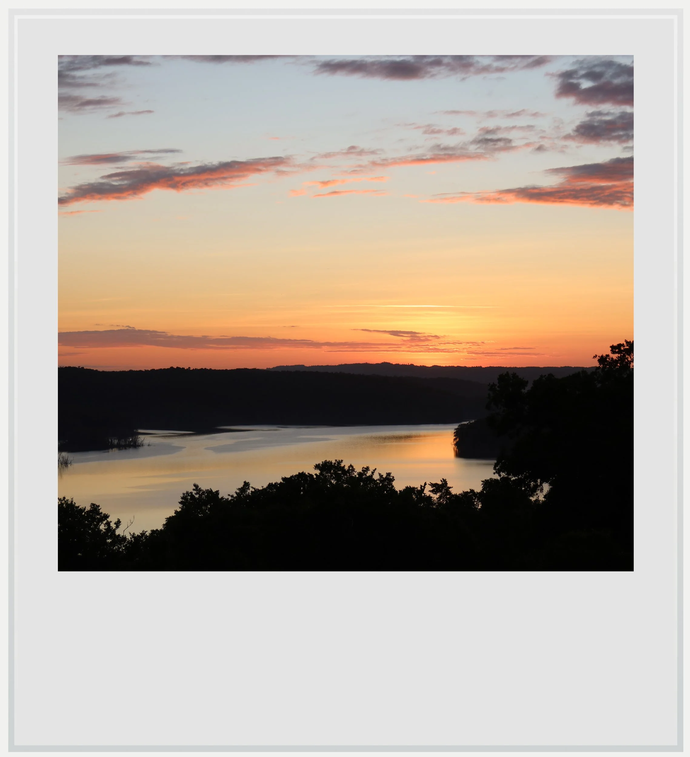
The sun disappearing over Lake Yaxha.
How much does it cost to visit Yaxha
At the time of my visit, entry to Yaxha-Nakum-Naranjo National Park cost 80 quetzals (about USD 10) for foreigners and 40 for Guatemalans. Guatemalans enter free on Sundays. You pay at the visitor center, in cash and in quetzals. The ticket covers the whole park, including Topoxte. The boat to Topoxte is extra (I paid 300 quetzals for a boat to myself; the price is the same for up to four people). Tipping the guide or boatman is optional but appreciated.
How long should I plan to visit Yaxha
Plan to spend two to three hours on the main site, following signposted forest paths between the groups. Add about two hours for Topoxte.
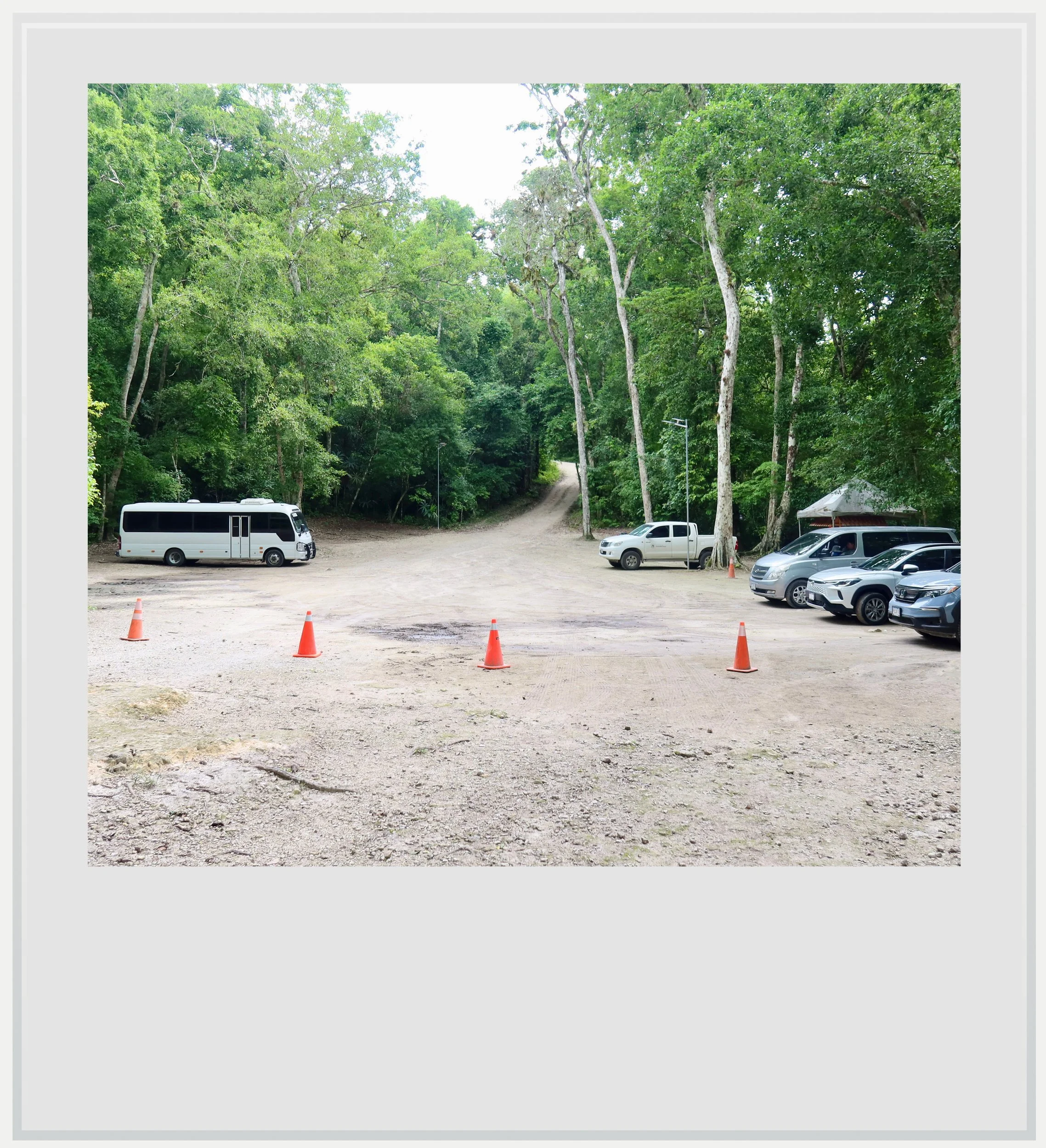
The parking lot at Yaxha.
What are Yaxha’s opening hours
The park is officially open every day from 8am to 5pm. In reality, the park stays open until after sunset, since a lot of tourists come to enjoy the sun setting over Lake Yaxha. You should leave right after sunset so you’re not walking through the jungle in the dark. I saw tour groups stay past 5pm every time I went to enjoy the sunset myself. Check with the visitor center on the day of your visit, and remember that the 7 miles (11 km) of dirt road are still ahead of you when you leave.
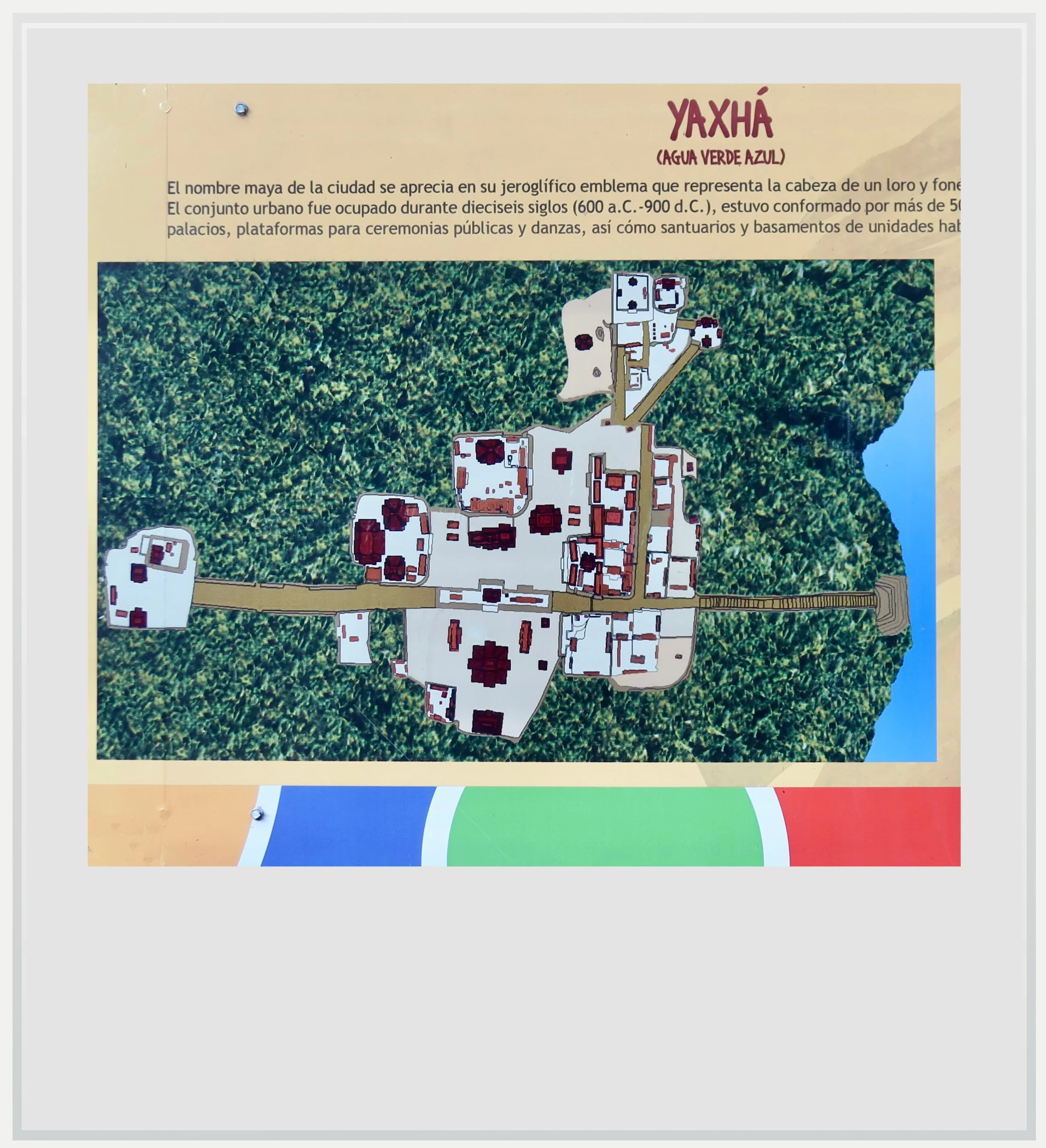
Yaxha’s official map (the Maler group is shown on the left, the lake on the right).
Climbing the temples at Yaxha
The rules are more relaxed at Yaxha than at Tikal: you can climb several of its temples.
Temple 216 (East Acropolis): at about 100 feet (30 m), it is the tallest building on the site, with a wooden staircase and a viewing platform at the top. It has a 360-degree view over both lakes and the forest. However, it is currently closed for major restoration work planned to last several years. Access is not possible at this time.
North Acropolis: the main pyramid is climbable, with a view across to Temple 216 rising above the canopy and the surrounding tropical jungle. You climb it by the pyramid’s original stone stairs, which can be treacherous, so be especially careful.
Pyramid at the Major Astronomical Complex: climbed by wooden stairs, this pyramid is currently the highest vantage point at Yaxha, with a beautiful view over the lake, and the main meeting point at sunset.
Maler Group: at the far northern end of the site, all three pyramids can be climbed via their original stone stairs.
The officiall National Park sign.
Best photo spots at Yaxha
Top of Temple 216 at sunset: the signature view of Yaxha, with the sun going down over Lake Yaxha. However, it is currently closed for restoration.
Temple 216 from the North Acropolis: the temple's crown rising just above the trees. Also a beautiful spot at sunset, even though Lake Yaxha isn’t visible from there.
Pyramid at the Major Astronomical Complex: currently Yaxha’s tallest accessible viewpoint, with a gorgeous vista over Lake Yaxha. The best spot to catch the sunset, though it can get busy at that time.
Lake Yaxha from the boat to Topoxte: the blue-green water and the forested shore, with the site on its ridge above.
Wildlife: spider and howler monkeys are common in the trees around the site. Bring a zoom lens.
Note that drones are prohibited on site unless previously approved by the park’s administration.
Topoxte, Nakum and Naranjo
The park holds three more ancient cities, and the Yaxha visitor center is a starting point for all of them.
Topoxte: this small site flourished centuries after Yaxha. Most of its buildings date to the Late Postclassic period, from about 1100 to 1450 AD, long after Yaxha’s great Classic-period temples had been abandoned. The ruins are smaller than those of Yaxha, but the boat ride across the lake and the island setting make the visit worthwhile.
Nakum: 11 miles (17 km) from Yaxha on a jungle track that is usually difficult in the rainy season. A local guide is necessary (although this wasn’t enforced during my visit, I strongly recommend getting a guide to visit). The trip can be made by dirt bike or 4x4.
Naranjo: Yaxha's powerful neighbor, reached either from the visitor center or, more easily, by 4WD from the Melchor de Mencos side. I haven’t yet visited this site.
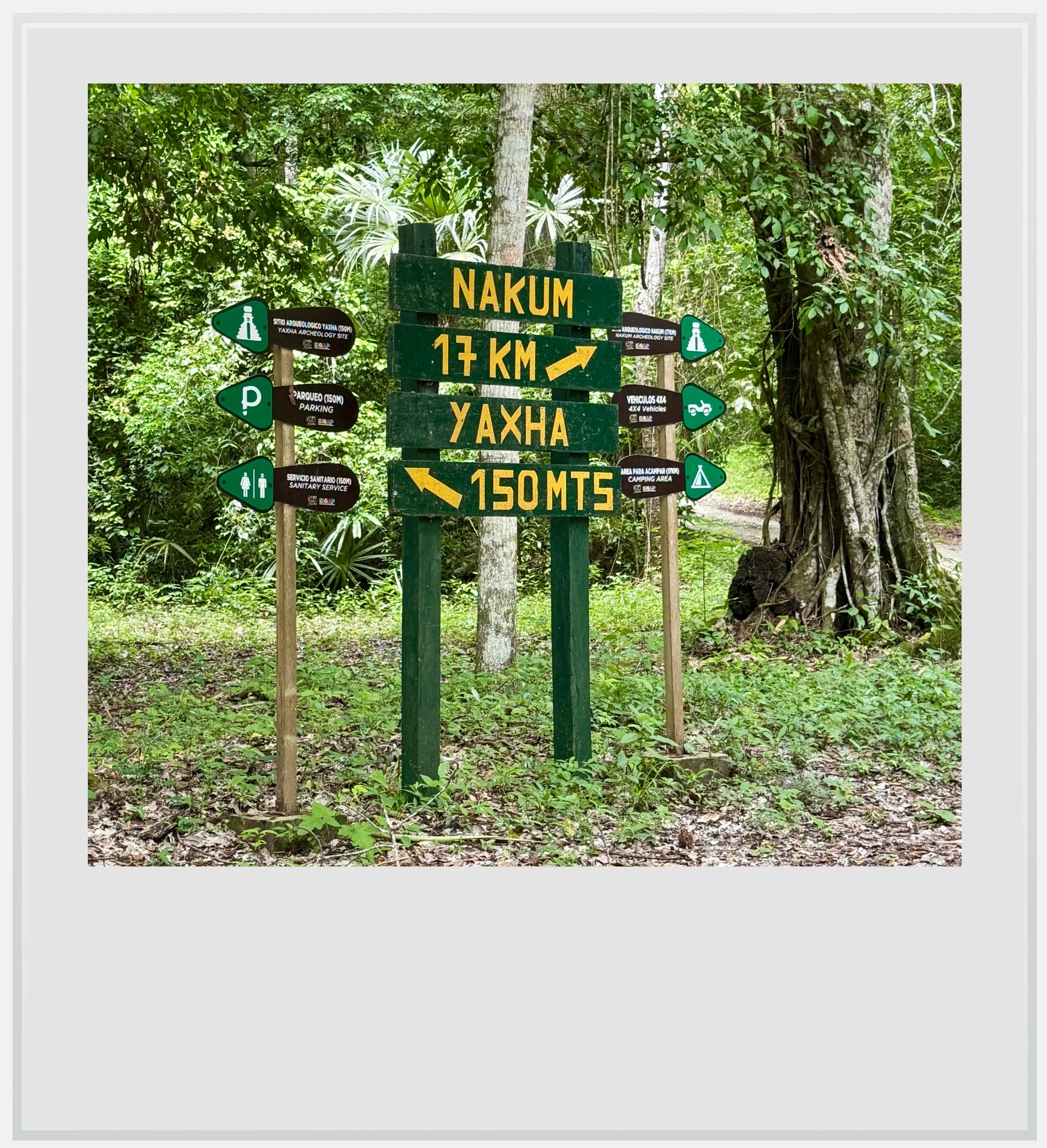
Road sign on the way to Yaxha.
Wildlife at Yaxha
Yaxha is inside the Maya Biosphere Reserve, and with far fewer visitors than Tikal, the animals are often closer. Spider monkeys and howler monkeys move through the trees around the plazas and are fairly easy to spot. Lake Yaxha is home to crocodiles, so don't swim in it (it is forbidden anyway). Stay on the paths, watch where you step at dusk, and bring insect repellent for the sunset hour by the lake.
Food & lodging near Yaxha
Hotel
There are no hotels inside the archeological site, although camping is allowed. The closest hotel option is the lakeside lodge near the park entrance, El Sombrero, a basic but clean and well cared-for hotel. My room cost USD 75 per night. Food is available for breakfast, lunch and dinner, with a lot more choice than I expected - and the cook is talented. Just watch for Rosco, the resident crocodile, who sometimes ventures onto land.
Otherwise, El Remate is closer to Yaxha than Flores and quieter, and Flores has the widest choice.
Food
Drinks and snacks are available by the car park at the entrance of the archeological site (about 1.2 miles (2 km) from the visitor center). The restaurant on the second floor of the visitor center was closed during my visit. El Sombrero can be a good option for lunch as it is close to the park’s entrance. Otherwise, bring snacks and drinks for the visit.
Safety at Yaxha
The State Department's Level 3 advisory for Guatemala was reissued in March 2026, with an update in November for the Zacapa and Izabal departments. Its "do not travel" areas are not in Peten, although the Izabal department includes the Rio Dulce, Livingston and Quirigua and Maya ruins, further south.
The practical concerns at Yaxha are the heat, the steep stairs on some of the buildings, and the drive back. After a sunset visit, you'll drive the 7 miles (11 km) of dirt road in the dark, with animals possibly crossing in front of you, so take it slowly. Also, don’t swim in the lake.
Cell service at Yaxha
I used Tigo (roaming) during my visit, and was able to get service at all times on the main road between Flores and the Belize border. Signal started getting weak after the turnoff in La Maquina, and had disappeared when I got to the park’s entrance. I was able to get a few bars of LTE signal at the top of the highest pyramid in the North Acropolis, however.
El Sombrero offers Wi-Fi to its guests, whether you’re staying there or having a meal. It can be a great option to reconnect with the wider world in the middle of the jungle.
All photos are mine and are copyrighted. Click on a picture (on a laptop) or tap on it (on a mobile device) to see the caption.