
A Second Life in the Maya World.
Looking for directions, opening hours, and safety recommendations? Head straight to the Practical Information section.
Topoxte, a small, remote island Maya site deep in the Peten region of Guatemala, wasn’t initially part of my trip. For my first visit to the Guatemalan side of the Maya world, I had planned to hit major sites, from Tikal to Yaxha to El Mirador.
When my helicopter ride to El Mirador fell through, I had to activate a backup plan, and Topoxte became the morning stop on the last day of my trip.
Although located close to other ancient Maya cities within the Yaxha-Nakum-Naranjo National Park, Topoxte doesn’t see the same number of visitors as the park’s most famous city, Yaxha. Here I was, on a gorgeous October morning, buying my entry ticket to the National Park and following the narrow path to the edge of Lake Yaxha, where my boat was waiting.
Hints of a much bigger world lying underneath the vegetation.
The boat was a lancha, a small, basic motorboat with nothing more than a few benches, a canopy to protect from the sun, and a few life jackets, one of which I was required to wear.
I thought about it for a second: drowning might be more appealing than being eaten alive by a hungry croc, but my boat operator gently signaled it wasn’t my call, and I put on the bright-orange vest so we could leave.
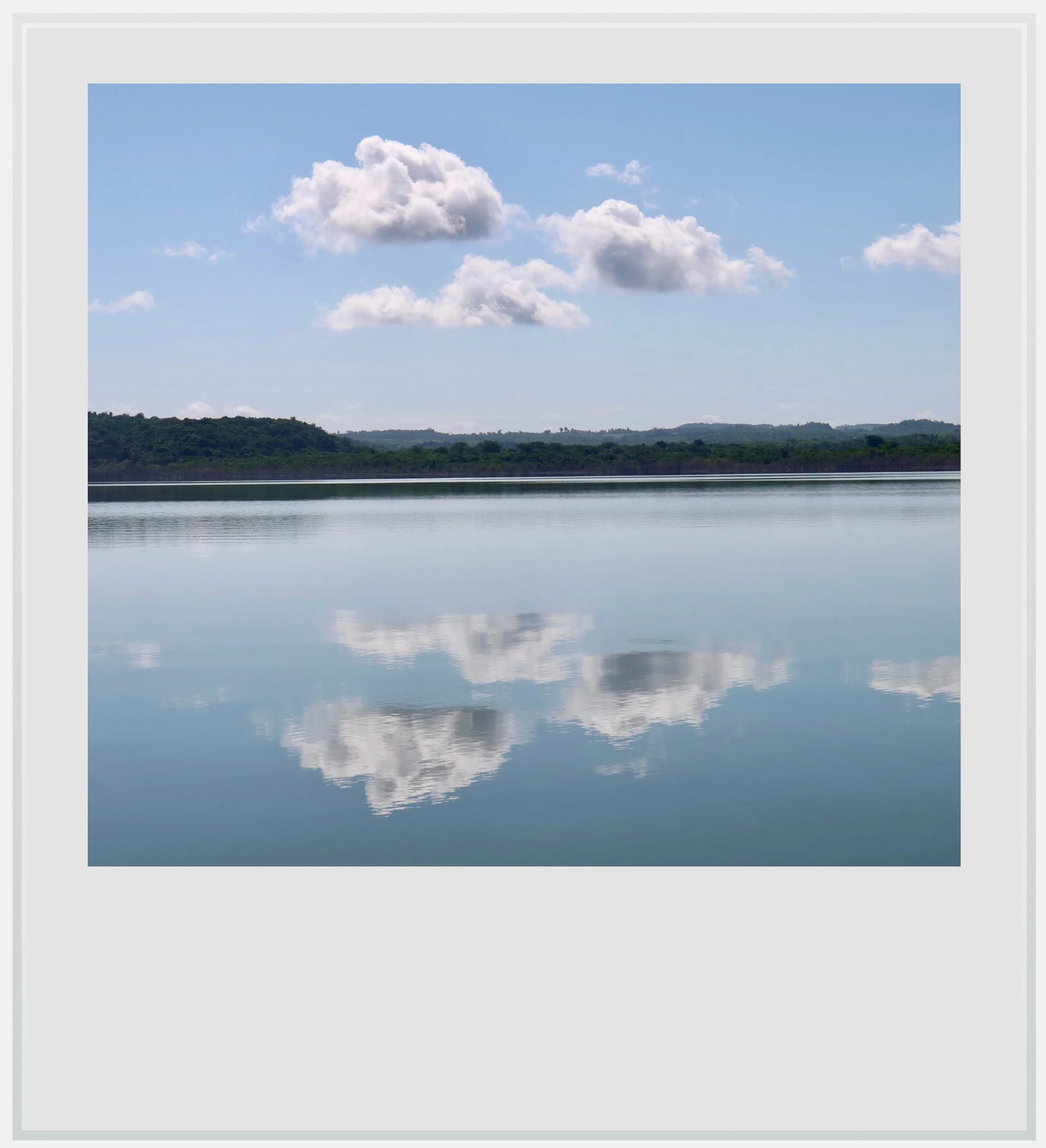
Crossing Lake Yaxha.
The crossing lasted about fifteen minutes across the smooth lake, whose peaceful surface was only breached in places by air bubbles, betraying a turtle or crocodile lurking below (there are more than 250 crocodiles living in the lake, hence my earlier dilemma). We could see the summit of Temple 216, the highest structure in Yaxha, to our right, poking above the treetops.
Just like in Tikal, seeing the tips of temples emerging from the canopy was a powerful reminder of the resilience of nature against the will of humans. Hundreds of years ago, in Maya times, plazas and entire neighborhoods were cleared of trees, but today, the forest had taken over and, from above (or, in my case, from Lake Yaxha), the only visible traces of an ancient civilization were like tips of icebergs on the sea: hints of a much bigger world lying underneath the vegetation.
This early in the day, during the off-season, I was the only one on Topoxte island. The operator told me he would wait for me for forty minutes, which would give me enough time to see the whole island -tiny as it was. As I stepped onto shore, I was quickly swallowed by the forest.
Although other small islands within Lake Yaxha were inhabited during the Preclassic and Classic periods (400 BC - 900 AD), it is believed that Topoxte island was the center of religious and civic life, where the major edifices were gathered.
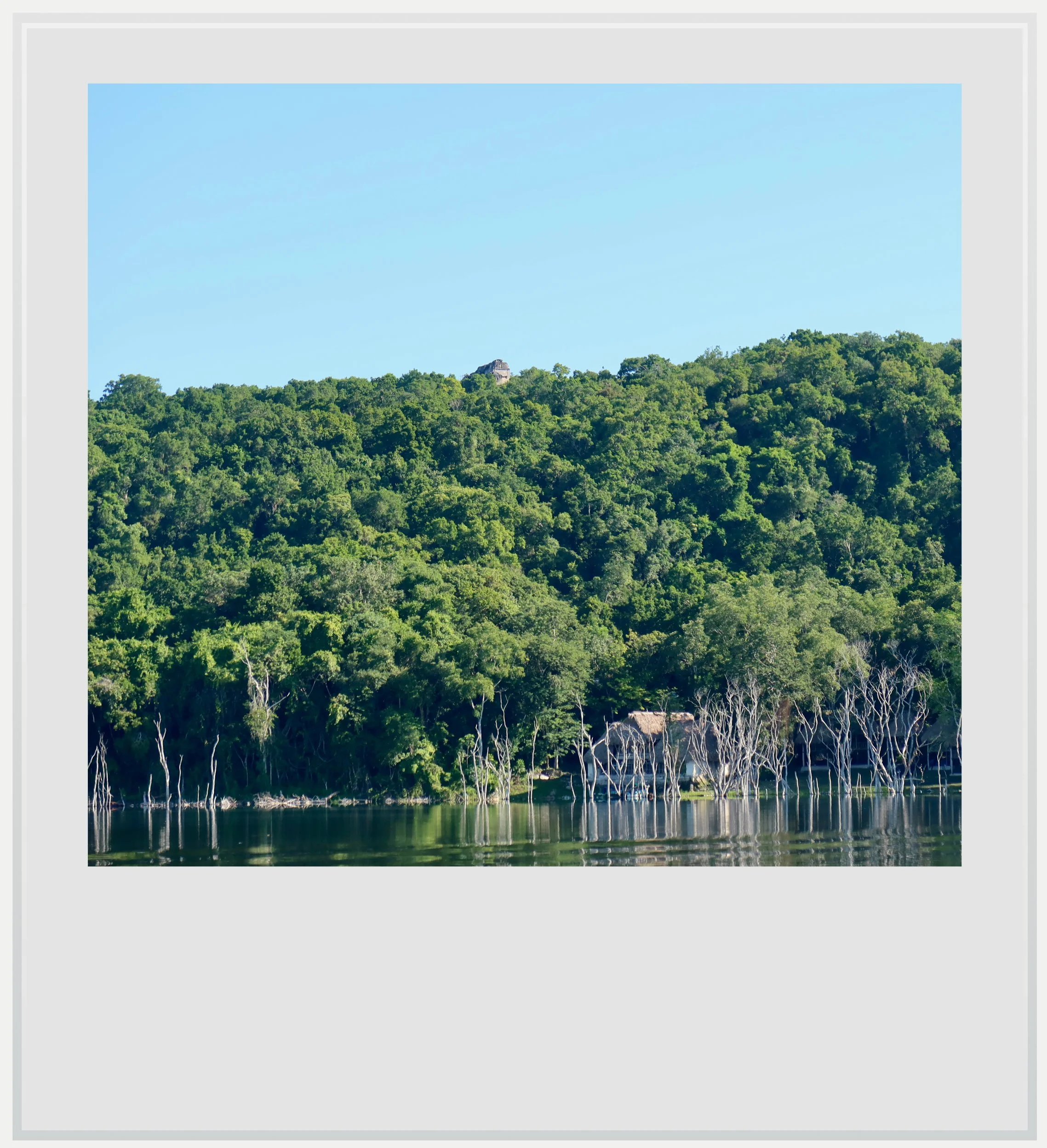
The summit of Yaxha’s Temple 216 from the boat to Topoxte.
In fact, after a few minutes’ walk, I arrived at the island’s main plaza, which would be the heart of my visit. It occupied the highest part of the island. Reaching it by a small wooden staircase, I was struck by the unexpected grandeur of the surrounding buildings.
Almost as soon as I set foot on the plaza, another question appeared. What was I looking at?
Only a few miles separate Topoxte from the Classic-period city of Yaxha, with its sprawling rectangular plazas and tall, imposing temples typical of the Peten architectural style. Yet the plaza looked nothing like I had expected. To understand why, we need to briefly step back in time.
The Peten region of Guatemala saw Maya polities flourish during the Classic period (250-900 AD). Yaxha, a major city built by the eponymous lake was important enough that archeologists believe its inhabitants had settled Topoxte at some point during the Classic period.
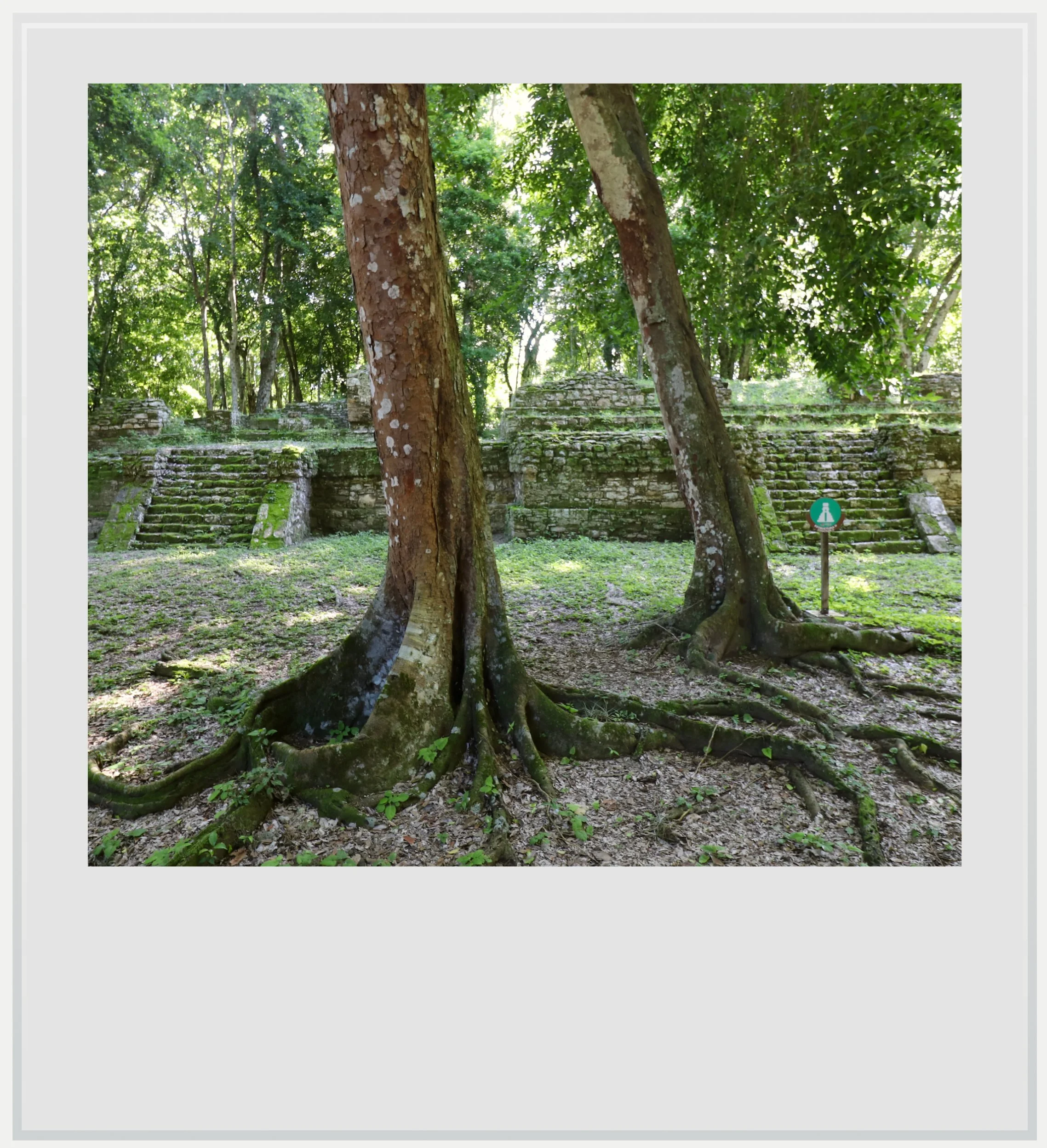
Building D on Topoxte’s main plaza.
Topoxte was likely a smaller satellite settlement under Yaxha’s influence and remained that way until the end of the Classic period. At that time, it is understood that Maya cities across the Peten very quickly lost their population and were abandoned. Why that happened hasn’t been established, although theories suggest incessant battles between rival cities, overpopulation, overconsumption of natural resources and several years of serious drought could have played a role.
We do not know for sure what Topoxte looked like back then: Maya buildings often stand on the remains of earlier structures, and what I could see in front of me was the latest iteration of the city, before its final abandonment. And that is where Topoxte’s own story takes an interesting turn. Although many of the surrounding cities were never resettled, Maya people did come back to live on Topoxte island. It happened around 1150 AD, and it would help illuminate why the buildings in front of me felt different from the ones I had seen in the region over the previous few days.
Building C looked like it could have been built on the Caribbean shore of the Yucatan Peninsula.
I initially thought the buildings around Topoxte’s main plaza were arranged a certain way because that’s all the terrain allowed: the island is narrow, and creating a vast acropolis with temples at its cardinal points may not have been feasible. But there may have been more to it. Before exploring that possibility, one word of caution: the theories used to make sense of Topoxte’s resettlement rely on very limited hard evidence gleaned from archeological research, and a lot of questions remain without definitive answers.
Topoxte’s Postclassic inhabitants have been linked to the Kowoj Maya, who claimed ancestral ties to Mayapan in northern Yucatan. We don’t know why they chose to resettle on Topoxte and not in neighboring Yaxha, a much bigger city. Research suggests an island may have been seen as a better defensive location, offering greater protection¹.
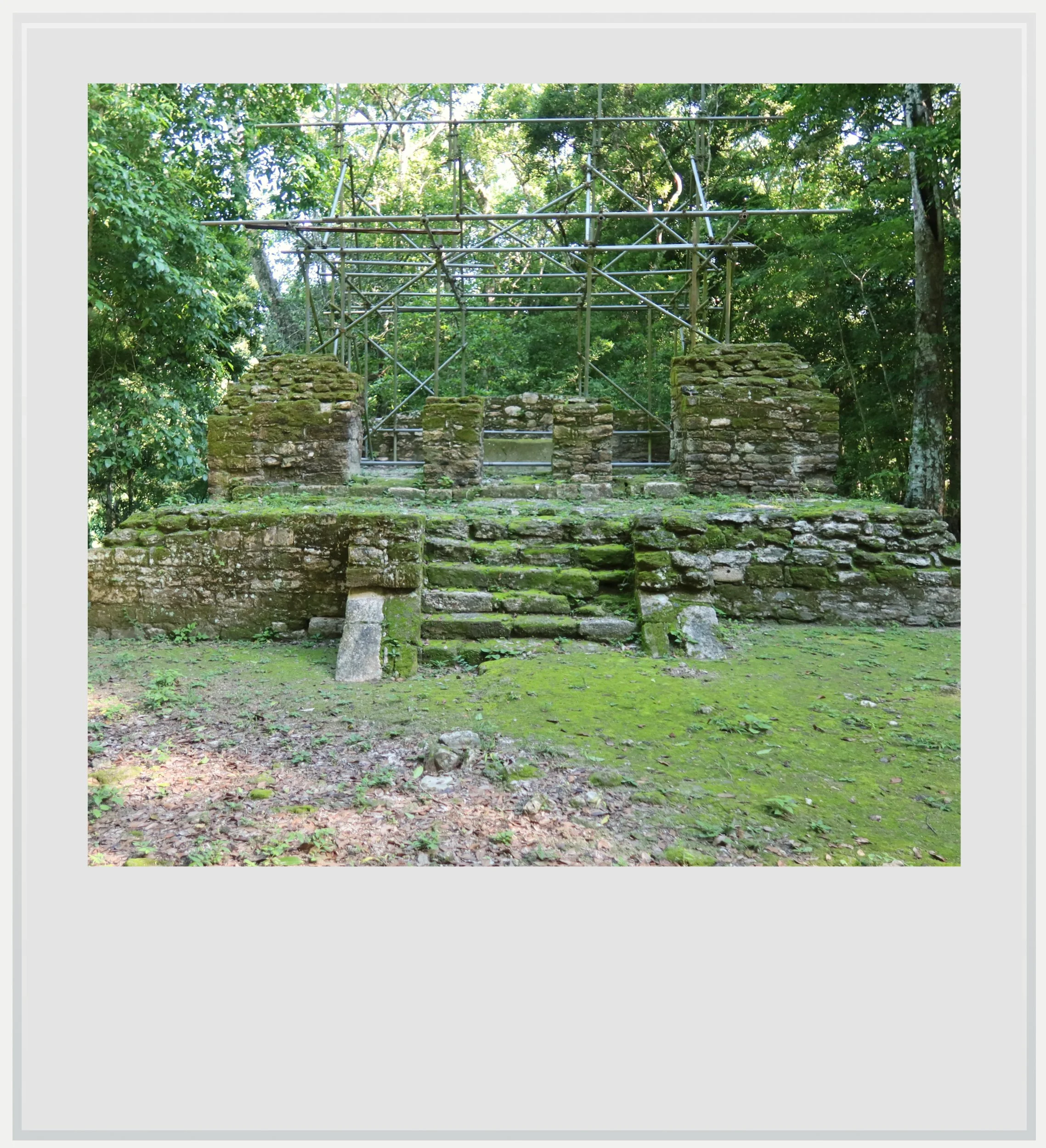
Building G on Topoxte’s main plaza.
The Kowoj hypothesis was interesting because the main plaza’s layout hinted at Mayapan influence: it combined a main temple with a smaller shrine, an open hall and one or more altars positioned in relation to these buildings. This “temple assemblage” is characteristic of Mayapan urban planning and wasn’t seen in major Peten Classic-period cities around Topoxte.
Mayapan’s period of dominance started around 1200 AD, which coincides with the first period of reconstruction after resettlement in Topoxte. It is therefore possible that its influence reached Topoxte, especially given the potential Kowoj connection.
Mayapan influence seemed to explain the plaza’s layout, but the buildings themselves left me more puzzled than before. Some mixed Mayapan design with architecture from another Maya region, the eastern coast of Yucatan, also known as Costa Oriental.
Mayapan, south of present-day Merida, is located more than 150 miles (240 km) from Tulum, Costa Oriental’s most famous ancient city. The two belong to very different cultural regions. Building C, the biggest edifice on the island, and Building B looked like they could have been built hundreds of miles north, on the Caribbean shore of the Yucatan Peninsula.
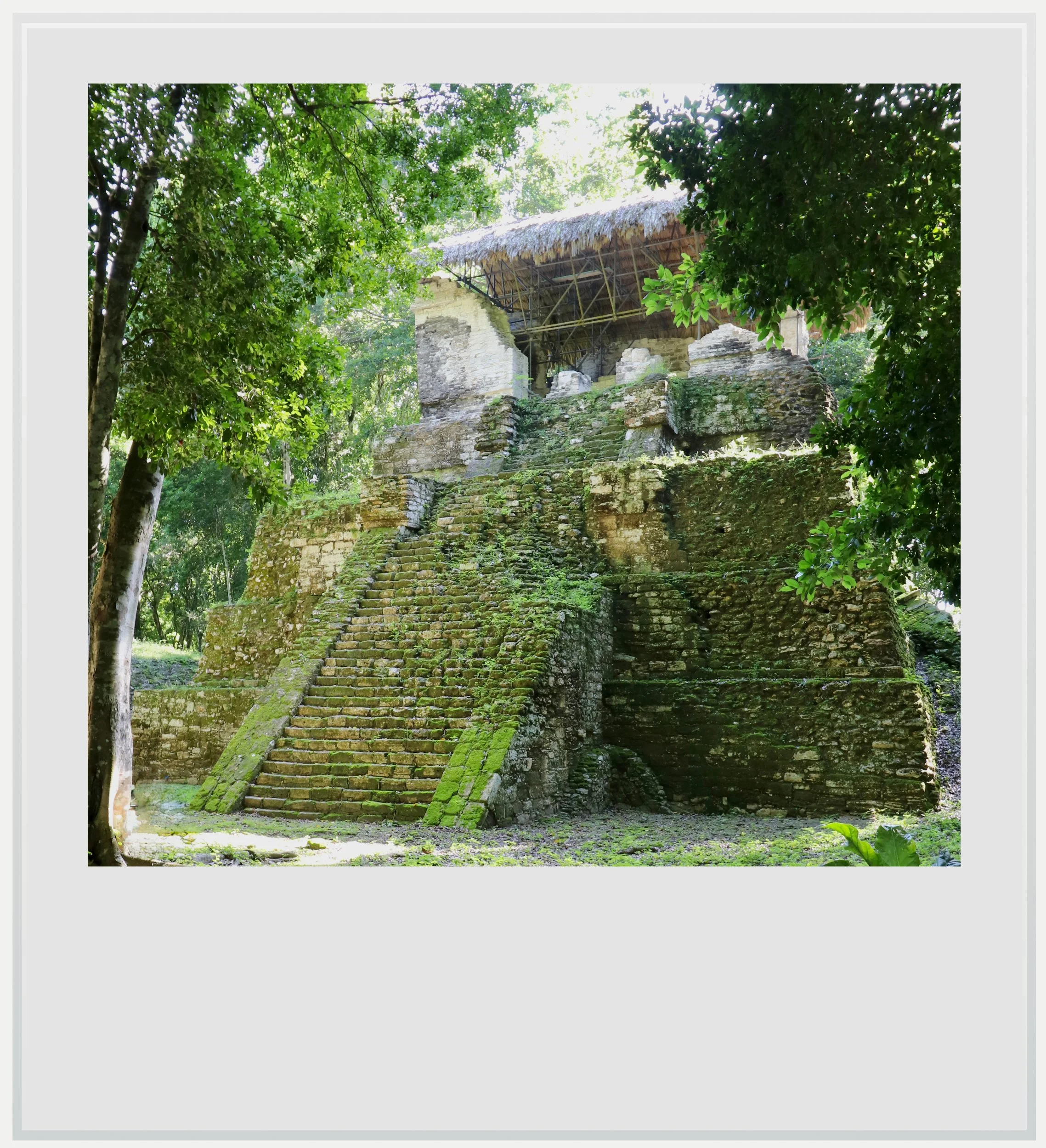
Building C on Topoxte’s main plaza.
As I walked closer to Building C, the resemblance to Costa Oriental architecture became obvious. At the top of the pyramid stood remnants of a temple with columned entrances and a flat roof, also seen in Costa Oriental buildings (the interpretive signs around the plaza showing what the temple may once have looked like were also telling).
How could I make sense of all of this? One of the hypotheses is that, in the Postclassic period, trade routes evolved and sea trade came to play a much bigger role in Maya commerce (hence the increasing importance of the Costa Oriental area)². After resettlement, Topoxte may have benefited from access to commercial routes all the way to the northern Yucatan coast and been influenced by the architectural style developed there at that time³.
What I saw on my screen wasn’t what I remembered.
While the buildings were impressive, their relatively modest height meant they never reached the canopy of the dense forest surrounding them. Unlike other cities in the jungle, where most plazas have been largely cleared of trees, Topoxte looked fully hidden under the lush vegetation, making it almost intimate.
The forest was hiding the lake from the plaza, accentuating the feeling about being deep in the forest, protected by the trees. I continued my walk past the plaza to enjoy the serenity of the place, only disturbed by a few spider monkeys jumping from tree to tree. A few mounds here and there told the story of older buildings yet to be excavated. They may one day shed light on why Topoxte was abandoned again, after a unique revival of a few centuries.
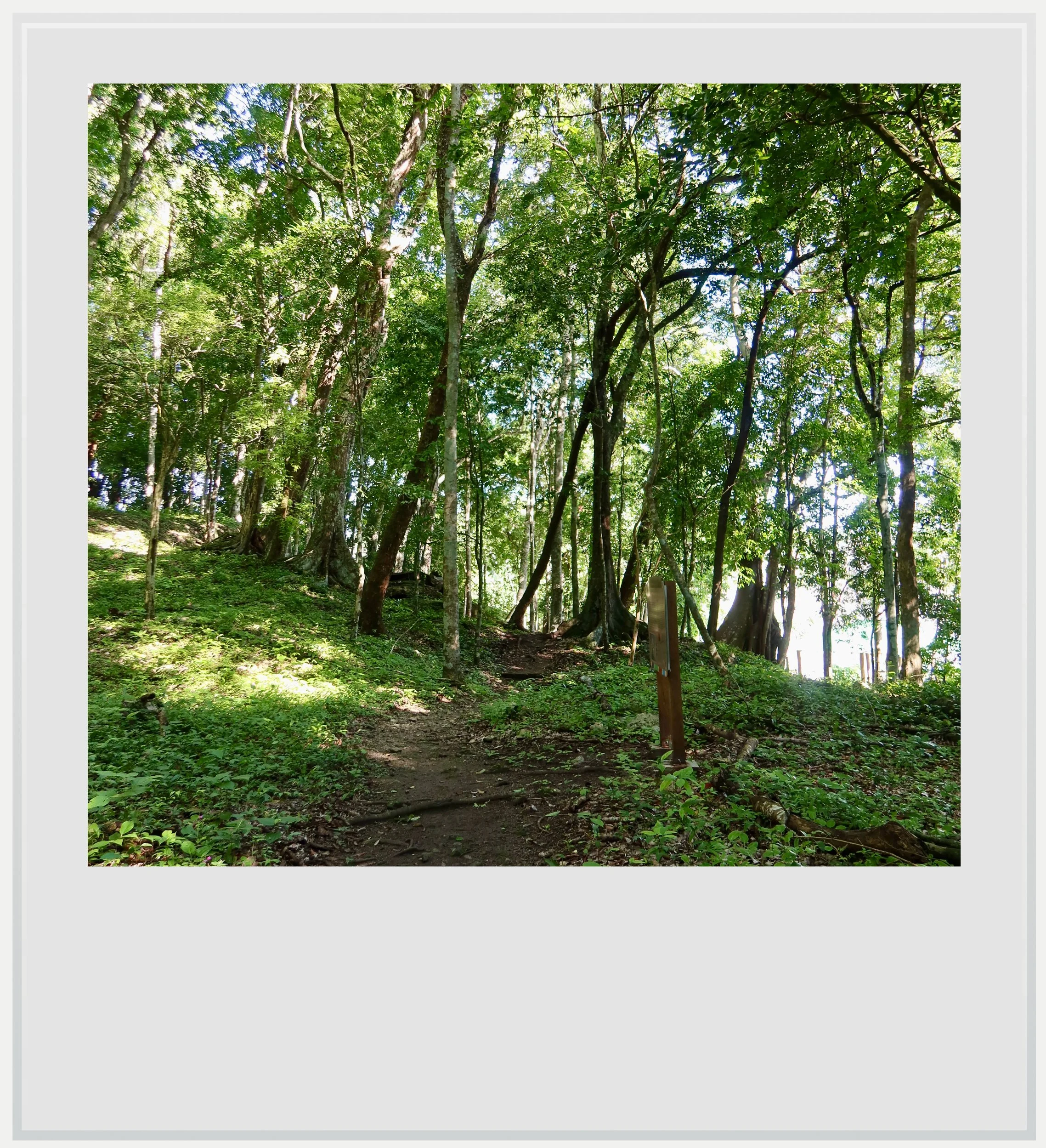
Walking through the forest on Topoxte island.
I glanced at my watch and noticed that my forty minutes were almost up. I slowly made my way back to the pier, passing by the main plaza again. The sun was now slightly higher and its rays had broken through the canopy to hit the very top of Building C’s temple, which sat bathed in light. There was an almost sacred aura to it, as if nature had chosen this very moment to shine on the highest man-made point on the island. I snapped a few more shots, hoping to preserve the fleeting moment.
As the boat glided back toward the visitor center, I checked my pictures and, strangely enough, what I saw on my screen wasn’t what I remembered. I could only see an overexposed temple and a sky so blown out it was nearly white. Yet I remembered exactly what I had seen. That a picture couldn’t capture it made me think that maybe I needed more practice with my camera.
Or perhaps I remembered the light a little differently, still under the island’s spell.
Notes
Practical information
(Everything you need to know about visiting Topoxte - updated November 2026)
In a nutshell
Topoxte is a small Maya archaeological site on an island in Lake Yaxha, reached by a fifteen-minute boat ride from the park’s visitor center. Its compact ceremonial plaza and Postclassic temples offer a striking contrast to nearby Yaxha, with the buildings tucked beneath dense forest. Allow around forty minutes on the island and up to one hour and a half for the full excursion. The visit combines easily with Yaxha.
Getting to Topoxte
How to get to Topoxte from the United States: the easiest way to reach Topoxte from the US is to fly to Guatemala City, which has non-stop connections with several major cities, including Los Angeles, Miami, Houston, New York and Washington. From Guatemala City, take a domestic flight to Flores, in northern Guatemala. That flight takes approximately one hour, with several daily services operated by Avianca and TAG Airlines.
How to get to Topoxte from Mexico City: There are no non-stop flights between Mexico City and Flores. The easiest option is to fly via Guatemala City, which is currently served by Aeromexico and Volaris. The flight to Guatemala City takes approximately two hours, followed by a domestic flight of about one hour to Flores.
How to get to Topoxte from Flores airport: From Flores airport, rent a car and drive toward Yaxha, approximately 75 km to the east. Follow the paved road toward Melchor de Mencos for about 62 km, then turn left at La Maquina onto an unpaved road for the final 11 km. Allow approximately 1 hour and 30 minutes for the drive, potentially longer depending on road conditions. A 4WD vehicle is not normally necessary, but a high-clearance vehicle, such as an SUV, is recommended for the unpaved section of the road.
Topoxte is located on an island within the Yaxha-Nakum-Naranjo National Park, and can only be reached by boat. Boats can be arranged at the Yaxha Visitor Center through the local association ASODESTY, for a cost of 300 Quetzals. My visit took about an hour and ten minutes: fifteen minutes by boat each way and forty minutes on the island. Allow up to two hours overall, including arranging the boat and any waiting time. There is no regular public transportation directly to Yaxha or Topoxte. Travelers without a rental car can arrange private transportation or an organized excursion from Flores, making sure that the boat trip to Topoxte is included.
Where to get on a boat to Topoxte: boat operators are usually available by the entrance of the national park’s visitor center. The route starts from a pier right behind it, and comes back to the same place. There is a parking area in front of the Visitor Center.
Can I get visit Topoxte on a tour: I was only able to find one guided tour including Topoxte on GetYourGuide. The same tour is available directly with Tikal Expedition and another one is offered by Tikal VIP Tours.
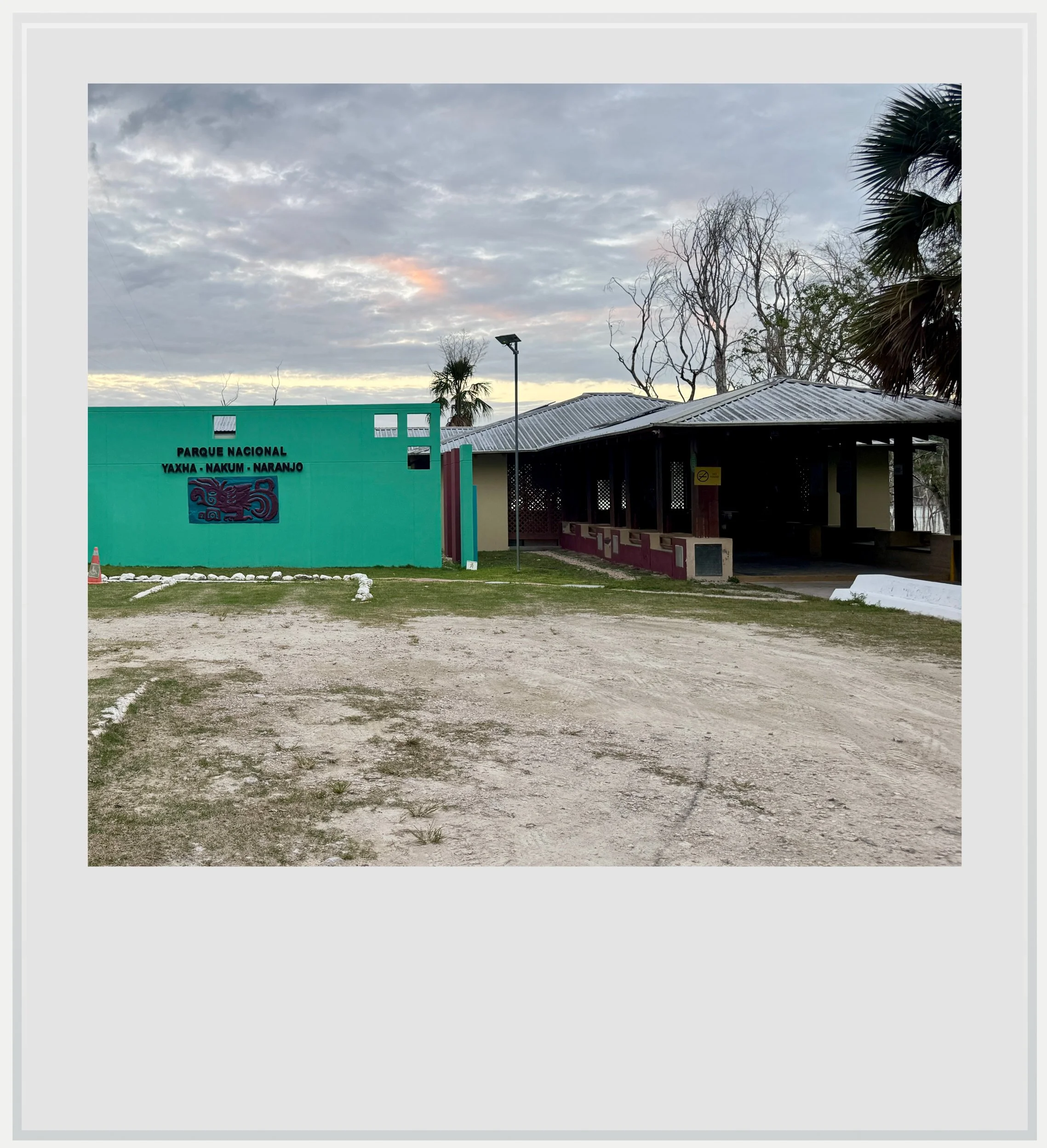
The Yaxha-Nakum-Naranjo National Park visitor center.
When to go to Topoxte
The best months weather-wise to visit Topoxte are during the dry season, generally between November and April. This is also peak tourist season in Guatemala, but Topoxte sees relatively few visitors, so crowds are unlikely to be an issue. I visited in October, toward the end of the rainy season, when the heat and humidity in Peten can still be intense. The site can be visited year-round.
There are no facilities on the island, so bring plenty of water and anything else you might need during your visit. The boat trip across Yaxha Lake is part of the experience, with beautiful views of the surrounding forest and the ancient city rising above the water.
What's the best time of day to visit Topoxte
Topoxte can be visited at any time of day, as the island is covered in forest, providing shelter from the heat and occasional showers. Make sure to arrange your boat in advance, as there is no regular service to the island. While it is usually possible to find a boat without a reservation, availability is limited, and you may have to wait a while if the boats are already out with other visitors.
How much does it cost to visit Topoxte
Visiting Topoxte requires access to the Yaxha-Nakum-Naranjo National Park (at the time of my visit, in October 2026, the entry cost was 80 Quetzals, or about USD 10.50 for foreigners) and a private boat (300 Quetzals for up to 4 people, cash only, to be paid directly to the boat operator). Tipping the operator is optional but appreciated (tip amount should be about 10% of the cost).
How long should I plan to visit Topoxte
Boat operators usually wait for tourists for about 40 minutes at the island pier. It is absolutely enough to check out the main buildings on the tiny island. Including the boat trip, the visit should therefore last about one hour and ten minutes. If you need more time to visit, ask your operator, they are usually flexible.
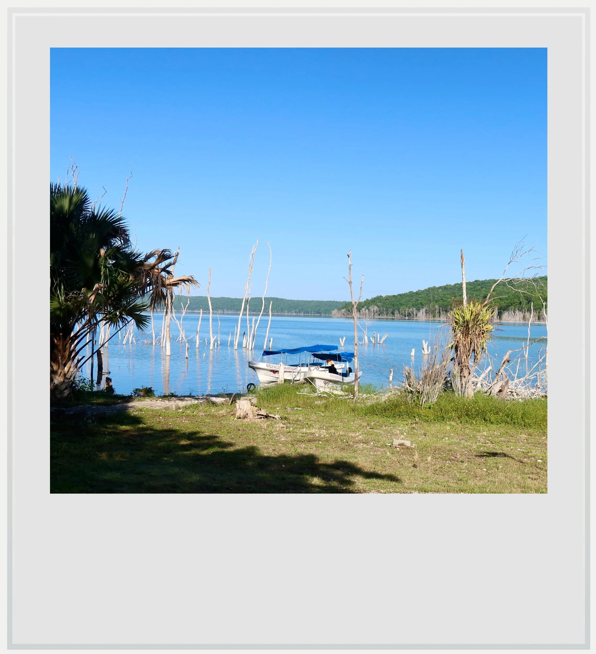
The pier behind the visitor center where boats to Topoxte leave from.
What are Topoxte’s opening hours
Access to the Yaxha-nakum-Naranjo national park is possible every day from 8am to 5pm. The ticket office closes at 5pm but the park stays open until 6pm (mostly so tourists can enjoy the sunset in Yaxha). A trip to Topoxte can be planned within these hours.
What to see near Topoxte
Yaxha is the natural companion to a visit to Topoxte, with monumental plazas, forest paths, and temples overlooking the lake. Nakum and Naranjo lie within the same national park, but require separate excursions and more planning: their proximity on a map does not mean easy access between the sites. Farther afield, La Blanca offers a more intimate encounter with Maya palace architecture, while Tikal brings the scale of a great capital and Uaxactun extends the journey north into the forest beyond it. For a change from archaeological sites, Flores offers walks through the compact island town, colorful streets, and waterfront views over Lake Peten Itza.
Safety at Topoxte
Guatemala is currently at Level 3 on the US State Department's travel advisory scale, meaning “reconsider travel.” The warning reflects the country's problems with violent crime, organized criminal groups and armed robberies. However, Peten's principal tourist destinations, including Tikal and Yaxha, are not among the areas specifically designated as “do not travel.”
This does not mean Peten is entirely free of crime, but there is little reason to consider a visit to Topoxte particularly dangerous. Topoxte is located within Yaxha-Nakum-Naranjo National Park, and access to the island is organized through local boat operators.
For visitors, the more immediate concerns are practical ones: the remoteness of the park, the condition of the access road, particularly after heavy rain, and the limited availability of services. I would recommend visiting during daylight hours and avoiding driving after dark. During my October 2026 visit, sections of the road between Melchor de Mencos and Ixlu, toward Flores, were in terrible condition.
Photo captions appear when you hover over an image on a computer or tap it on a smartphone.
All photos are mine and copyrighted.