The Tumultuous Rises and Falls of a Great Maya Kingdom.
Looking for directions, opening hours, or where to stay and eat? Head straight to the Practical Information section.
I had just passed the entrance gate to the Tikal National Park. Around me, the forest seemed so close to the road that it appeared ready to swallow it. I had the uncanny feeling that, left untended for a few months, that road might disappear underneath the vegetation, cutting Tikal off from the rest of the world.
Tikal sits in the heart of the Maya Forest, which straddles Guatemala, Mexico and Belize and is the largest tropical rainforest in the Americas after the Amazon. On the Guatemalan side, it is protected as the Maya Biosphere Reserve, covering some 8,000 square miles, or nearly a fifth of the country.
The reserve includes very remote sites like El Mirador. Tikal is much easier to get to, but the fifteen minutes of driving through the pristine forest served as an emotional buffer between the modern world and the ancient city I was about to discover. I kept on hoping to glimpse a wild animal along the road. A coati, or maybe one of the big cats known to live in the park?
I would encounter one of these cats later, in one of the highlights of my visit, but that morning, the forest immediately next to the road seemed completely empty.
It would be a few hours before I could walk inside Tikal’s most impressive plazas. I had planned a morning tour of Uaxactun, another ancient Maya city 14 miles (23 km) to the north. I quickly met my guide and was on my way.
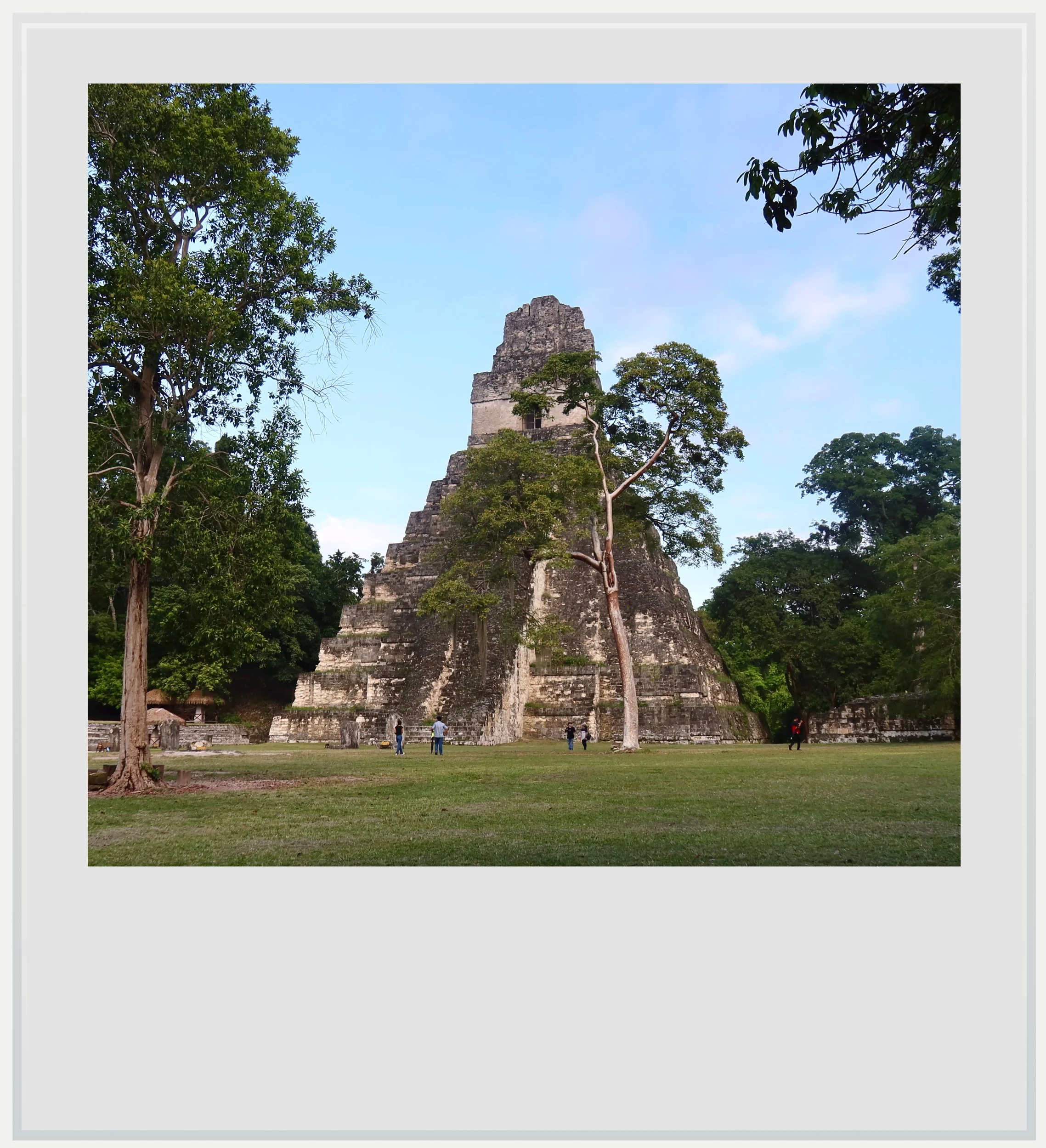
Temple 1 from the Great Plaza at Tikal.
Today, Uaxactun is a quiet site, its temples scattered around a small village, and few of Tikal’s visitors make the detour. It is hard to imagine that, for centuries, it was Tikal’s closest rival in the region, until the year 378 AD settled the matter, as I would learn later.
It started raining just as we were getting back to Tikal. Afternoon showers are frequent for most of the year - the rainy season in Peten, the area where Tikal is located, lasts from May to December. I visited in late October, towards the end of the worst part of it, so I expected some rain.
Finding your way around Tikal
The downpour only lasted thirty minutes, and I got out of my room as soon as it stopped. It was already 3pm and the park closed at 6pm, so I wanted to maximize my time in the archeological zone.
Although Tikal averages about a thousand visitors a day, most of them come between 9am and 3pm, because the vast majority are day-trippers from outside the park.
The rain had probably discouraged most of the stragglers, and the park was virtually empty as I started walking towards the Great Plaza, Tikal’s most iconic square.
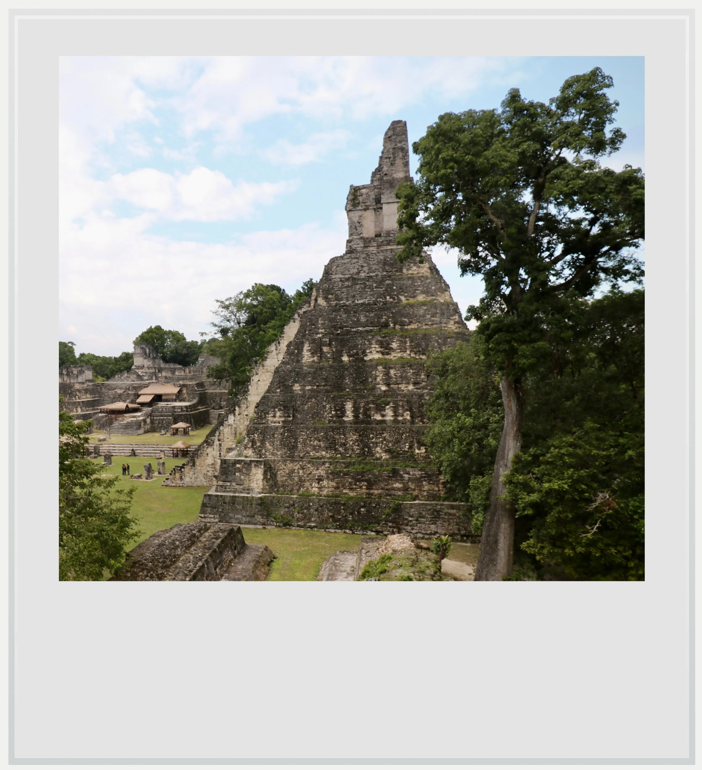
Temple 1 from the Central Acropolis in Tikal.
The path from the entrance led me through the forest, and delivered me below the plaza level at the back of Temple 1. It felt like this wasn’t how I should have first encountered the city’s heart.
I had imagined a grandiose entrance, the kind one gets at Chichen Itza when discovering the Kukulkan pyramid. It seemed I had taken a backstage detour.
That’s not to say the temple wasn’t impressive. In fact, seen so suddenly from below, it looked almost as menacing as it was massive.

Temple 2 from the North Acropolis.
Peten architecture is known for its size: monumentality was a way to project power, and from the back, Temple 1 was a perfect illustration of that. I slowly walked around the building to finally reach the Great Plaza.
There are moments that define a trip, and entering Tikal’s Great Plaza was one of them. I may have seen countless photos, but the sight of the huge square and the buildings surrounding it on all sides stopped me in my tracks.
Tikal’s history started at the Mundo Perdido.
To my immediate right lay Temple 1, with its nine stepped tiers, grand staircase and temple at the top. Its sheer verticality seemed almost surreal. Further to the right, the North Acropolis, though only partially restored, gave the square an imposing presence. In front of me sat Temple 2, echoing the grandeur of Temple 1 on the other side. To my left stood an elegant palace topping the Central Acropolis.
That central plaza is critical to understanding parts of Tikal’s story over the centuries. Temple 1, or Temple of the Jaguar, was the burial ground for one of Tikal’s most important rulers, Jasaw Chan K’awiil, and we’ll get back to him in a bit.
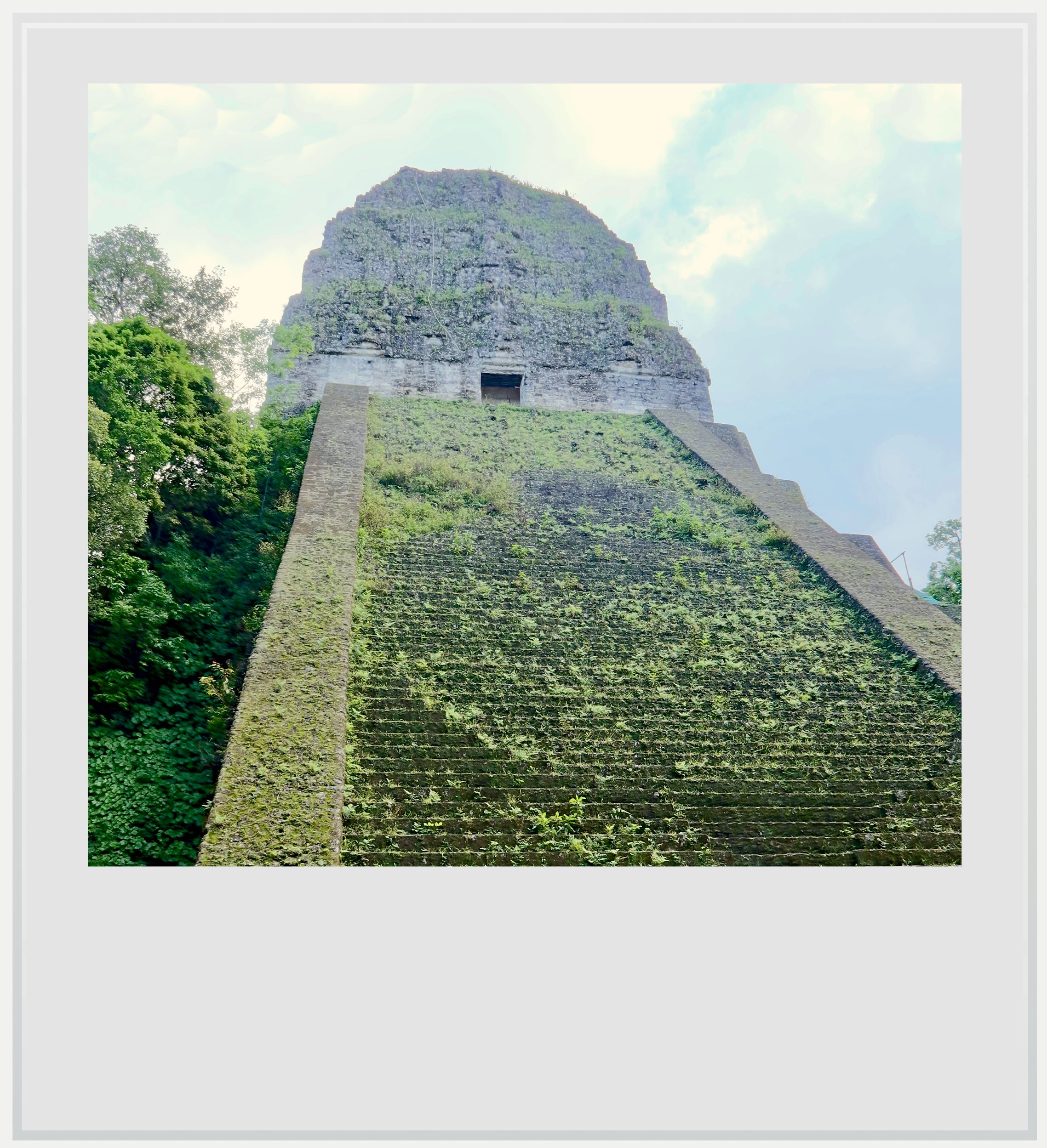
Temple 5 in Tikal.
Leaving the plaza, I stepped back into the surrounding jungle. Tikal’s core is rather spread out, and most of its key temples are linked via causeways, called sacbes in the Maya language. Some estimates put the population of the city as a whole close to 50,000 people, a huge number at the time.
After a few twists and turns on the path beyond the Central Acropolis, I arrived in front of Temple 5, one of the tallest and most impressive structures on site. It sat right next to the South Acropolis, a major complex that is only partially excavated and closed to the public, a reminder that Tikal’s secrets haven't all been unearthed yet.
Beyond the South Acropolis, I passed the Plaza of the Seven Temples to arrive at the Lost World area, or Mundo Perdido. Odd name aside (it was given by archaeologists from the University of Pennsylvania as a nod to Arthur Conan Doyle’s novel of the same name), the area is important because in many ways, Tikal’s history started there. The Lost World group was the first monumental complex built in the city, back around 600 BC, in the Preclassic period.
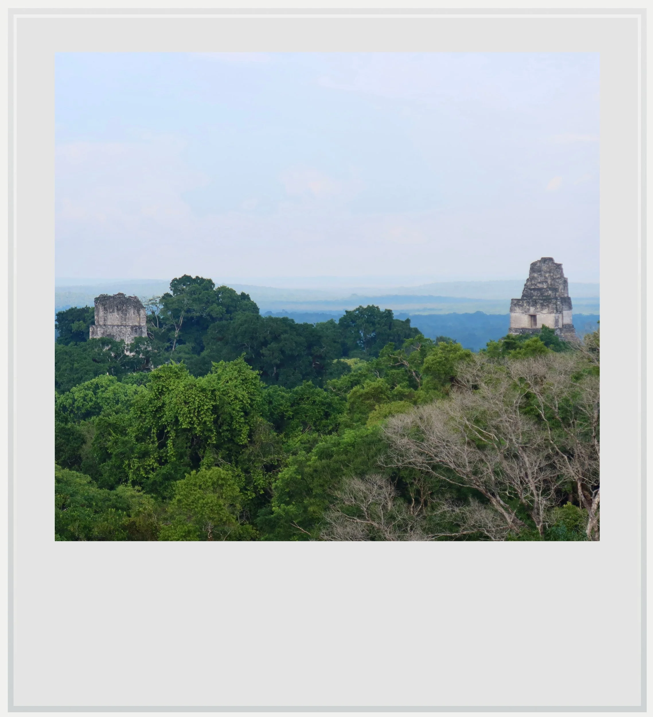
The view over Temples 1 & 2 from the top of the Lost World pyramid.
It is unclear how Tikal first grew into an important city, but the size of the main buildings in the Lost World group shows how much power its rulers aimed to project. The settlement wasn’t yet the major power it became centuries later, and part of the reason why lies 14 miles (23 km) to the north: up until the 4th century AD, the nearby city of Uaxactun was an important rival, which prevented either from truly dominating the region.
The Lost World Pyramid, the biggest edifice in Tikal’s oldest complex, was rebuilt several times over the centuries, and remained one of Tikal’s main centers throughout the years. The plaza around it was expanded around 250 AD, at the start of the Classic period, so the pyramid would be at its center.
Was I imagining a possible connection to Teotihuacan?
The most intriguing aspect of the Lost World group, however, lay further north. Another pyramid, Structure 5C-49, had a typical talud-tablero base, which felt a little out of place.
The style isn’t unheard of in Maya cities, but it is rare; it immediately sent my mind to Teotihuacan, arguably the most important city in Mesoamerica at the time, where the style originated.
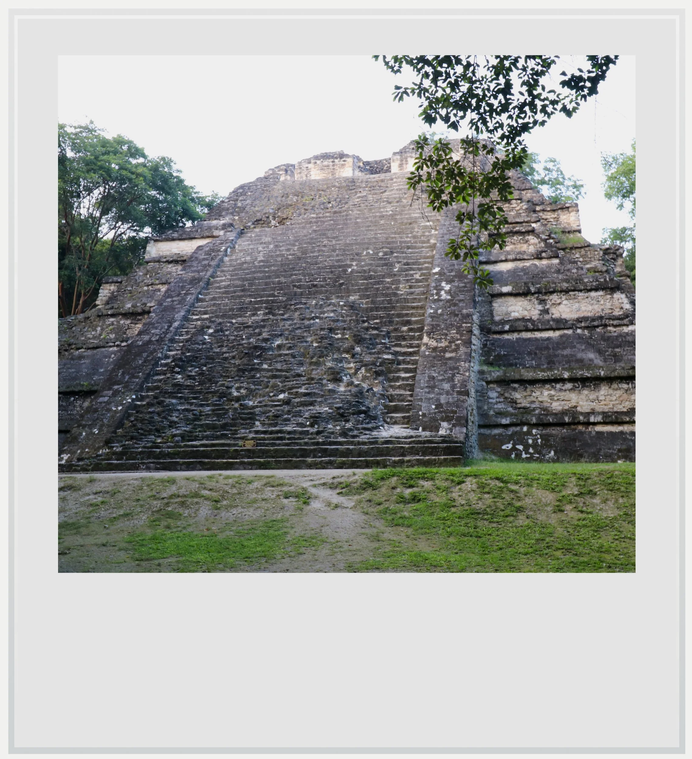
Structure 5C-49 in the Lost World group.
I started to question my assumptions about Tikal at that very moment. Was I imagining a possible connection to Teotihuacan or was there proof that a relationship existed, right before my eyes? I had a feeling that this could unlock a deeper understanding of the ancient city and knew that I wouldn’t rest until I found an answer.
I continued my trek through the immense forest, enjoying the wide causeways linking the various parts of the site and ended up at Temple 4 an hour before sunset.
Seen from below, Temple 4 is misleading, as most of it hasn’t been excavated; it looks like a massive forest-covered mound. Once I reached its left side, I found wooden stairs leading to the top.
About 230 feet (70 m) tall, Temple 4 is one of the tallest structures ever built in Mesoamerica. The climb was arduous, but the payoff was worth it. I reached the top of the pyramid and stood on a wooden viewing platform facing east.
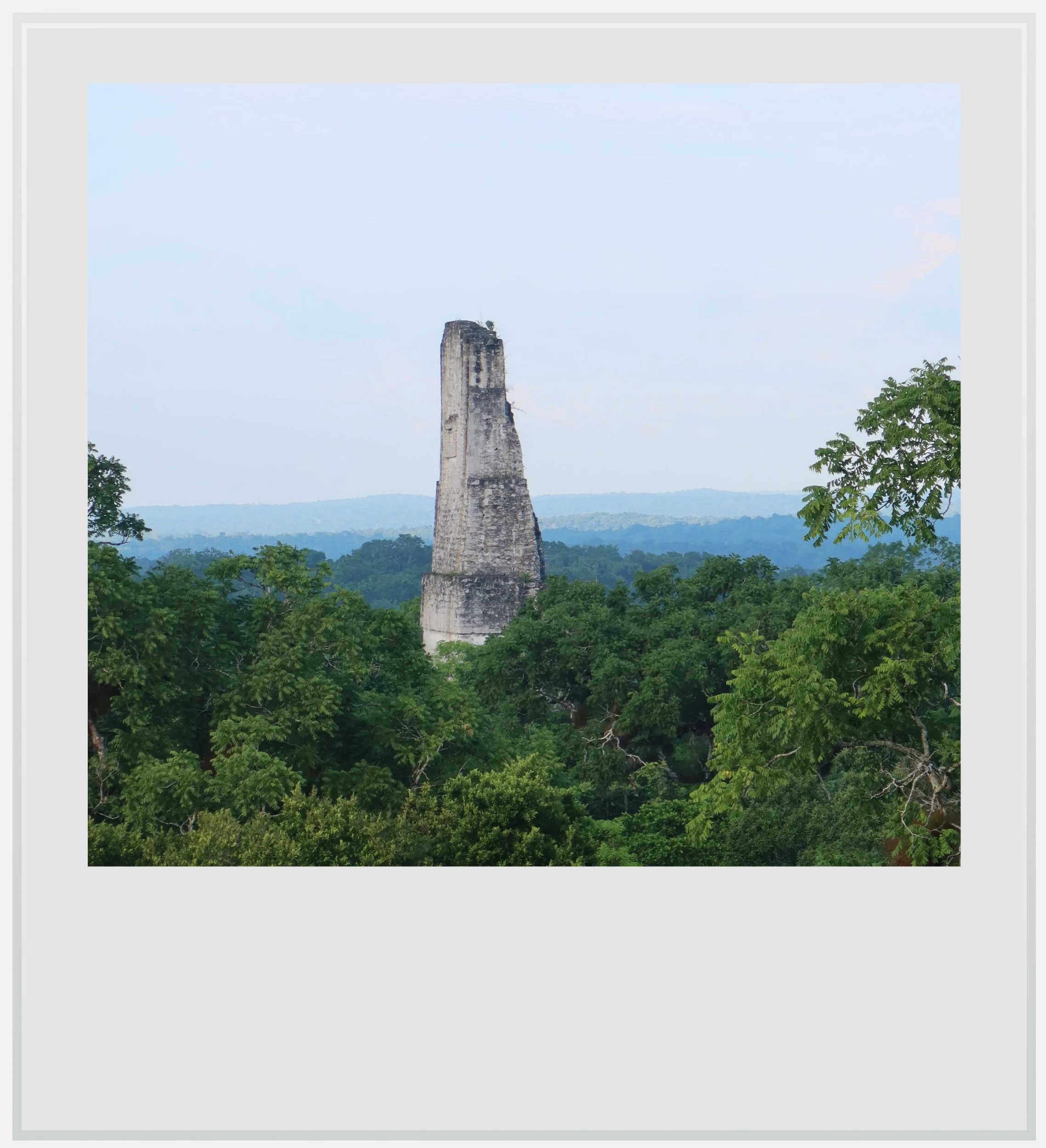
The top of Temple 3 seen from the Lost World pyramid in Tikal.
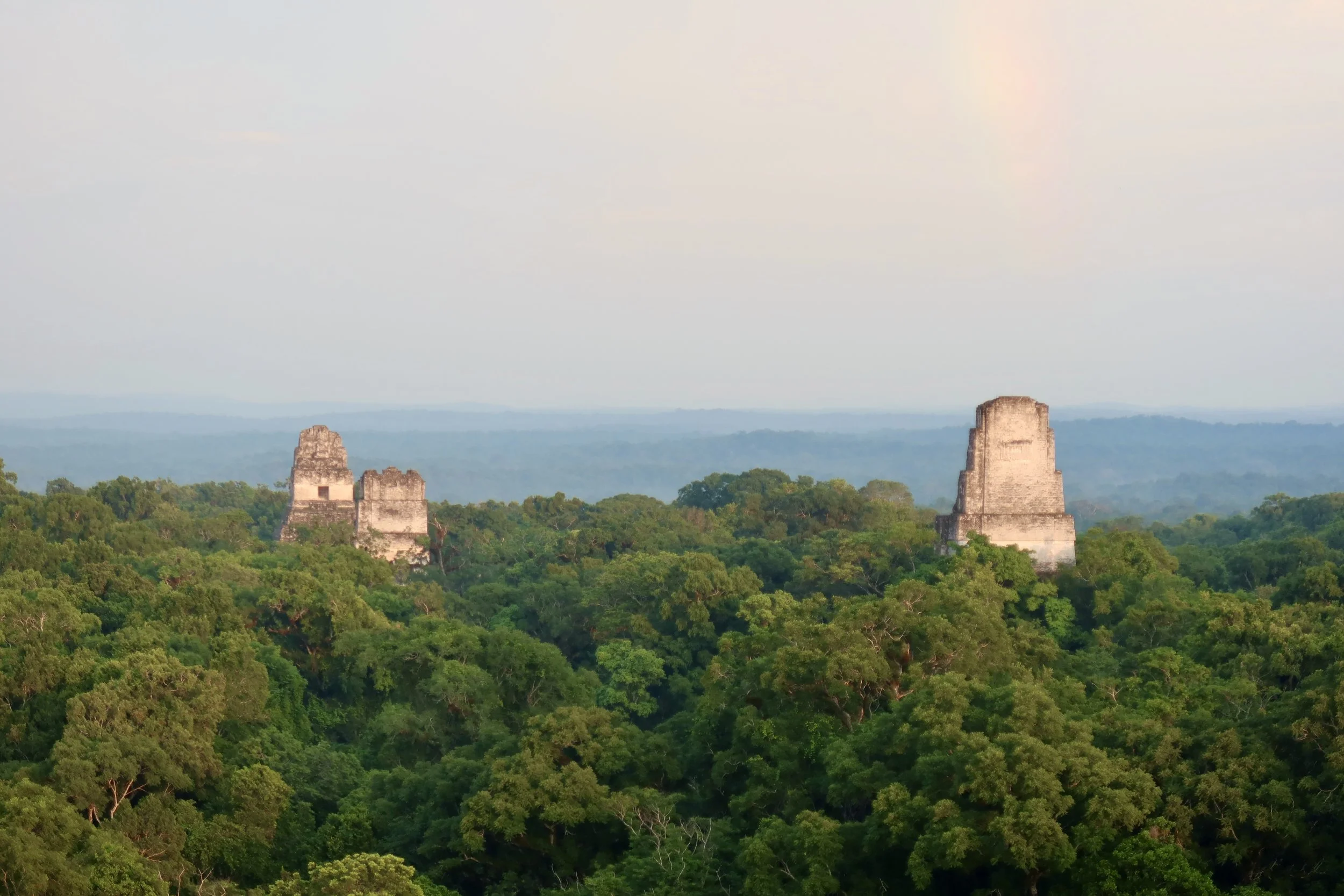
In front of me, among a jungle canopy that seemed to stretch forever, emerged the tops of Temples 1, 2 and 3. Having seen how massive these temples were a few minutes before, it seemed hard to believe that they would look so tiny in an uninterrupted sea of greenery. I was reminded of icebergs at sea; it would have been hard to guess how much of each temple was hidden underneath the canopy, but the emerging tips gave the landscape such dramatic heft that I knew I would stay gazing for a while.
Little by little, everyone left the platform and it wasn’t long before I was alone with a guard above the tree line, taking in the subtle change of light as the sun sank towards the horizon behind me.
Our guide stopped and whispered “Jaguar, over here”.
Fifteen minutes before the sun disappeared behind the trees, it started bathing the scenery in a golden hue that brought the forest to life. The sea of deep emerald tones became warmer, more intense, and the grey temples looked like they could have been made of Parisian limestone. The transformation was as brief as it was stunning.
As soon as the sun disappeared, I climbed down and briskly walked back to the park entrance, so I could be out by 6pm, the official closing time. I had a quick dinner and went to bed just after 9pm. I had to be up at 3am the next day to enter the park at 4am for the sunrise tour.
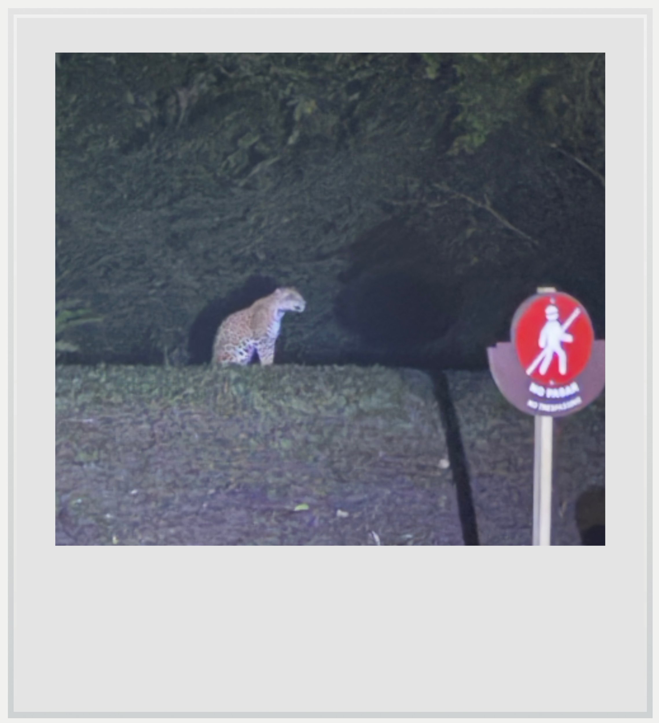
A fleeting encounter with a wild jaguar in Tikal.
It was just past 4am when we stepped away from the small checkpoint where we received our access wristbands. It was very dark, and the only light came from the headlamps worn by our guide and a few others.
All of a sudden, the guide stopped and whispered urgently “Jaguar, over here”. Sure enough, about a hundred feet from us, on a patch of grass by the access road, we could faintly see a dark shadow, barely moving. Our guide turned on his flashlight and directed it towards the shape he had called out for us, and the jaguar appeared.
The encounter lasted mere seconds, but time seemed to stop. It was hard to believe this had happened (thankfully, I managed to take the low-quality photo above with my phone). I had seen big cats in the wild before, in Africa, but never this close, and never on foot.
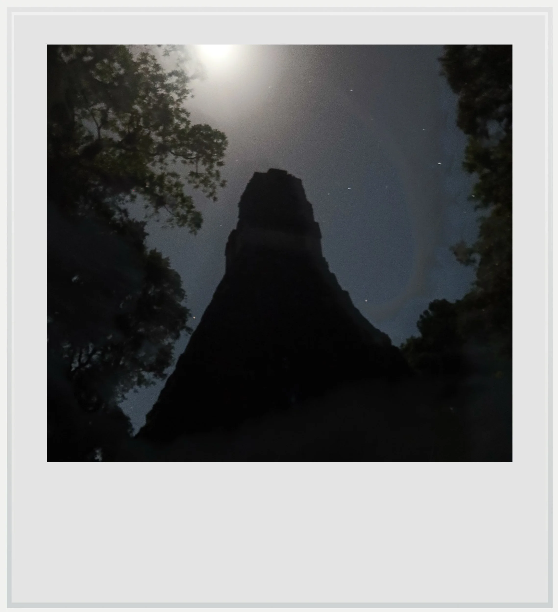
The back of Tikal’s Temple 1 before sunrise.
What felt even more surreal was that the jaguar didn’t seem fazed to see us and only reluctantly turned away. It signaled a great start to this second day in Tikal.
Walking in the tropical forest in the depth of the night felt somewhat scary - thankfully a full moon helped avoid a pitch black hike - but we never saw any other animal.
Tikal’s rise to regional dominance is generally dated to 378 AD.
Crossing the Great Plaza on our way to Temple 4, where we would watch the sunrise, we seemed like out-of-place intruders. The night made the size of the two temples anchoring the plaza almost oppressive.
Since we had a little time before sunrise, our guide started talking to us about the numerous stelae lined up along the northern side of the plaza. Stelae are among the few written records of Maya history archeologists came upon during excavations in many old cities, and they have been critical to our understanding of the earlier centuries of Maya history.

Stela P-83 in front of Temple 2.
Stela 31 was found buried inside Temple 33, which was right in front of us, and is now held at the site museum. It held the first key to understanding the relationship between Tikal and Teotihuacan that had puzzled me the previous day.
Tikal was first settled around 800 BC. By the early centuries AD, it was already a major city with its own royal dynasty¹. Its rise to regional dominance, however, is generally dated to 378 AD, when it became the center of a network of allied and subordinate kingdoms across the central Maya lowlands. Stela 31 records, in carved hieroglyphs, what happened that year.
Around January 16, 378, a war leader named Siyaj K’ahk’ arrived in Tikal. According to Stela 31, the city’s king died on the very same day². His entire lineage was overthrown, and a new line of kings took power, starting with Yax Nuun Ahiin I.
Yax Nuun Ahiin I was the son of “Spearthrower Owl,” a figure whose name glyph, an owl and a spear-thrower, points to Teotihuacan. The early years of his reign seem to have been dominated by Siyaj K’ahk’ in a sort of regency. Two other stelae help complete the picture: they show Yax Nuun Ahiin I in Mexican rather than Maya attire, which was critical in helping archeologists point to his origin outside of the Maya world.
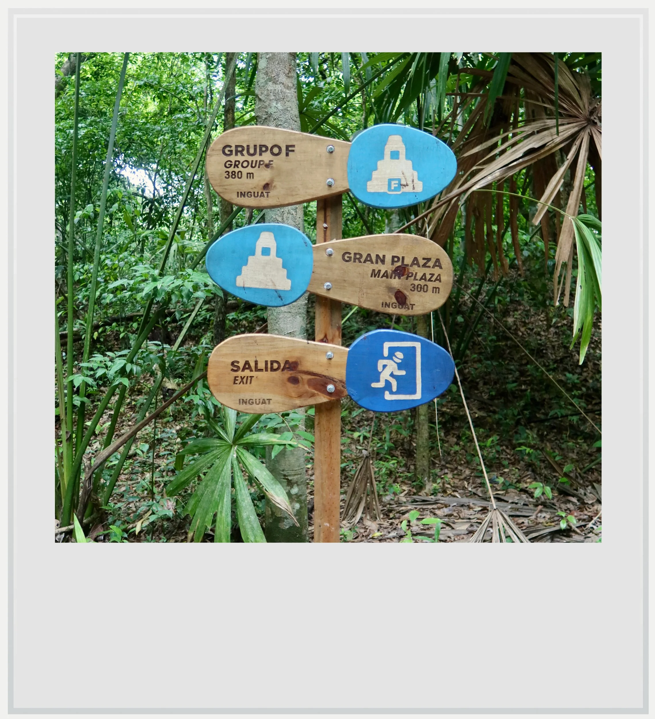
Wayfinding at Tikal.
That Siyaj K’ahk’ took over Tikal’s rule was one thing. That the same leader is believed to have taken control of Uaxactun the same year was another. Taken together, these help explain Tikal’s rise as the dominant power in the Maya lowlands for the next couple of centuries.
With few visual clues bearing witness to this era across the city, this flourishing period would have been lost on me without the guide’s explanations. Maya architects tended to build over existing structures, and most of the buildings surrounding us had been modified several times since then.
The three temples looked like symbols of Tikal’s rebirth.
One of the clearest signs of Teotihuacan’s imprint can be seen in the Lost World group, where several temples were remodeled in the Teotihuacan style in the fifth century.
This prosperous period in Tikal’s history lasted until 562 AD. What happened then? A leading theory is that the Snake kingdom, then based at Dzibanche and later at Calakmul, defeated Tikal with the help of its ally, the city of Caracol. From then on, Tikal raised very few stelae, large construction declined and public sculptures were deliberately mutilated.
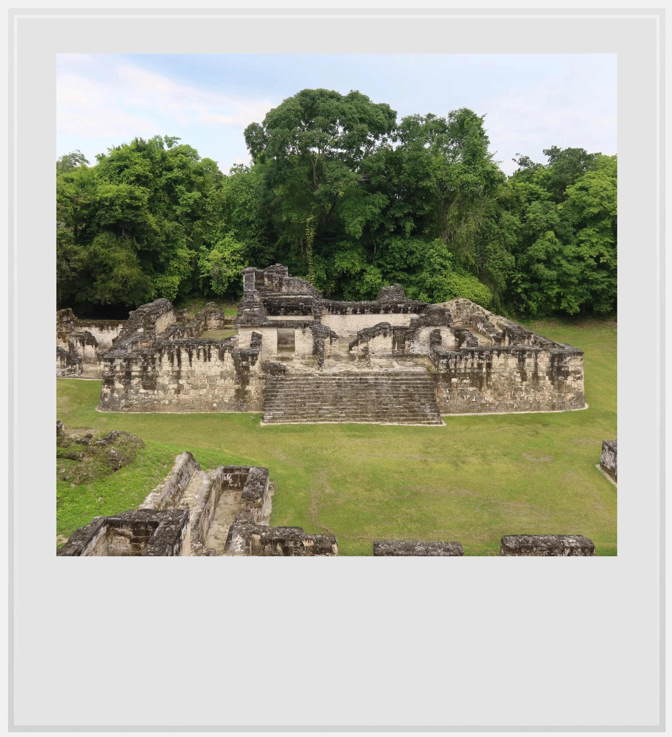
Parts of the Central Acropolis in Tikal.
While the story is best told by Altar 21 in Caracol, we learned earlier that Stela 31 was found buried inside Temple 33, possibly to save it from destruction. That the stela documenting Tikal’s rise was hidden during its decline says a lot about Tikal’s eclipse during those years.
Hearing about Tikal’s darkest years on the Great Plaza under the moonlight made the tale even more dramatic. Before moving on, our guide mentioned Stela 11, the last dated monument ever found at Tikal, which was standing there among other carved stones. I would understand its significance a few hours later.
We continued our walk towards Temple 4, our ultimate destination, and climbed to the top to witness the jungle waking up. Little by little, as the light came up, it revealed soft bands of grey mist among the trees. The first birds started flying, and howler monkeys began their cacophonous morning rituals.

The three Tikal temples in front of us slowly emerged from the shadows and, as the new day dawned, they looked like symbols of Tikal’s rebirth. The dark years that began in 562 AD ended in 695 AD, when King Jasaw Chan K’awiil led Tikal to its revenge against Calakmul. The city then found its way back to dominance across a wider area of the Maya lowlands.
Successful rulers expanded the city’s monumental footprint: Temple 1 was built by Jasaw’s son over his father’s tomb. I now understood what it stood for, beyond its sheer size. Temple 2, built in honor of Jasaw’s queen, and Temple 4, from which I was looking at the city, date from the same era, with Temple 3 coming much later.
Like the previous golden age, this one was bound to end.
These temples rose above the edifices built earlier in Tikal’s past, and from my vantage point, told the story of an immensely powerful and prosperous city.
The wide causeways leading to and from the main groups were built or expanded in that era as well. Getting down from Temple 4, I walked the Maudslay Causeway towards the North Zone. I was quickly alone in the jungle, leaving behind the main tourist flow.
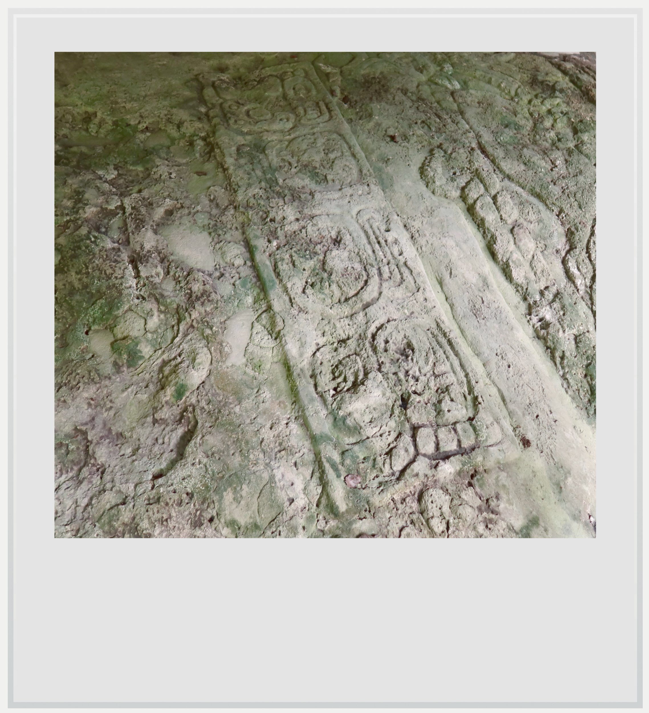
The petroglyph depicting a Naranjo captive.
It was now time to go back to the Great Plaza. Along the path, a stunning petroglyph was further proof of Tikal’s rebirth after 695 AD. It depicted a captive, probably a noble from the Naranjo–Yaxha area, facing Tikal's 27th ruler, Yik’in Chan K’awiil, the king who defeated Naranjo in 744. Whoever the prisoner was, the message was clear: Tikal was strong again.
I reached the Great Plaza to look at its two main temples one last time. In daylight, now that I knew the story behind them, they stood taller, even more commanding, like true symbols of Tikal’s might in the 7th and 8th centuries.
Like the previous golden age, this one was bound to end. Stela 11 stood nearby on the plaza, and it helped me connect the final dots in Tikal’s pre-Columbian past. Stela 11 bears the latest date ever found at Tikal: 869 AD.
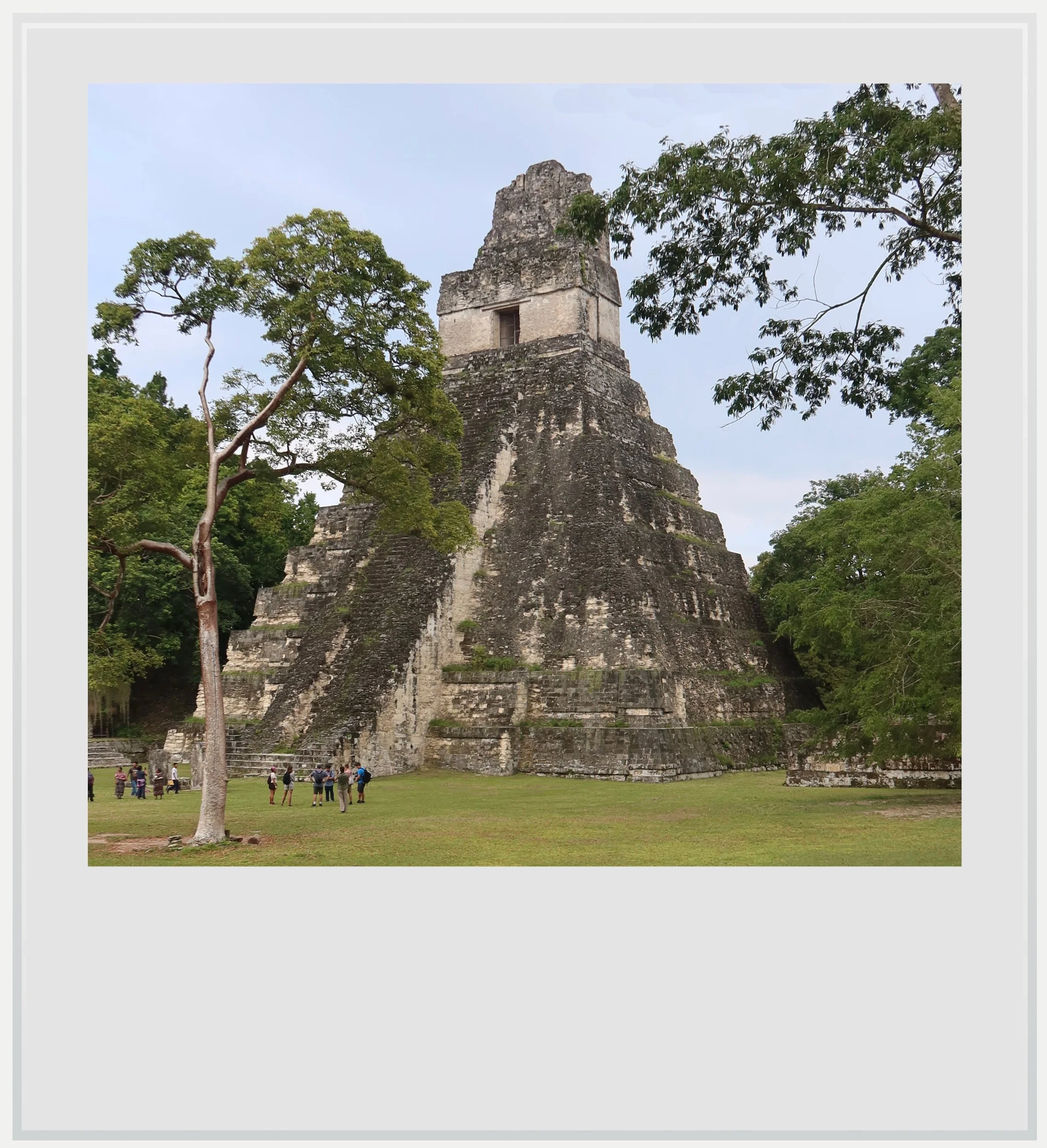
Temple 1 from the Great Plaza.
A century later, the city was largely abandoned. This time, the collapse affected most of the southern Maya lowlands. Researchers are still debating what could have caused the fall of so many cities, but they now tend to think several factors combined: decades of war between cities, overpopulation and overconsumption of natural resources, compounded by prolonged droughts.
Recent fieldwork on the site has helped refine these hypotheses for Tikal itself: a 2020 study found that some of Tikal’s central reservoirs were contaminated with high levels of mercury and toxic algae, possibly brought on by the Maya themselves (mercury, for instance, likely came from a red pigment used on buildings and ceramics). It may have been one factor in the city’s collapse.
Latest findings increasingly point to a strong Teotihuacan presence at Tikal.
More research also sharpened our understanding of Teotihuacan’s influence at Tikal. In 2016, a LiDAR survey revealed what looked like natural hills south of the Lost World. They turned out to be a carefully designed replica of Teotihuacan’s Ciudadela³. The complex had been deliberately buried in ancient times, and had remained unnoticed until then.
In 2019, other excavation work in a residential area further east of the Ciudadela uncovered a buried altar, whose painted panels recalled typical Teotihuacan art⁴. This led Stephen Houston, one of the leading archeologists of the Maya world, to say that “wealthy leaders from Teotihuacan came to Tikal and created replicas of ritual facilities that would have existed in their home city”. It also seems to point to Tikal erasing its past links to Teotihuacan at some point in its history.
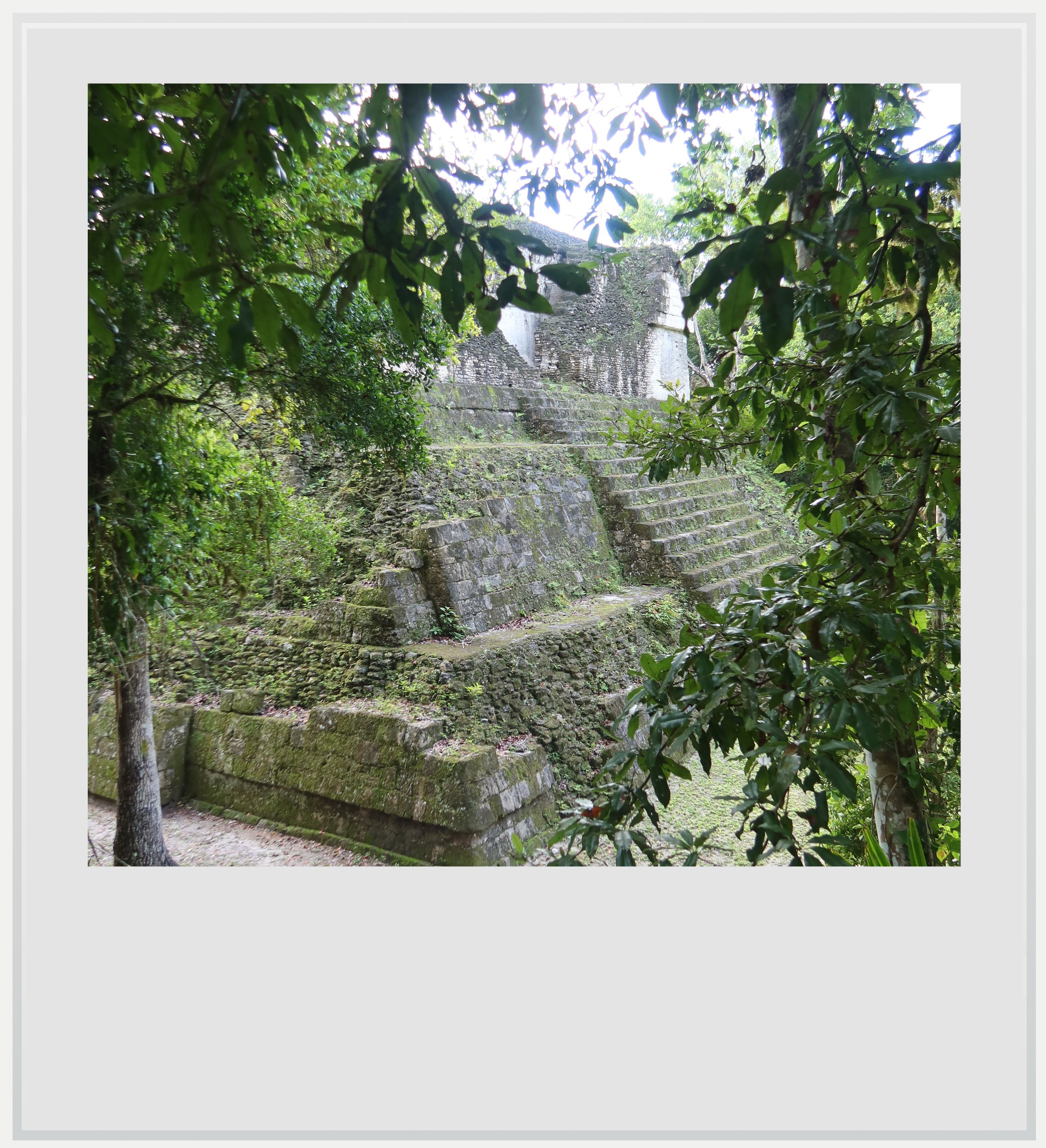
A temple in the North Zone (Group H) at Tikal.
A few days after my visit to Tikal, I was able to attend a seminar covering the latest archeological discoveries there. It was held at the University of Texas at Austin, one of the most prominent universities involved in ancient Maya research. Archeologists shared their latest findings, some of them not yet published, all pointing increasingly to a strong Teotihuacan presence at Tikal during the Classic period.
Edwin Roman Ramirez, the lead archeologist of the South Tikal Archeological Project (PAST, from its Spanish name), was there in person with his team, and it was fascinating to be able to discuss with them how their understanding of the city’s past was changing based on their latest finds.
This brought me back to the first building that made me question my understanding of the city, in the Lost World group. Pyramid 5C-49, whose base was built in a typical talud-tablero style, had reminded me of Teotihuacan, and that seemed a thought so out of place that it had sent me on a quest to understand it. I knew more about the link between the two polities now, but one crucial detail was still bugging me. If Teotihuacan rulers arrived in Tikal in 378 AD, how could that explain the look of a temple estimated to have been built between 250 and 300 AD, roughly a century before their arrival?
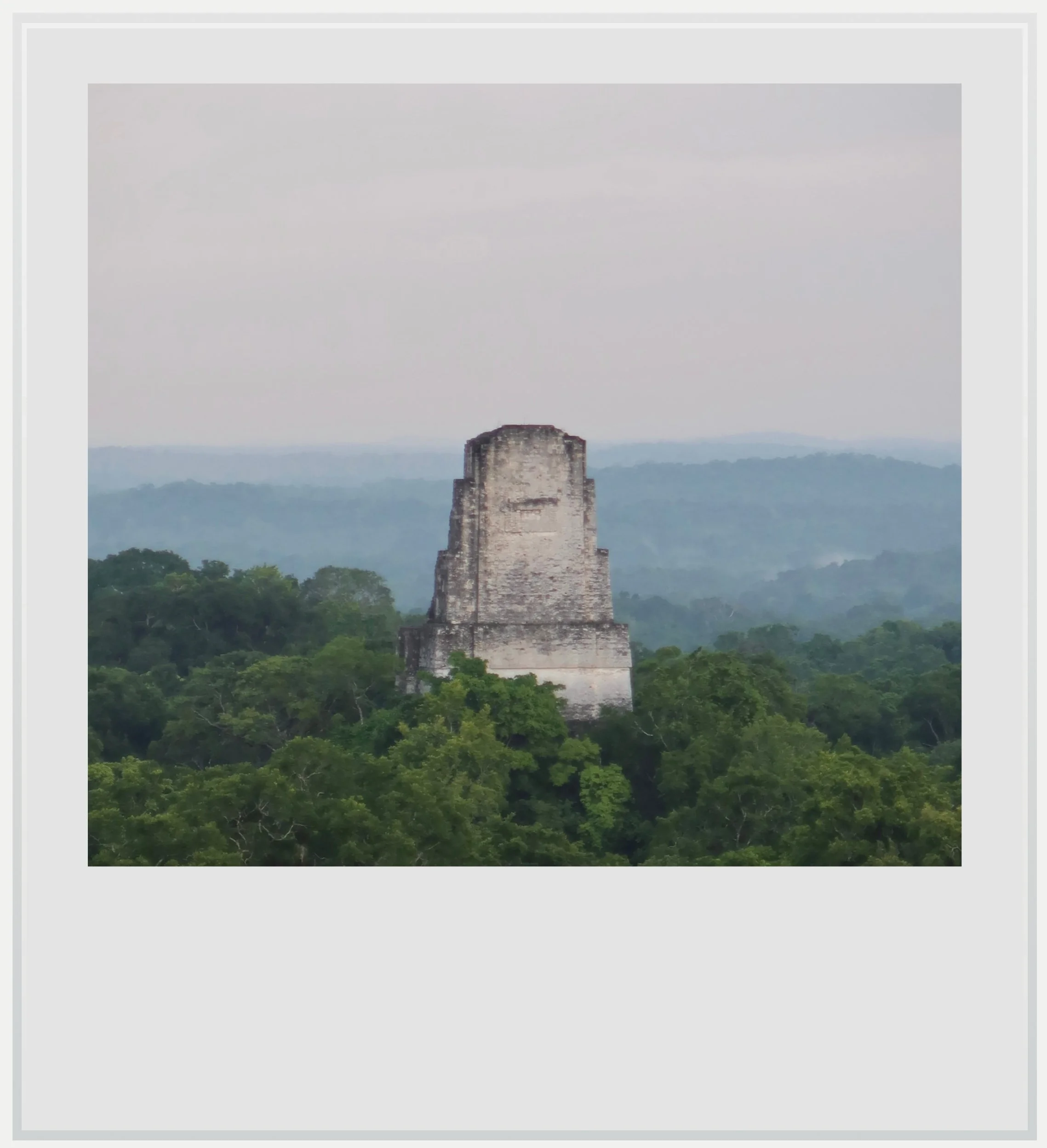
The top of Temple 3 at sunrise, seen from the top of Temple 4 at Tikal.
The answer may lie somewhere under one of Tikal’s many temples yet to be excavated, and if so, I am sure the PAST team will find it one day. Their efforts highlighted a thread I hadn’t noticed until then; I was walking through a city that seemed to keep its past beneath the surface. It deliberately buried some of its Teotihuacan-style compounds beneath layers of fill and hid some of its most important stelae to protect them. Once the city was abandoned, the forest reclaimed it and kept it out of sight for centuries.
I remembered standing at the top of Temple 4 that morning, with the mist still hanging between the trees and the howler monkeys calling all around us. The tips of Temples 1, 2 and 3 had come out of the forest like icebergs, and I had spent a long time looking at them without really thinking about what was under my own feet. Temple 4 is still largely unexcavated, and archeologists believe that Yik’in Chan K’awiil, the king facing his captive on the petroglyph, is buried somewhere inside it. His tomb has never been found.
For now, Tikal has kept that secret, too.
Notes
Chronicle of the Maya Kings & Queens, Simon Martin & Nikolai Grube
The Arrival of Strangers, David Stuart
A Teotihuacan complex at the Classic Maya city of Tikal, Guatemala, Stephen Houston, Edwin Roman Ramirez et al.
A Teotihuacan altar at Tikal, Guatemala: central Mexican ritual and elite interaction in the Maya Lowlands, Edwin Roman Ramirez, Lorena Paiz Aragon et al.
Practical information
(Everything you need to know about visiting Tikal - updated November 2026)
Tikal at a glance
Name: Tikal, a modern name probably meaning “at the waterhole.” Its rulers called their kingdom Mutul and the city Yax Mutul, “First Mutul.”
Location: Tikal National Park, Peten, northern Guatemala, in the heart of the Maya Biosphere Reserve. It’s a UNESCO World Heritage Site for both its ruins and its rainforest.
Getting there: by rental car, about 90 minutes (40 miles / 63 km) north of Flores and Mundo Maya airport (FRS) on a paved road. Shared and private shuttles also run from Flores. The ticket checkpoint is well before the ruins, so allow about 15 more minutes of jungle driving after the gate.
Hours: 6am to 6pm daily. With an add-on ticket you can also enter 4–6am for sunrise, or stay 6–8pm for sunset.
Fees: GTQ 150 per person for foreigners (about USD 20), per day. Sunrise or sunset adds GTQ 100. Buy online on the Ministry of Culture’s ticket portal before you go, since the signal at the park is weak. Sunrise and sunset visits also need a licensed guide, hired separately (your hotel likely offers packages for these).
Time needed: a full day for the main groups. Stay overnight if you want both sunset and sunrise.
Best season: dry season (January–April) but visiting in good conditions is possible in November and December at the tail end of the rainy season, with less frequent showers.
Services: restaurants, hotels and the site museums near the entrance plaza. No cell service except (potentially) at the top of some of the tallest buildings on site (Temple 4 and the Lost World Pyramid).
Where to stay: inside the park, about 10–15 min on foot from the ruins: Jungle Lodge, Tikal Inn or Jaguar Inn. Otherwise El Remate (about 30 min) or Flores (about 90 min). Outside the hotels, bring cash for food and services.
Nearby Maya sites to consider: Uaxactun (23 km of dirt road north of Tikal, GTQ 50 add-on entry fee), Yaxha, Topoxte and Nakum.
Last checked: Visited October 2026. Last updated November 2026.
Getting to Tikal
How to get to Tikal from the United States: the easiest way to reach Tikal from the US is to fly to Guatemala City, which has non-stop connections with several major cities, including Los Angeles, Miami, Houston, New York and Washington. From Guatemala City, take a domestic flight to Flores, in northern Guatemala. The flight takes about one hour, with several daily services operated by Avianca and TAG Airlines.
How to get to Tikal from Mexico City: there are no non-stop flights between Mexico City and Flores. The easiest option is to fly via Guatemala City, which is currently served by Aeromexico and Volaris. The flight to Guatemala City takes about two hours, followed by a domestic flight of about one hour to Flores. TAG has at times offered seasonal flights between Flores and Mérida or Cancún, so check whether any are running when you travel.
How to get to Tikal from Belize: Tikal is also an easy side trip from Belize. The Melchor de Mencos border crossing is about 100 km from the park, roughly two hours’ drive. If you’re driving a rental car, check that your rental company allows border crossings.
How to get to Tikal from Flores airport: rent a car and head north on the paved road through Ixlú and El Remate, about 63 km and one hour of driving. You’ll show your ticket at the park entrance checkpoint. From there it’s still about 15 km of jungle road to the visitor center. Your ticket is time-stamped at both ends to make sure you stick to the 40–45 km/h speed limit, which protects the wildlife crossing the road. Allow about 90 minutes in total. No 4WD is needed. If you’d rather not drive, shared and private shuttles run from Flores every day, starting before dawn for sunrise visits.
Can I visit Tikal on a scheduled tour: yes, easily. Tikal is the most visited site in Guatemala, and tours leave Flores and El Remate every day, from sunrise departures around 3am to standard morning trips and sunset tours. Most tours do not include the entrance ticket or the sunrise/sunset supplement, so check before you book.
Do I need a guide at Tikal: not for a regular daytime visit. Trails are well marked and you can explore on your own. For sunrise or sunset access, you must go with a licensed guide, who you hire separately from the ticket. I booked my sunrise tour through the Jungle Lodge hotel (they have a dedicated tour page). It cost USD 17, not including the park entrance of 150 quetzals (about USD 20) for regular access and 100 additional quetzals for the sunrise access.
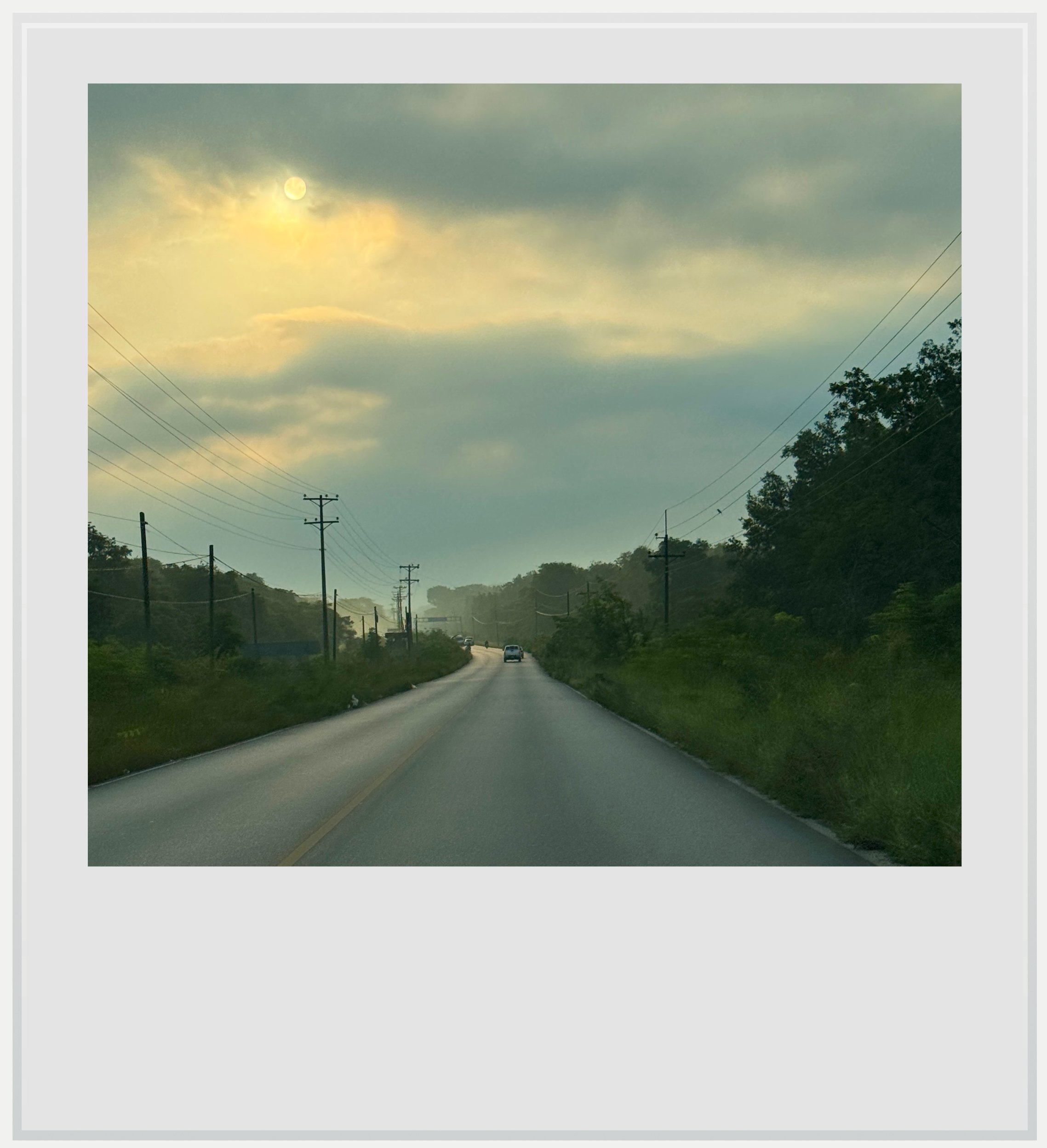
Early morning on the road from Flores to Tikal.
When to go to Tikal
The best months weather-wise are in the dry season, between January and April. I visited in late October, and aside from a brief shower on my first afternoon there, which virtually emptied the park, the weather was very pleasant. In other words, the tail end of the rainy season (November and December) can be a good time to visit as well.
The site is open year-round. Unlike Nakum or Uaxactun, the access road is paved all the way, so the rainy season makes for wetter trails but doesn’t threaten access.
What’s the best time of day to visit Tikal
Opening time is the best time. The gates open at 6am, wildlife is most active in the early morning, and most tour groups from Flores only arrive mid-morning. Late afternoon is my other recommendation: day-trippers leave to drive back to Flores, and if a shower passes through, as it did for me, you may have the site almost to yourself.
From a photographer’s perspective, both ends of the day have their advantages, because the two great temples of the Great Plaza face each other. Temple 2 faces east, so it catches the morning sun, and its front is best photographed early in the day, from the Central or North Acropolis. Temple 1 faces west, toward Temple 2, which means it is backlit in the morning and lit head-on in the afternoon. If you can only come once, the late afternoon has a slight edge: Temple 1 is the more famous of the two, and the light from the top of Temple 4 is at its best as the sun sets behind you.

Sunrise view over the jungle from the top of Temple 4.
Are the sunrise or sunset tours worth it at Tikal?
Both tours require an add-on ticket and a guide. Most people arrange these via their hotel or through global platforms such as Viator. Bear in mind the actual base cost of entry at Tikal isn’t usually included in these prices and you’ll need to secure these on your own (see below).
Sunrise from Temple 4 is the famous one, but mornings at Tikal are often foggy, and I didn’t really think the experience itself was worth the much shorter night. The sun rises in front of the viewing area, meaning that Temples 1, 2 and 3 are backlit, and the area at the top of Temple 4 can get quite busy: there were about 100 people when I went. The one incredible bonus is being able to see more wildlife this early in the morning. As the very first group to get into the park, we did manage to see a wild jaguar, and that was an unforgettable (if extremely rare) experience.
I didn’t actually purchase the sunset tour and didn’t really need to: sunset happened at 5.30pm while I was in Tikal, and I was able to enjoy thirty minutes of gorgeous light over Temples 1, 2 and 3, alone (see the photo at the top of the article). I left the temple at 5.30pm with time to spare to exit the park by 6pm. In other words, I managed to get the sunset experience without having to pay extra for it. Check sunset times at the time of your visit to see if this is an option for you. From an atmosphere perspective, with the sun behind you as it sets, the hues over the jungle were far more impressive than during sunrise.
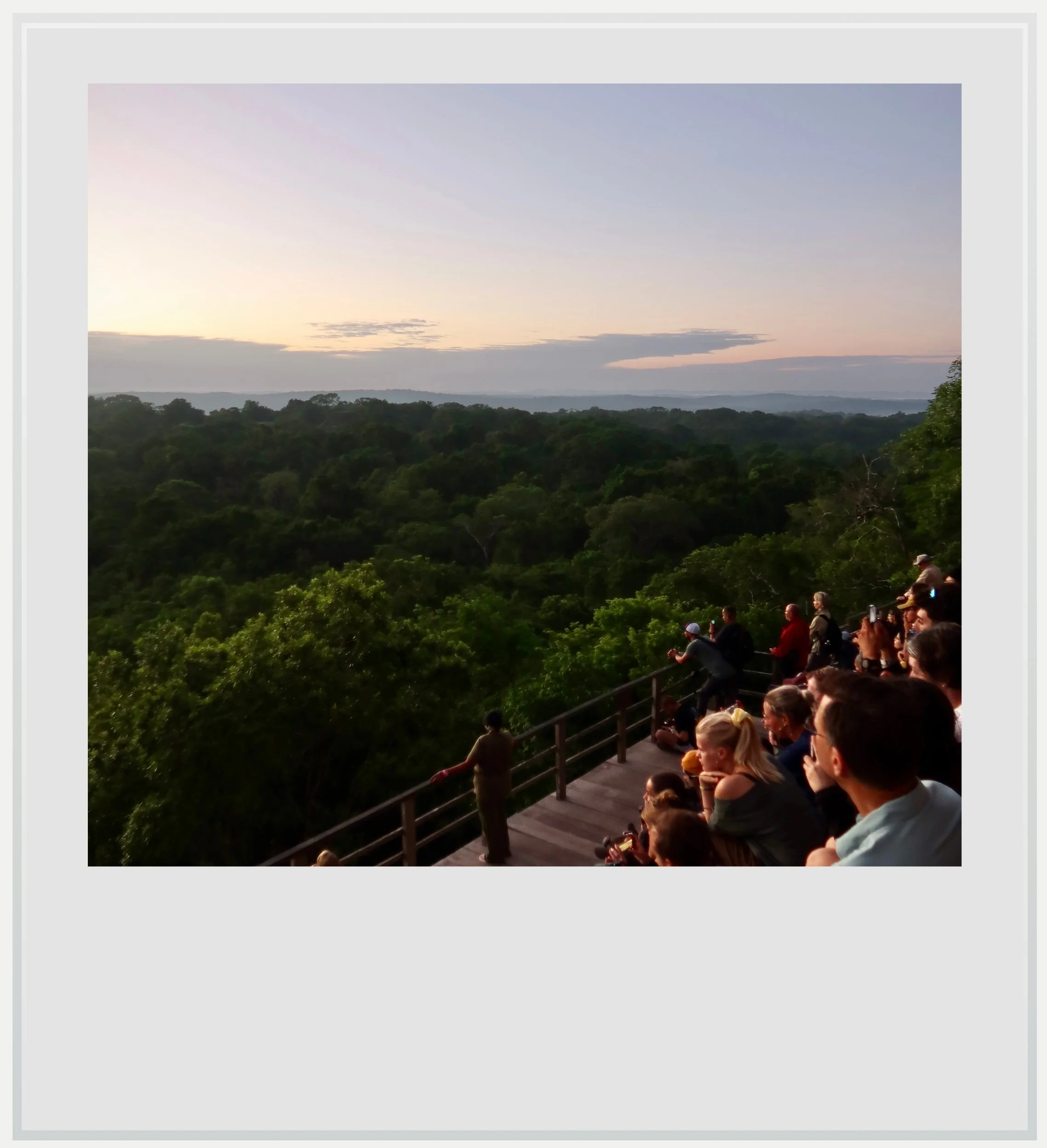
A hint of the crowd at the top ot Temple at sunrise.
How much does it cost to visit Tikal
At the time of my visit, entry to Tikal National Park cost 150 quetzals (about USD 20) for foreigners, valid for one day. Sunrise (4-6am) or sunset (6-8pm) access costs an extra 100 quetzals and requires the regular park ticket too. Unless your guide or tour is taking care of tickets for you, I strongly recommend buying them ahead of time on the Ministry of Culture’s online ticket portal: mobile signal at the park is weak, and for sunrise there is no way to buy at the gate, since the ticket office only opens at 6am. I booked my guide through the Jungle Lodge hotel (tour page) where I was staying, and the cost per person for the group tour was USD 17. Access to Uaxactun costs 50 extra quetzals (no guide necessary but I still recommend one).
Access to the park works with a system of colored wristbands which show exactly what access you have purchased, making controls by guards inside the park fairly easy, so don’t try to skip the additional ticket.
How long should I plan to visit Tikal
Tikal is huge, and the main groups are spread out along forest causeways. Between the Great Plaza, the North and Central Acropolis, Mundo Perdido, and Temples 4 and 5, you’ll easily walk 10–15 km. Plan at least five to six hours for the main sights, or a full day if you want to take it slow. To see it at both sunset and sunrise, as I did, you need to stay overnight inside the park or nearby.
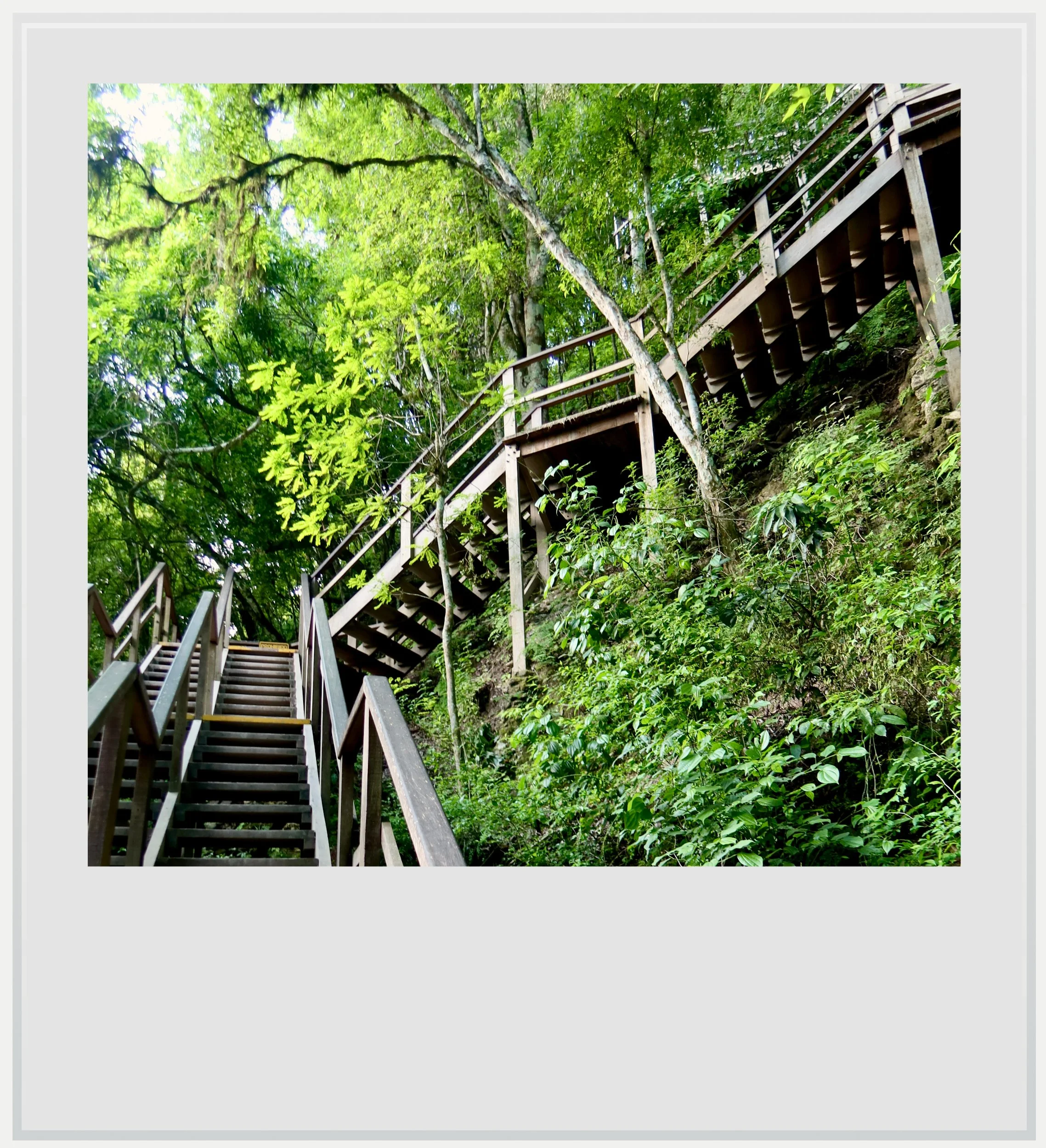
The stairs leading to the top of Temple 4.
What are Tikal’s opening hours
Tikal National Park is open every day from 6am to 6pm. With the add-on tickets, sunrise visitors can enter from 4am and sunset visitors can stay until 8pm. The site museums keep their own, shorter hours.
Climbing the temples at Tikal
You can climb only some of the temples, and none by their original staircases:
Temple 4: the tallest at Tikal, climbed by a wooden staircase alongside the pyramid. The summit gives you the famous view of the tops of Temples 1, 2 and 3 above the canopy.
Temple 2: a short wooden staircase leads to a great view over the Great Plaza and Temple 1. It was closed at the time of my visit, but people I spoke with in the park expected it to reopen within a few weeks, so ask when you arrive.
Lost World’s great pyramid: climbable, with wide views and fewer people than Temple 4.
Temple 1: closed to climbing.
Temple 3: closed to climbing.
Temple 5: closed to climbing, as a sign at its base makes clear, whatever photos you may have seen online.
What to see in Tikal (and the best photo spots)
Top of Temple 2: the classic view over the Great Plaza, with Temple 1, Tikal’s most famous temple, seen from above. Come in the afternoon, when the sun is behind you and lights up the front of Temple 1 (Temple 2 was closed for climbing during my visit but was expected to reopen soon).
Temple 1 from the Great Plaza: the front of Temple 1 faces west, toward Temple 2, so it’s backlit in the morning and lit straight on in the afternoon. Shoot it later in the day.
The Central Acropolis: in the morning, this is where to photograph Temple 2 itself. The Central Acropolis sits on the south side of the Great Plaza, and as you climb its terraces toward the Temple 1 side, you get a lovely angle on Temple 2 in the morning light.
The North Acropolis: on the other side of the Great Plaza, it offers an equally beautiful view of Temple 2, also best in the morning.
Temple 5 from the trail: you can’t climb it, but it’s the second-tallest structure at Tikal, and its steep, moss-covered staircase rising out of the trees is one of the most dramatic sights from the ground. The forest softens the light, so it works at any time of day.
Temple 3 from the ground: still largely covered in vegetation, it shows what Tikal’s temples looked like before excavation.
The Plaza of the Seven Temples: a row of small temples side by side, east of the Lost World group. It’s quiet, unusual, and makes for a good wide shot.
Top of the Lost World pyramid: wide views over the forest, and another great place to watch the sunset, usually with fewer people than Temple 4.
Top of Temple 4: for me, the finest view at Tikal, especially in the late afternoon. There are fewer people, the sun is behind you, and the tops of Temples 1, 2 and 3 rise above the rainforest canopy. It’s the photo I chose for the cover of this story.
Wildlife: ocellated turkeys and coatis around the visitor center and the Great Plaza are easy subjects. Bring a zoom lens if you want toucans and monkeys in the canopy. Obviously no sighting is guaranteed.
Jaguar sighting: just past the checkpoint where sunrise visitors get their wristbands, I saw a wild jaguar on a patch of grass by the access road, a little after 4am. It was pure luck and extremely rare, so don’t count on it, but keep your eyes open on the walk in. You might be lucky too.
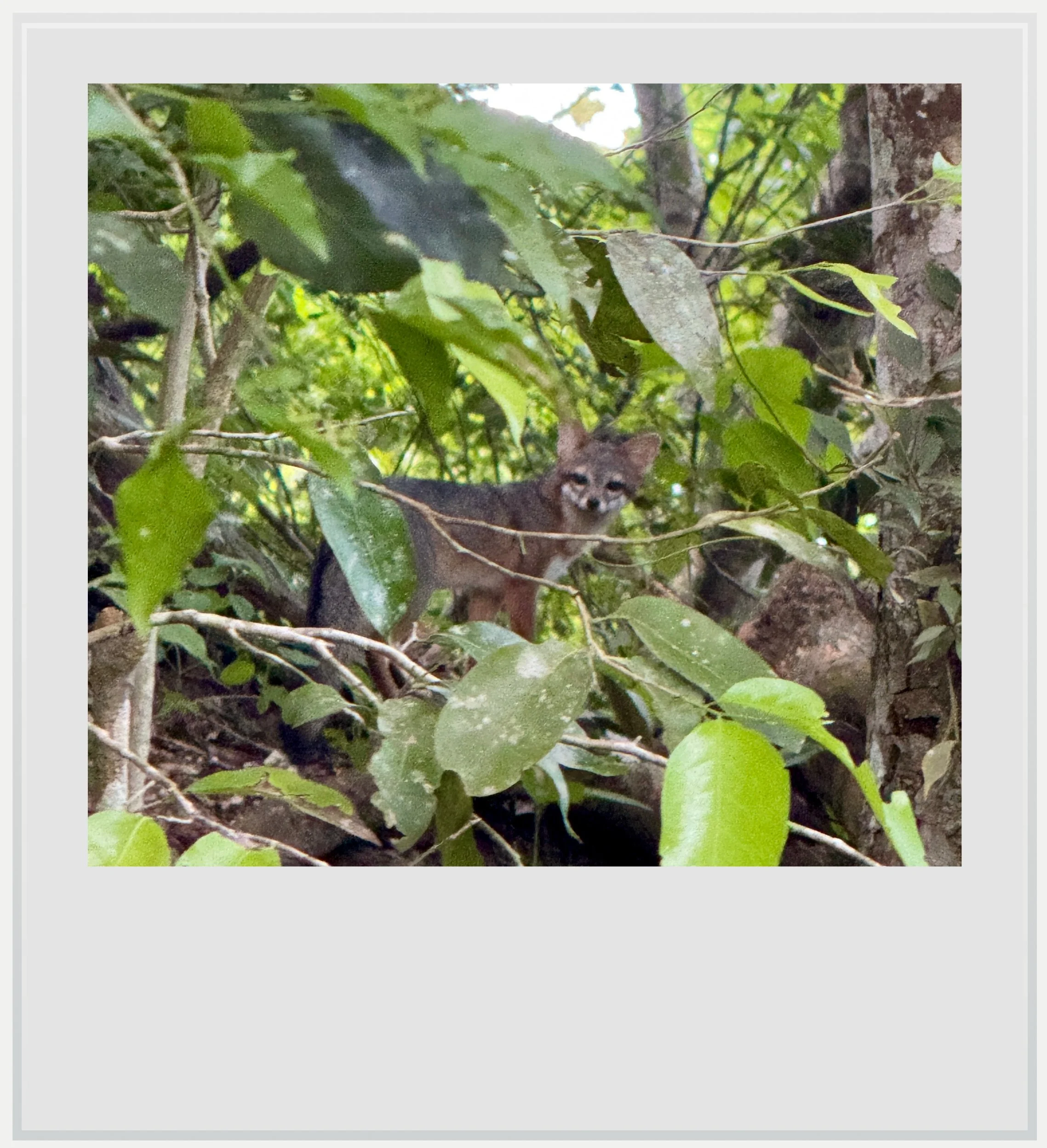
A grey fox in the Tikal jungle.
Museums at Tikal
Tikal has two small museums near the visitor center, which I unfortunately didn’t visit this time around. They need a separate ticket, which has typically been around 30 quetzals and covers both.
Museo Sylvanus G. Morley (ceramics museum): pottery, incense burners and vessels from the excavations, plus the most important object at the site. Stela 31 shows Siyaj Chan K’awiil II flanked by figures in Teotihuacan dress, and its inscription is a key source for the events of 378 AD. The museum also has a reconstruction of the tomb of Jasaw Chan K’awiil, found under Temple 1. If you read the history part of this article, this is where it comes alive.
Museo Litico: in the visitor center, with carved stelae and altars from the site, and early photographs of the ruins as the first explorers found them.
Wildlife at Tikal
Tikal sits inside the Maya Biosphere Reserve, the largest protected forest in Central America, and the wildlife is half the experience. Howler monkeys are the soundtrack of the park, and you’ll likely hear them long before you see them, especially at dawn. Spider monkeys swing through the canopy above the trails. Coatis move through the plazas in groups, and ocellated turkeys, with their iridescent blue-green feathers, wander around the visitor center and the Great Plaza. Bird life is outstanding: keel-billed toucans, parrots, and oropendolas with their hanging nests. Gray foxes and agoutis are common too.
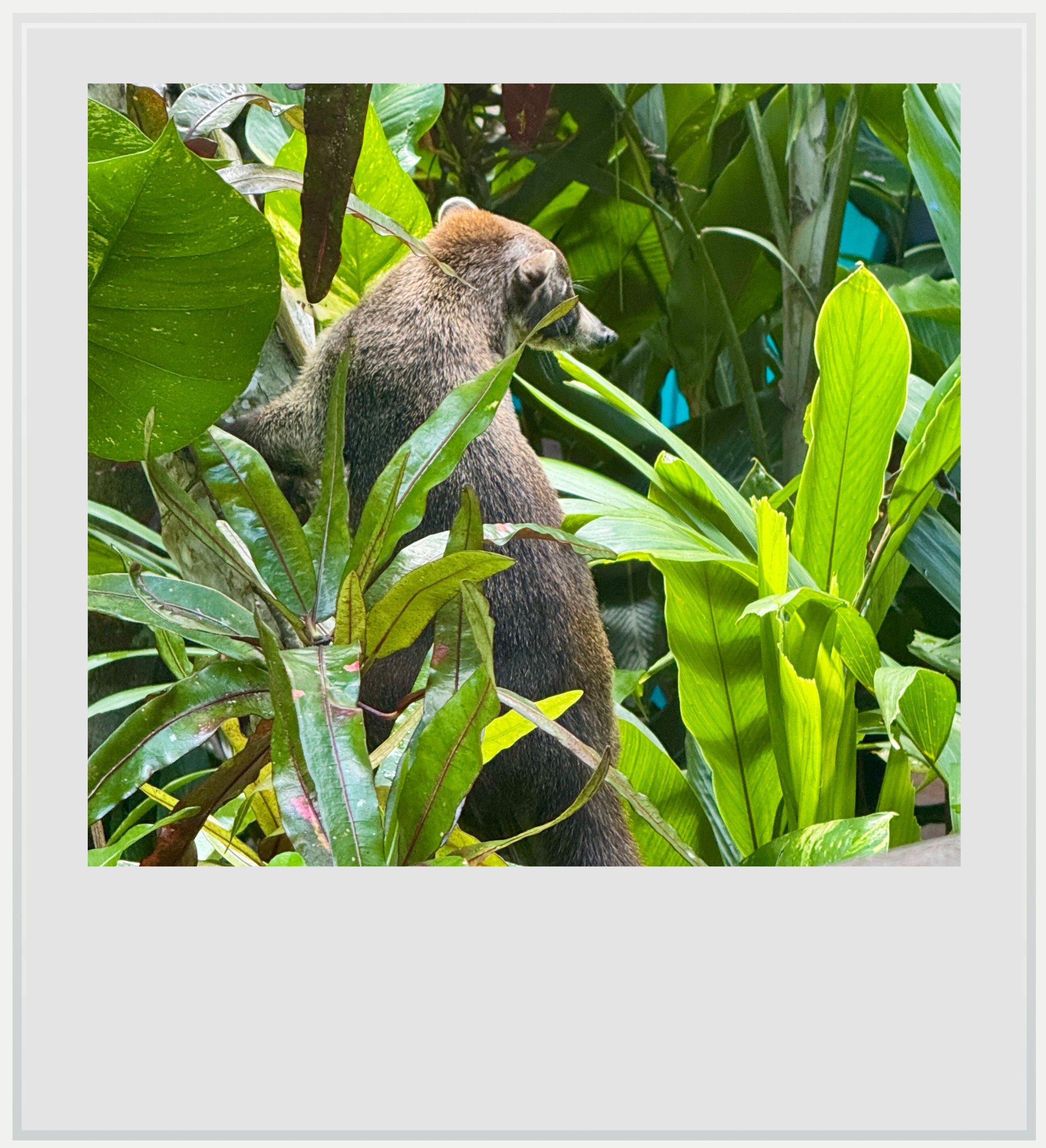
A coati in the Jungle Lodge gardens.
Jaguars and pumas live in the reserve but are rarely seen. I was lucky enough to see a wild jaguar at the very beginning of my sunrise tour (the details and a picture feature in the story above) but this was entirely unexpected. Snakes, including the venomous fer-de-lance, are present but rarely encountered on the main paths. Stay on the trails, especially at dawn and dusk, and watch where you step. Don’t feed the animals, coatis included, however insistent they are. Bring insect repellent: mosquitoes can be relentless, especially in the rainy season and around sunset.
What to see near Tikal
Uaxactun is the natural companion to a visit to Tikal: it lies 23 km north on a dirt road through the park, and you need a separate 50-quetzal ticket on top of your Tikal ticket. The road was passable in late October, and is used several times a day by public buses reaching the small community around the ruins. Uaxactun was Tikal’s rival until the Teotihuacan-backed conquest of 378 AD, which makes it a fitting side trip. To the east, Yaxha, about 1 hour 30 minutes from Tikal, offers temples overlooking a lake and the best sunset in the region, plus side trips to Topoxte island and, for the adventurous, Nakum.
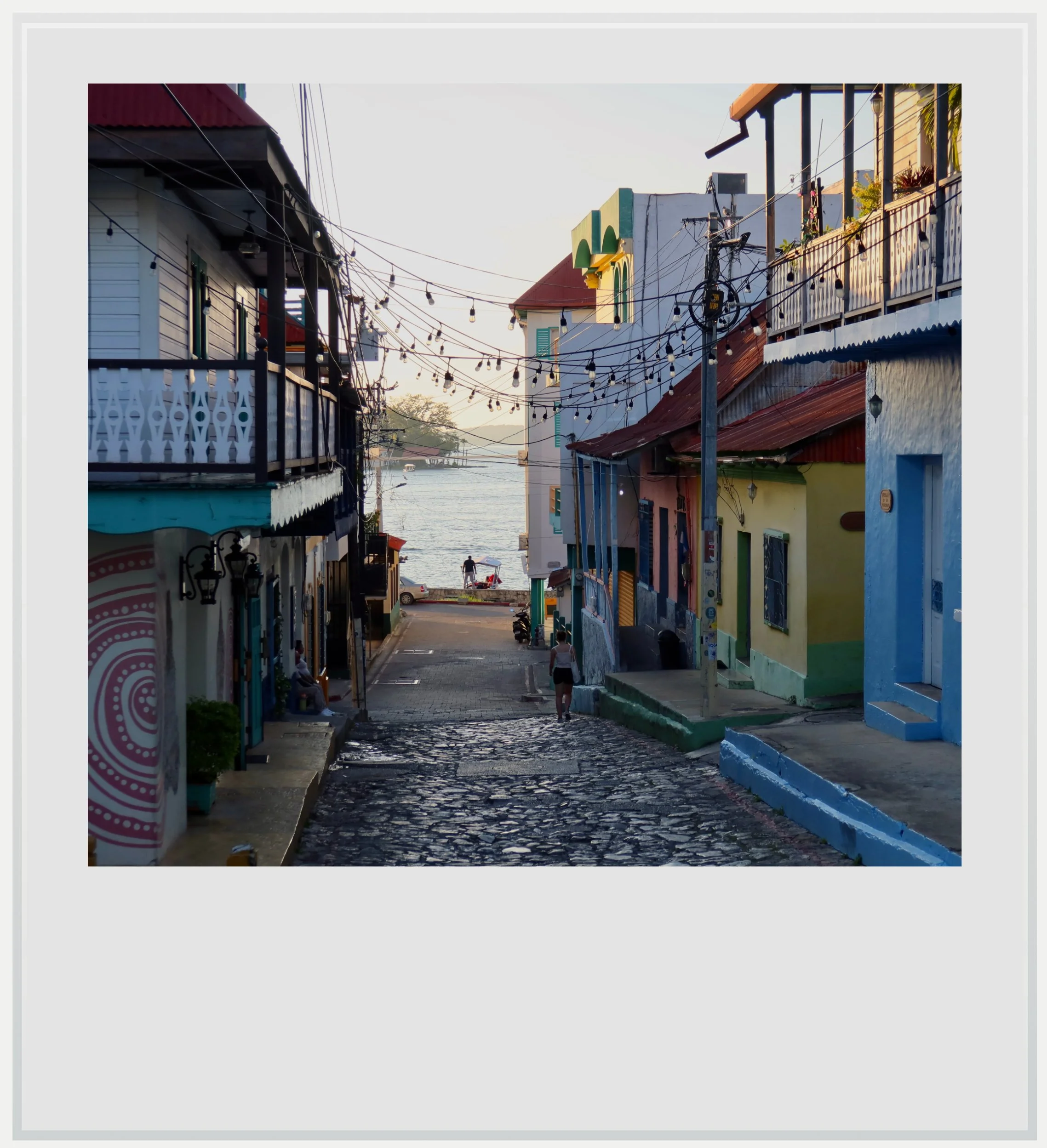
A quiet street on the island of Flores, Guatemala.
For a change from archaeological sites, Flores offers walks through its compact island town, colorful streets and waterfront views over Lake Peten Itza, and El Remate is a quieter base on the same lake.
Food & lodging near Tikal
Hotels
Three hotels operate inside the park, about 10–15 minutes’ walk from the ruins: Jungle Lodge, Tikal Inn and Jaguar Inn. Staying inside the park is the only way to visit at both sunset and sunrise without a 3am drive from Flores, and to hear the howler monkeys at dawn.
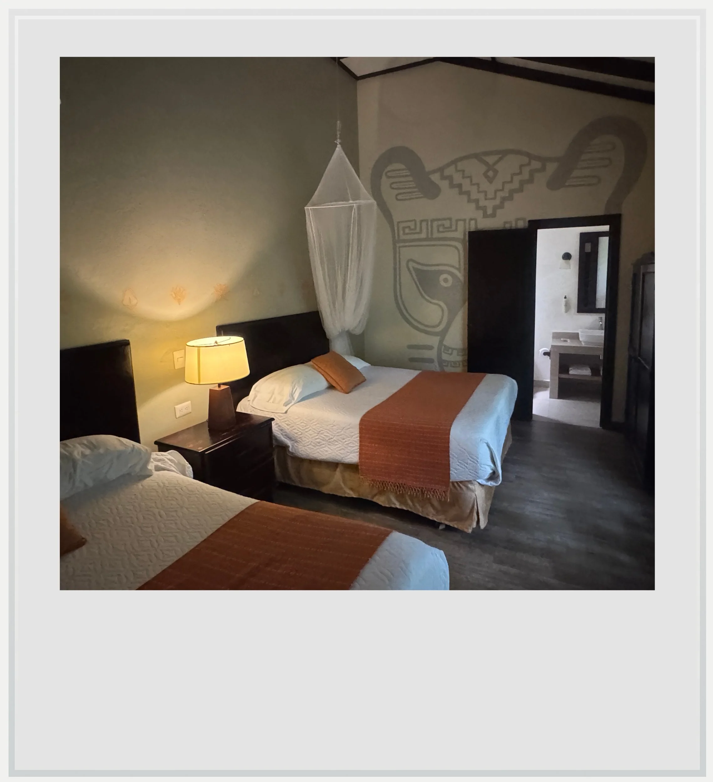
My room at the Jungle Lodge inside Tikal National Park.
I stayed at the Jungle Lodge, a premium property with elegant, spacious rooms, a pool and very pretty landscaped grounds. The hotel organizes a sunrise and a sunset tour for its guests, has a nice restaurant open for breakfast, lunch and dinner, and offers free Wi-Fi in the reception area and the restaurant (but not in the rooms). I paid around USD 120 for a night. A cheaper, shared-bath option is available on the grounds as well.
Otherwise, El Remate is about 30 minutes away and Flores about ninety minutes away, with far more choice.
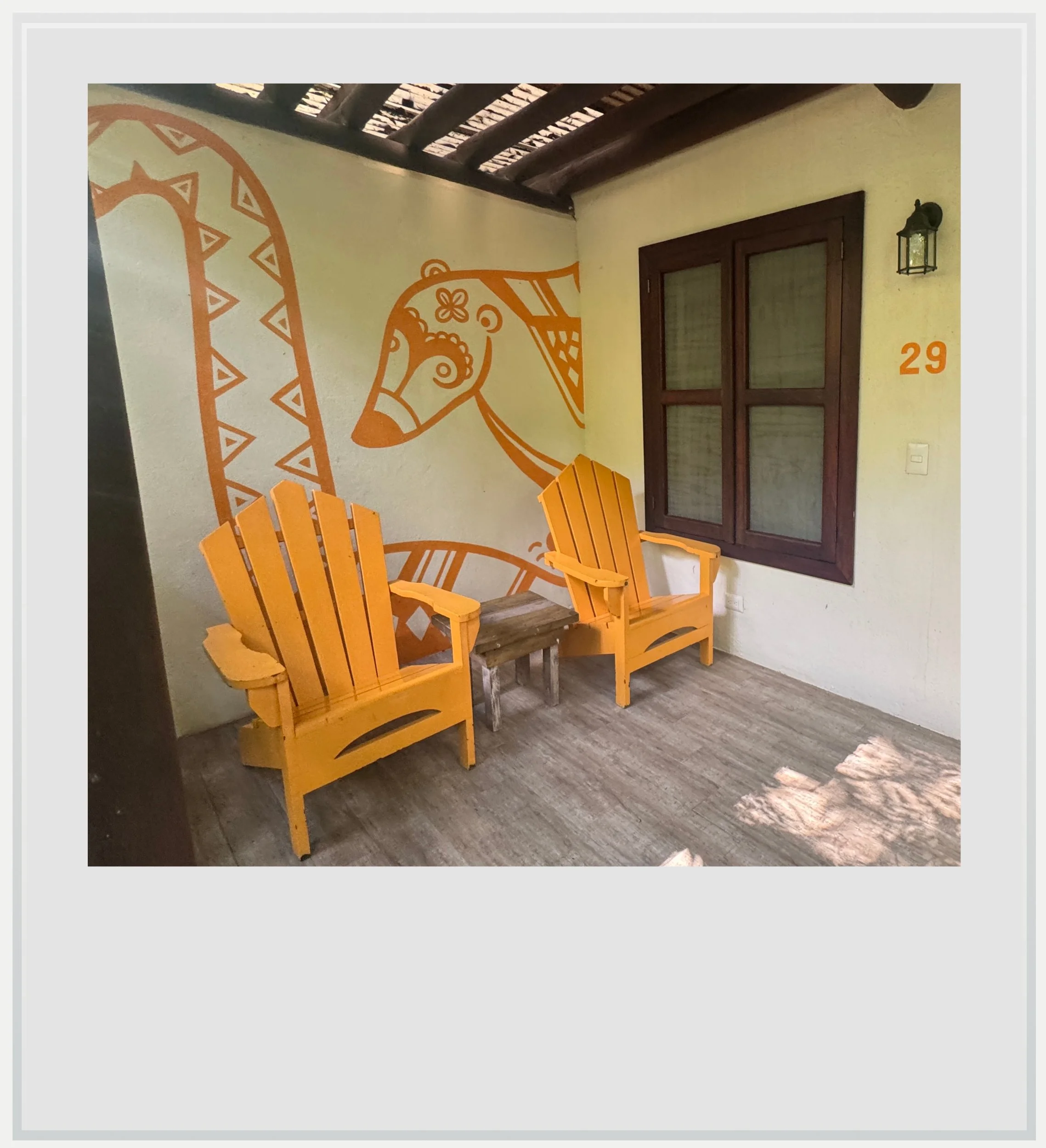
My room’s front patio at the Jungle Lodge.
Food
There are a few restaurants and comedores near the visitor center, as well as at the in-park hotels. I only ate at the Jungle Lodge, because it was convenient and the value for money was really good. Note the hotel offers a bagged breakfast for the sunrise tour, for about USD 18, to be ordered the night before.
Bring cash: outside the hotels themselves, food and services are generally cash only. Take water and snacks on the trails, since distances between groups are long. It is a good idea to stock up at this modern convenience store just before the park for the best choice, and the possibility to pay by credit card (the store also has the closest ATM to the park, if you need cash).
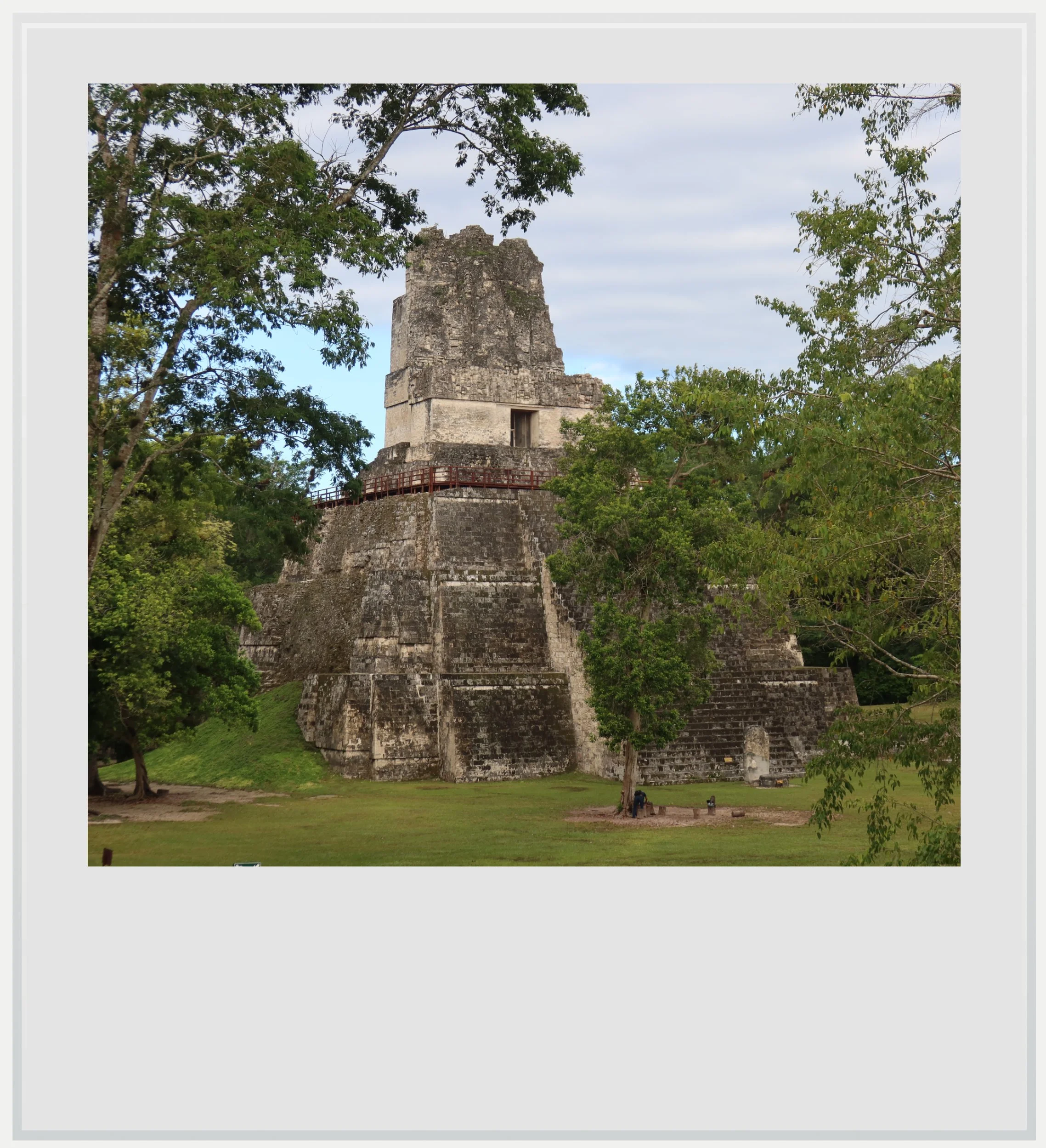
Temple 2 from the Central Acropolis in Tikal.
Safety at Tikal
Guatemala is currently at Level 3 on the US State Department’s travel advisory scale, meaning “reconsider travel,” because of crime and terrorism risks. The “do not travel” areas are San Marcos and Huehuetenango departments, Zone 18 in Guatemala City and the city of Villa Nueva, all far from Peten. US government employees are explicitly allowed to visit Tikal.
As at any large site, the more immediate concerns are practical: heat, dehydration and long walks. The wooden staircases up the temples are steep, so take them slowly, especially coming down in the dark after sunset. Avoid driving the park road after dark, when animals cross it.
Cell service at Tikal
Mobile signal is available along most of the road from Flores, but weak or unavailable once inside the park. I was roaming with TIGO, one of the leading providers in Guatemala with Claro, and I lost service as I got into the park. I could only get a few bars of LTE coverage at the top of Temple 4 and the Lost World pyramid. The Jungle Lodge hotel offers free Wi-Fi for hotel and restaurant guests. Download your tickets and an offline map before you leave Flores.
Photo captions appear when you hover over an image on a computer or tap it on a smartphone.
All photos are mine and copyrighted.