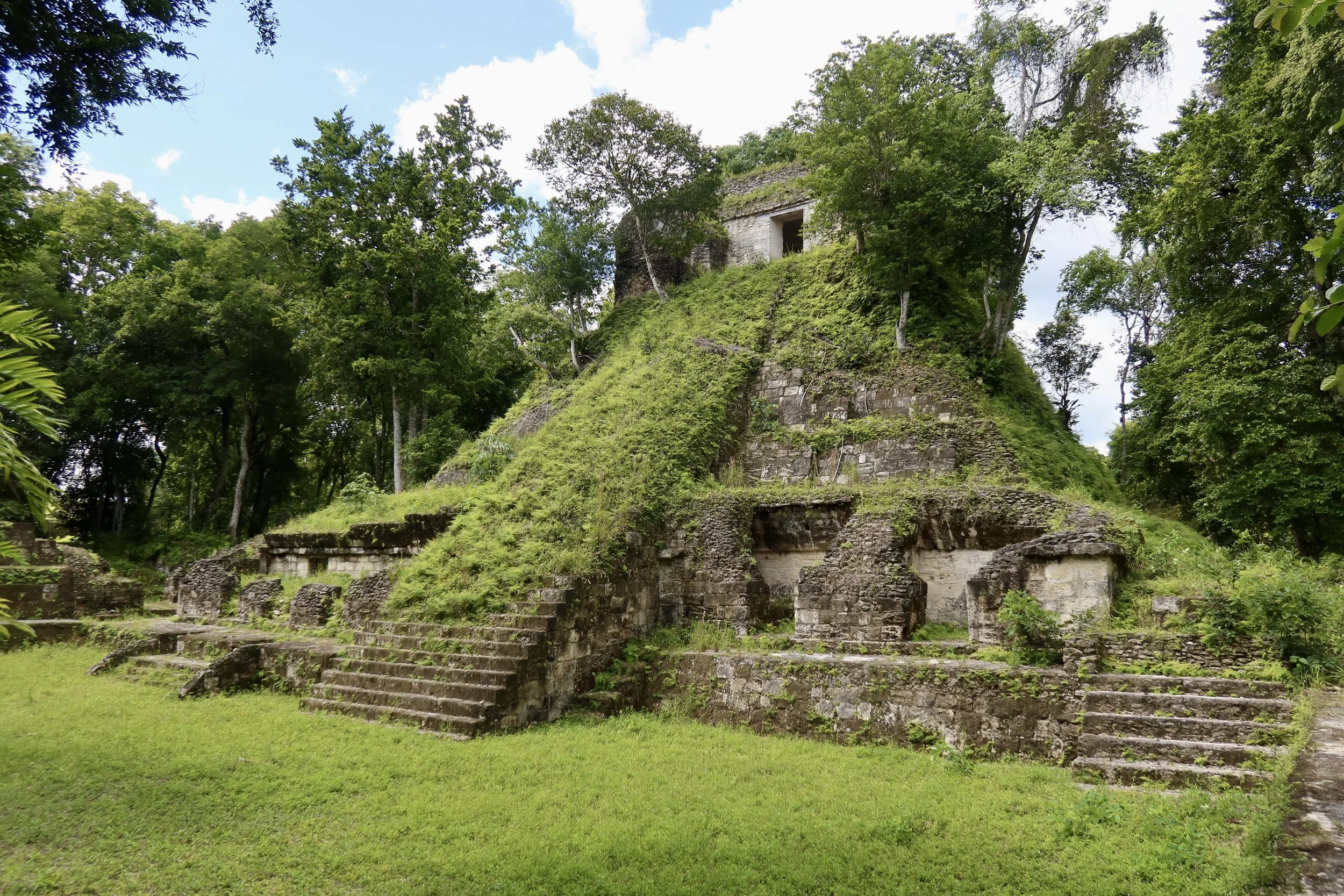
On the Holmul River, a Remote Maya City That Thrived Amid Collapse.
Looking for directions, opening hours, or where to stay and eat? Head straight to the Practical Information section.
I tried to jump over a muddy patch to reach the other side of the dirt track, and failed. I felt my foot sink deep into the ground, almost swallowed whole. When it reappeared, it looked like I might need a new shoe, and a new sock.
To my right, I could hear my guide clearing a path through the jungle for his motorcycle. His machete was methodically cutting vegetation from left to right, up and down, until he reappeared with a smile on his face.
He pushed the motorcycle through the opening, set it back on the road and I climbed back on.
We were halfway through the ten miles of the rough jungle track leading to the Nakum archeological remains, but it felt as if we’d been riding forever. It was hard to go more than fifteen miles an hour, given the road conditions. Here, we slalomed around fallen branches so thick we wouldn’t have come through with a car. There, the mud looked deep enough to trap the bike, so I got off and walked along the side of the track.
I knew what I was in for. The road to Nakum is notorious for being a difficult drive in the rainy season, and usually only passable with a high-clearance 4x4 vehicle during the dry season. We had initially planned to use a big car to get there, but a few days before our trek, Emnett, my guide, reached out with seemingly bad news. He’d heard that fallen trees were blocking the road. We wouldn’t be able to go through by car. Would I be OK with going on a motorcycle? “It will be an adventure”, he said, and this felt strangely appealing.
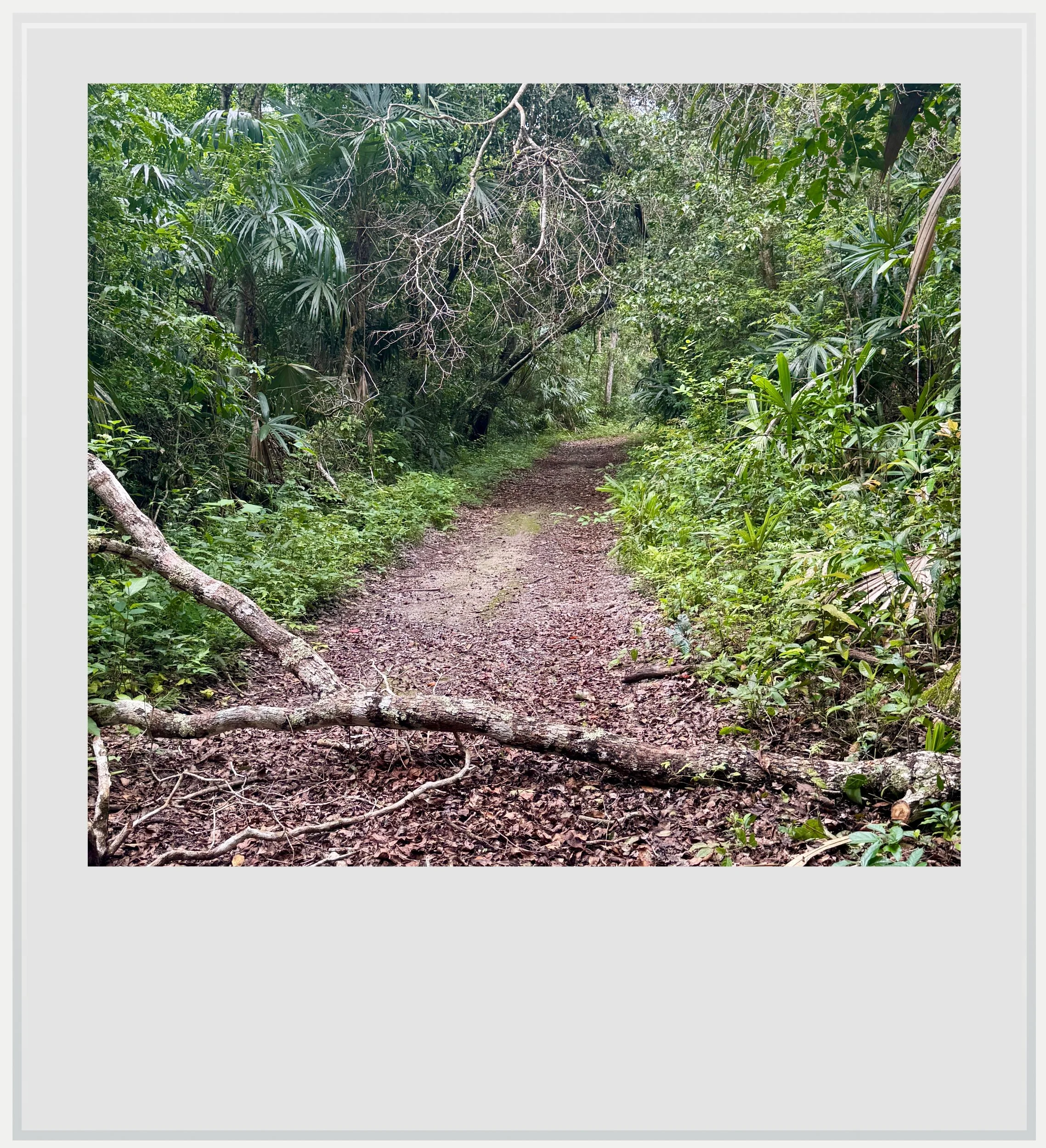
A fallen branch on the dirt track to Nakum.
It had rained heavily the night before, and I feared nature wouldn’t let us through, but we were doing well so far. Nakum, deep in the Yaxha-Nakum-Naranjo National Park, in Northeastern Guatemala, isn’t an easy archeological zone to reach by any means. I don’t think I would have dared to go on my own, even during the driest months of the year.
A few guests at El Sombrero lodge had chuckled when I told them where I was going. “It will be an adventure”, they said, echoing what Emnett had said word for word, and for a moment I wondered if I was the butt of some joke. For all I knew, we might have to turn around after a mile and call it a day.
A makeshift wooden bridge that seemed ready to collapse got us across the river.
Although the track looked challenging at times, it revealed stretch after stretch of lush tropical forest. For almost a mile, we rode among towering palms whose gigantic leaves seemed unreal. Most of all, we were surrounded by silence, the revving engine of the dirt bike the only sound disturbing the jungle.
My biggest fear was crossing the Holmul river. Passing right by Nakum, the river is known to swell unexpectedly, and I wasn’t going to like crossing it through thigh-high water, especially in an area where crocodiles had been documented.
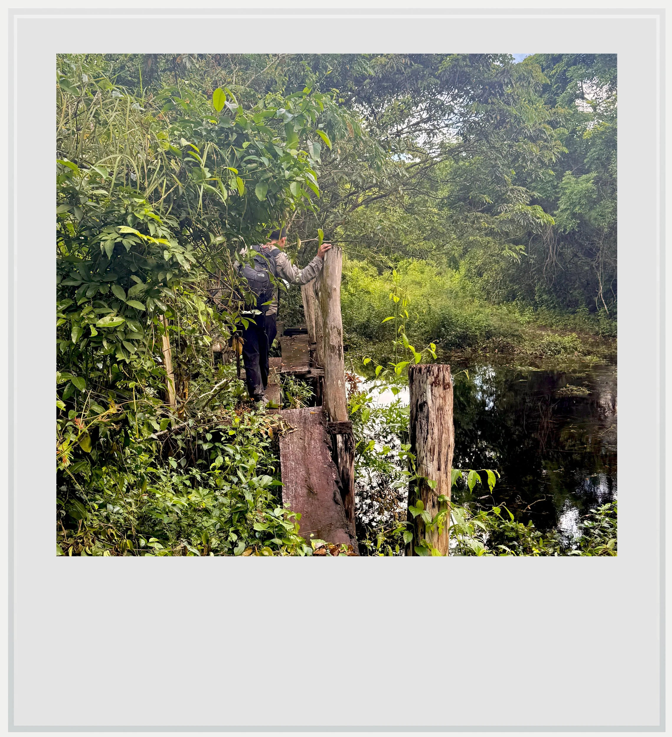
The rickety bridge over the Holmul river.
When we finally reached the bank, I breathed a sigh of relief at the sight of the peaceful stream. It was too deep for our dirt bike to go through, but a makeshift wooden bridge that seemed ready to collapse got us across the river. Its planks were barely supporting my weight, but we made it through.
A few minutes later, we arrived in Nakum proper. My first view of the site was unexpected: a basic camp had been built for researchers visiting the site from time to time. It felt like an abandoned military outpost, with small barracks and a common mess with a kitchen in the middle. It also looked like someone had just stepped out. Pots and pans were left to dry by the sink. For a moment, I thought the camp had just been deserted, but we were indeed alone.
As I looked around me, the ruins were nowhere to be seen. The ancient city mapped by archeologists encompasses a northern and a southern sector, the latter being where most of the excavation work has been done. This is the area we visited.
The Southern Acropolis is accessed from the side, which meant that, from the camp, I could only make out forested mounds, not a hidden city. We started going in that direction. Rusty wayfinding signs were still standing, meaning that, at some point, the Guatemalan government must have planned for Nakum to receive a regular flow of tourists.
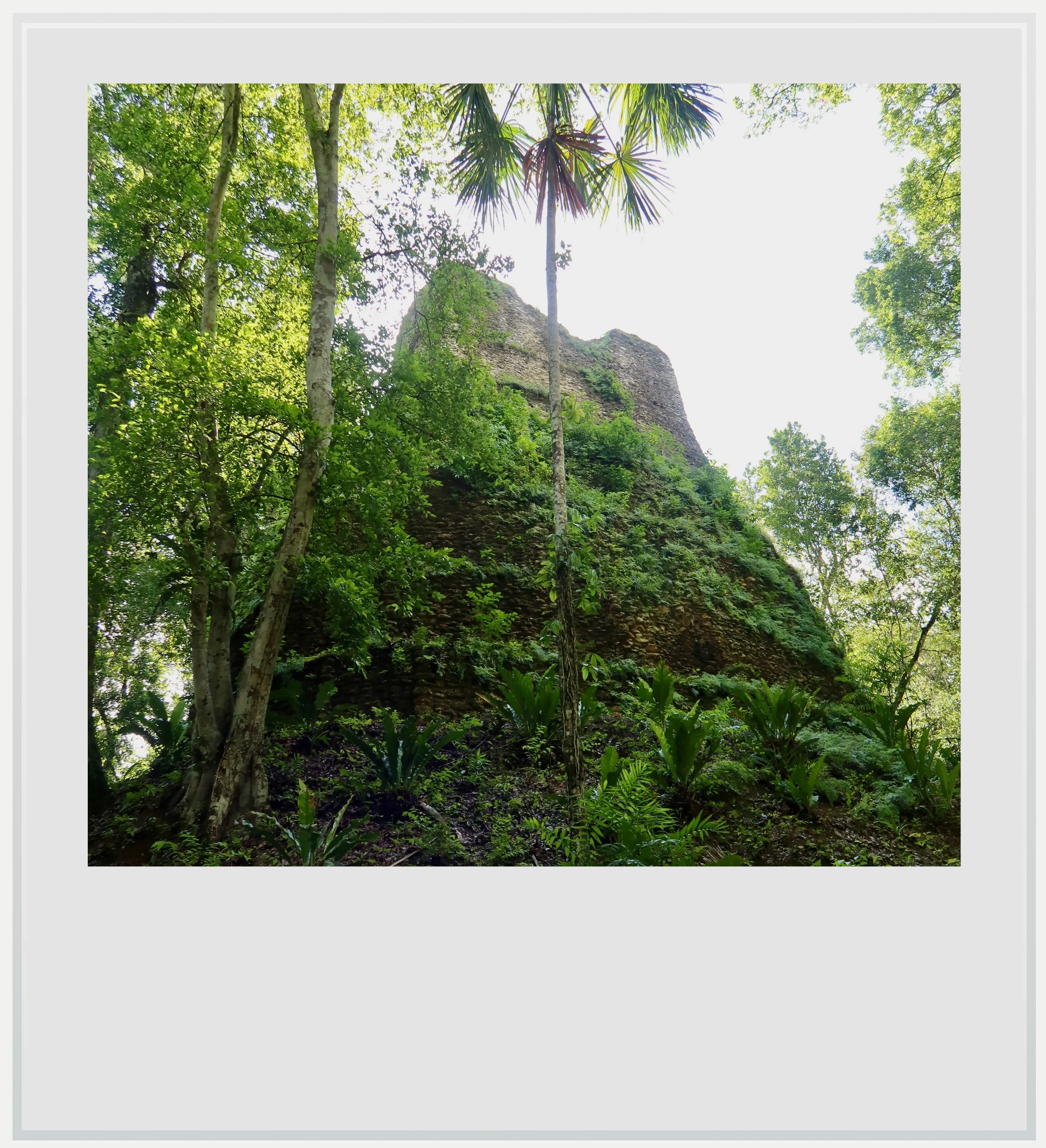
A partially excavated temple in Nakum.
Before getting to the acropolis, we walked across a gentle plain. It was hard to describe how I felt. We were still in the middle of the tropical forest, but instead of the oppressive thickness of the vegetation along the road, we had reached a clearing. It was obvious that around us modest mounds covered in grass were hiding more Maya buildings, but unlike other cities hidden in the forest, these didn’t look swallowed by the jungle. Instead, they stood out in the clearing. I assumed the city had been designed to look like this by the park’s management, an old city cleaned up but still left under a thin veil of grass.
The South Acropolis, elevated and ringed by palaces left me speechless for a moment. In front of us lay a majestic square plaza, surrounded by a grand pyramid facing east, a massive palace to the south and smaller edifices on the other sides. The dimensions of the plaza left no doubt as to the political importance Nakum once had in the region.
A potential obstacle to getting to Nakum today could have been a key reason for the city’s flourishing in the 10th century.
The southern palace hadn’t always been this large. It was expanded from a 19-room building to a 38-room one during the Terminal Classic period. At the time, Nakum defied the collapse of the Maya civilization in the Peten lowlands. It is believed that, by the end of the Classic period (around 950 AD), most Maya cities around it were abandoned.
Scholars have long been puzzled as to why, but they now tend to think several factors combined: decades of war between cities, overpopulation and overconsumption of natural resources added to several years of drought.
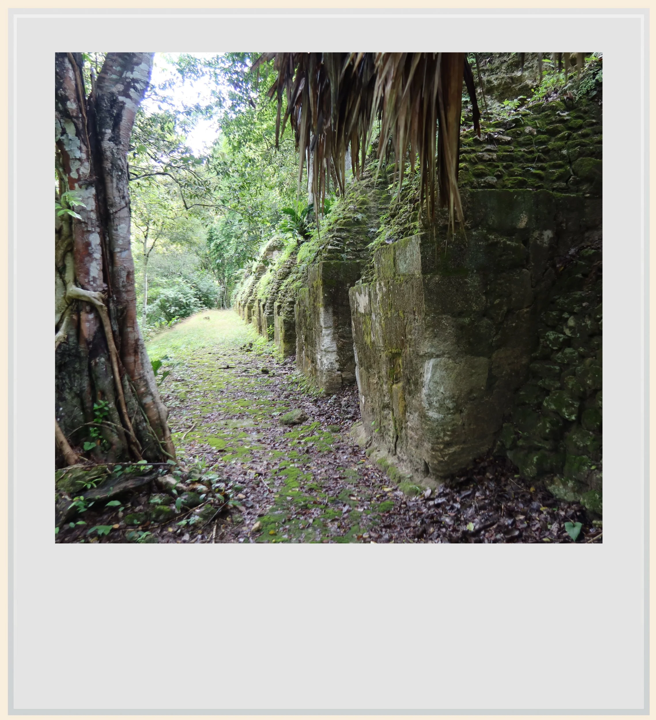
A moss-covered wall in Nakum’s Southern Acropolis
Nakum didn’t escape this fate, but it did thrive while Tikal and Naranjo, its two most powerful neighbors, bled inhabitants. We couldn’t tell from the imposing building in front of us that it came to symbolize the city’s ascending power in the Terminal Classic period, but we certainly felt it.
Archeologists Jaroslaw Zralka and Bernard Hermes suggest that Nakum survived its once-powerful neighbors by about a century¹. They argue that Nakum’s position on the Holmul, which may have linked the city to Caribbean trade routes, gave its rulers a chance to expand their trade as Tikal and Naranjo weakened.
Another detail made the river even more pivotal: archeologists found what may have been a canoe landing right at Nakum. In the rainy season, a narrow channel may have connected an artificial reservoir by the southern acropolis to the river, allowing canoes to reach the very edge of the city.
I couldn’t help but think back to my fears about crossing that river earlier. What was a potential obstacle to getting to Nakum today could have been a key reason for the city’s flourishing in the 10th century.
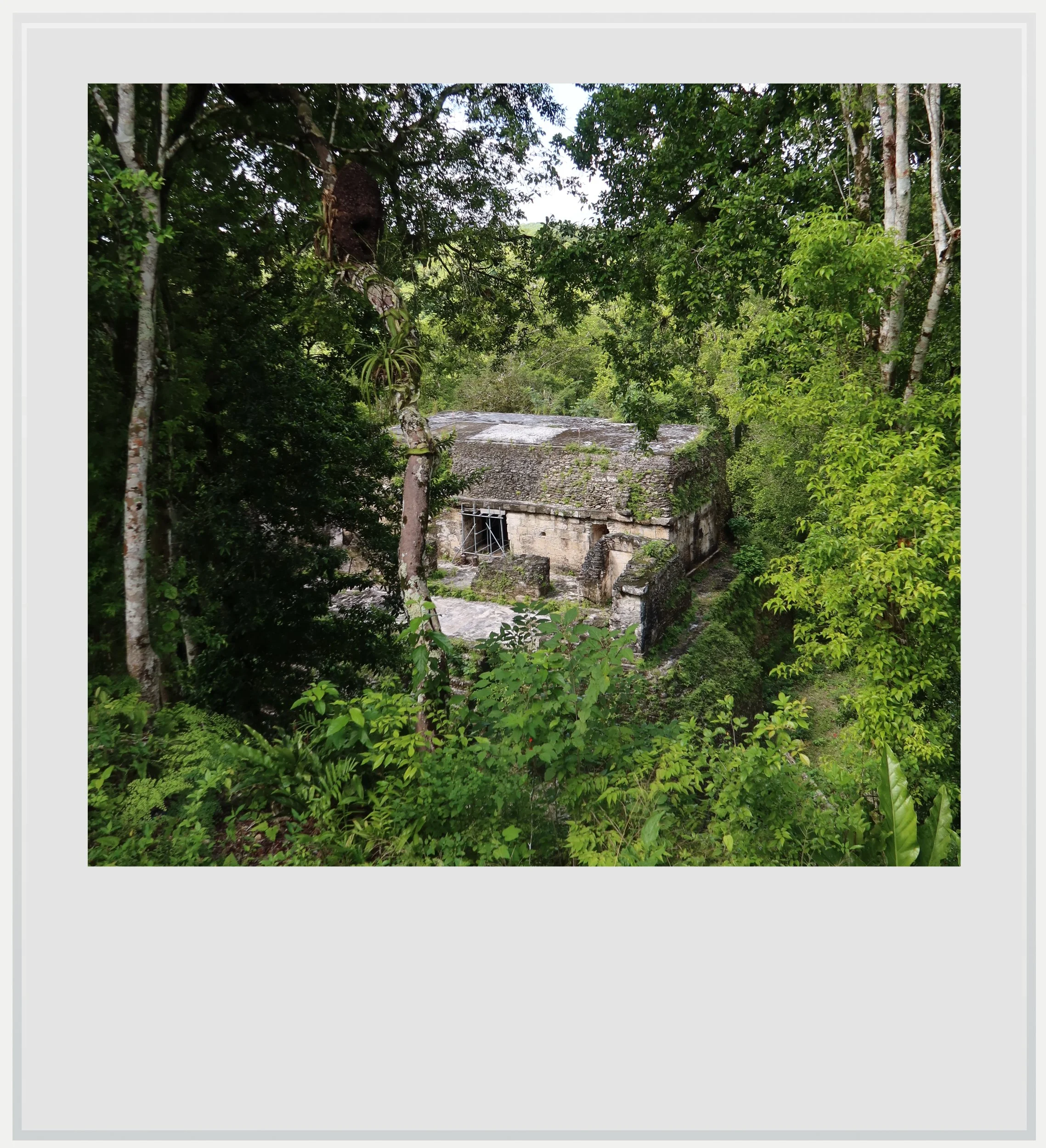
Building N seen from the top of the main palace in Nakum.
When I looked back at the plaza, I realized my amazement came from the complete absence of people. I had been alone among Maya ruins before, but never at the center of what must have been a very important nexus of power in the Terminal Classic.
Not only that, but the plaza’s condition told us two successive stories at once: that of a previous restoration, and of being slowly reclaimed by nature. It appeared most of the steps of the main temple (Building E) had been rebuilt, given their even appearance, but they were now covered by a thin layer of grass, nature physically regaining control over the plaza. We had crossed through hostile jungle to find a place that looked like it had once been taken care of, only to be abandoned again.
By the end of the 10th century, Nakum’s last inhabitants had left: the city could only delay the march of history and eventually collapsed like other nearby Maya polities. It was eventually documented by French traveler Maurice de Perigny in 1905. Excavations were slowed down by the relative lawlessness of the region, including looters who profited from the absence of the state at the time when preservation of historical artifacts wasn’t a priority. That changed in the late 1990s when systematic excavations started and again in 2003 when the Yaxha-Nakum-Naranjo National Park was created.
I knew archaeologists had been working at Nakum again since the late 1990s, but standing in that empty plaza, I felt like the first person back.
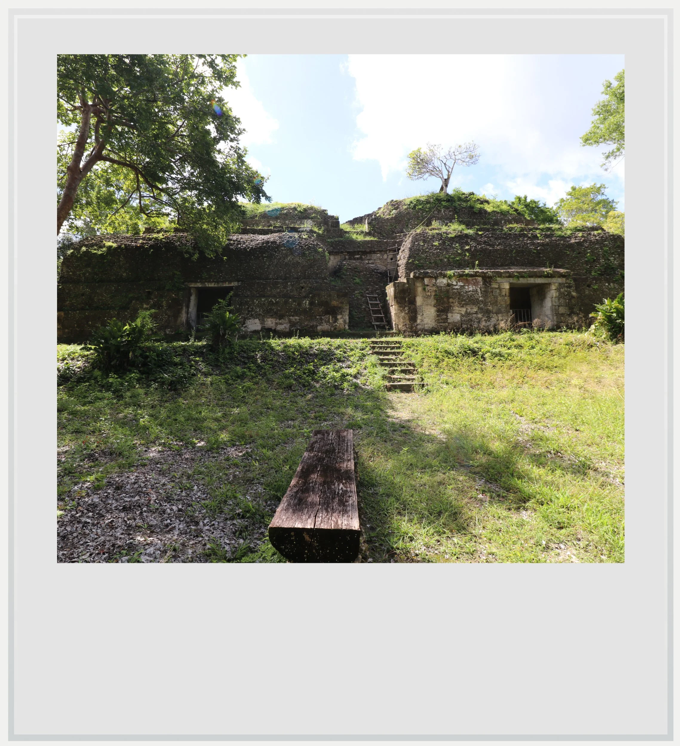
The top levels of the main palace on Nakum’s South Acropolis.
The southern palace, the one that was massively expanded during the Terminal Classic, wasn’t as nicely restored as Building E, but a series of wobbly ladders enabled us to climb to the top to enjoy an uninterrupted view over the never-ending forest canopy.
From up there, it felt as though there were miles of wilderness between us and the next person. Being on top of Temple 4 at Tikal and looking above the canopy was equally gratifying, but here, we were truly alone.
I hoped that Nakum would stay off most tourists’ radar.
Loneliness is relative in the tropical forest. We were surrounded, of course. By mosquitoes. Relentless, hungry mosquitoes, which, according to my guide, weren’t kept at bay by any sort of repellent. We also saw quite a few bats, some rather big, perched atop walls in the darkest rooms we visited.
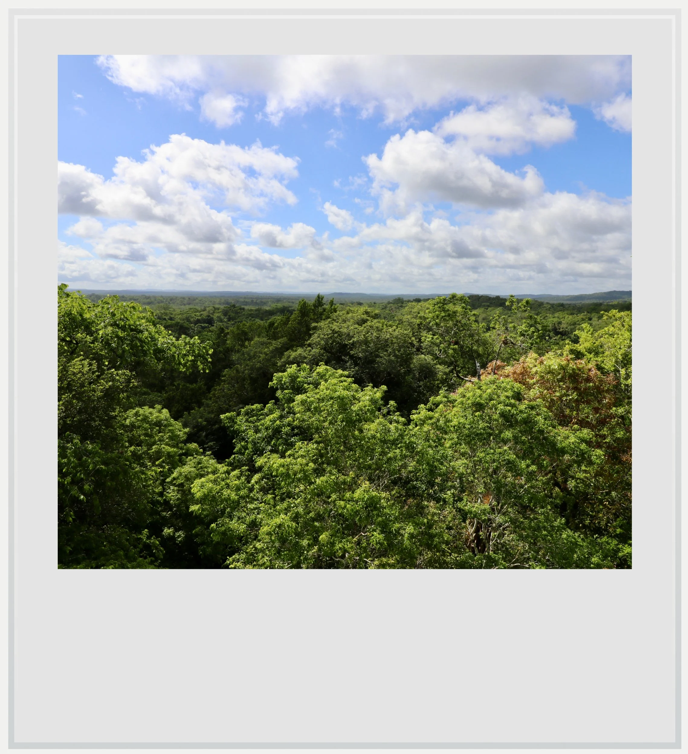
The tropical forest around Nakum, seen from the top of its main palace.
From the top of the palace, it was easy to imagine that the forest would be swallowing Nakum again - after all, it looked like the process had already started. More than twenty years ago, archaeologists digging at Nakum found green obsidian and platforms built in the style of Teotihuacan, the great Pre-Columbian city near present-day Mexico City. Then, in 2025, researchers announced that they had uncovered a painted altar in that same style at Tikal. It made me wonder what another excavation at Nakum might tell us. How had the architecture of a city in central Mexico made its way to Nakum, and what could it say about the relationship between central Mexico and the Peten lowlands fifteen hundred years ago?
I wanted archaeologists to come back. I also hoped, somewhat selfishly, that Nakum would stay off most tourists’ radar. I’d spent the morning fearing we might not make it across the Holmul. Now I found myself wondering what the next people to dig here might find, and hoping that whoever came to see it could still have the plaza to themselves for a while.
Notes
Great Development in Troubled Times: the Terminal Classic at the Maya Site of Nakum, Peten, Guatemala, Jaroslaw Zralka and Bernard Hermes, 2012.
Practical information
(Everything you need to know about visiting Nakum - updated November 2026)
In a nutshell
Go to Nakum for the rare chance to explore a major Maya city in near solitude. The ride through the forest is an adventure in itself, and the payoff is a grand plaza that stays hidden until the last moment and a view from the palace rooftop over miles of unbroken jungle.
Getting to Nakum
How to get to Nakum from the United States: the easiest way to reach Nakum from the US is to fly to Guatemala City, which has non-stop connections with several major cities, including Los Angeles, Miami, Houston, New York and Washington. From Guatemala City, take a domestic flight to Flores, in northern Guatemala. That flight takes approximately one hour, with several daily services operated by Avianca and TAG Airlines.
How to get to Nakum from Mexico City: There are no non-stop flights between Mexico City and Flores. The easiest option is to fly via Guatemala City, which is currently served by Aeromexico and Volaris. The flight to Guatemala City takes approximately two hours, followed by a domestic flight of about one hour to Flores.
How to get to Nakum from Flores airport:
Flores airport to Yaxha: from Flores airport, the first step is to rent a car and drive toward Yaxha, the gateway to the Yaxha-Nakum-Naranjo National Park, approximately 75 km to the east. Follow the paved road toward Melchor de Mencos for about 62 km, then turn left at La Maquina onto an unpaved road for the final 11 km. Allow approximately 1 hour and 30 minutes for the drive, potentially longer depending on road conditions. A 4WD vehicle is not normally necessary, but a high-clearance vehicle, such as an SUV, is recommended for the unpaved section of the road.
Yaxha to Nakum, with a special word of caution: Nakum is located 10 miles (17 km) north of Yaxha on a rough dirt road that can be impassable outside of the dry season between February and May. It is technically possible to go there on your own, but I strongly advise against it, except if you try your luck during the dry season, with a high-clearance 4x4 vehicle, and after checking at the visitor center that the road is in good enough condition. Possible threats include mud that could get your vehicle stuck, fallen trees blocking the way and a river just before reaching Nakum that may be too deep to cross by car, let alone on foot.
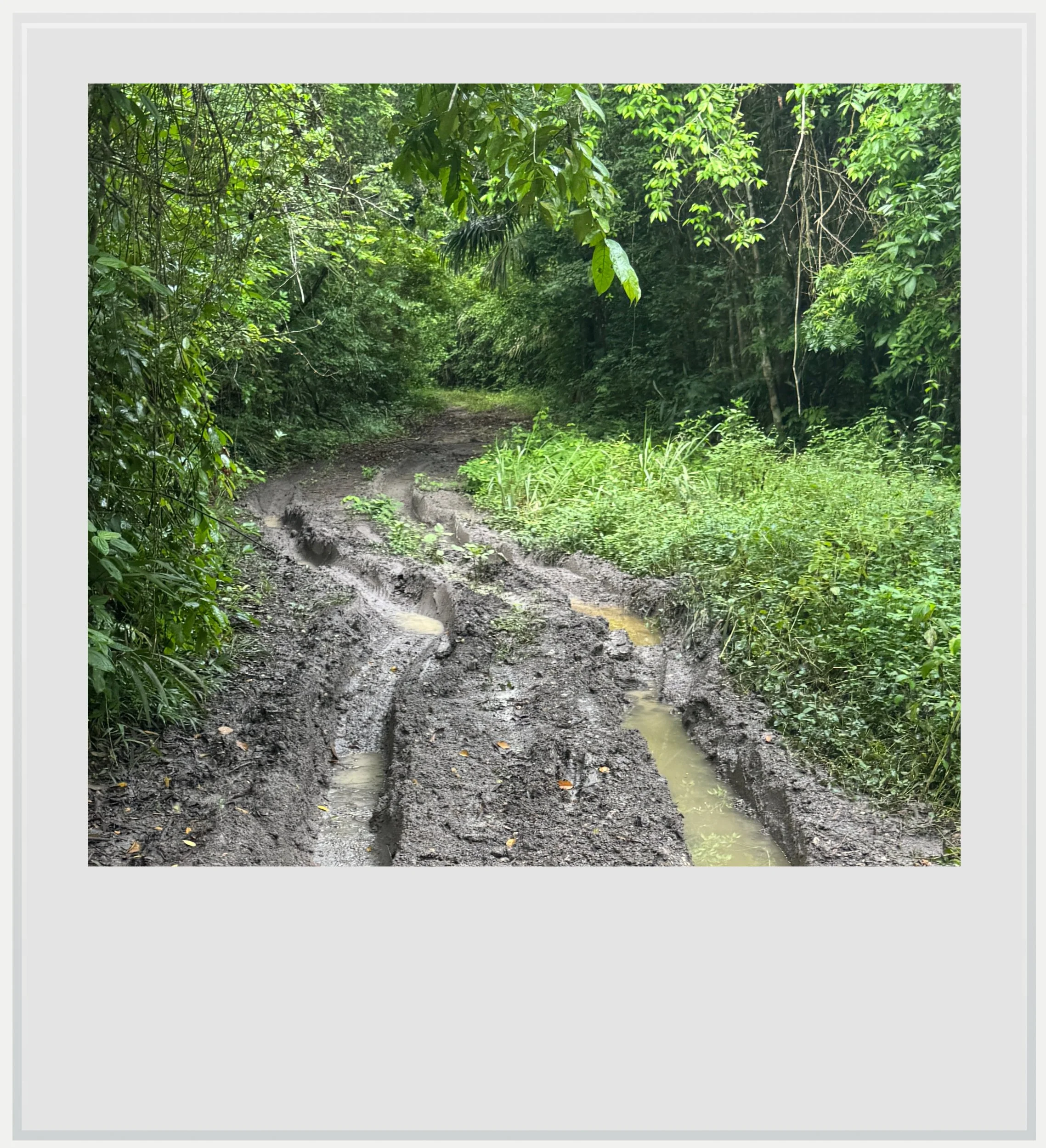
A muddy section of the dirt track to Nakum.
I went to Nakum in late October with a guide, on a motorcycle, because my trip happened at the end of the rainiest part of the year. It did rain quite a bit the night before and we had to slalom through recently fallen branches that would have prevented a car from coming through. We also had to cut our way through the jungle with a machete at some point to avoid a muddy patch of road we might have gotten stuck in. Finally, the Holmul river’s water levels were low enough that the two ends of the narrow, rickety wooden bridge weren’t submerged and we were able to cross it on foot, but anyone not prepared or without the right vehicle or equipment would likely have gotten stuck, with no way to call for help on a road that sees only a few vehicles a month.
How to hire a guide for Nakum: The Yaxha Community Guides Association, part of ASODESTY, can arrange a guided visit. I went with Emnett and would happily recommend him. He speaks basic English and knows the route well.
Can I visit Nakum on a scheduled tour: I haven’t found packaged tours that included Nakum in their itinerary, probably because of the access constraints explained above. It is possible to hire a guide for the day through ASODESTY (see above).
When to go to Nakum
The best months weather-wise to visit Nakum are during the heart of the dry season, generally between February and April. This is also peak tourist season in Guatemala, but Nakum sees almost no visitors, so crowds will not be an issue, unless you happen to come while archeologists are doing fieldwork. I visited in late October, toward the end of the worst part of the rainy season, when the heat and humidity in Peten can still be intense. The site can technically be visited year-round, but access may be very difficult outside of the dry season.
There are facilities at Nakum, including toilets, as a rudimentary camp for archeologists has been set up near the ruins. We were able to find shade and even cooking utensils for our lunch, but don’t expect anything fancy.
What's the best time of day to visit Nakum
Nakum can be visited at any time of day, but I would recommend going in the morning, to improve your chances of dry weather (in the rainy season, rain usually happens in the afternoon).
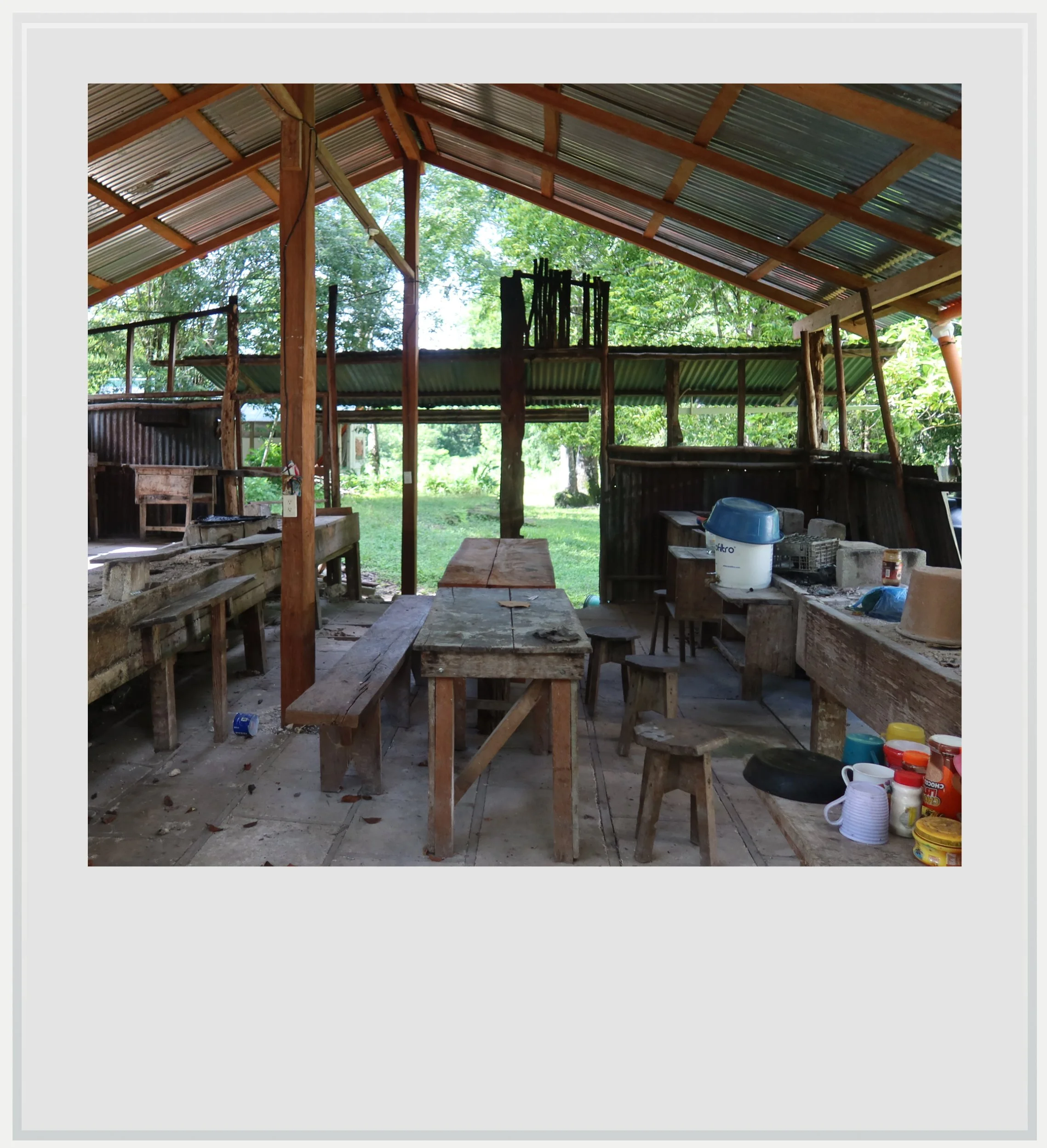
The kitchen area at the makeshift camp by the Nakum ruins.
How much does it cost to visit Nakum
Visiting Nakum requires access to the Yaxha-Nakum-Naranjo National Park (at the time of my visit, in October 2026, the entry cost was 80 quetzals, or about USD 10.50, for foreigners). Although not technically compulsory, I very strongly recommend to go there with an experienced guide. Mine cost about USD 300, including transport. Tipping the guide is optional but appreciated (tip amount should be about 10% of the cost).
How long should I plan to visit Nakum
The drive to the archeological zone covers 10 miles (17 km) if leaving from the park’s visitor center, but given the state of the dirt road, it took us about an hour to arrive in Nakum. It’s easy to spend an hour and a half to two hours on site, so I would block four hours for the visit starting from the visitor center, more if you include lunch.
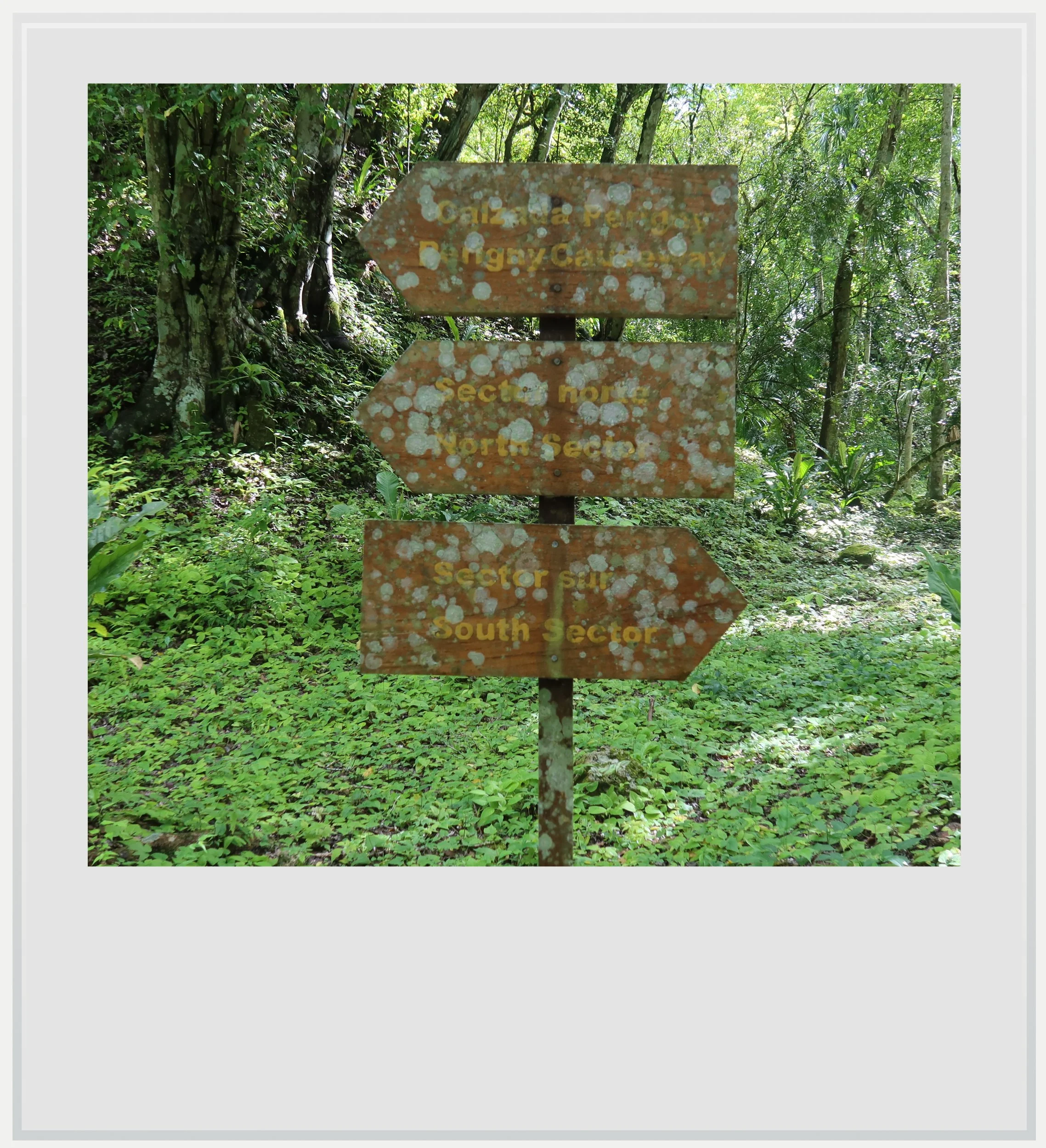
Old wayfinding signs in Nakum.
What are Nakum’s opening hours
Access to the Yaxha-Nakum-Naranjo National Park is possible every day from 8am to 5pm. The ticket office closes at 5pm but the park stays open until 6pm (mostly so tourists can enjoy the sunset in Yaxha). A trip to Nakum can be done within these hours, understanding that you do not want to drive the difficult access road after sunset, so plan accordingly.
What to see near Nakum
Yaxha is the natural companion to a visit to Nakum, with monumental plazas, forest paths, and temples overlooking the lake. Topoxte island can be a neat side trip: boats depart from the park’s Visitor Center, and a visit there will last less than two hours. Naranjo’s archeological zone lies within the same national park, but requires a separate excursion and more planning: its proximity on a map does not mean easy access. Farther afield, La Blanca offers a more intimate encounter with Maya palace architecture, while Tikal brings the scale of a great capital and Uaxactun extends the journey north into the forest beyond it. For a change from archaeological sites, Flores offers walks through the compact island town, colorful streets, and waterfront views over Lake Peten Itza.
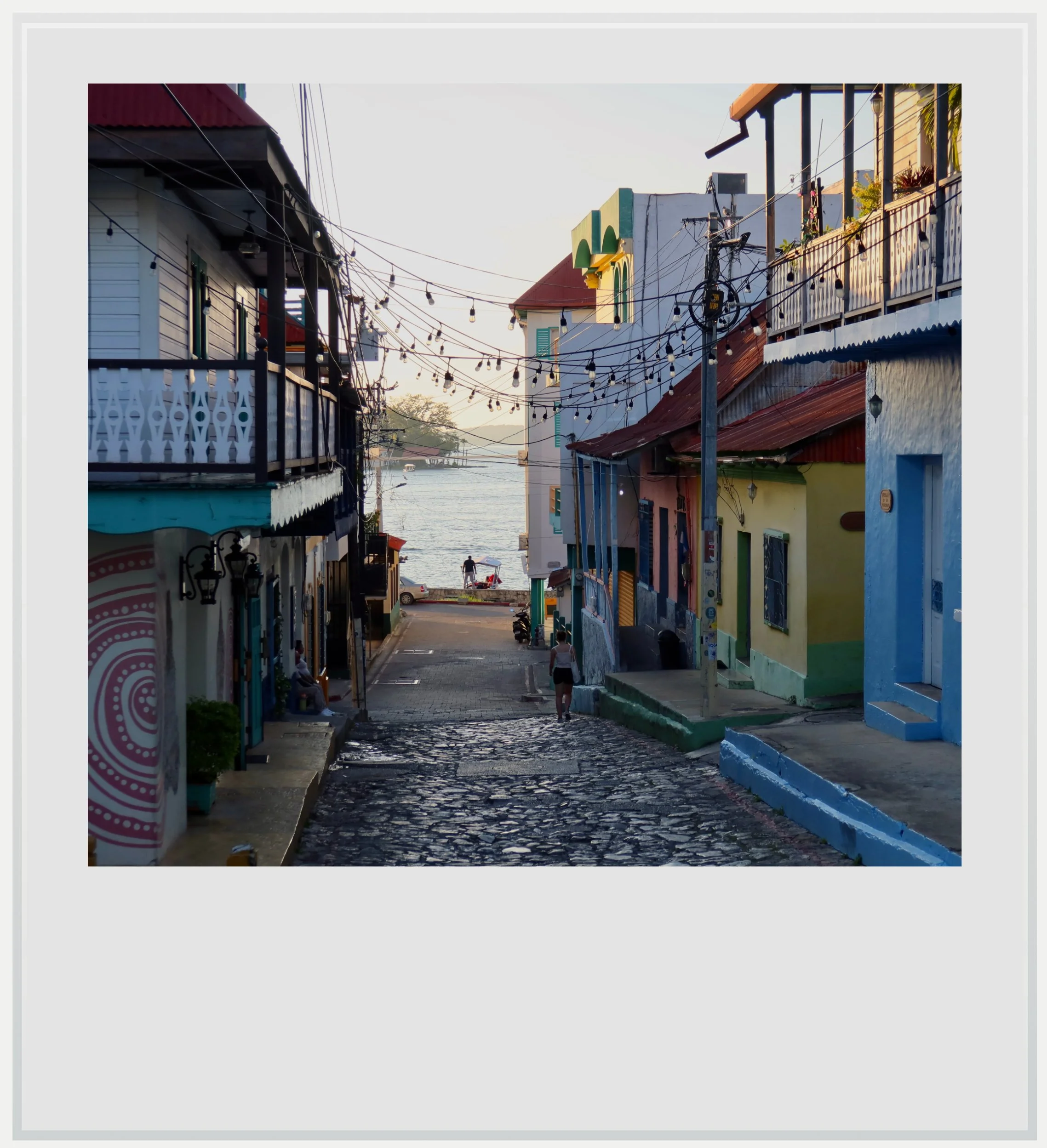
Late afternoon on the island of Flores.
Food & lodging near Nakum
Hotel
Most tourists visiting the Yaxha-Nakum-Naranjo National Park come for the day as part of a tour, and that means the tourism infrastructure isn’t very developed. The only hotel near the park’s main entrance, close to the Yaxha and Topoxte archeological zones, is El Sombrero EcoLodge, a basic and rustic outpost right on Lake Yaxha. I stayed there for two nights and really enjoyed it. The lodge was only a few hundred feet from the park entrance, and I really enjoyed its lakeside setting in the jungle. Given its location and remoteness, electricity isn’t guaranteed 24 hours a day, but it was never an issue for me (it is usually on at night).
Food is offered for breakfast, lunch and dinner, and is both really good and affordable. As such, it can be a great lunch option even if not staying at the hotel. It also offers free Wi-Fi, which is useful in an area where cell coverage is close to non-existent.
The lodge is located in the tropical forest and therefore, the usual precautions apply: wild animals abound nearby. Your biggest threat may be mosquitoes and sand flies, pretty agressive around sunset, but watch for Rosco, the resident crocodile, who sometimes ventures on land. Howler monkeys will most likely wake you up before sunrise, so bear that in mind as well. I would go back in a heartbeat for the location, the atmosphere and the ease of getting in and out of the park.
Nightly room cost for one person during my stay was around USD 75.
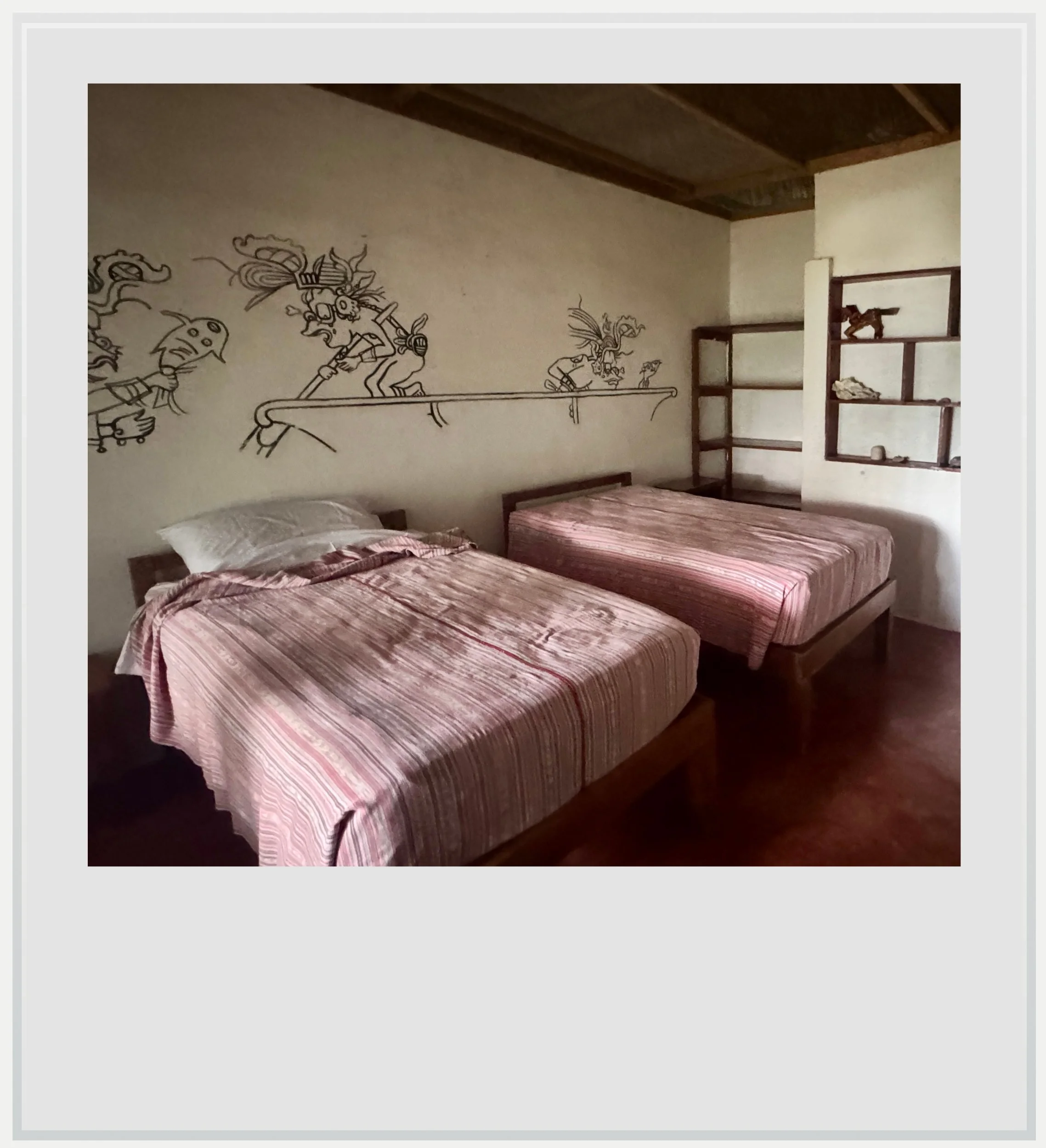
My room at El Sombrero Eco-Lodge
Food
El Sombrero Ecolodge is the only sit-down option within ten miles of the park entrance that was open at the time of my visit, and luckily it is a solid one.
Snacks and drinks are also offered near the parking lot at the entrance of the Yaxha archeological zone (not by the Visitor Center, but a couple of miles further).
Safety at Nakum
Guatemala is currently at Level 3 on the US State Department's travel advisory scale, meaning “reconsider travel.” The warning reflects the country's problems with violent crime, organized criminal groups and armed robberies. However, Peten's principal tourist destinations, including Tikal and Yaxha, are not among the areas specifically designated as “do not travel.”
This does not mean Peten is entirely free of crime, but there is little reason to consider a visit to Nakum particularly dangerous. Nakum is located within Yaxha-Nakum-Naranjo National Park, which is protected by Guatemala’s military (you’ll have to go through a military checkpoint just before the park’s visitor center).
For visitors, the more immediate concerns are practical ones: the remoteness of the park, the condition of the access roads, particularly after heavy rain, and the limited availability of services. I would recommend visiting during daylight hours and avoiding driving after dark. During my October 2026 visit, sections of the road between Melchor de Mencos and Ixlu, toward Flores, were in terrible condition.
Cell service in Nakum
Cell service is available most of the way between Flores and the Yaxha-Nakum-Naranjo National Park, but very spotty once in the park. I was roaming on Tigo, one of the two leading providers in Guatemala, alongside Claro. On my visit, I was able to pick up a Tigo signal at the top of the temple of the Northern Acropolis in Yaxha, as well as on the top of Nakum’s tallest temple. Outside of these high points, it is highly unlikely you will get service.
NPerf shows coverage areas in Guatemala. This map shows Claro coverage east of Flores. Use the drop-down menu to check for Tigo coverage. The map doesn’t show much coverage in the region but I was indeed able to get 4G/LTE coverage all along the road leading to the Belize border.
Photo captions appear when you hover over an image on a computer or tap it on a smartphone.
All photos are mine and copyrighted.