Ixtapan de la Sal & Tonatico, Mexico
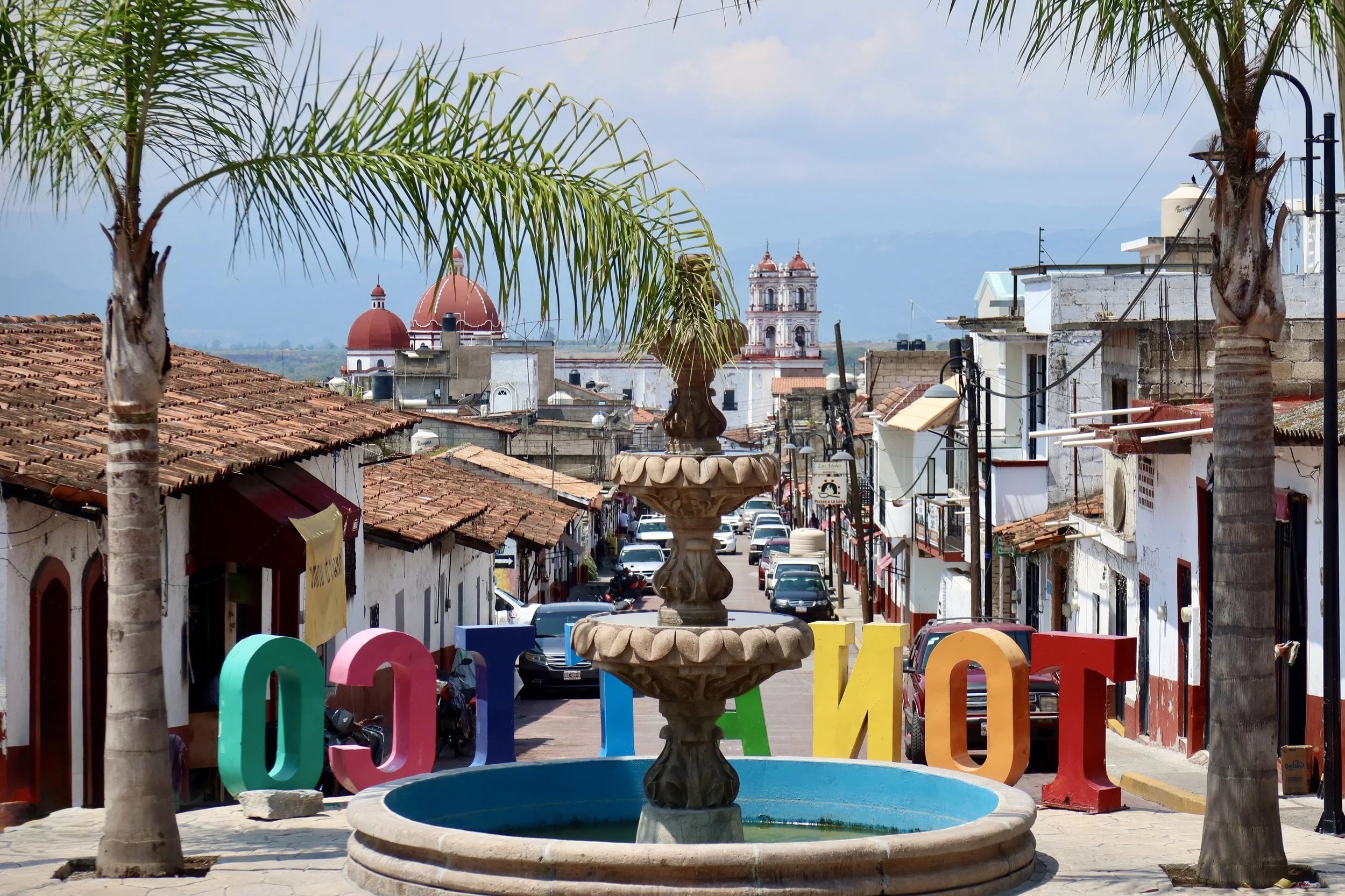
Two highland towns finding their footing in Guerrero’s shadow.
Looking for directions or where to stay and eat? Head straight to the Practical lnformation section.
Ixtapan de la Sal and Tonatico, two small highland towns nestled in the southern part of the state of Mexico, had been on my list of places to discover for a while. Every time I planned a trip, I would look into them, but somehow, they never seemed to make the cut. Maybe, I thought, they weren’t going to be different from other nearby towns I had already checked out, like Malinalco, Tepoztlan, or even Taxco. There was always another destination that seemed more exciting.
After a lot of long-haul travel, I decided I needed to explore closer to Mexico City, and, naturally, both towns came up. This time would be the one, and I booked a three-day trip for early June.
If you ask a Chilango about Ixtapan, the first thing you’ll likely hear is “thermal spa”. The town is famous for its volcanic waters, infused with minerals said to have cured various ailments since pre-Columbian times. The vast majority of people going to Ixtapan and, to a certain extent, Tonatico, have a spa weekend in mind, and will spend some time in one of the cities’ thermal baths.
This wasn’t why I was going there, and getting wet for physical relief was so not on my agenda that I didn’t even pack a bathing suit. Instead, I was looking forward to walking along another colonial downtown or two.
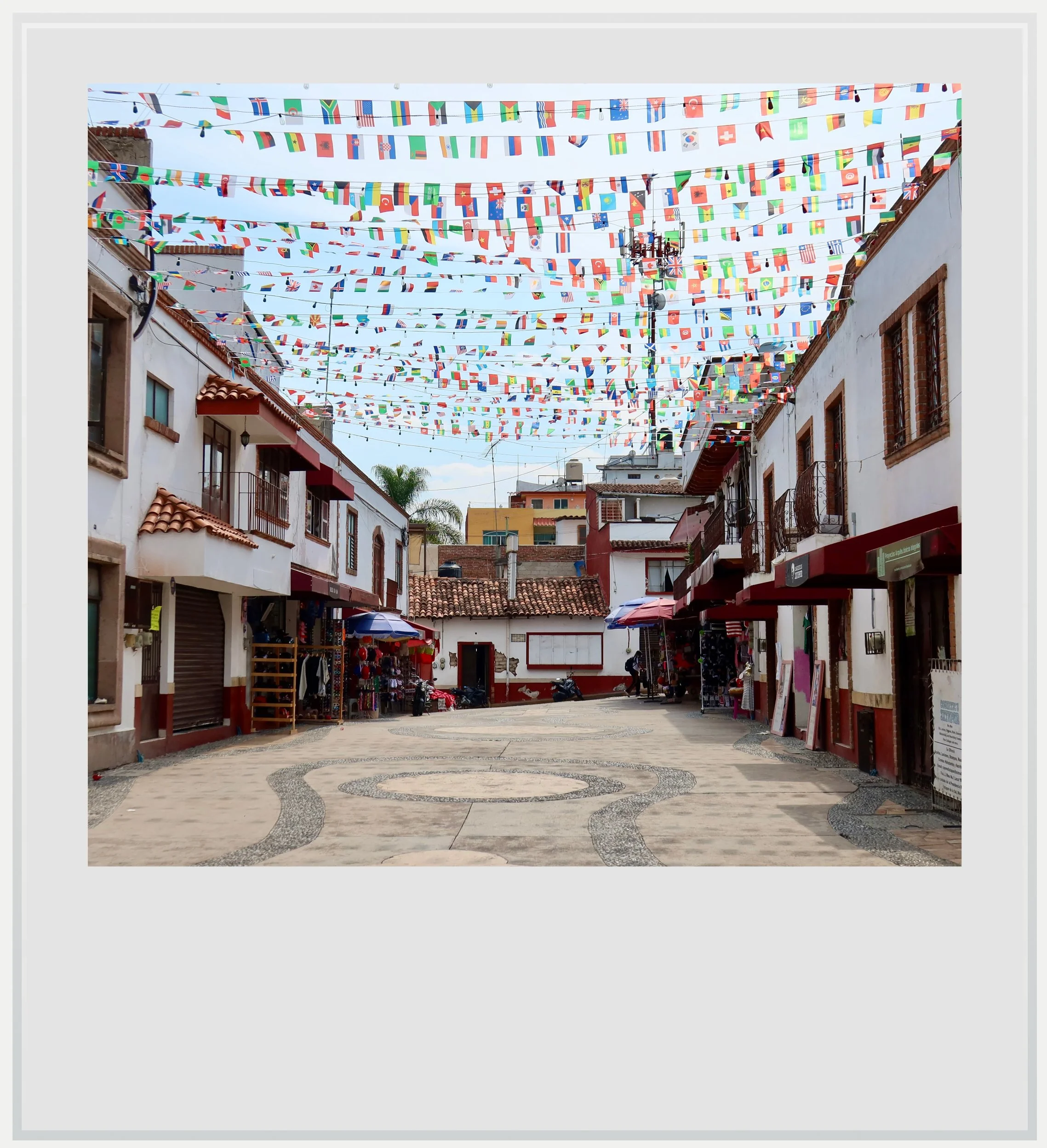
Francisco Mina street in Ixtapan de la Sal.
Getting there was as easy as showing up to the bus terminal and getting on the first bus out. Mexican bus travel is unusually convenient and comfortable, and this trip didn’t disappoint. We left the Observatorio terminal at 1pm on a Tuesday, at a time when traffic getting out of the city was smooth, and, for the first forty-five minutes, rode towards Toluca, just like I had when I went to Malinalco, another magical town in the southern part of the state of Mexico I had been to about a year ago.
Most bus services between Mexico City and Ixtapan are non-stop, which made the trip effortless. I might even have slept but my eyes stayed glued to the changing landscape, from the agressively tall skyscrapers of Santa Fe to the flatlands by Lerma to, finally, the lush mountains surrounding my destinations.
Where Ixtapan was busy and unpolished, Tonatico was quiet and charming.
My first contact with Ixtapan was a little underwhelming - it turned out that would be a telling sign. I was dropped at a big intersection, and walked along a busy road to my hotel.
Mexico’s pueblo magico program was devised in the early 2000s to help spread the economic benefits of tourism to areas of the country that weren’t necessarily on the main tourist circuit. Aiming to bring visitors beyond the country’s main attractions, the Mexican government began awarding the “magical town” label to villages recognized for their unique history, well-preserved colonial architecture, celebrated cultural traditions, or stunning natural beauty.
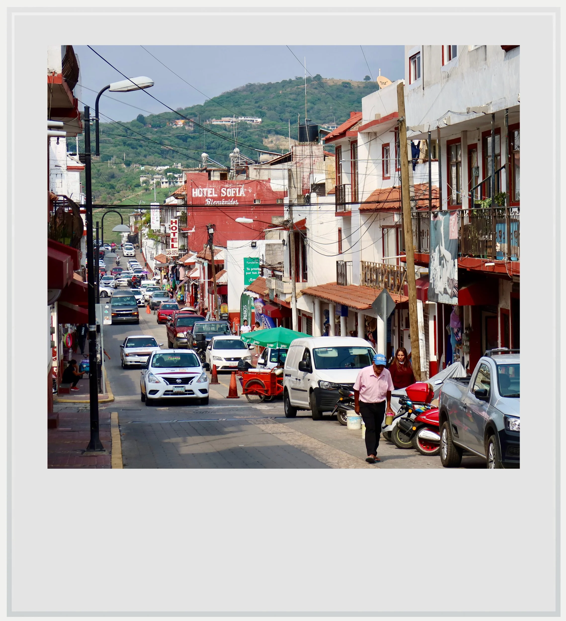
20 de Noviembre street in Ixtapan.
It quickly became clear to me that Ixtapan had accessed the program based on the strength of its cultural significance as a renowned thermal hub. That isn’t to say the little town wasn’t picturesque. It’s just that its beauty didn’t immediately grab me like Taxco or Bernal had.
The historical center was fairly small, and lacked a grand, leafy zocalo anchoring the town’s social life. Instead, its oddly shaped plaza, dominated by the palacio municipal, felt underwhelming. Its main church was curiously disconnected from the main square, not just above it like in Papantla, but almost hidden, looking away from it.
Throughout the main streets, I noticed signs the town might have been more prosperous before. The street leading to the church looked like it had been conceived as a small-town version of a grand avenue, with slender palm trees alongside a stream of shops. These days, it looked as though the fancy boutiques that might have once lined it had given way to more ordinary businesses. Here and there, faded paint and chipped walls told the story of a town that, perhaps, didn’t have the means it once had to maintain itself. It seemed counterintuitive for a magical town, and I filed this mentally as something I would need to research on later.
The following day, I woke up to clear and sunny skies, and knew this was my cue to head down to Tonatico. Only a few miles south of Ixtapan and at a lower elevation, it couldn’t have seemed more different.
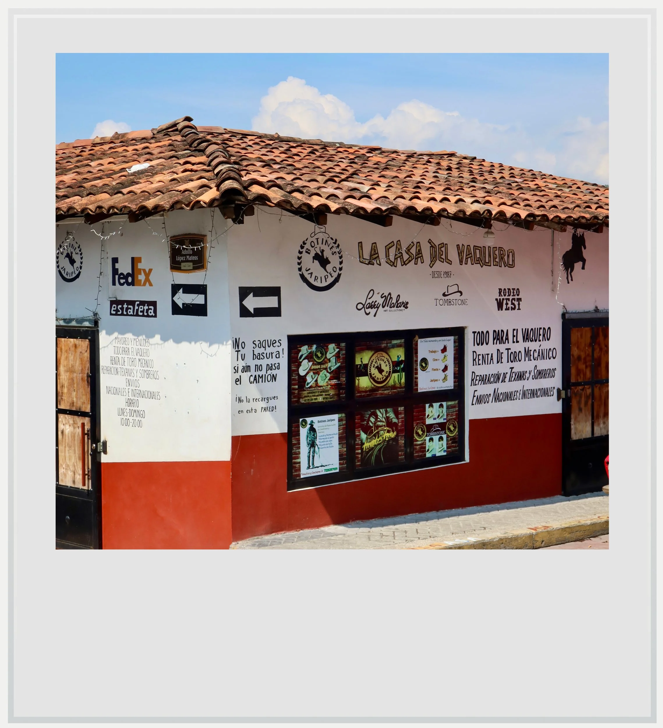
La Casa del Vaquero boutique in Tonatico.
Where Ixtapan was busy and unpolished, Tonatico was quiet and charming. I immediately sensed the smaller town would win my heart, and it very quickly did. I found in Tonatico all the ingredients that made the quintessential Mexican village: a well-maintained colonial downtown, partially anchored around an arcade, featuring both the city hall and the main church. A slower sense of pace, unhurried and unworried. A certain distance with modern life that was more obvious than in its neighbor. This felt like a village of ranchers, and the many stores catering to them grounded Tonatico in a different universe: not just a town waiting for weekenders coming to enjoy volcanic spa treatments, but rather designed for locals going about their business.
I couldn't draw too thick a line between the two villages, though: just outside of Tonatico sat its balneario municipal, open and sparsely frequented on a late Wednesday morning. The town also sees a weekend influx of big-city dwellers, but it would be hard to argue that this was its only appeal.
Beyond its elegant red-and-white facades and prim central church, Tonatico offered far more than its compact historic center suggested. Its main attraction was the La Estrella cave system, a network of famous limestone caves known to the Aztecs in pre-Colombian times. Highly rated and well maintained, it offered a vivid contrast with less fortunate attractions around town. The now-neglected and partly closed Tzumpantitlán waterfall park, on the southern edge of town, used to allow for a fantastic view over a cascade and the deep gorge in which it flowed. The gorgeous panorama at the top of Cerro de la Cruz offered a wide view over Tonatico and the surrounding mountain range but would need heavy maintenance to attract tourists.
I initially wrote off the tension between a partially decaying tourism infrastructure outside of the urban core and a vibrant colonial center as a product of visiting on one of the slowest days of the week. There may not have been many tourists anywhere in town, but locals were having lunch, getting groceries or just chatting on the main square. The city felt inhabited when its purely touristic attractions didn’t. Had I come on a Saturday and seen the ecological park around the waterfall busy with people eating, drinking and playing, it might have changed my perception that the town once tried to encourage tourists to visit places beyond a few colonial blocks, failed, and stopped trying.
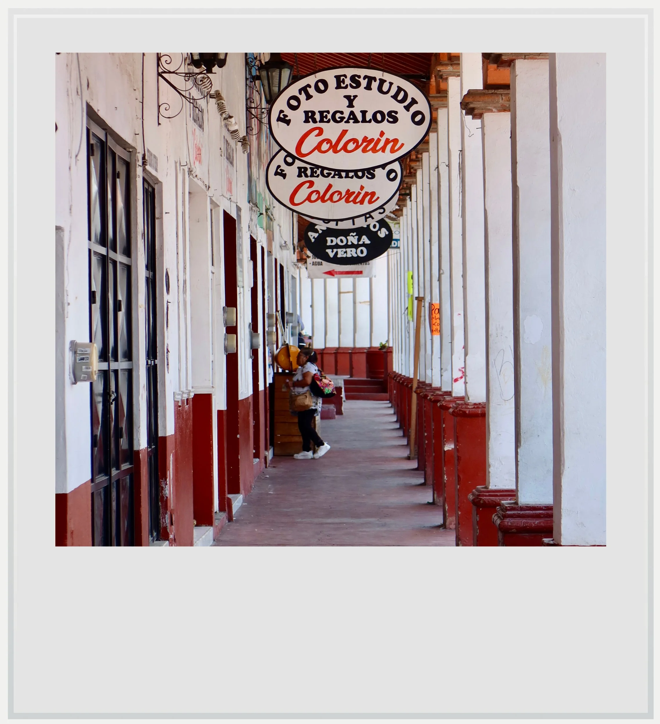
Arches leading to Tonatico's main square.
Yet this possible explanation didn’t really satisfy me. It was the second time I felt perception dissonance in two days. Why would two pueblos magicos so close to each other give me the sense that, perhaps, all wasn’t well economically, and that their rosier times were behind them?
I decided to dig further, and what I found ended up completely changing my perception of the region.
The two towns were newly-minted pueblos magicos trying to rebound from a slump in tourism.
Searching for answers first led me to Cuernavaca in 2009. There, on December 16, a big drug cartel leader, Arturo Beltran Leyva, was killed by the Mexican army (I wrote about this in my Cuernavaca article). As a result, his then-powerful organization splintered into different factions which started fighting for territory and influence. In Guerrero, a poor, isolated and mountainous state close to both Cuernavaca and the southern part of the state of Mexico, this meant both infiltration of local police and administrations as well as violent confrontations between newly warring cartels.
In 2014, 43 local students were abducted and likely murdered near Iguala, in central Guerrero, during what many Mexican investigative journalists described as cartel fighting gone wrong. The event caused incredible outcry in Mexico and beyond, especially because there was credible suspicion the Mexican army might have been involved in the kidnapping and its cover-up.
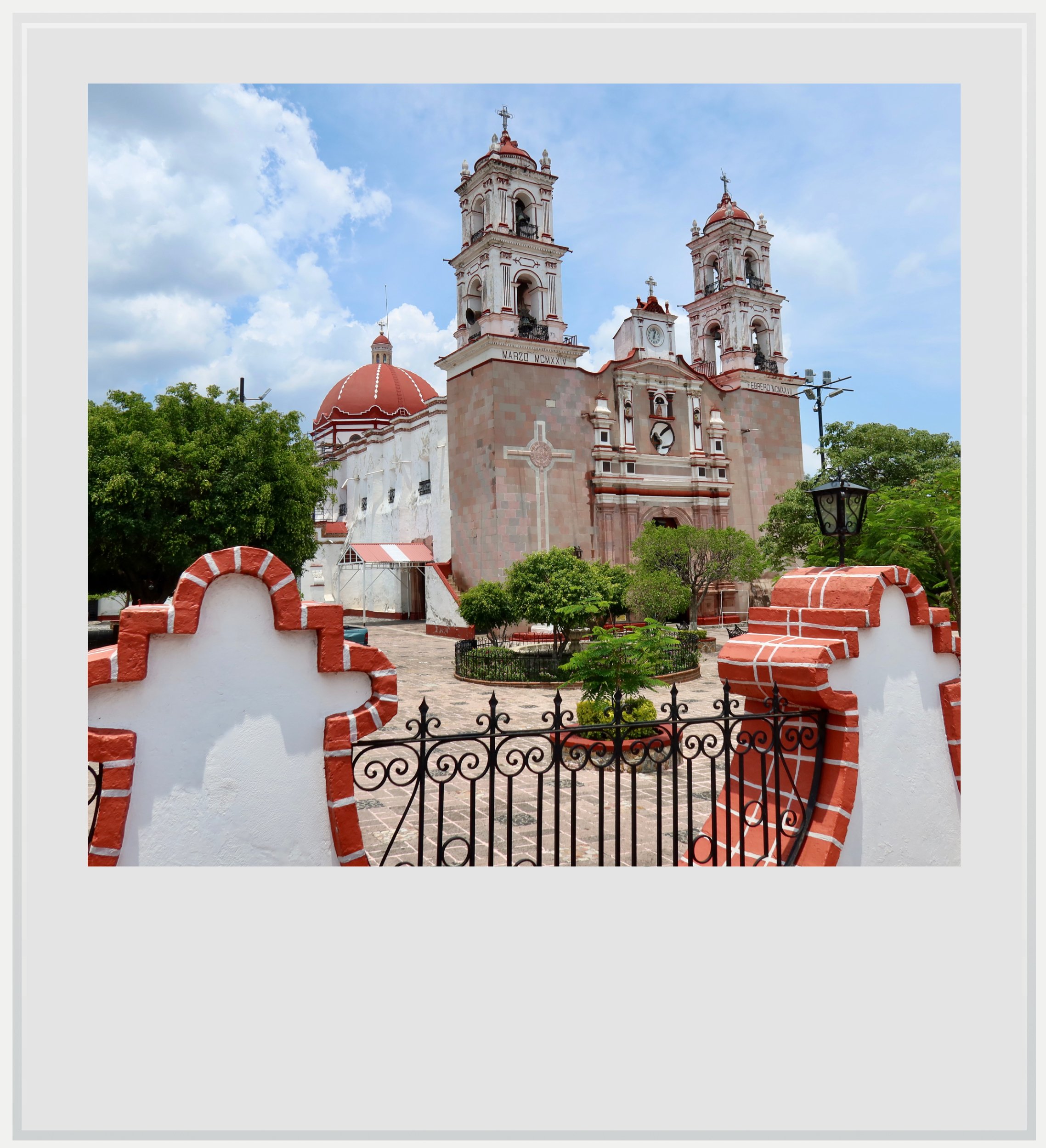
Tonatico's main church on the main square.
In the wake of the students’ disappearance and the cleanup operations that ensued, federal investigations uncovered that Ixtapan was one of many municipalities, in this area bordering Guerrero, where local police and administration had been infiltrated by one of the warring cartels. This led to the arrest of Ixtapan’s mayor and the disarming of its entire police force (source, in Spanish).
Suddenly, the region around Ixtapan became a place to avoid and tourism slowed down. Visitor numbers in Ixtapan dropped by more than 50% in 2014.
It would be tempting to jump to the conclusion that Ixtapan was awarded the label of Magical Town by the Mexican government in late 2015 to help it recover from the 2014 crisis. In reality, the designation arrived at a moment when Ixtapan was already searching for ways to reinvent itself. A 2014 competitiveness study described a destination facing structural challenges and in need of new investment, diversification and repositioning. By giving new visibility to the town, one can argue the authorities aimed to help Ixtapan get over the drop in tourist numbers. If anything, the 2014 events probably helped secure the label.
The Covid pandemic, in 2020, added another hurdle to the region, and was likely a factor in the Mexican government awarding Tonatico with the pueblo magico label in December 2020.
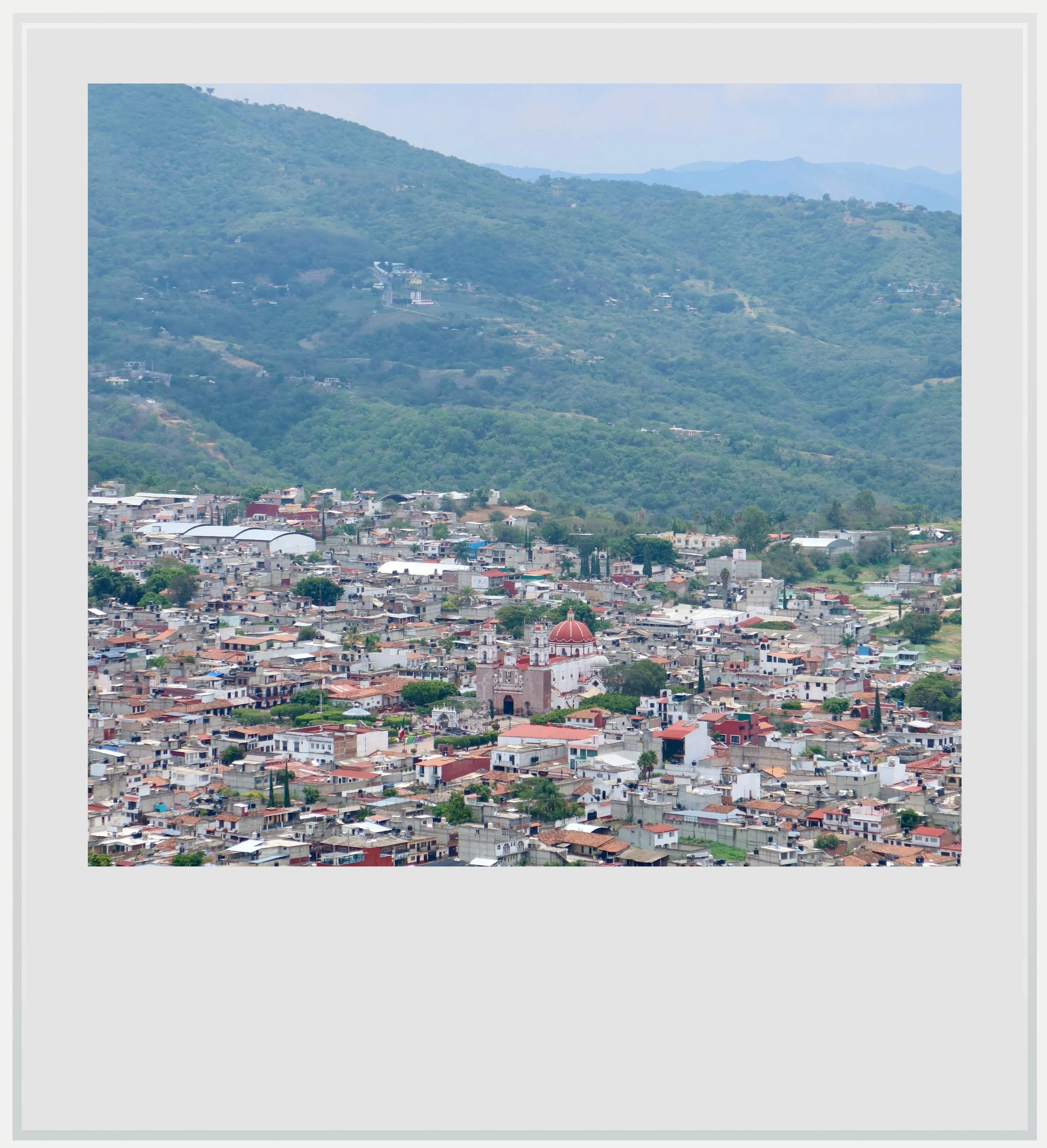
Tonatico, seen from the Cerro de la Cruz.
It turned out I had understood these pueblitos all wrong. What I had perceived as magical towns resting on their laurels and failing to invest in critical tourist infrastructure were in fact newly-minted pueblos magicos trying to rebound from the slump in tourism likely due to two serious crises in the past 15 years.
It also helped me understand why no one I had asked, from the taxi driver leading me to a mirador to chatty shop owners, had a clear-cut answer to explain the state of their tourist infrastructure. Who wants to remind tourists the region came to be associated with one of the worst cartel-led acts of violence against civilians since the beginning of Mexico’s war on drugs?
These thoughts were no longer on my mind as I was cutting a delicious if rather saucy chile relleno, under the shaded arches of the main square. From there, Tonatico couldn’t have been a better postcard for the magical town program. Quiet, quaint and colonial, this little village in a remote corner of the state of Mexico looked as though its past troubles were far behind it.
My trip had started with a nagging sense that both towns had somehow missed the train. Sitting in Tonatico’s main square a day later, I wasn’t so sure. What I had mistaken for decline now looked more like a region slowly finding its footing again.
Practical information
(Everything you need to know about visiting Ixtapan de la Sal and Tonatico - updated June 2026)
In a nutshell
Ixtapan de la Sal and Tonatico sit just north of the Guerrero border in the southern part of the state of Mexico, where the shockwaves of the drug war and, later, the pandemic left deep marks on local tourism. Today, visitors will find thermal baths, colonial streets and surprisingly few crowds during the week, but also a region still finding its footing after more than a decade of setbacks.
How to get to Ixtapan de la Sal & Tonatico
How to get to Ixtapan de la Sal & Tonatico from the US: Ixtapan de la Sal and Tonatico, two small highland towns in the State of Mexico about two hours southwest of Mexico City, are best reached from the Mexican capital. To get there, first fly into one of Mexico City’s international airports, MEX or NLU. MEX, the main airport, also known as AICM or Benito Juarez airport, is closer to the city center, and therefore a more convenient option to reach the Poniente Bus Terminal, also known as Terminal Observatorio, from where buses to Ixtapan depart.
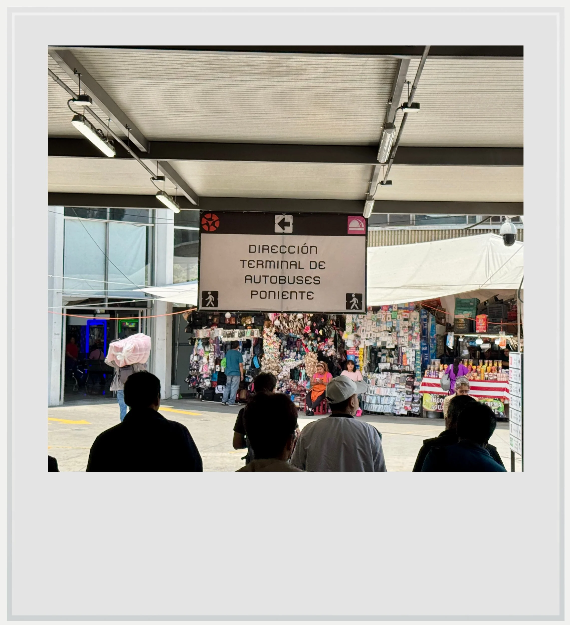
Exiting the Observatorio subway station towards the bus terminal.
How to get to Ixtapan de la Sal & Tonatico from Mexico City: make your way to the Terminal de Autobuses Poniente (also known as Terminal Observatorio), the second smallest of the four main bus stations in Mexico City. It sits right by the subway line 1 Observatorio station, at the heart of a key transit hub, home to the Insurgente suburban train line to Toluca. From central CDMX, the subway trip on line 1 takes about 15 to 20 minutes, but an Uber ride can also be a good choice, although more expensive and not that much faster. Once you get to Observatorio, get out of the subway station towards the left - do not go up following signs for the Insurgente train, but instead look for signs marked “Terminal de Autobuses Poniente” or for a black-and-white bus icon (signs are not prominent on the platforms themselves, but are once you exit the subway station). Once out of the station, the pathway is well signposted. The total walk is about 3 minutes. Flecha Roja’s ticket counters are right at the entrance of the station.
What bus company serves the Mexico City - Ixtapan de la Sal route
Flecha Roja is the line of choice between the two cities, with around 9 non-stop services a day from 7am to 7pm, every 90 minutes or so. You can’t miss the ticket counters as they are right in the path when coming from the subway.
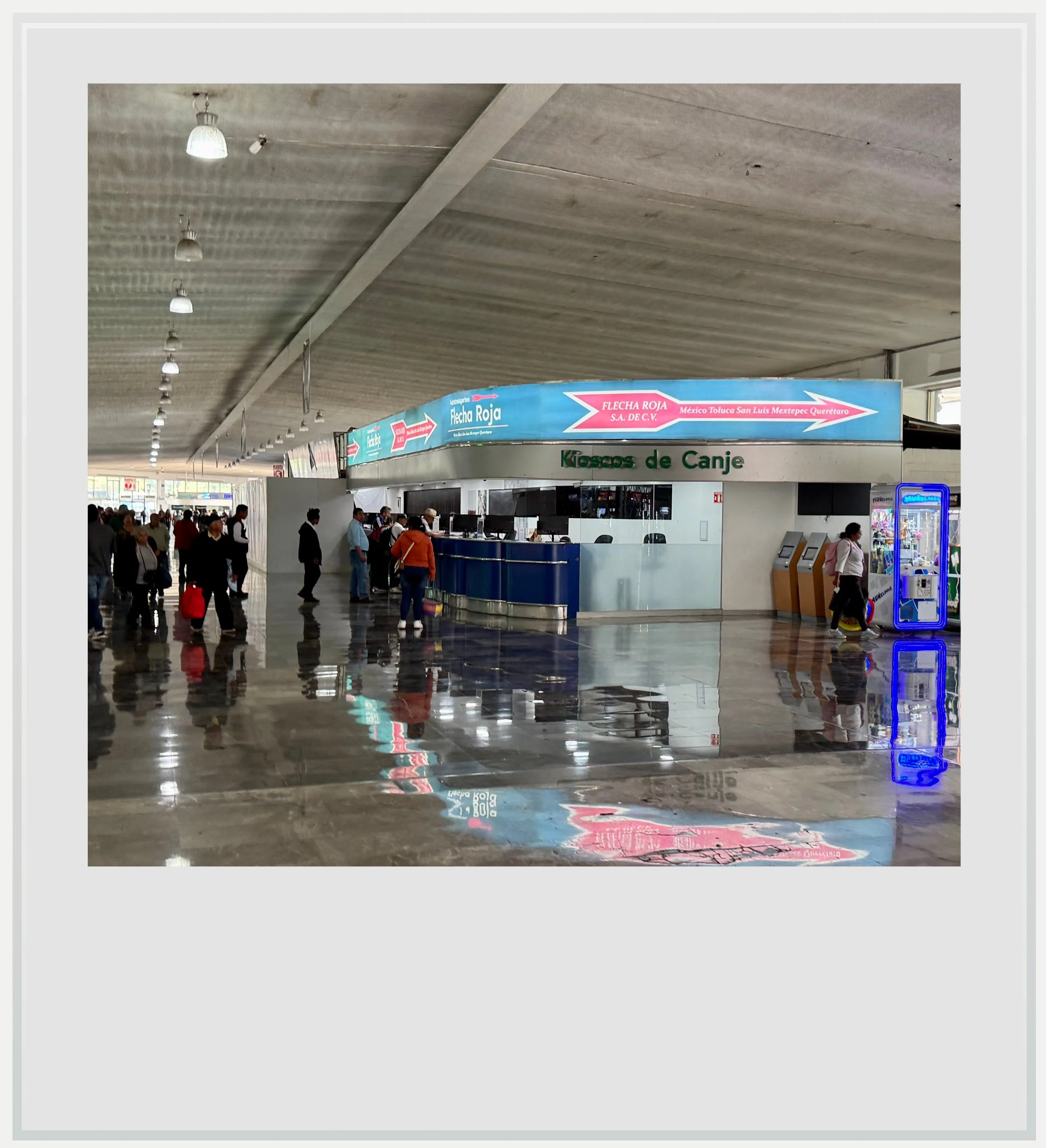
The Flecha Roja ticket counters in the Observatorio terminal
How long does the trip to Ixtapan take from Mexico City
The bus ride takes about 2 hours, although Flecha Roja lists the trip as lasting 2h13 minutes. My trip took exactly 1h55 on an early Tuesday afternoon (outside of rush hour).
How much does a bus trip cost between Mexico City and Ixtapan de la Sal
A one-way ticket costs MXN 180 if purchased online, and MXN 200 at the counter, for the non-stop service. Tickets are only available online a couple of weeks before but I have never been able to pay for one with a foreign-issued credit card. The site seems to only accept Mexican-issued VISAs and Mastercards. Foreign credit cards are accepted at the Observatorio terminal, at the secondary bus terminal in Ixtapan (“El Crucero”), but not at the main terminal further south, where payment is cash only.
What kind of bus does Flecha Roja operate between Mexico City and Ixtapan de la Sal
Flecha Roja services are very comfortable second class buses with about 44 reclinable seats laid out two on each side of the aisle. Second class services offer seat selection (both online and at the terminal), air conditioning and children-friendly movies broadcast on overhead screens. They do not offer bathrooms. My bus featured leather seats but most Flecha Roja services actually are equipped with fabric seats.
If you’re unclear about bus service levels in Mexico, check out this guide here.
Where to get off for Ixtapan or Tonatico
This is where it gets confusing. Ixtapan’s main bus terminal sits on the main road linking the two cities (here). Before getting there, buses make two stops in Ixtapan proper: Balneario, by the town’s main baths and Crucero. Both are close to the city center, and depending on where your accommodation is, they are likely to be more convenient if you’re staying in Ixtapan.
To get to Tonatico, get off at the last stop, the main terminal, and take a taxi from there (colectivo MXN 20, regular taxi MXN 50, cash only). There are almost always taxis waiting at the terminal.
On the way back, note that there is no ticket counter at the Balneario stop, so if you want to hop on the bus there, you would have to buy a ticket at either of the other two terminals beforehand.
How to get to Tonatico from Ixtapan de la Sal and vice versa
There is no bus service between the two cities as the main bus terminal is located between them. Instead, hail a regular taxi (MXN 50) or a shared one (colectivo, MXN 20) on the main road. They are ubiquitous and will get you from one town to the other in a few minutes.
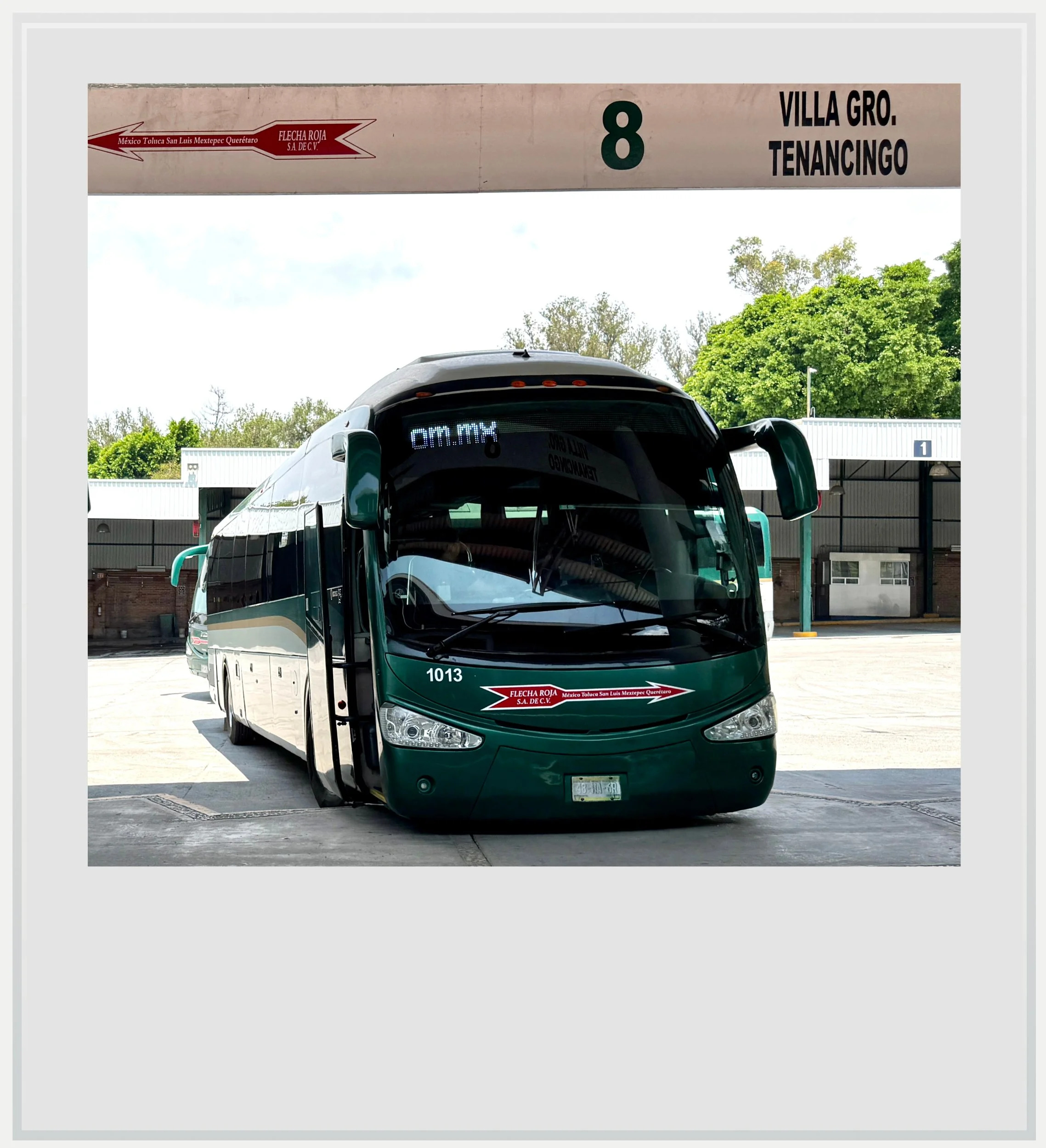
A Flecha Roja bus at Ixtapan's main terminal.
When to go to Ixtapan de la Sal & Tonatico
Ixtapan de la Sal and Tonatico are neighboring towns in the southwestern part of the State of Mexico, very close to the Guerrero state line. Ixtapan de la Sal sits at an elevation of approximately 6,200 feet (1,890 meters), while Tonatico is located further down the valley, at around 5,300 feet (1,600 m).
Like many magical towns within easy reach of Mexico City, Ixtapan de la Sal & Tonatico, get most of their visitors on weekends. If you can visit during the week, you’ll enjoy quiet streets and empty restaurants.
Season-wise, the town’s climate is fairly similar to Mexico City, with higher temperatures due to the lower altitude: expect gorgeous, dry days from November to April, and sunny mornings with afternoon showers during the rainy season, from May to October. I visited both towns in early June, and every day followed the same pattern: sunny weather in the morning, cloudy skies after noon and rain falling for an hour or so around 4pm.
How long to stay in Ixtapan de la Sal & Tonatico
Ixtapan and Tonatico are known in Mexico for their thermal waters, and the small towns get busy on weekends with Chilangos enjoying their balnearios. Spending two days and one night is the perfect length to visit both and have time for a relaxing spa treatment.
Food & lodging in Ixtapan de la Sal & Tonatico
Although Tonatico was, for me, the most charming town of the two, its more limited tourism infrastructure meant a wider choice of accommodations was available in Ixtapan.
Hotels
I stayed in the Quinta San Carlos hotel, on the edge of Ixtapan’s town center. I liked that it was close enough to the historic downtown without being right in the middle of it, and that it was located on the main road, making it easy to get to Tonatico. The hotel has a large pool and a big garden and is protected from street noise. Price was around US 100 per night, with breakfast included.
Tonatico offers a few options but they looked like they may not fit the needs of most international travellers - most of them didn’t appear on global travel sites. One exception is Hotel boutique Lila&Co, well-rated and situated right next to Tonatico’s balneario.
Restaurants
I spent more time checking out bakeries than legitimate eateries, but enjoyed my very simple lunch at Restaurante La Abuela, on Tonatico’s main square, where the gorditas were so big that one would probably have been enough for lunch and dinner. Nearby Restaurante Rebeca was recommended to me but I didn’t have the opportunity to try their food.
A special mention to Gordo Colibri, a lovely coffee shop with kitschy colibri-inspired decor and delicious food on the outskirts of Ixtapan. It’s a lovely place going all in on a bird theme (down to the colibri-shaped mugs), with incredibly friendly service.
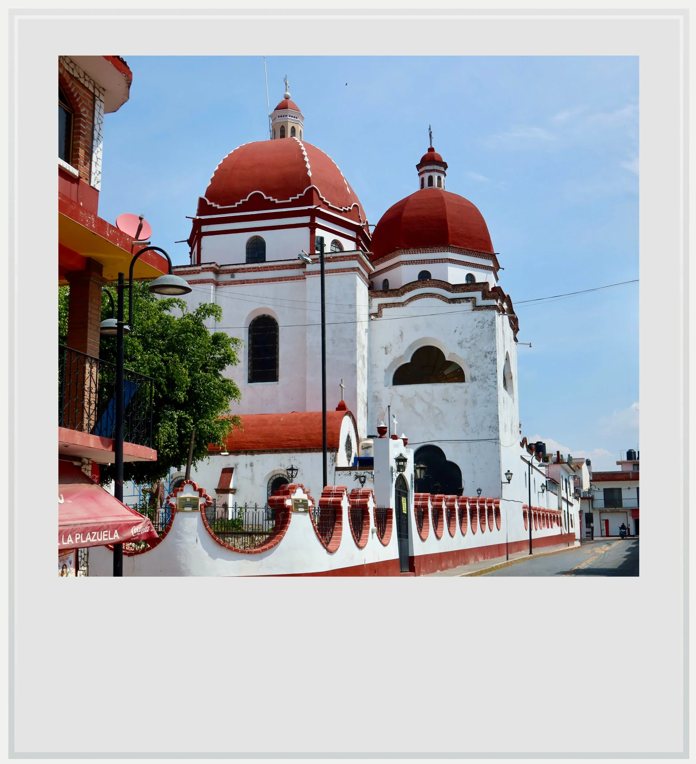
The back of Tonatico's main church.
Safety in Ixtapan de la Sal & Tonatico
Ixtapan and Tonatico are located in a relatively remote part of the state of Mexico, rated level 2 by the US Department of State, meaning “exercise increased caution” during your travels. For reference, this is a similar warning level as Mexico City or many European countries, such as Germany or Spain.
The state of Guerrero, which begins just south of Tonatico, is seen as much more dangerous, with a level 4 “do not travel” warning. Some travel insurance policies contain exclusions for travel to destinations subject to a Level 4 U.S. State Department advisory, so travelers should review their policy wording carefully.
Guerrero is a large state, and conditions vary considerably from one region to another. From researching the state’s recent history while writing about Taxco, my view is that some areas are no longer facing the same level of disruption that characterized the 2010s, even if the state’s reputation has yet to fully recover.
As in most smaller Mexican towns, it is sensible to stay aware of your surroundings after dark and use registered taxis when moving around at night.
Driving is possible, but bus travel is generally the better option. Intercity buses in Mexico are safe, frequent, comfortable and affordable, and eliminate the need to navigate unfamiliar roads, especially after dark.
Keep in mind these travel tips
Ixtapan de la Sal & Tonatico sit at a lower elevation than Mexico City, making days warmer, but nights can still be chilly, so bring layers.
The UV index may be low in the morning and evening, but during the day, it gets pretty high, so don’t forget to wear SPF.
Bring cash. While many shops accept foreign credit cards, bus companies, taxi drivers or restaurants may not.
Cell service can be hit-or-miss in the southern mountains of the state of Mexico. Both Telcel and Altan Redes (provider of many local MVNOs like Bait) had good coverage of the area, with AT&T and Movistar lacking in Ixtapan proper. Telcel is always the safest bet, but is usually more expensive than the others. If you’re roaming, check that you can roam on Telcel, or investigate a Mexican eSIM that uses this network. Telcel coverage is independently mapped here. Change the network in the dropdown menu at the top to see other networks.
Every photo caption appear if you hover over it (on a computer) or click on it (on a smartphone).
All photos are mine and copyrighted.