San Miguelito, Mexico.
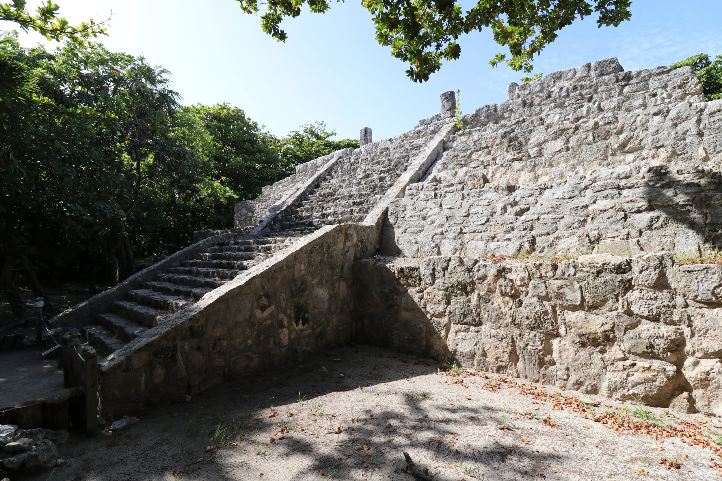
The Maya city Cancun almost erased.
Looking for directions, opening hours, or where to stay and eat? Head straight to the Practical Information section.
San Miguelito, a small Maya site on Cancun Island, was hard to get to, but not from a distance perspective. In fact, it sits right in the middle of Cancun’s world famous Hotel Zone, where sparkling-white hotel towers soar high above a picture-perfect shore, and among the few Maya sites around Cancun, it was actually the closest to my hotel.
I wasn’t initially able to locate the site, however. The Google Maps directions seemed to be pointing me to the Hilton hotel parking lot, and I had to get help from the guard there, who wouldn’t let me enter the resort premises.
Only when, having parked my rental car on the side of the road, I started walking towards what Google Maps said was the site’s entrance did it dawn on me. That beautiful white building ahead of me wasn’t part of any of the hotels surrounding it, although it seemed like the design vision was to make it blend in.
That building was the actual Maya Museum abutting the San Miguelito ruins. I couldn’t see any monument yet, but reassured I was at the right place, I got in.
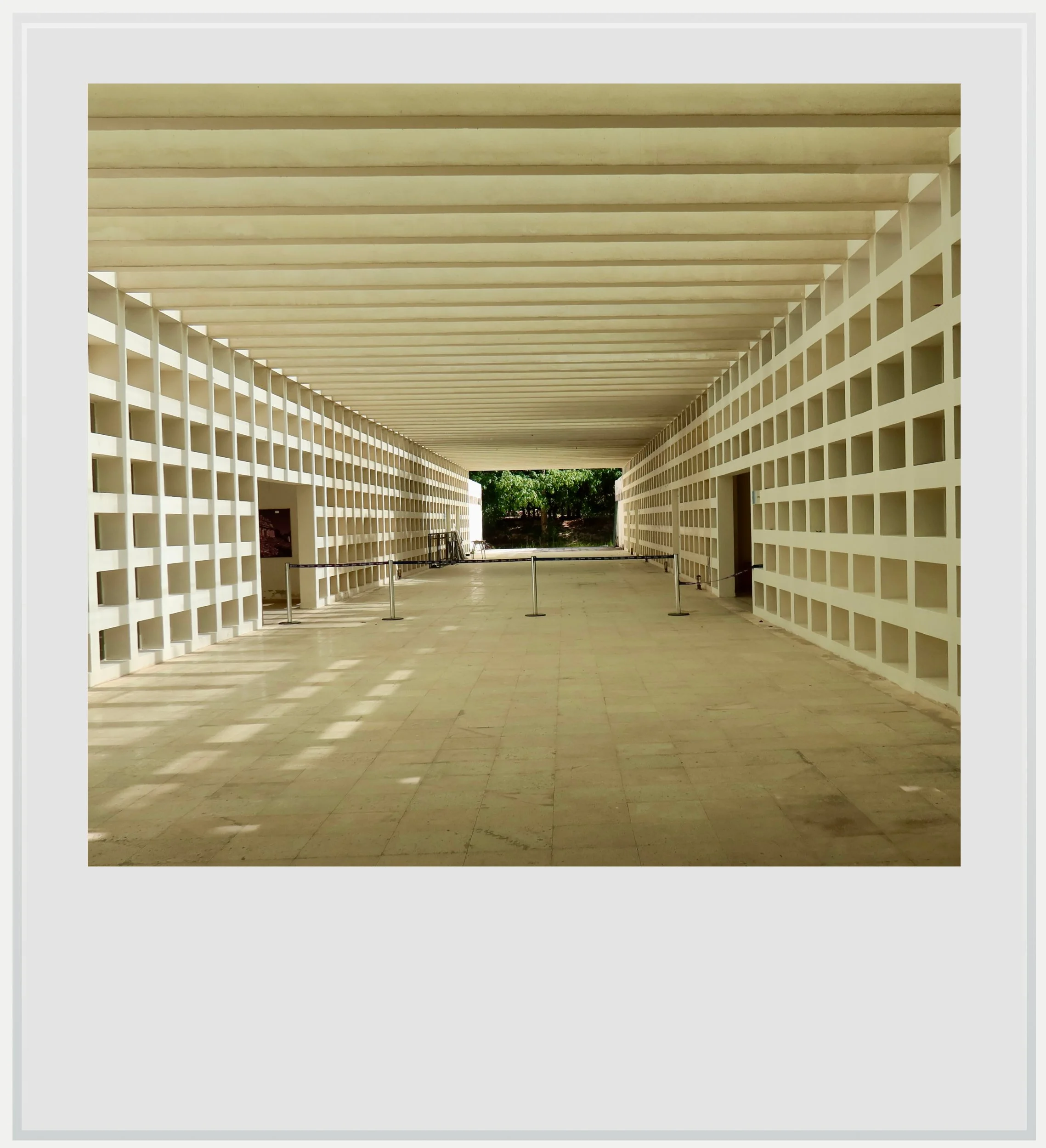
The Maya Museum entrance hall.
The Maya Museum of Cancun is one of the largest projects undertaken by Mexico’s National Institute of Anthropology and History (INAH) over the past two decades. The modern building is visually impressive, although its exhibition rooms, on the second floor, take up a relatively small footprint. The pieces shown are stunning, and most of them exceptionally well preserved.
What I appreciated the most was how clearly and accessibly the interpretive panels helped put Maya culture into context. After browsing the three exhibition rooms, I walked down to the ground floor, and entered to the archeological zone.
I was really surprised by what I found. I was expecting another El Meco (a beautiful archeological zone 15 miles to the north) where the old settlement was hemmed in by visible urban development. Here, the sounds and visuals of the busy Hotel Zone were curiously absent. It was as pleasant as it was unexpected. San Miguelito, right in the middle of a heavily developed stretch of beach, could have been a remote site in the deep jungle of southern Yucatan.
That sense of seclusion wasn’t accidental. In fact, it tells a fascinating story about how the archaeological zone came to be.
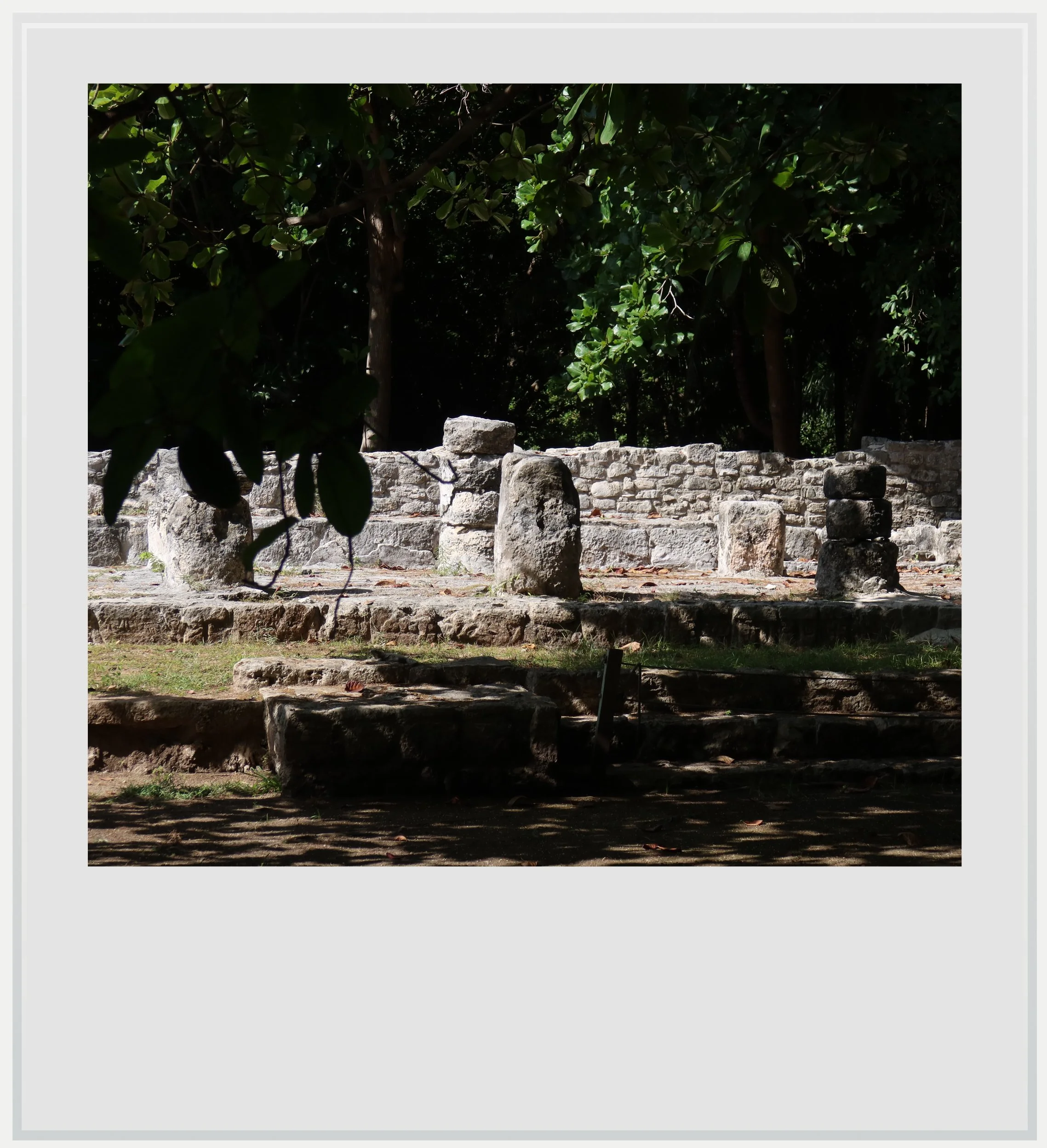
A view of the Chaac palace.
In the late 1960s, the Mexican government decided to create a world-class beach resort from scratch on Cancun island, to help develop what was, at the time, a sparsely populated and rather humble part of the Yucatan peninsula. Cancun itself was a tiny little fishing outpost, but a few years later, the area was transformed into one of the biggest beach destinations in the Americas.
When Cancun island was divided into building lots, the San Miguelito parcel was kept undeveloped by FONATUR, Mexico’s tourism development entity, because Maya ruins had been known to exist there. The rest of the island was bulldozed over to make way for sprawling resorts: massive hotels, large swimming pools, and a golf course. FONATUR eventually transferred the parcel to INAH, which started excavating the site to uncover the Maya city beneath it.
A Maya city in the heart of a master-planned resort.
On a now largely deforested island, San Miguelito stood out as one of the only areas where the original vegetation still existed. We can’t be sure the Maya saw the same mix of trees and shrubs back in the day: the land around the archeological zone had been a coconut farm at some point before the creation of the Hotel Zone. In any case, San Miguelito was one of the only places where I could experience the island just as it was before Cancun-the-resort was created.
This tiny pocket of native vegetation felt like a relief from the manicured grounds of the nearby hotels. I could vaguely hear the roar of passing cars, muffled by the tree cover and mingling with the chirping of birds. I followed the natural path along the trees, and, when the first Maya building appeared, it almost felt like a discovery, as if I had stumbled upon ancient ruins by chance.
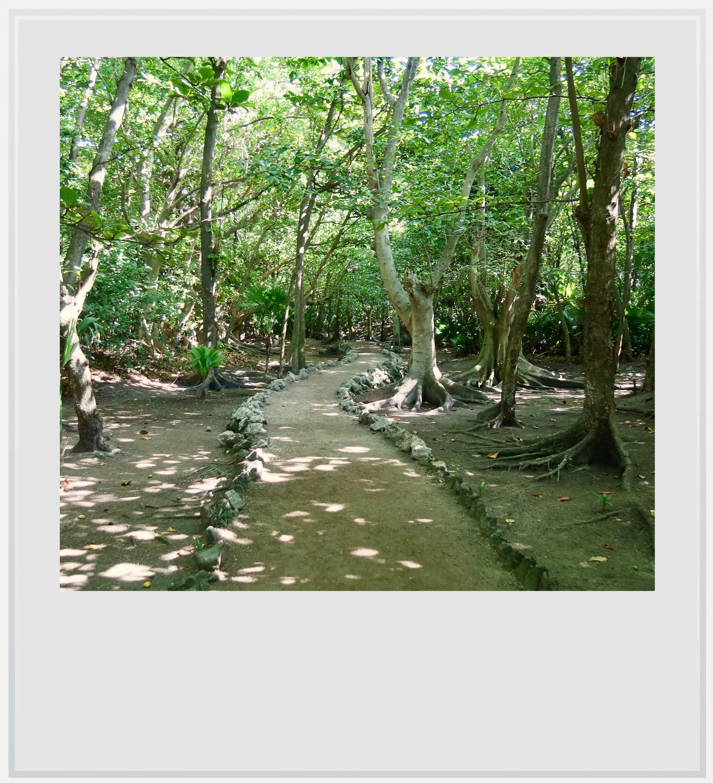
The path into the archeological zone.
The North Complex wasn’t the best preserved building group of the old settlement. Archaeologists found 47 burials there, 30 of them children. The unusually high rate of child mortality has been linked to poor health and nutrition among an impoverished population during the 16th century—a sobering glimpse of what life must have been like here during San Miguelito’s final years.
One of the most interesting structures in San Miguelito came next, after a left turn on the path. Named Chaac Palace by archeologists because of small carvings seemingly made in honor of this important Maya deity, sometimes called “the God of Rain”, the building was a great example of typical Costa Oriental Maya architecture. In slightly better condition than a similar edifice in El Meco (Structure 12), it was easy to recognize the long, flat construction style, lined with columns, most of them still visible, and to imagine the flat roof they were supporting.
I continued walking along the shaded path among wary iguanas, until I reached the southern end of the settlement, where I came upon another beautiful example of Late Postclassic pyramid on the Costa Oriental. Smaller than the one at El Meco, it was nonetheless impressive and fairly well preserved, save for the temple at its top, of which much was left to the imagination.
The version of the temple I had in front of me was actually the third iteration, as the structure had been built over twice, a reflection both of the Maya practice of building over existing structures and of San Miguelito’s long history, during which the pyramid was repeatedly enlarged.
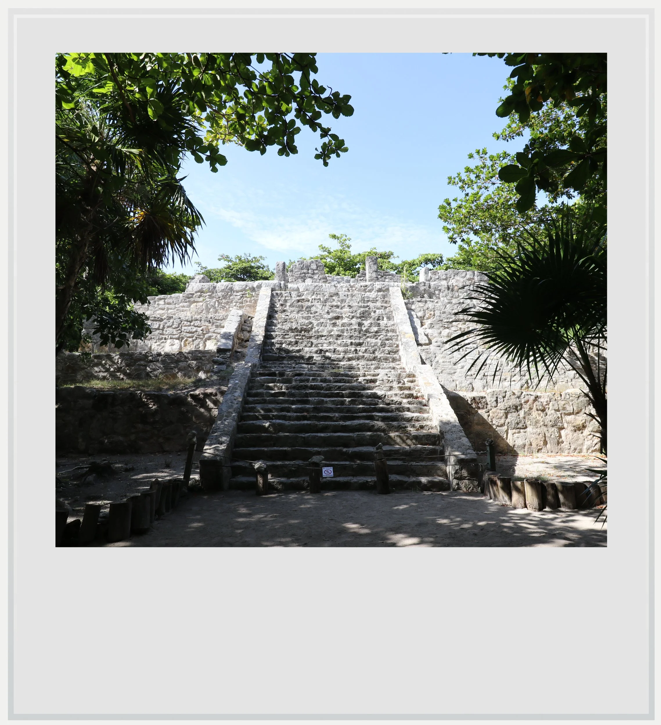
The pyramid at San Miguelito.
INAH notes that back in the Postclassic period, the pyramid would have likely been painted in red and blue hues. Looking at the beautifully restored edifice and its exposed grey stones, it was hard to imagine how different the pyramid must have looked a few hundred years ago, covered in stucco and painted in bright colors.
Beyond realizing how little the exposed grey stones resembled what the ancient Maya would have seen, what puzzled me was the seemingly odd position of the building within the complex. It was located at the very south of the archeological zone, yet seemed to be turning its back on all the other structures. It didn’t seem to make sense.
A possible explanation comes from another piece of Cancun’s development history. It is believed that San Miguelito and El Rey, the other Maya archaeological zone to its south, may once have formed part of the same city. It could explain why San Miguelito’s pyramid faced in El Rey’s direction.
We may never know for sure. The land between the two zones was sold to developers during Cancun’s creation, and a 2012 La Jornada article reported that archaeological remains were lost during construction of the Hotel Zone, as heavy machinery moved earth without systematic checks for pre-Hispanic material. (link, in Spanish).
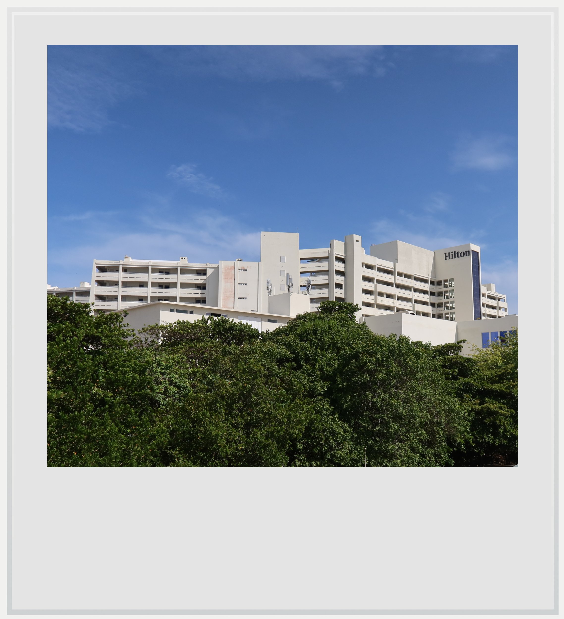
A nearby resort seen from the second floor of the Maya Museum.
It is conceivable that whatever buildings remained between the core areas of San Miguelito and El Rey were more modest, less conspicuous structures, making them easier to miss during the Hotel Zone’s construction phase. It was a stark reminder that the creation of Cancun probably destroyed parts of what once was a vibrant Maya settlement.
It made me even happier that the parts of San Miguelito that were saved from the bulldozing were left intact, vegetation and all. It also reassured me that the archeological zone was anchored by the Maya museum, a visible commitment to safeguarding San Miguelito further and highlighting its unique role, that of a genuine Maya settlement within the Cancun Hotel Zone.
San Miguelito may have been almost erased, but the parts left standing were telling a wonderful story: that of a Maya city’s survival against all odds in the heart of a master-planned world-class resort.
Practical information
(Everything you need to know about visiting San Miguelito - updated August 2026)
In a nutshell
San Miguelito is a small Maya archaeological site hidden in the middle of Cancun’s Hotel Zone. Its ruins are modest compared with major sites along the Caribbean coast, but the combination of shaded paths, well-preserved Costa Oriental architecture and the excellent Maya Museum makes it well worth a visit.
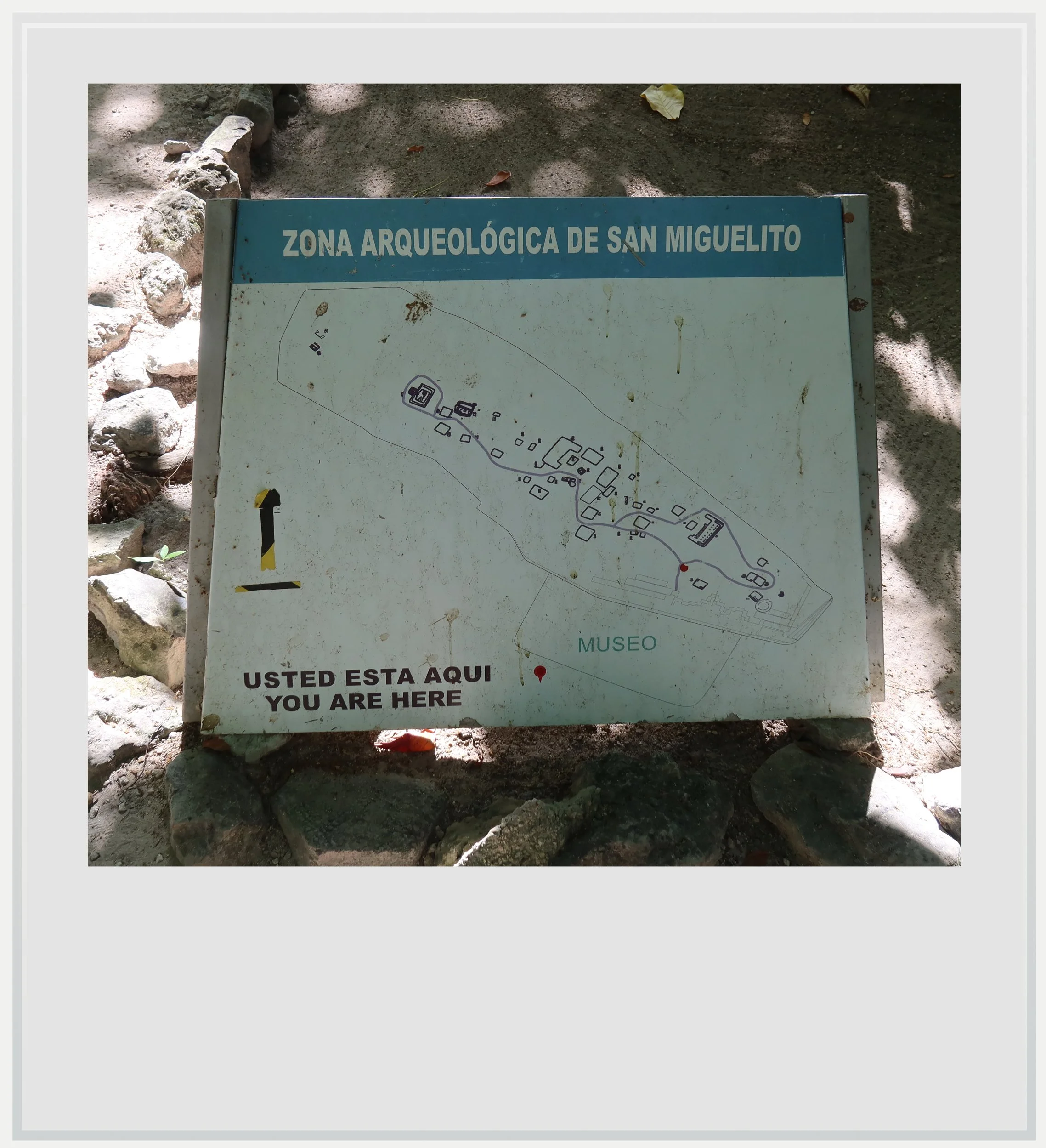
The San Miguelito orientation map.
Getting to San Miguelito
How to get to San Miguelito from the United States: San Miguelito, located within the Cancun Hotel Zone between the Caribbean Sea and the Nichupte lagoon, is probably one of the easiest Maya archeological zones to reach from the US or Canada. Many North American cities enjoy non-stop service to Cancun, at least seasonally. On a typical day in November, 25 cities in the US and Canada can be reached non-stop from the famous Mexican city.
How to get to San Miguelito from Mexico City: Mexico City to Cancun is one of the busiest air routes in Mexico, with more than 20 flights a day on three airlines (Aeromexico, Viva Aerobus and Volaris). The flight takes approximately 2 hours.
How to get to San Miguelito from Cancun airport: from the airport, San Miguelito is easy to reach by rental car (about 20 minutes) or by taxi (rideshare services are more complicated as Uber and the like are technically not allowed to pick up from any of the terminals). Google Maps directions are straightforward, and the archeological zone offers parking, although it is easy to miss.
It is also technically possible to get to San Miguelito using public transport. From the airport, take an ADO bus to the Hotel Zone (MXN 160, every hour from 10am to 6pm, trip duration approximately 40-60 min depending on which terminal you’re arriving at). The ADO Shuttle has an official stop at the Museo Maya, which is part of the San Miguelito archeological zone.
How to get to San Miguelito from Cancun’s Hotel Zone: given its location within the Hotel Zone itself, this is an easy trip. If your hotel is close (Seadust, Iberostar, Royalton, Hilton) you may be able to walk to the Maya settlement. If not, a taxi or a quick bus ride on either the R1 or R2 line (frequent buses, MXN 12) will get you to it fairly quickly.
Can I visit San Miguelito on a tour: a few tours including San Miguelito are available on some of the global tours website, but not all of them feature a guide, and the pricing is significantly marked up.
When to go to San Miguelito
The best months to enjoy San Miguelito weather-wise are during the dry season, between November and April. This is also peak season but the site doesn’t see a lot of visitors, so it is unlikely to ever get crowded. I went to San Miguelito in August, at a time when the heat and humidity in Quintana Roo can feel too much. The site itself is pretty shaded so visiting during the hottest hours of the day isn’t an issue.
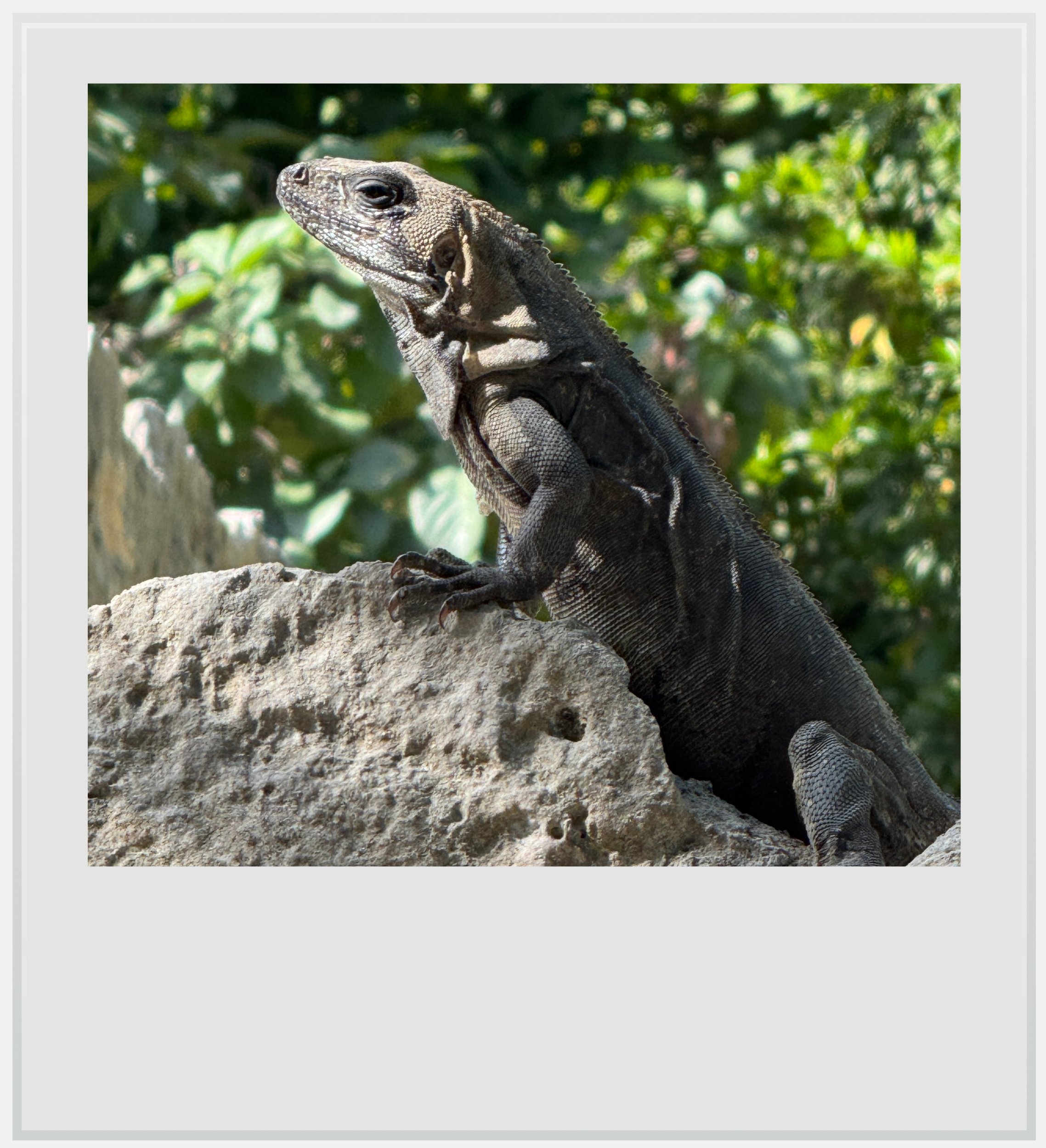
An iguana in San Miguelito.
What’s the best time of day to visit San Miguelito
The main buildings (the pyramid and the Chaac palace) are oriented towards the south and as such, the light will be beautiful at any time during opening hours (although you may see it in the shade in the late afternoon). Given the site’s extensive tree cover, a visit at basically any time of the day will be comfortable enough.
How much does it cost to visit San Miguelito
At the time of my visit, the entry price was MXN 210 for foreigners and MXN 105 for Mexican citizens and official Mexican residents, with proof of residency. This included access to both the archeological zone and the Maya museum.
How long should I plan to visit San Miguelito
Plan to spend 45 to 75 minutes on site, including the museum. The museum itself isn’t really big (a surprise, given the building’s footprint) but the exhibits are well done and interesting to get introduced to some aspects of ancient Maya culture. If you’re only planning to see the actual ruins, 30-45 minutes should suffice.
What are the opening times of San Miguelito
The archeological site and the museum are open every day except Mondays from 9am to 4.30pm (last entry). Note that the museum closes at 6pm, with entry allowed until 5pm, so if you come between 4.30pm and 5pm, you will only have access to the museum.
Safety at San Miguelito
The Yucatan peninsula is one of the safest areas in Mexico. The U.S. State Department currently classifies Quintana Roo as Level 2, meaning travelers should “exercise increased caution.” This is the same warning level as Mexico as a whole, and similar to the level assigned to several European countries such as France, Germany and Italy.
Quintana Roo, however, has been in the news because of a few highly publicized violent events in recent years, from a shooting at the Xcaret hotel in 2022 to the murder of a Canadian citizen in a Cancun gym in 2023.
In these highly publicized cases, it is understood tourists weren’t targeted and foreigners involved in these incidents had, according to Mexican authorities, links to organized crime. It would not be truthful to write Quintana Roo is a state devoid of violence, but it is also fair to observe it is highly localized and extremely unlikely to affect a trip to the state.
Keep in mind these travel tips
SPF will be your best friend. The UV index may be lower in the morning and evening, but during the day, it gets pretty high.
Do not forget to hydrate. OXXO and GoMart convenience stores are ubiquitous in and around Cancun, and always stock cold water and drinks. Make sure you always have water handy and drink regularly to make the heat more bearable.
Every photo caption appears when hovering over it (on a computer) or clicking on it (on a smartphone).
All photos are mine and copyrighted.