El Rey, Mexico.
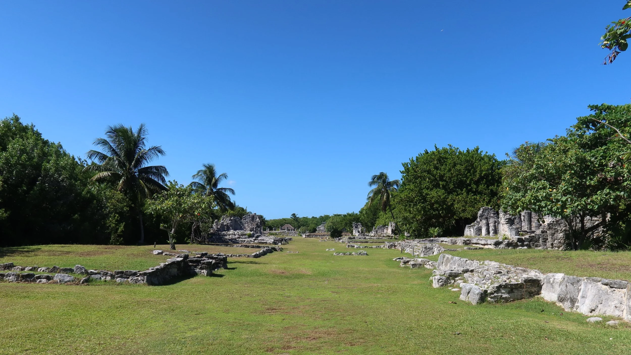
A Glimpse of a Different Kind of Maya Urban Planning.
Looking for directions or opening hours? Head straight to the Practical Information section.
At first glance, the ancient Maya settlement of El Rey doesn’t seem like a must-see attraction on Cancun Island. Beyond the white-sand beaches tourists flock to, a Maya enthusiast may favor more well-known Maya sites nearby, like El Meco or San Miguelito.
It’s understandable. Unlike these two sites, also easily reachable from Cancun’s Hotel Zone, El Rey doesn’t have the same immediate visual appeal. At first glance, it can look like a few Maya ruins scattered in an open field, between the Nichupte Lagoon and Kukulkan Boulevard.
The first minutes of my trip there seemed to confirm this impression. First of all, it was hard to find the site. Unlike El Meco, its entrance and wayfinding hadn’t recently been updated. Unlike San Miguelito, it wasn’t anchored by an ambitious museum, a destination in itself for anyone interested in ancient Maya culture.
In fact, the site’s entrance looked so amateurish, lacking official signage, that I thought this was nothing more than a tourist trap: on the side of the road, between beach parking and a decrepit red building, sat a recessed green-and-white sign saying ‘El Rey, archeological zone’, that looked like it might have been painted by well-meaning volunteers. That sign was cut in half by a recently added electricity meter, oddly superimposed over the lettering and hiding part of it.
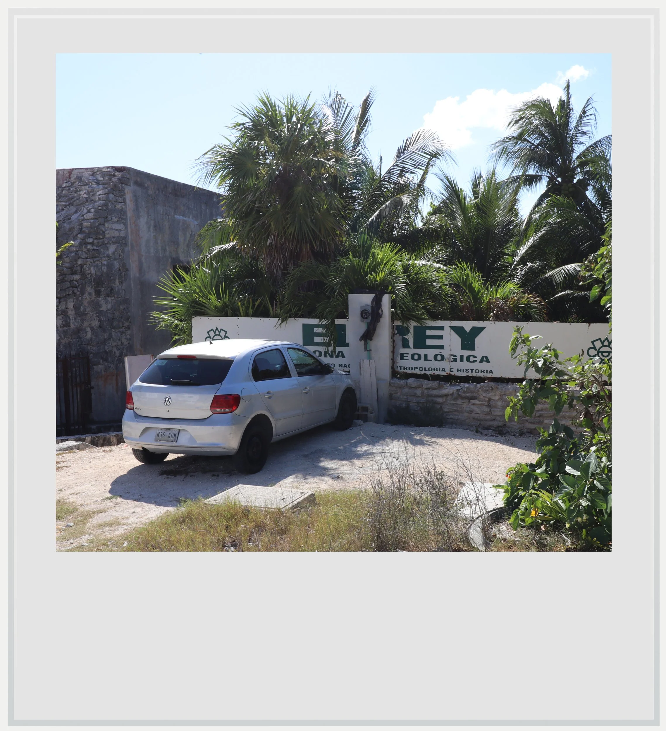
The unofficial-looking entrance to El Rey’s site.
Once I got closer, I noticed a flimsy vinyl panel with visitor information. I wouldn’t have believed it to be genuine if I hadn’t known an actual archeological zone was supposed to be there. All signs pointed to one that had been neglected, which meant that my expectations going in were low.
After paying the entry fee, I stepped into what was a mostly tree-free lot, oriented parallel to the lagoon. My first reaction was indeed to wonder if this was it. In front of me were several old Maya buildings in various states of disrepair, most showing only a foundation and a few columns. I couldn’t make out any major temple dominating the site. This felt, at best, like a secondary site that I wouldn’t spend much time visiting.
As I started walking along the ancient structures, a realization hit me. There was something very peculiar about the place, and it had little to do with how poorly preserved its edifices were. I was looking at two perfect lines of buildings bordering what I assumed was a street.
Most Maya sites I had visited were organized around one or several big temples, usually set in the middle of a plaza, around which smaller structures were built, and the settlement seemed to radiate from that. I couldn’t remember ever seeing what looked, to me, like a perfectly straight avenue lined by former houses, without a bigger structure to anchor them.
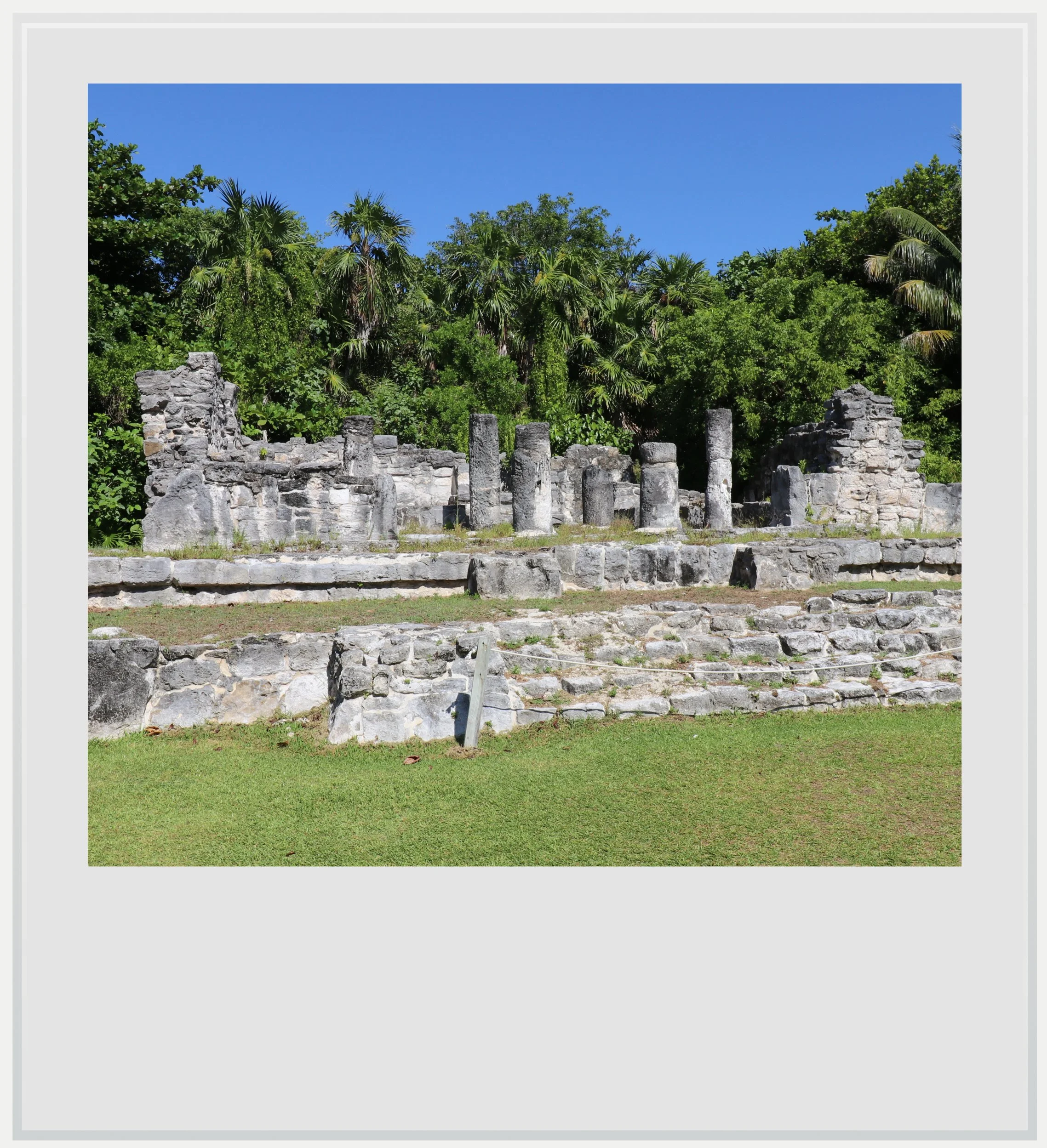
One of the houses lining the main avenue at El Rey.
That’s not to say such streets never existed in other settlements, but the topography and urban design never made it that obvious.
Two factors may explain this unusual sight. Although the first buildings at El Rey date to around AD 300, it is believed that the settlement only became a city of importance about a thousand years later, considerably later than some of the grandest Maya cities I had already visited (like Calakmul, Uxmal or Edzna).
El Rey’s most distinctive feature is its urban planning.
It is believed that El Rey may be only part of a larger city that was eventually abandoned and decayed after the Spanish conquest. Continuing the straight line that forms El Rey’s spine to the north would lead us right to the Maya site of San Miguelito, where the biggest structure, a pyramid, faced directly towards El Rey.
It is possible we will never know for sure - in the 1970’s, groundworks for the creation of Cancun’s Hotel Zone probably destroyed whatever clue lay in the soil between the two archeological zones, as I reported in my article about San Miguelito.
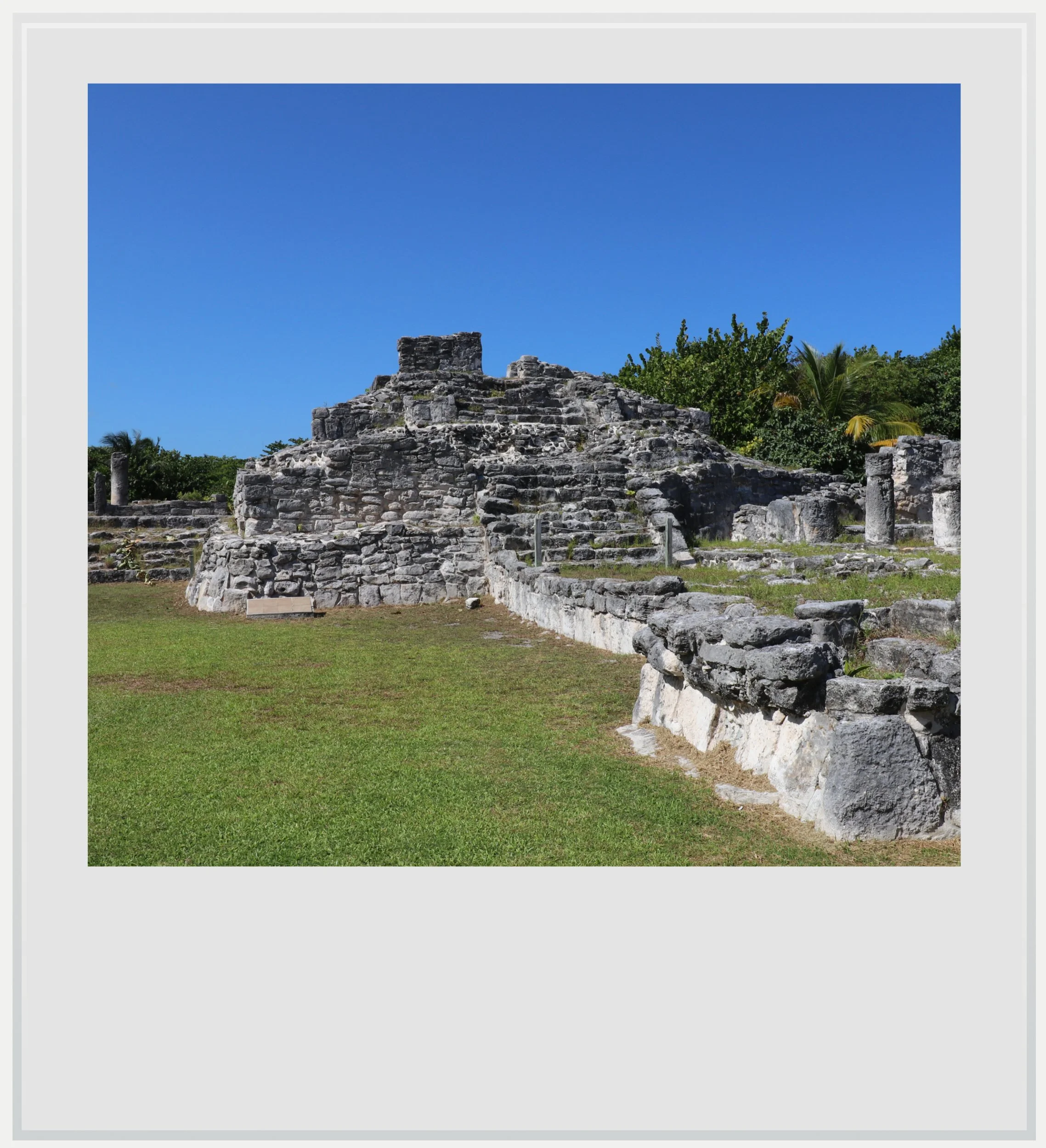
El Rey’s pyramid, one of only four on the Costa Oriental.
In any case, this was an appealing theory, that El Rey might have been a neighborhood of a bigger city. I imagined myself strolling past grand Maya residences, in what may have been the posh end of a bigger metropolis.
Although my imagination was boundless, reality didn’t allow me to know for sure. What we do know is that the structures lining El Rey’s southern causeway were made of stone, requiring more labor and therefore more resources to build, and INAH, the Mexican Institute for Anthropology and History, concluded that these were indeed opulent homes for important people in the polity.
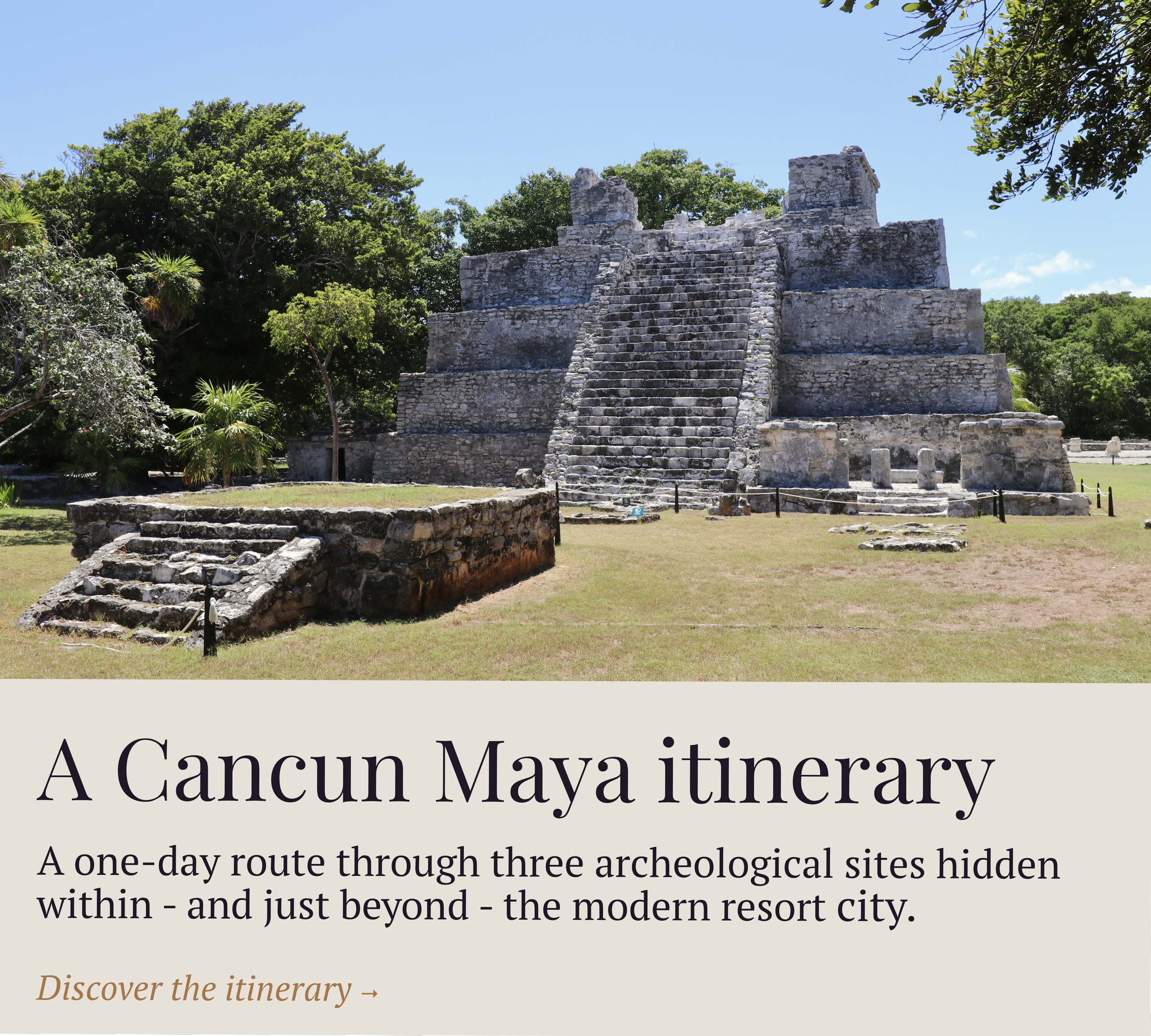
If El Rey’s most distinctive feature is its urban planning, that is not to say it doesn’t feature interesting structures. About midway through the lot, I arrived at the site’s main plaza, breaking the perfect perspective with a few buildings that seemed to be in the way. Rather than a mere collection of edifices, this cluster is understood to be the civic center of the old city - which somehow seemed to contradict the theory El Rey and San Miguelito might have been part of the same settlement, until I realized a big Maya city could have several ceremonial or civic centers.
The two buildings I spent the most time examining were Structure 2, the pyramid, and Structure 4, a palace. Although neither as visually impressive as the one at El Meco nor as well preserved as the one at San Miguelito, the pyramid at El Rey was striking. It was, after all, the tallest building on the site, at 5.5 meters (18 ft). Excavation work in the 1970s unearthed the tomb of a powerful individual, inhumed with precious possessions, highlighting the important role of this edifice in the settlement.
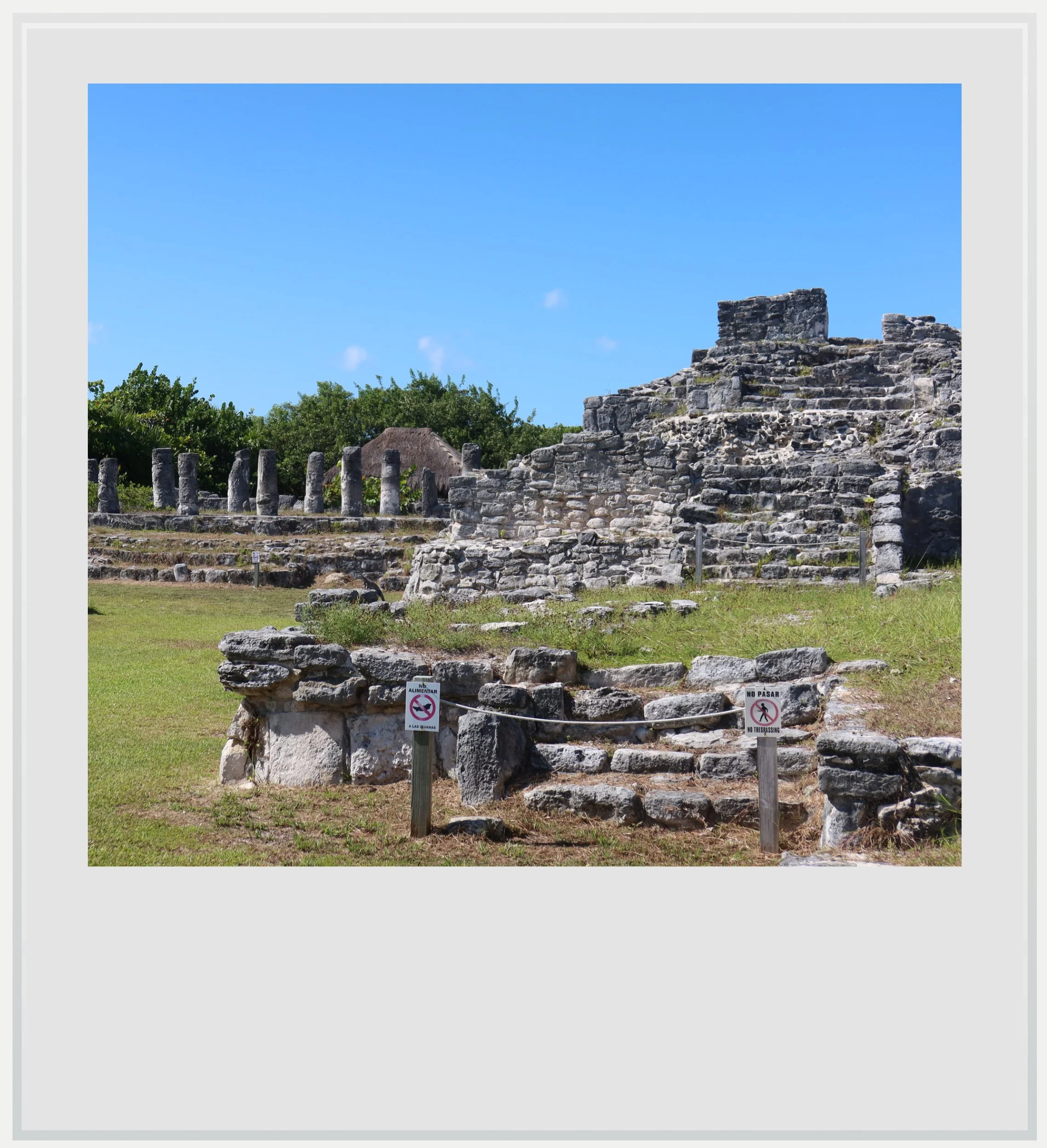
Structure 2 (the pyramid) on the right and Structure 4 (a palace) on the left.
It’s also worth noting that Late Postclassic-era pyramids are uncommon in the Costa Oriental, a region largely corresponding to what is known today as the Riviera Maya. Beyond the three already discussed, all found in the Cancun area, INAH locates the other one in Tulum. It strengthens the argument that El Rey must have been an important settlement in Postclassic Maya times.
Structure 4 was fascinating for a different reason. Although not the most important edifice of the archeological zone, it was remarkable for its L shape, as well as for its architecture, which featured columns and, in ancient times, a flat roof highly characteristic of the Late Postclassic Costa Oriental tradition. Despite being named a palace in official INAH documents, this was probably an administrative building and not a residence.
Beyond the main plaza, a few platforms were visible. These are a testament to a slightly different type of housing, as they are said to have served as foundations for more humble wooden homes, and helped me understand the spatial organization of the settlement, seemingly arranged according to social status.
Turning back towards the exit, I was suddenly aware of the intense heat bearing down on me - the site’s exposure to the elements made my early afternoon visit a little too hot for my taste. Heading back towards the entrance, after having taken in the whole site, the walk felt even more special as I imagined myself on a beautiful avenue among elite Maya houses.
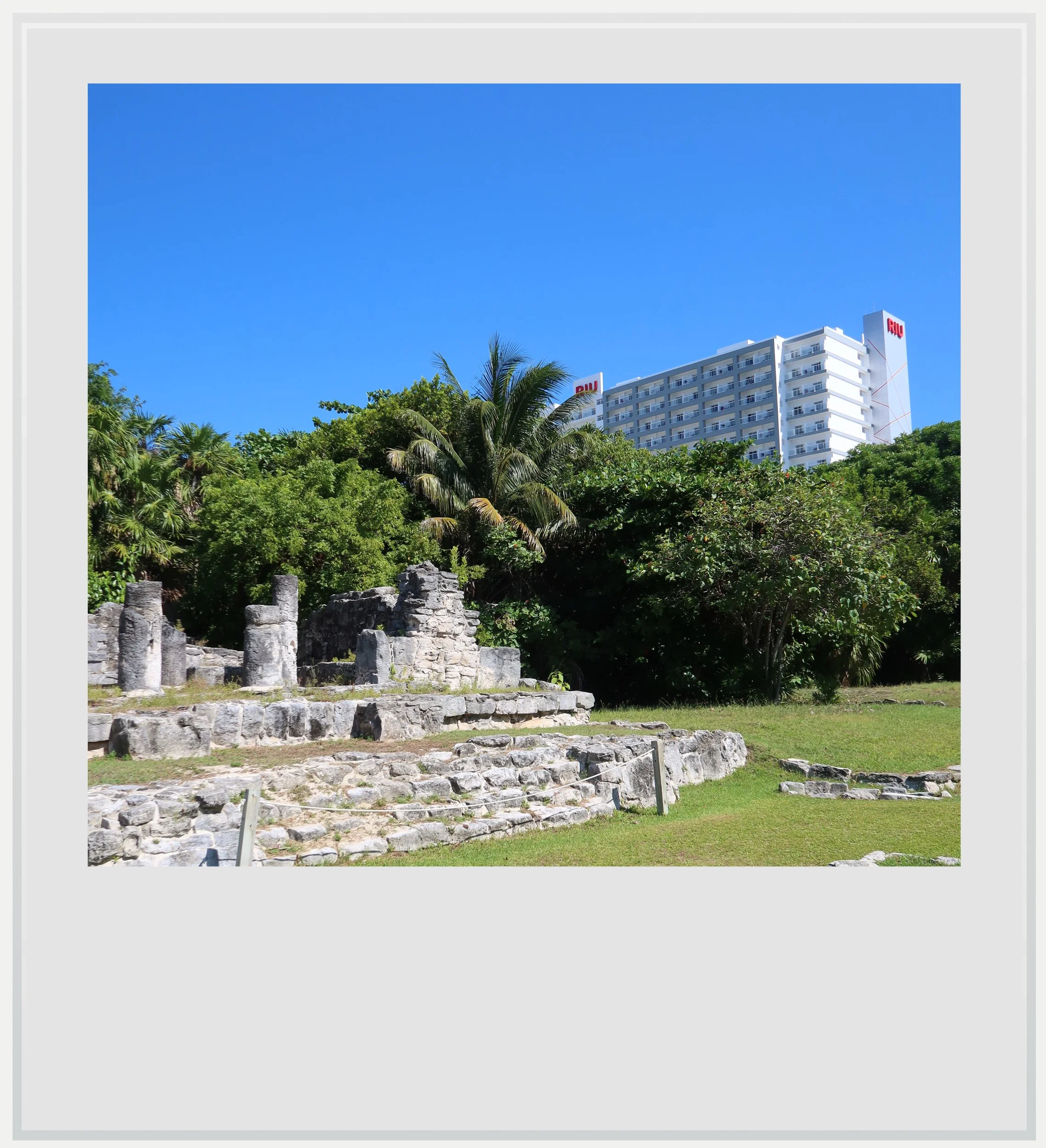
Hotel Zone’s resorts are never out of sight in El Rey.
My only regret was not being able to physically connect El Rey with its neighboring site of San Miguelito, a few hundred yards to the north. Kukulkan Boulevard, built with the Hotel Zone in the 1970s, was in the way. This boulevard was now the island’s spine and main thoroughfare, overshadowing the grand Maya avenue that, centuries before, might have played the same role.
It was bittersweet to think that, in the haste to build the new Cancun, one avenue partly destroyed the other. There was one redeeming feature I couldn’t ignore. Kukulkan Boulevard was initially named Bulevar Costero (Coastal Boulevard in English). Yet it became unofficially known as Kukulkan Boulevard, after one of the most important Maya deities, in the years after its inauguration.
Part of me loved to think that Maya cosmic forces might have surreptitiously intervened to change the name, to ensure that Cancun Island’s main highway still bore a connection to their world, after all.
Practical information
(Everything you need to know about visiting El Rey - updated August 2026)
In a nutshell
El Rey is a small Maya archaeological site hidden in plain sight in the middle of Cancun’s Hotel Zone. Its modest ruins belie what makes the site fascinating: an unusually clear urban layout, with ancient structures lining a long, straight causeway that offers a rare glimpse into Maya city planning.
Getting to El Rey
How to get to El Rey from the United States: El Rey, located within the Hotel Zone between the Caribbean Sea and the Nichupte lagoon, is probably one of the easiest Maya archeological zones to reach from the US or Canada. Many North American cities enjoy non-stop service to Cancun, at least seasonally. On a typical day in November, 25 cities in the US and Canada can be reached non-stop from the famous Mexican city.
How to get to El Rey from Mexico City: Mexico City to Cancun is one of the busiest air routes in Mexico, with more than 20 flights a day and three airlines (Aeromexico, Viva Aerobus and Volaris). The flight takes approximately 2 hours.
How to get to El Rey from Cancun airport: from the airport, El Rey is easy to reach by rental car (about 20 minutes) or by taxi (rideshare services are more complicated as Uber and the like are technically not allowed to pick up from any of the terminals). Google Maps directions are straightforward, and the archeological zone offers parking, although it is easy to miss.
It is also technically possible -though not easy or quick - to get to El Rey using public transport. From the airport, take an ADO bus to the Hotel Zone (MXN 160, every hour from 10am to 6pm, trip duration approximately 40-60 min depending on which terminal you arrive at). The ADO Shuttle has an official stop by the Museo Maya, right by another Maya archeological zone, San Miguelito. Cross Kukulkan Boulevard and wait for a southbound R1 or R2 local bus, and get off here for El Rey.
How to get to El Rey from the Hotel Zone: given its location within the Hotel Zone, this is an easy trip. If your hotel is close (Riu Ventura, Crown Paradise, Solaris) you may be able to walk to the Maya settlement. If not, a taxi or a quick bus ride on either the R1 or R2 line (frequent buses, MXN 12) will get you to it fairly quickly.
Can I visit El Rey on a tour: I wasn’t able to find many tours with a stop in El Rey, and the few that did stopped at the site as part of a bigger tour whose other stops may or may not be of interest to Maya ruins enthusiasts. That said, the old settlement is easy to get to, making it easy to visit independently.
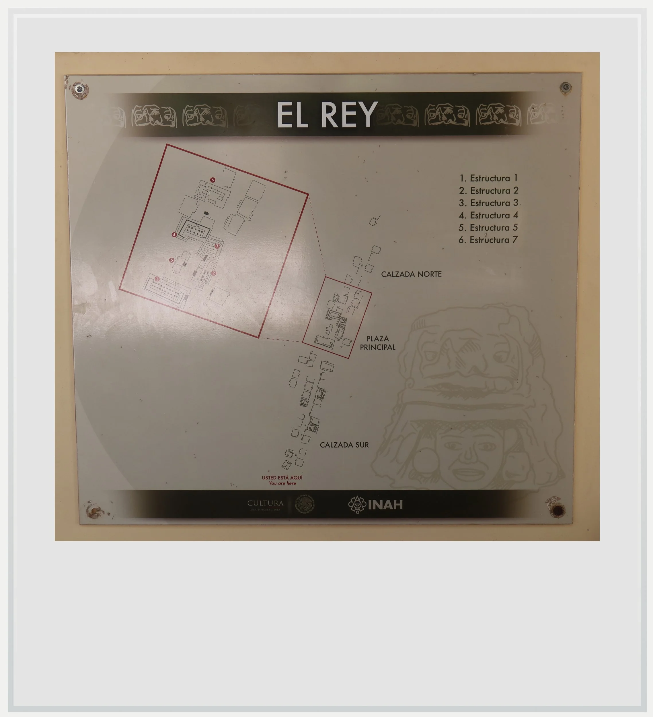
El Rey’s site map.
When to go to El Rey
The best months weather-wise to enjoy El Rey are during the dry season, between November and April. This is also peak season but the site doesn’t see a lot of visitors, so it is unlikely to ever get crowded.
What’s the best time of day to visit El Rey
The zone is organized on a north-south axis so the light should be your friend at any time of the day. Unlike nearby San Miguelito, El Rey isn’t located in a forest, and the lack of tree cover means a midday visit might get uncomfortable quickly. It is best to visit the site in the early morning or late afternoon.
How much does it cost to visit El Rey
At the time of my visit, the entry price was MXN 145 for foreigners and MXN 80 for Mexican citizens and legal Mexican residents, with proof of residency.
How long should I plan to visit El Rey
Plan to spend 30 to 45 minutes on site. The area is relatively small, with only a few noteworthy structures.
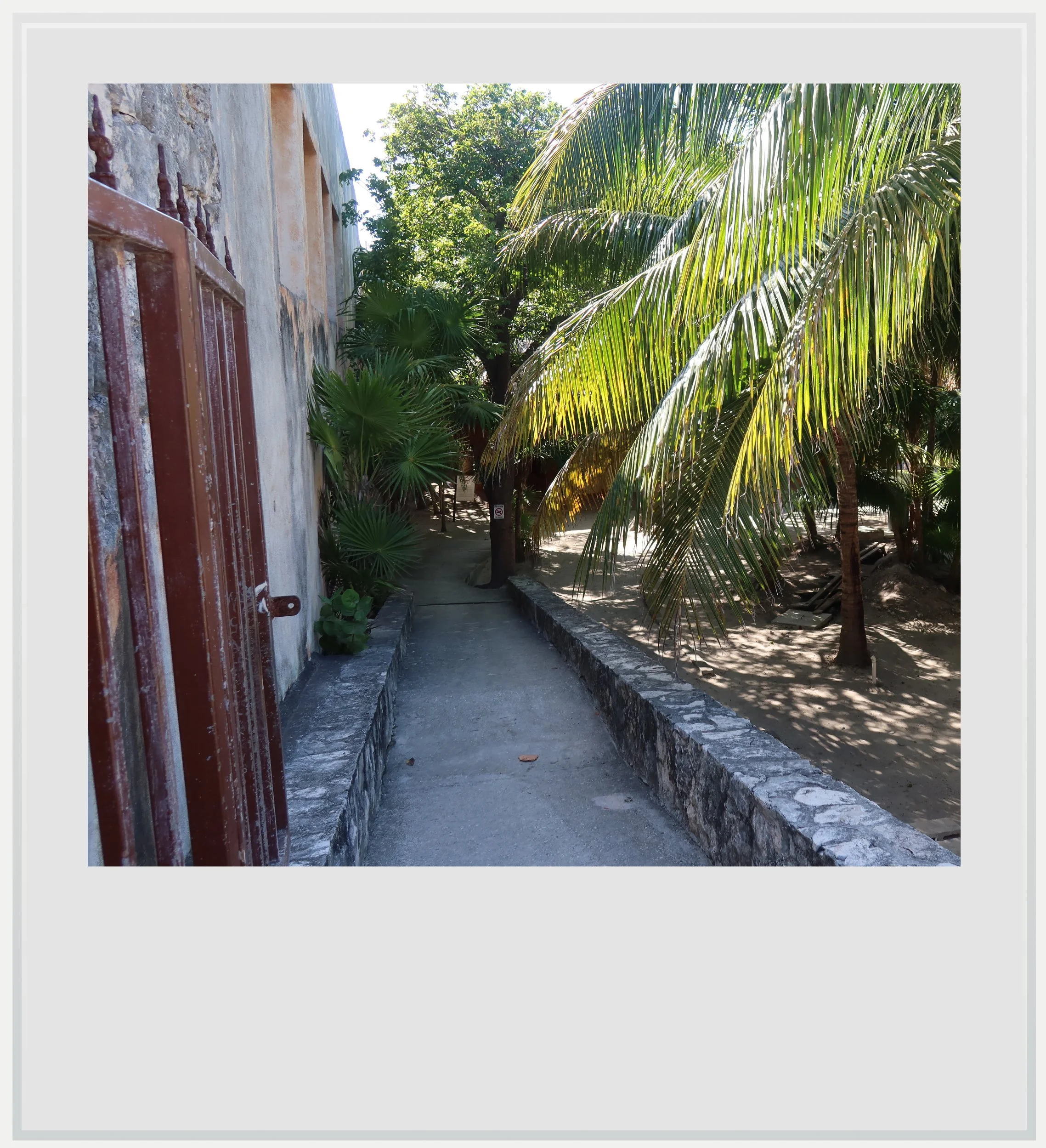
Getting past the old guard house at El Rey.
What are the opening times of El Rey
The site is open every day from 9am to 5pm (last entry at 4.30pm).
Safety at El Rey
The Yucatan peninsula is one of the safest areas in Mexico. The U.S. State Department currently classifies Quintana Roo as Level 2, meaning travelers should “exercise increased caution.” This is the same warning level as Mexico as a whole, and similar to the level assigned to several European countries such as France, Germany and Italy.
Quintana Roo, however, has been in the news because of a few highly publicized violent events in recent years, from a shooting at the Xcaret hotel in 2022 to the murder of a Canadian citizen in a Cancun gym in 2023.
In these highly publicized cases, it is understood tourists weren’t targeted and foreigners involved in these incidents had, according to Mexican authorities, links to organized crime. It would not be truthful to write Quintana Roo is a state devoid of violence, but it is also fair to observe that it is highly localized and extremely unlikely to affect a trip to the state.
Keep in mind these travel tips
Sunscreen will be your best friend. The UV index may be lower in the morning and evening, but during the day, it gets pretty high.
Do not forget to hydrate. OXXO and GoMart convenience stores are ubiquitous in and around Cancun, and always stock cold water and drinks. Make sure you always have water handy and drink regularly to make the heat more bearable.
Every photo caption appears when you hover over the image (on a computer) or click on it (on a smartphone).
All photos are mine and copyrighted.