Coba, Mexico.
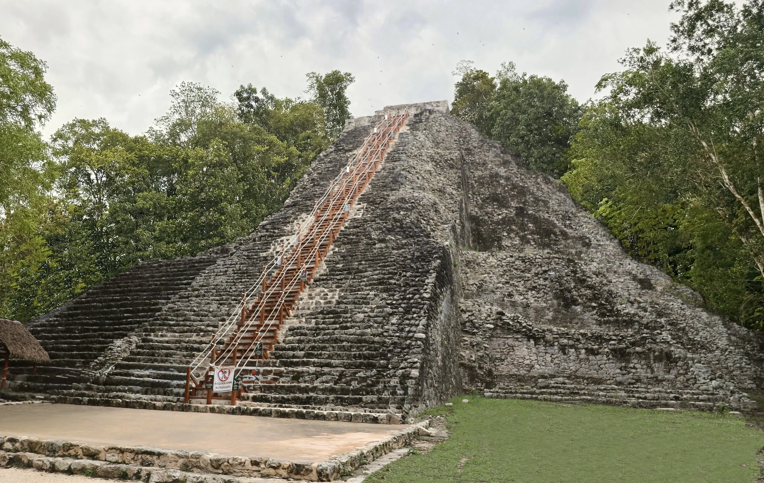
The Underappreciated Capital Between Maya Worlds.
Looking for directions or opening hours? Head straight to the Practical Information section.
As I was driving my rental car through the Yucatan tropical forest, I couldn’t really figure out if I was excited to discover Coba, or slightly peeved to make such a detour for what I imagined to be a nothing-special Maya archeological zone.
There isn’t much to do on the way to Coba. The ruins sit about halfway between Tulum, the buzzing Caribbean resort, and Valladolid, a lovely magical town in the eastern part of the State of Yucatan, in an area that’s very sparsely populated. The road was cutting through low jungle, as monotonously verdant and thick as the road was straight.
In my drive to visit all of the Maya world's officially recognized archeological zones open to the public, I knew I had to cross Coba off my list. But while pictures of sites like Uxmal or Edzna had captivated me and made me want to visit, Coba’s number one claim to fame, its tall pyramid, didn’t feel like such a draw. I was really going to Coba because I had been near Tulum, and it felt like the most logical site to see after the ones along the Riviera Maya.
The following morning, I parked my car on a vast parking lot, both unpaved and dotted with muddy potholes. There was a weird tension to the place. The car park and the surrounding stores were very basic yet the large parking area meant site traffic had to be high. I would have expected the infrastructure to follow the tourist numbers, but in Coba, that wasn’t the case.
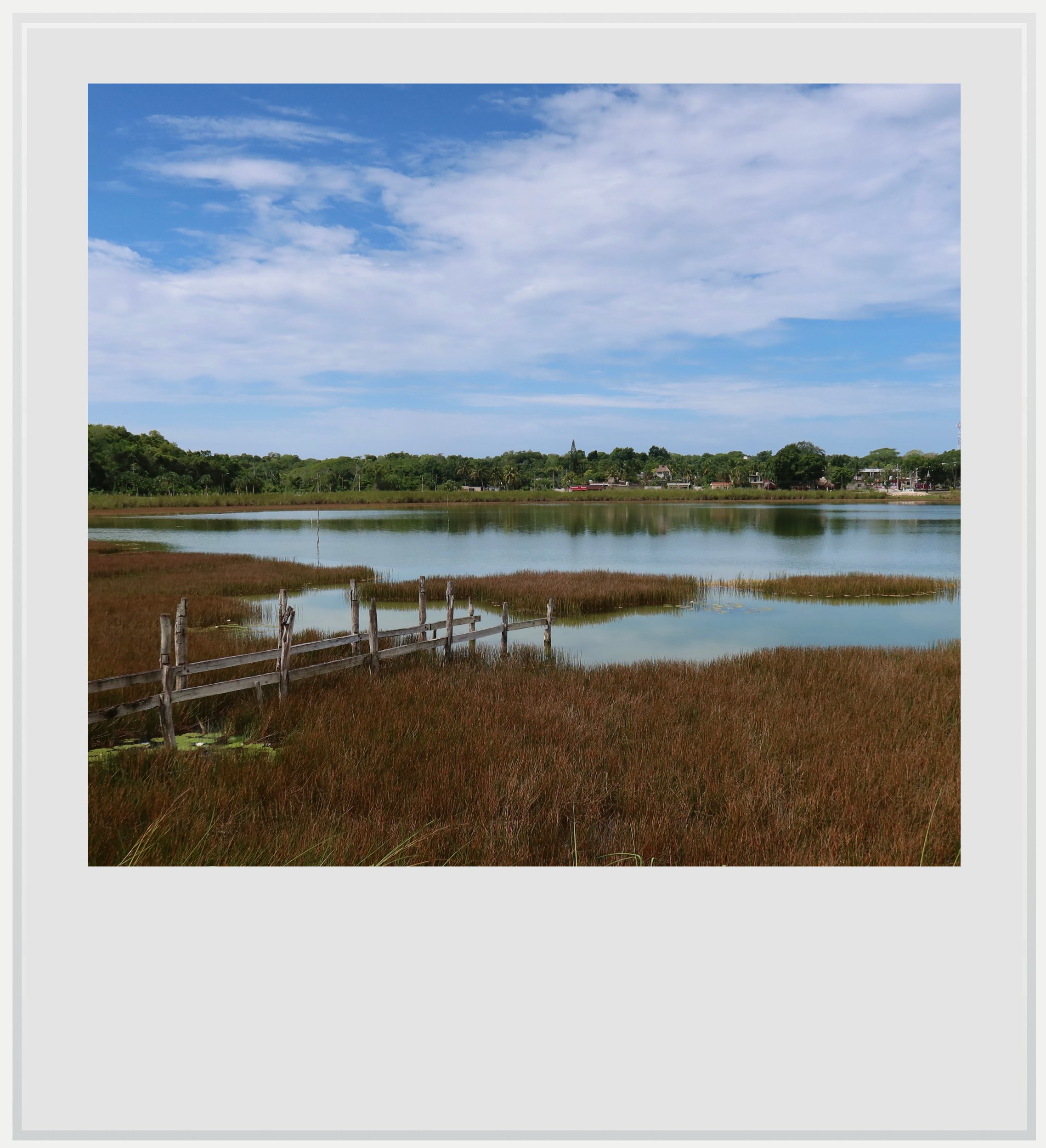
The Coba lagoon.
The time was 8am, and I was the only one to reach the ticket office this early. I would have the site to myself for a little while.
Around me, I could sense the anticipation of another busy day. The many restaurants and small shops selling souvenirs were getting ready to open and, inside the protected area, a number of rental bikes were lined up to be picked up.
I chose to walk, although the bike vendors kept hustling me. “It’s a 2-kilometer hike! It’s far!” I kept on walking and little by little, the forest swallowed me.
I noted the contrast between the tree cover and the jungle I had passed by on my way the previous day. Here, the forest wasn’t denser but taller, with the canopy reaching more than sixty feet (18 meters) in places. It also looked deeper, the green of the leaves darker and lusher. There was a sense I was deep among very old trees and I was careful to not disrupt them too much.
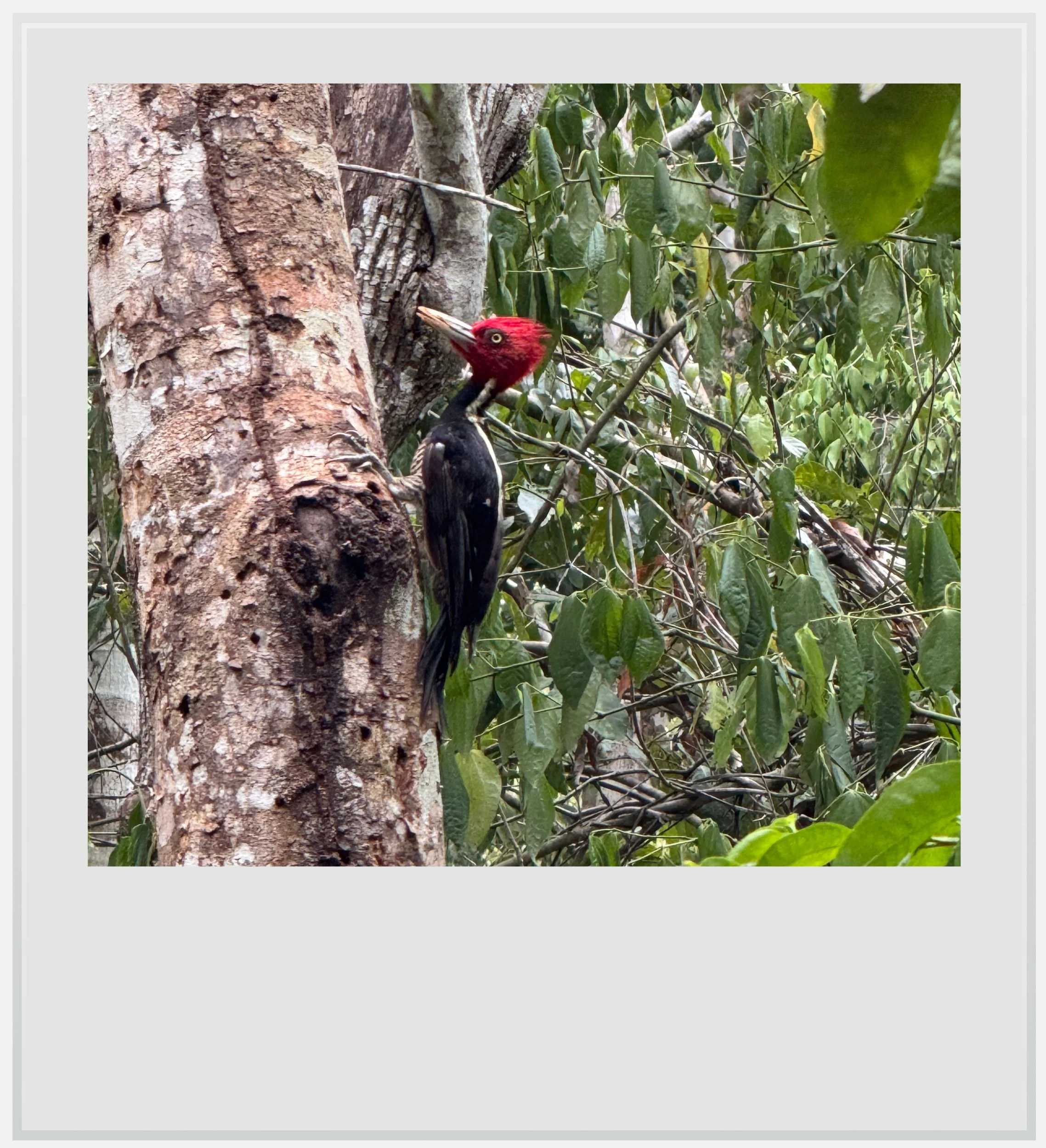
A busy woodpecker in the forest around Coba.
The birds did seem to mind a bit. I was likely the very first person to walk the shaded paths that morning, and I must have bothered a woodpecker enough for it to noisily voice its disapproval.
I wanted to start my visit with Nohoch Mul, the site’s most iconic pyramid. At the northern end of the archeological zone, it was part of a group of structures furthest from the entrance, but I had read it could get busy and, with a timed access system, wait times to climb the pyramid could get long. I was determined to take advantage of my early arrival to be the first at the top.
Coba was at the junction of many natural and cultural worlds.
Nohoch Mul (“great mound” in contemporary Maya) is famous for being one of the tall pyramids within easy reach of the Riviera Maya that visitors can still climb, although access had only recently been restored, after a 6-year hiatus due to restoration and protection work. At 138 feet (42 meters) above ground, the view over the surrounding tropical forest is superb.
As blasé as I was getting to Coba, the sheer size of the structure stopped me in my tracks. 138 feet tall had seemed relatively abstract until I stood in front of it. There, dwarfing the surrounding tropical forest, lay the tallest pyramid in Northern Yucatan. The second tallest, the Pyramid of the Magician in Uxmal, reaches 115 feet (35 meters). With a height of 98 feet (30 meters), Chichen Itza’s famous El Castillo doesn’t even make the top five.
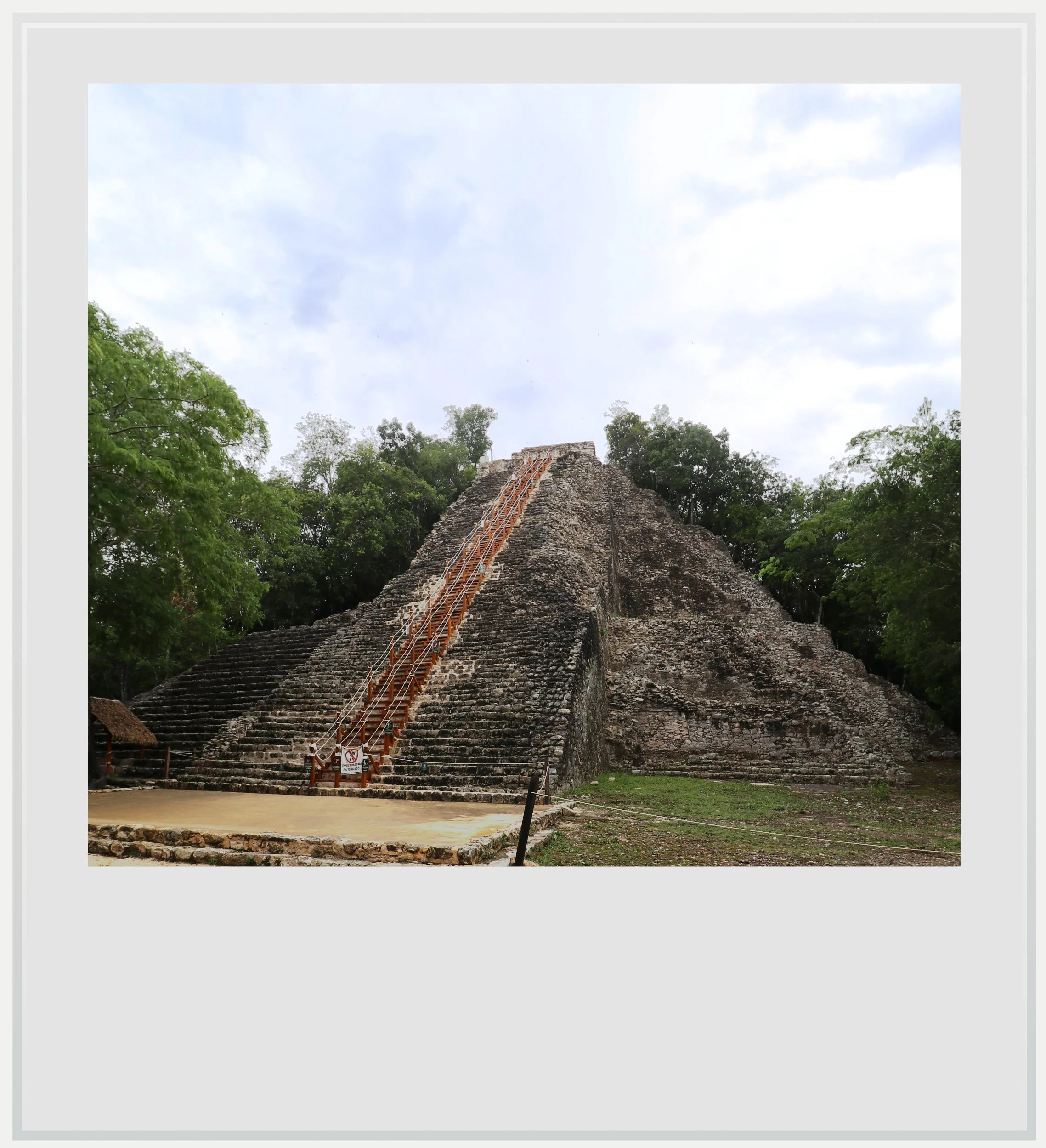
Nohoch Mul, Coba’s tallest structure.
Walking towards Nohoch Mul, I couldn’t shake off the feeling that I had seen this all before. It would occur to me, during lunch, that I had visited Coba more than 15 years ago, but this wasn’t what it was about. The tropical forest I had just walked through was a clue, but when I sat in front of the Nohoch Mul pyramid, it clicked. The monumentality. The grey stones. The deep forest setting. Coba reminded me of Calakmul.
Calakmul, one of the most important Maya capitals during the Classic period (250-900 AD), was about 215 miles away (350 km) to the west as the crow flies, deep in the eponymous biosphere reserve. I was less than an hour from Tulum and the cerulean Caribbean waters. This made no sense.
And yet. In their book Coba, A Classic Maya Metropolis, Folan et al. explain that “Coba […] is situated on a line that marks the ecological transition from the dry evergreen formation of northern Yucatan and the wet, tropical rain forest to the south.” I now had a logical explanation for the setting similarities.
Calakmul’s architecture was deeply influenced by the Peten style, whose most famous city is Tikal, in Guatemala. Could it be that Peten influence had reached Coba as well? The sheer height of the pyramid, its seven stepped levels and the very steep stairways seemed to confirm the Peten connection.
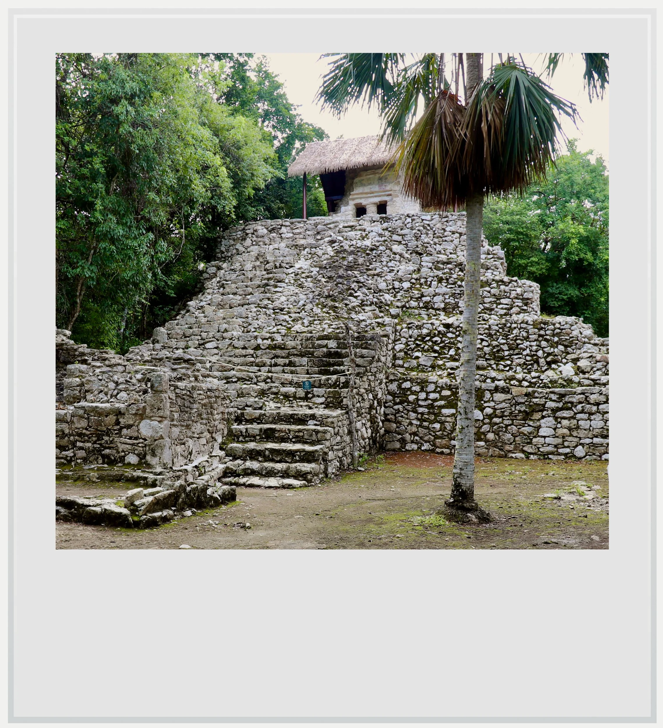
The Palacio de los Frescos, another example of structure mixing different styles.
Although various theories aim to explain the influence of Peten architecture over Coba, there is no consensus as to how it came to be. In Estudio de los Monumentos Esculpidos de Cobá, Quintana Roo, y su Contexto Arqueológico (2016), Esparza infers from a jadeite plaque belonging to a Coba ruler from the 7th century AD, found in Tikal and seen as a diplomatic gift, that there may have been an alliance between the two cities, possibly to counter the influence of Calakmul, then Tikal’s arch rival. Other scholars argue that the cities may have been linked by marital alliances.
Back in the present, I was indeed the first one to get to the base of Nohoch Mul (I was worried biking tourists would beat me to it, but that didn’t happen). I was so early that there was no one manning the access to the stairs leading to the top. I had to wait a few minutes for an INAH employee to arrive and let me up.
It was two hours past sunrise but the jungle looked like it was still half asleep. Small, foggy clouds were hanging above the canopy and a few birds were flying around silently. On top of the pyramid, it was as if I was watching the forest slowly getting ready for the coming heat.
The view reached far, all the way to the modern village of Coba and beyond, but I couldn’t discern any other Maya structure breaking the canopy ahead of me. Nohoch Mul seemed to be the only sentinel looking to the sky, and I imagined it to be a sort of celestial guardian for the settlement.
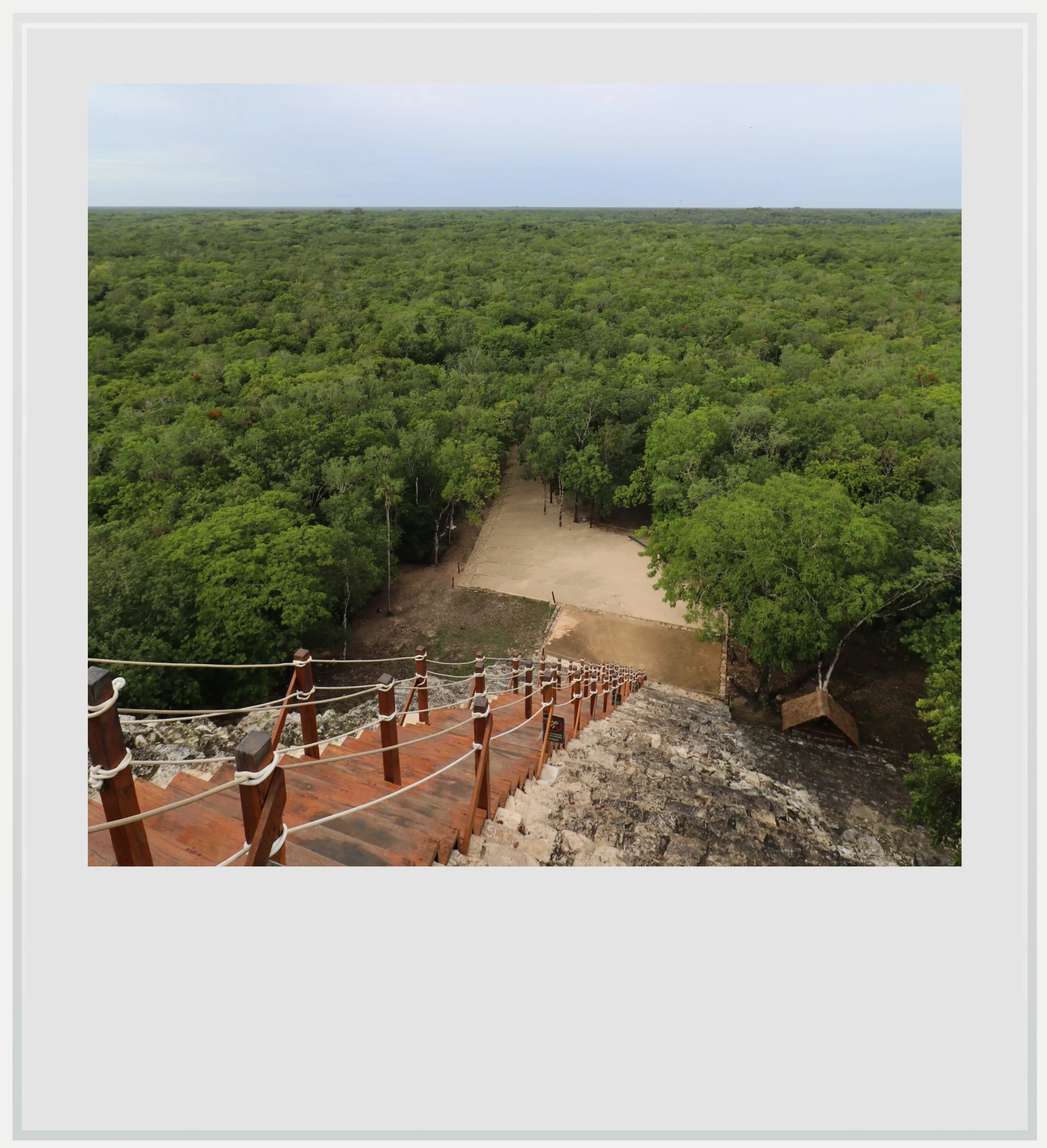
At the top of Nohoch Mul.
Being at the top not only gave me a sense of the immensity of the Yucatan jungle, but it blurred my previous understanding of Coba’s architecture. The temple at the top of Nohoch Mul shared features with classic Costa Oriental temples, the kind found at Tulum or Muyil, sans the supporting columns. We know it was built much later than the pyramid itself, during the Postclassic period (AD 900 to 1550). From below, the pyramid was clearly influenced by Peten. From the top, it became clear it was actually combining different architectural traditions.
It was a vivid reminder that Coba, just like many other Maya cities, lived through enough centuries that its buildings were adapted or built over, sometimes centuries later.
Coba’s buildings showed a mix of influences that I initially found disorienting given its geographical location.
As I came down, I saw the first flow of tourists getting to the waiting line. It was just a trickle, but I knew the line would get very busy in a few hours. Most people seemed to have decided, as I had, to start with the pyramid, which meant the rest of the site was still eerily quiet.
Walking south, I passed Xaibe, Coba’s most unexpected building: it is a four-level rounded pyramid without a temple at the top, whose role at the site is still unknown to archeologists. What has fascinated researchers for decades is that, on top of its unusual shape, the structure sits at the intersection of several sacbes, the ancient Maya’s raised causeways linking different parts of a settlement together and, in some cases, reaching further afield.
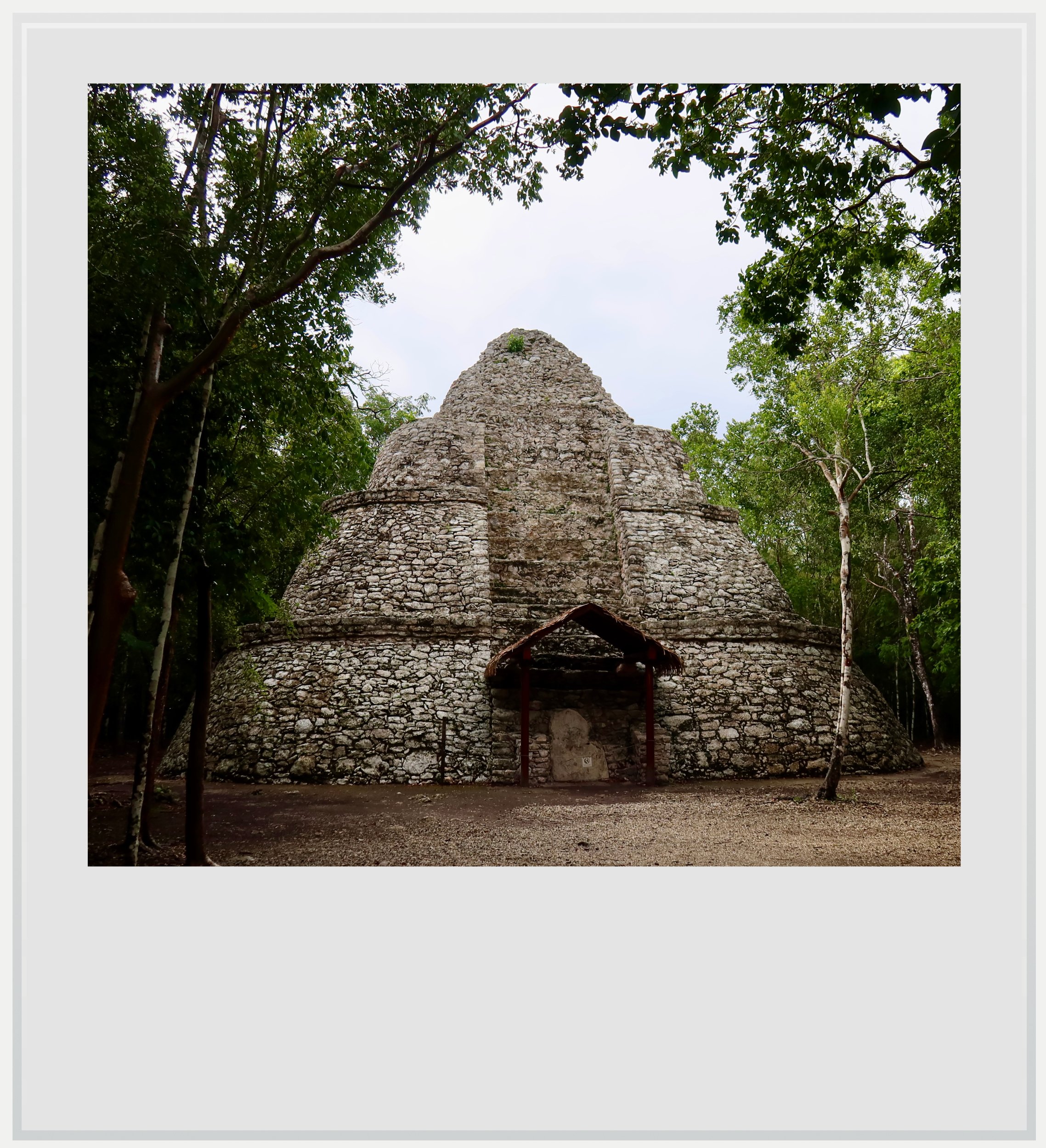
El Xaibe in Coba.
Coba is a great example of the latter. Its sacbe system, the largest known in the Maya world, was so extensive that its longest one reached Yaxuna, another settlement 62 miles (100 km) to the west, in Chichen Itza’s backyard. This helps illustrate how integrated Coba was into the wider region, given that sacbes helped the circulation of people and goods.
Looking at a map of Coba’s sacbe network is like diving into the geography of the city’s influence over a large part of northern Yucatan. More than 40 different sacbes have been identified, going into many directions.

Beyond these roads, Coba’s connections extended eastwards towards the Caribbean, where Xelha and Muyil are both believed to have been ports closely associated with it.
The thought of Coba’s extensive road network was inescapable as I was walking on sacbe 9, the widest on the site, leading to the Macanxob group. I briefly interrupted a coati’s morning search for food before getting to the structures. Much more modest in size, the group is believed to have served as a ritual place, and was where many of the site’s stelae were found. Stelae, large carved stones, are critically important to understand the Maya world as they provide names, dates and events, as well as depictions of deities or rulers.
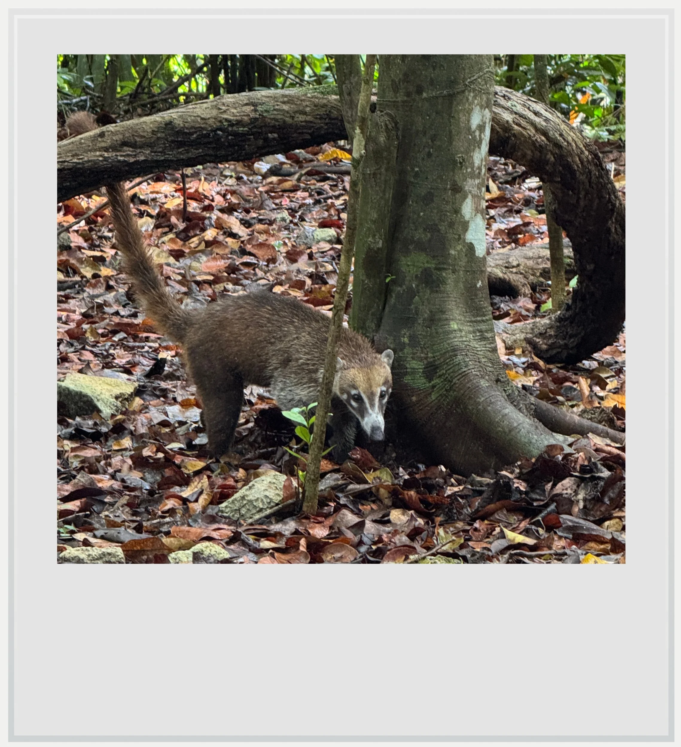
Oh! A coati.
Several stelae are exposed in the Macanxob group and although badly eroded, it is still possible to see richly dressed rulers on a few of them. Other stelae depict captives, which scholars interpret as evidence that Coba’s rise was linked to territorial expansion and conquest. The stelae bear dates from the 7th century AD, while Coba was at the height of its power.
As I was walking back to the exit, I hadn’t realized a group of buildings I had rushed by earlier would make for such an impressive ending. The Coba group, to the right of the site’s entrance, was the site’s largest group. It is believed that the original settlement started there, in a privileged location right between the Coba and Macanxoc lagoons. From there, six different sacbes radiate in as many directions. The group retains the solemnity of its role as Coba’s original core, and its building density only adds to it.
It was two hours past sunrise but the jungle looked like it was still half asleep.
The main anchor there is La Iglesia (The Church) pyramid. At 79 feet (24 m), it isn’t as tall as Nohoch Mul, but because there is less room to back away from it, the verticality mixed with the lack of perspective makes it equally impressive. Another example of Peten architectural influence, the edifice is less preserved than Nohoch Mul, but still a striking sight.
Exposed in front of the Church pyramid is Stela 11, which bears evidence of a conflict with a polity tentatively identified as Motul de San Jose, deep in the Peten region of Guatemala.
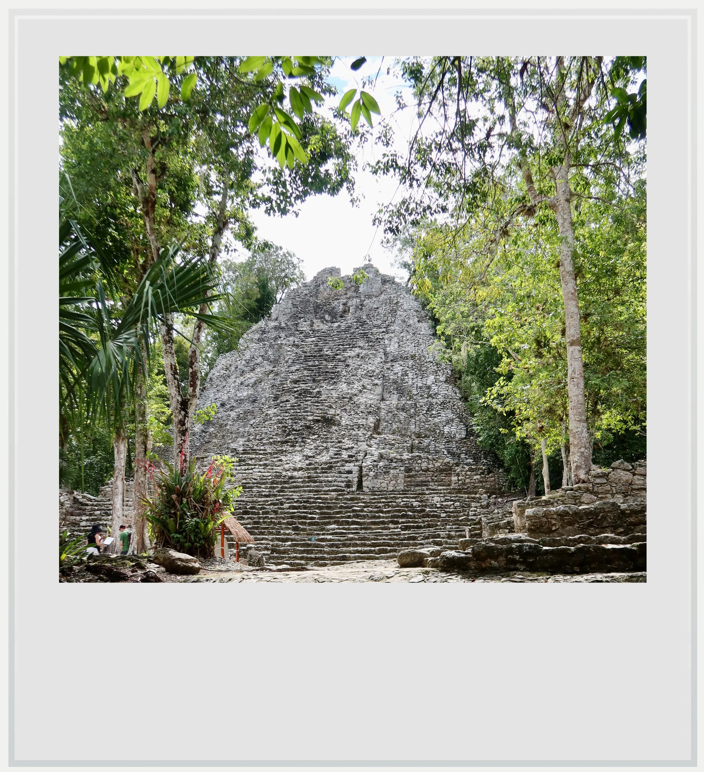
La Iglesia pyramid in the Coba group.
These additional links to the Peten and the location of the Coba group at the center of an early network of sacbes crystallized a feeling I couldn’t name until now. Coba’s buildings showed a mix of influences that I initially found disorienting given its geographical location. The fact is, Coba was at the junction of many natural and cultural worlds, which helped mold the city over time.
I wandered through the rest of the Coba group, taking in the other buildings and the ball court, before seeing the first group of tourists slowly making their way towards me. I knew this would be the end of my quiet enjoyment of the settlement, but I couldn’t blame others for wanting to walk through this underappreciated Maya city.
Coba may not have featured high on my list of sites to visit, but I knew, getting back in my car, that it would have a lasting impact on my understanding of ancient Maya culture. Beyond the scenic jungle views and massive pyramids, Coba is an extraordinary, if not immediately legible, expression of how far the power of a Maya capital could reach, and how these far-reaching connections could, in turn, shape the capital itself.
Once its pieces began to fit together, Coba became all the more striking.
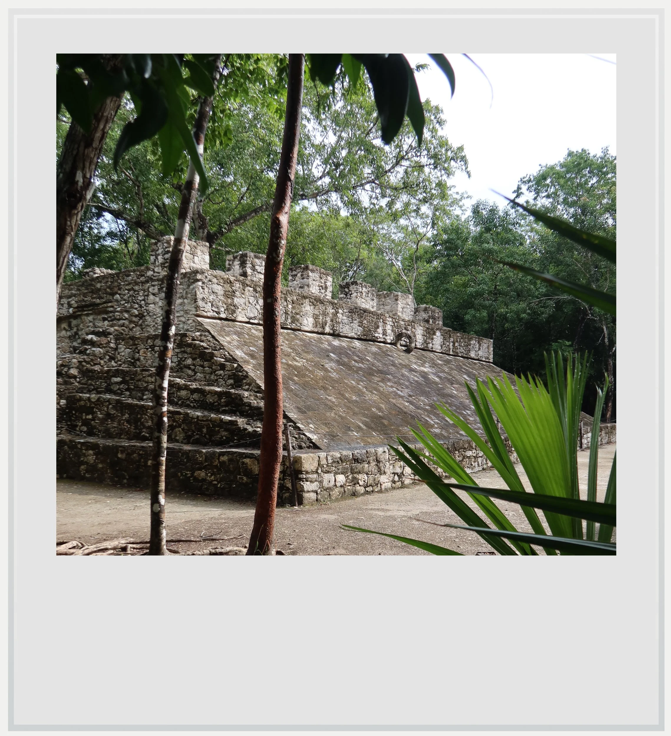
One of several ball courts in Coba.
Practical information
(Everything you need to know about visiting Coba - updated September 2026)
In a nutshell
Although monumental, Coba can initially feel difficult to read, with imposing pyramids and other structures scattered through dense forest and drawing on traditions from different parts and periods of the Maya world. At its height, it was one of northern Yucatan’s most powerful capitals, with connections extending across a remarkably wide region. Understanding how those connections also shaped Coba makes the experience even more rewarding.
Getting to Coba
How to get to Coba from the United States: Coba, located 29 miles (47 km) northwest of Tulum, a few miles off the well-maintained road between the resort town and Valladolid, isn’t especially hard to reach from the US. While the closest international airport, Tulum (TQO), is 80 minutes away by car, it only receives a few non-stop flights from the US per day (it is, however, the easiest option if flight times and prices work out). Cancun airport (CUN), 2 hours to the north, offers a lot more non-stop options from the US and Canada. On a typical day in November, 25 cities in the US and Canada have non-stop service to the famous Mexican resort.
How to get to Coba from Mexico City: Mexico City to Cancun is one of the busiest air routes in Mexico, with more than 20 flights a day, while the Mexico City to Tulum route offers a few daily flights, depending on the season. Flights take approximately 2 hours.
How to get to Coba from Cancun and Cancun airport: from the city, the Hotel Zone or the airport, the fastest way usually takes toll road 180D towards Merida (the signs should say “Merida Cuota” meaning “Merida via toll road”), until Los Aluxes, where you have to make a puzzling detour towards the road to Playa del Carmen before exiting the highway and getting on the old, free Highway 180 (trust Google Maps directions even if they don’t seem to make sense, I know I didn’t and I lost twenty minutes). In Nuevo Xcan, follow signs for Coba. There aren’t a lot of opportunities for gas or cold drinks on the way (but both are available in the village of Coba). The drive should take around 2 hours depending on your starting point and traffic.
How to get to Coba from Tulum: Tulum is the closest anchor point to Coba, and many tours for the great Maya city start from there. Follow directions towards Valladolid until you reach a huge roundabout featuring a giant billboard showcasing the main Coba pyramid, take the road towards Coba and you will be there in no time. The archeological zone is located at the southern edge of town, past the lagoon. The drive should take 45 minutes.
How to get to Coba from Tulum airport: Tulum airport is on the wrong side of the city of Tulum to reach Coba, and therefore the trip will take a little longer, about 80 minutes. From the airport, follow signs for Tulum and once in Tulum, signs for Valladolid (see above for directions from Tulum).
How to get to Coba from Merida or Valladolid: Coba can be reached from the capital of the state of Yucatan in about 2h30. The key is to get on the toll highway (Highway 180D) towards Cancun (road signs will say “Cancun Cuota”) and exit at Valladolid (Highway 295), get on the Valladolid ring road (Highway 180) and continue on this route until a turnoff towards Coba and Tulum just before Chemax. About 25 minutes after the turnoff, you will get to a huge roundabout and the village of Coba will be on the right, about 3 miles further. Bear in mind that Quintana Roo is one hour ahead of Yucatan all year long as it could impact your visit timing.
Can I visit Coba on a tour: there are many options available, from Tulum, Playa del Carmen and Cancun. Tours offering Coba usually include other stops to fill a full, sometimes intense day. A lot of these are heavily marked up so if you have your own transport, that option will be more economical. Also bear in mind the best time to enjoy Coba is at opening time (8am), before anyone gets there. Tour buses from Tulum start arriving at Coba around 9am, and those from Cancun around 10am. Coba can get busy but the site is large and outside of the entrance area and the famous Nohoch Mul pyramid, you’ll likely encounter very few visitors.
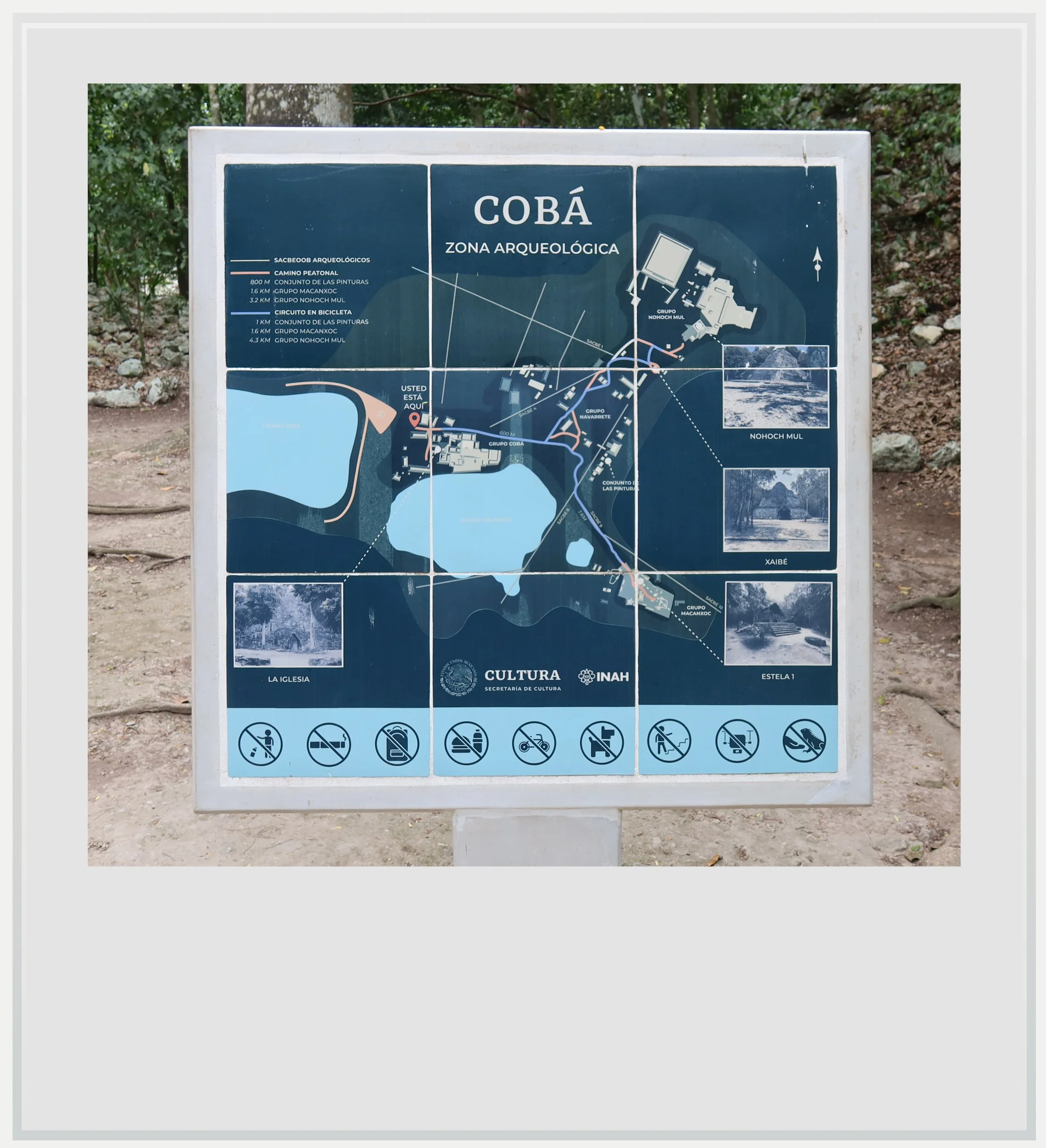
Coba’s site map.
When to go to Coba
Weather-wise, the best time to visit Coba is the dry season, from November to April. This is also peak season but the site is vast and, aside from the Coba group and the area around Nohoch Mul, the site is unlikely to feel crowded.
How much does it cost to visit Coba
At the time of my visit, the entry price was MXN 210 for foreigners and MXN 105 for Mexican citizens and foreigners with residency in Mexico (with proof of residency).
How long should I plan to visit Coba
Plan to spend two to three hours on site. It is easy to spend more time as the site is huge, and many of the paths offer a solitary experience, away from the crowds walking or biking on the main path between the entrance and the Nohoch Mul pyramid.
How busy does Coba get?
Although the 6th most visited Maya site in Mexico, Coba has seen an average of 538 visitors per day (in the latest YTD INAH figures). Given the size of the site, it is an entirely manageable number, especially if arriving early or late, avoiding the most crowded hours of the day (approximately 10am to 2pm). For reference, Tulum, less than an hour away, saw more than 1 million visitors in the full year 2025, or about 2,800 daily visits on average, on a much more compact site. A visit to Coba will therefore feel much quieter in comparison.
What are the opening hours of Coba
The archeological zone is open every day from 8am to 5pm (last entry at 4pm). Last access to Nohoch Mul is 3.30pm and it takes about 30 minutes to get there from the site entrance.
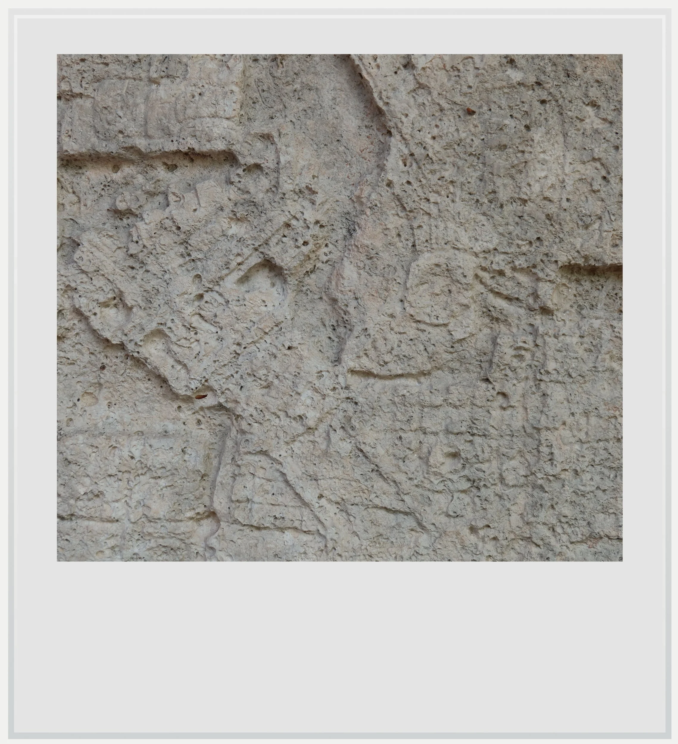
Detail of a stela in Coba. The outline of a face is visible in the middle of the image.
Can I climb the Nohoch Mul pyramid in Coba
Yes, the pyramid is accessible, although the conditions are very different from when I first climbed it in 2009 (back then, there were no access rules and no rope to help you on the way up). Today, climbing is limited to a group of up to 15 people every 15 minutes, and the line to get up can get quite long. The view over the Yucatan jungle is absolutely amazing, however, and totally worth the wait and arduous climb.
The pyramid has been equipped with wooden stairs, one for people climbing and one for people descending, with railings, which makes it easier to trek up and down - but it requires some effort, the pyramid is 138 feet tall (42 m) after all.
Officially, climbing is allowed from opening time (8am) until 3.30pm. I was the first on site the day of my visit, and no one was there to let me access the pyramid stairs until about 8.30am (which, in all fairness, is the time it takes an average tourist to get from the entrance to the pyramid). I was alone for a few minutes up there but when I climbed down, people were already lined up - and that was before the first tour buses arrived at the site. In other words, if you want to get to the top of the pyramid without too long a wait, get to the site early, or wait until 3pm, when most tour buses have gone.
Given how big Coba is, are there alternatives to walking the site
Absolutely. While it is absolutely feasible to walk the entire site, even in the hottest parts of the day, given the amount of tree cover, bike rentals and tuk-tuk rides are offered for people looking for an easier experience. Note that bikes and tuk-tuks can’t go everywhere and leave some approaches to be covered on foot. Both are available for a few dollars past the entrance gates.
Where to eat in Coba
I spent a full morning in the archeological zone and was happy to find El Cocodrilo, a modest restaurant on the short stretch of road along Coba lake between the village and the Maya site. Food was really good, affordable and payment with credit card was possible. I gave way too much of my meal to a curious dog who I am sure just happened to be passing by as my food was served. The scenery was relaxing and I was able to eat in the shade. I’d go back there in a heartbeat.
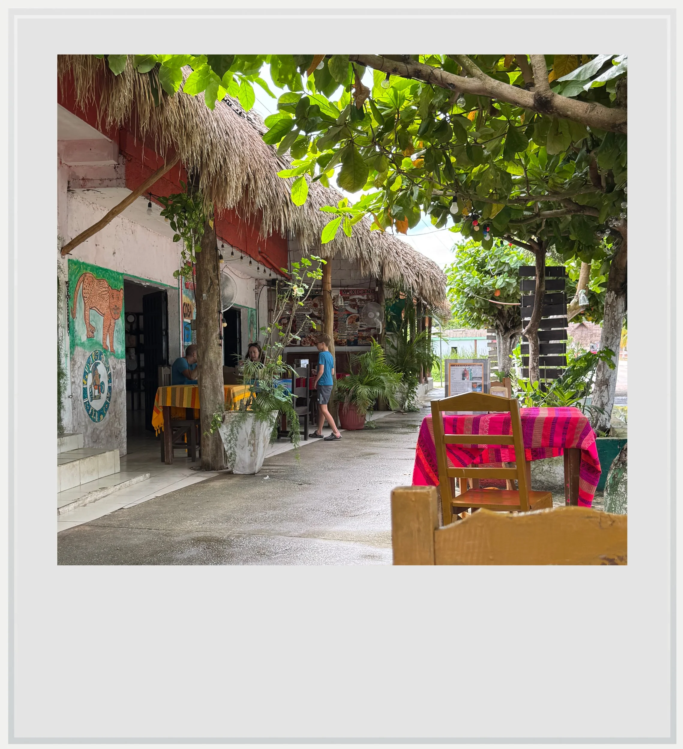
El Cocodrilo restaurant in the village of Coba.
Safety at Coba
The Yucatan peninsula is one of the safest areas in Mexico. The U.S. State Department currently classifies Quintana Roo as Level 2, meaning travelers should “exercise increased caution.” This is the same warning level as Mexico as a whole, and similar to the level assigned to several European countries such as France, Germany and Italy.
Quintana Roo, however, has been in the news because of a few highly publicized violent events in recent years, from a shooting at the Xcaret hotel in 2022 to the murder of a Canadian citizen in a Cancun gym in 2023.
In these highly publicized cases, it is understood that tourists weren’t targeted and foreigners involved in these incidents had, according to Mexican authorities, links to organized crime. It would be misleading to describe Quintana Roo as free of violence. The risk, however, is generally localized and extremely unlikely to affect an ordinary trip to the state.
Coba, although fairly remote, felt perfectly safe to visit. It sits by a tranquil village along a lagoon and has an official INAH presence. My scariest moment in Coba was seeing the signs warning visitors of the presence of crocodiles in the lagoon - sadly, I didn’t see any.
Keep in mind these travel tips
Sunscreen will be your best friend. The UV index may be lower in the morning and evening, but during the day, it gets pretty high.
I wasn’t bothered by mosquitoes in Coba, although I visited at the wettest time of the year (in August) and the site is close to two lakes and surrounded by forest. That doesn’t mean you can forego insect repellent, which is always a good idea deep in the Yucatan peninsula.
Do not forget to hydrate. OXXO and GoMart convenience stores are ubiquitous in and around Tulum, and stock cold water and drinks. Make sure you always have water handy and drink regularly to make the heat more bearable.
Every photo caption appears when you hover over the image (on a computer) or click on it (on a smartphone).
All photos are mine and copyrighted.