El Naranjal, Mexico
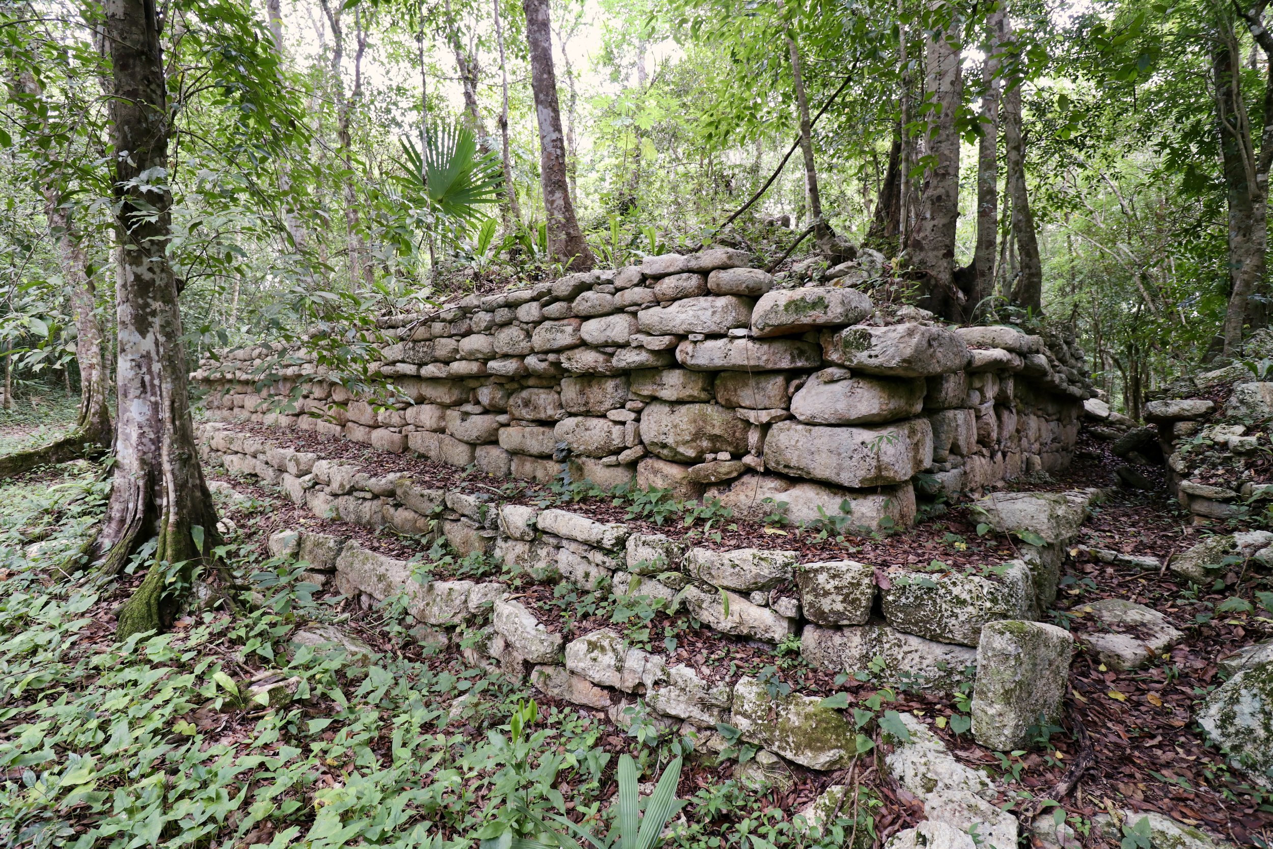
The Maya City that disappeared twice.
Looking for directions or opening hours? Head straight to the Practical Information section.
Author’s note: El Naranjal is a recognized Maya archaeological site, but it is not currently open to the general public by INAH, Mexico’s National Institute of Anthropology and History. I visited with a resident of the local community; access should not be assumed without prior local arrangements.
As I left the small village of San Francisco, deep in the Yucatan tropical forest, I kept wondering whether continuing on to El Naranjal was a good idea. A minute before, I had stopped by two policemen idling by and asked if there was any reason not to continue.
They had told me it was safe, with eyes that were half-asking if I was serious. I didn’t want to sound like the crazy-anxious tourist, but leaving the highway and driving twenty minutes on a small road leading to a tiny village, with no other way to exit than to turn back, made me feel like I had to double-check the safety of my destination.
The truth is, the hamlet of El Naranjal was probably the smallest, most humble Mexican village I had ever been to. Even a very remote outpost like Vicente Guerrero, in the heart of rural Campeche, felt like a busy metropolis next to it.
The village consisted of a wide square lined with modest, colorful houses. A bright yellow church anchored the southern street. That was pretty much it. Google Maps directions to the archeological zone took me to an unpaved road past the square, itself leading nowhere. I was stuck. I asked around for directions (and by that I mean I had to wake up a nice old lady from her afternoon siesta in a nearby hammock) and was told to try the last house on the gravel road.
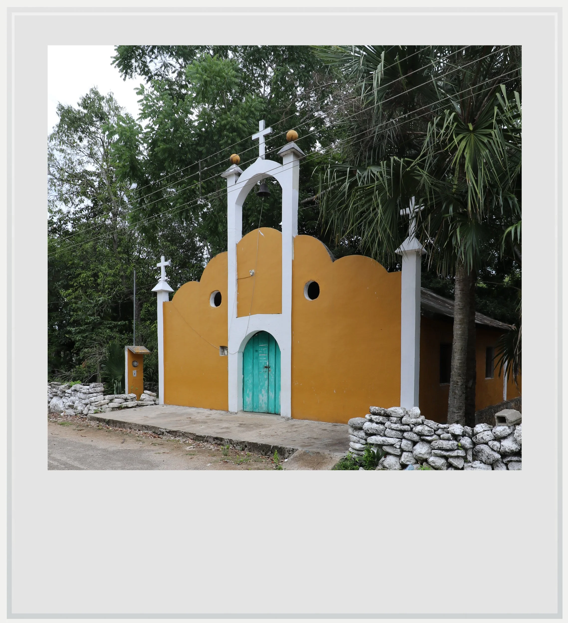
There is often a sense, in Mexico, that when everything seems to be stacked against you, luck will come your way. As I stopped my car at the very end of the path the woman had shown me, a man got out, shooed his barking dogs away, and asked how he could help.
A few minutes later, Eulegio was leading me through the forest surrounding his modest abode, using a machete to clear a path for us. He had looked at my outfit with a mix of amusement and concern - I was wearing a short-sleeved shirt, and that’s never a good idea when hiking through the jungle - but then he shrugged. It hadn’t rained in a few days, so there shouldn’t be any mosquitoes. I hoped he was right.
I was glad to be following him. I wouldn’t have been able to find the Maya ruins, let alone make it back to my rental car, without him leading the way. At some point, he stopped, turned to me and put a finger in front of his mouth. We stood still for a few seconds, and I noticed the canopy above us swaying in a way that could only mean one thing: monkeys.
Indeed, a few spider monkeys were jumping from branch to branch, seemingly oblivious to the humans below them. We let them pass, and resumed walking, daylight receding further as we walked deeper into the forest, until we got to what looked like a stone wall. I looked closer, and realized this was part of an ancient Maya monument, Structure 10.
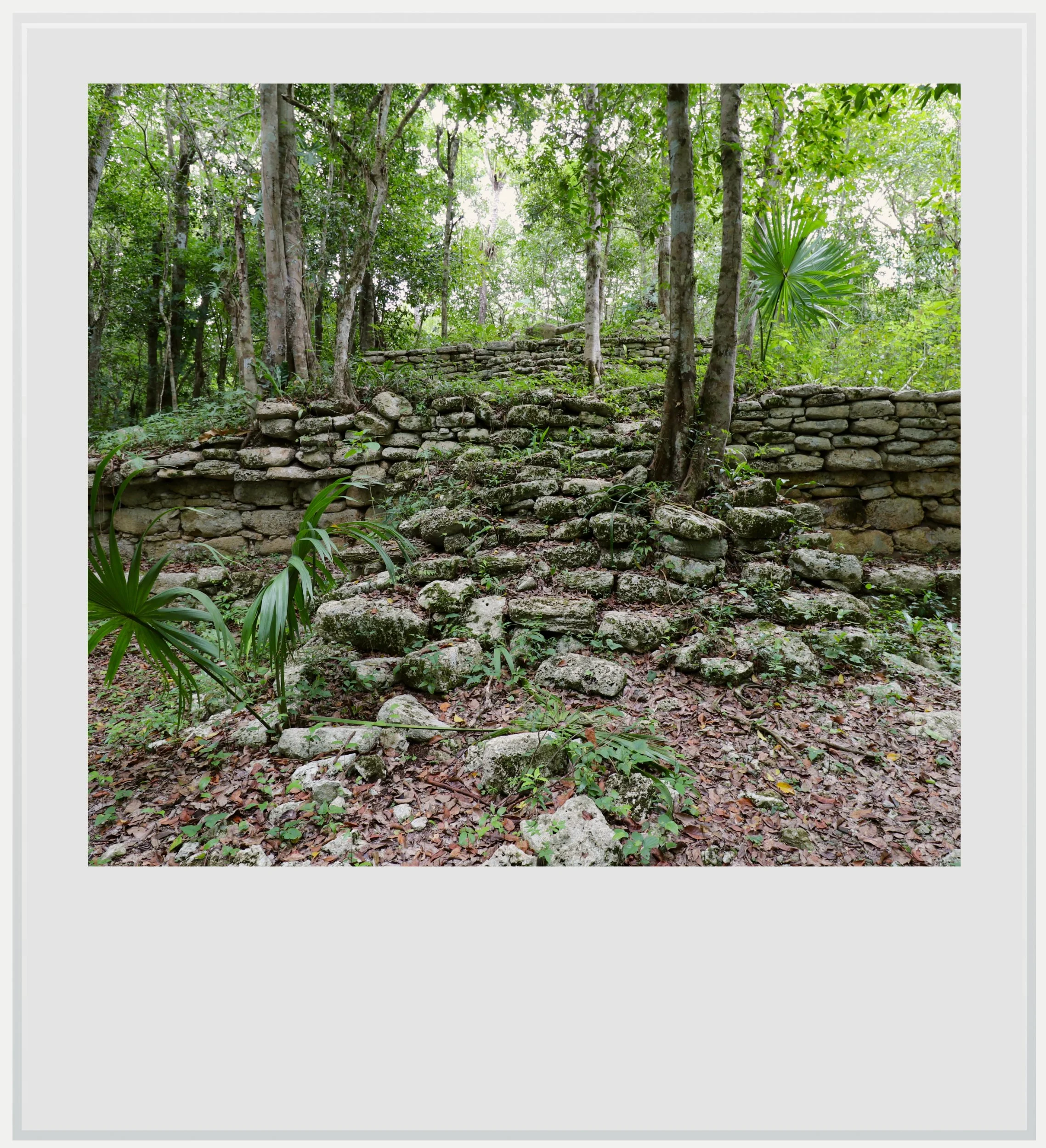
Part of the main group of buildings currently mapped out, Structure 10 stands out for a vaulted passageway that runs beneath the building’s monumental staircase. The staircase was hard to read, but the passageway, a rare feature in Maya architecture, impressive. It is believed to have once run the full length of the structure.
Coming out of it, I started to notice things that seemed oddly unusual in a Maya context. Beyond the fact that the structures were literally covered in vegetation and seemed to be losing their battle against it season after season, the remaining low walls on Structure 10 were built using much larger cut stones than I had seen at other sites, without mortar between them, and the structure’s corners were elegantly rounded.
It was hard to reconcile the historical significance of the area with the landscape in front of me.
These features are typical of the Megalithic architectural tradition and were fundamental to the archeologists’ understanding of El Naranjal. The settlement is located in a natural area of northern Yucatan called the Yalahau region, known for its high concentration of freshwater wetlands, in contrast with the much drier area around it.
This may help explain why the Yalahau region was settled relatively early: occupation is estimated to have started around 700 BC, when other cities nearby like Coba hadn’t yet developed. Its major demographic expansion is believed to have occurred during the Terminal Preclassic period, roughly between 75 BC and 400 AD.
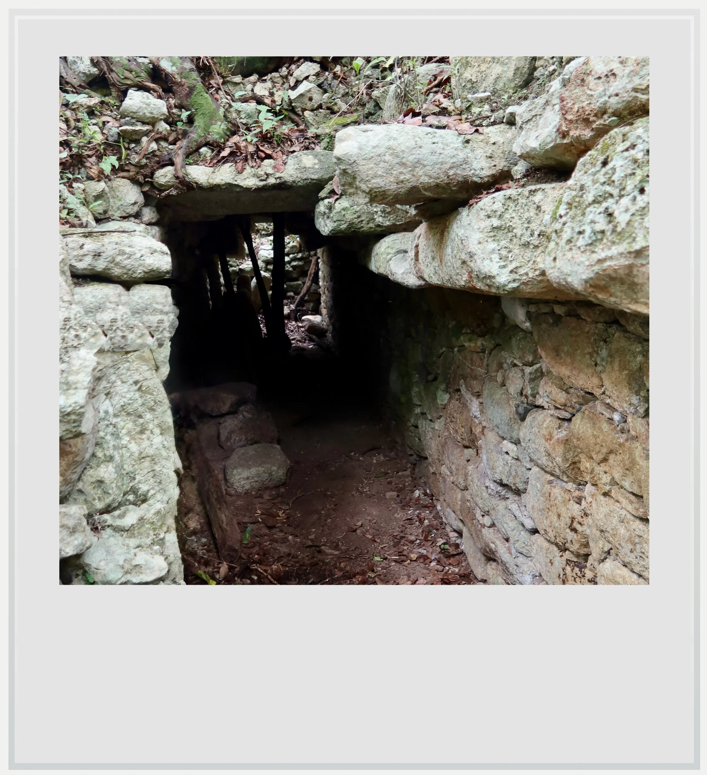
Structure 10’s vaulted passageway.
This is when El Naranjal developed into one of the most important Maya polities of the region. Like many Maya centers, El Naranjal later declined, its buildings gradually overtaken by the vegetation.
We continued walking through the jungle. I was amazed at how skilled Eulegio was at finding his way through the foliage. To me, the landscape offered no clues, but he saw paths I wasn’t able to read, and led me into another area, where a smaller building lay on a natural platform, topped by a tree.

Again, there wasn’t much in terms of monumentality, but the fact that these buildings were still there, buried in the forest and stumbled upon unexpectedly was more than enough to make this small expedition worthwhile.
The ancient city of El Naranjal began to emerge into the archaeological record during the twentieth century, with systematic mapping starting in the 1990s. INAH did some preservation work in the early 2000s - to maintain the site, rather than to open it up to tourism. Eager to develop their area, local residents then worked with INAH to manage the area themselves and offer community-based tours.
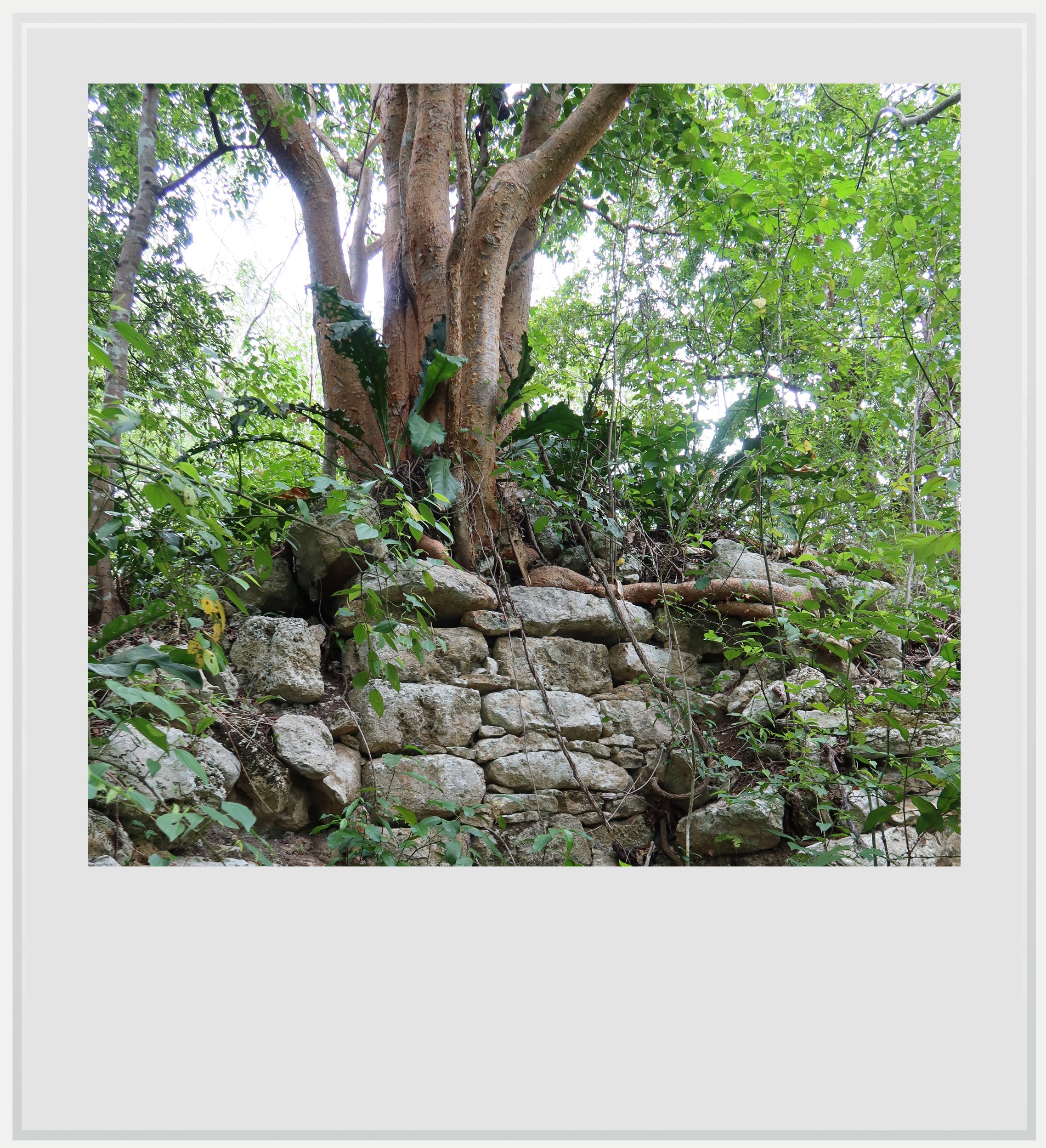
In the 2010s, a fledgling tourism operation started promoting the old Maya city alongside jungle trails and cenotes. The effort never gained traction, and COVID put an end to the experiment a few years later. This helps explain why the site felt overtaken by the forest. It was the physical legacy of a community-based program that had faded and never fully restarted.
In a sense, El Naranjal had disappeared twice: first beneath the forest after the ancient city declined, and then from public view after this attempt to bring it back had faded.
The community hasn’t given up, however, and in March 2026, Por Esto! reported on a local initiative to get federal funding to restart a tourism project.
I imagined that perhaps what El Naranjal needed was context as much as preservation, something community-led tours could provide. It was hard to reconcile the historical significance of the area with the landscape in front of me. Its importance became obvious only once I understood what I was looking at, not from the ruins themselves.
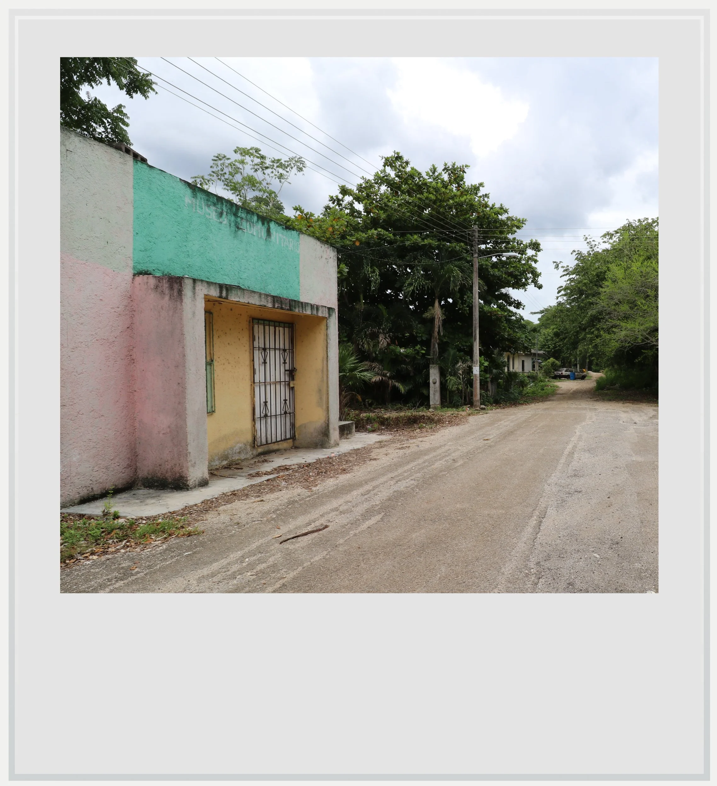
The community museum and the unpaved road leading to the ruins.
One possible explanation for why sites like El Naranjal struggle to attract investment can be read in the visitor numbers for Maya sites across the Yucatan Peninsula. The most visited sites in the region tend to share one characteristic: visually impressive monumentality. From Chichen Itza and its Castillo to Uxmal and its Pyramid of the Magician to Coba’s Nohoch Mul, all of them showcase stunning structures likely to make visitors reach for their cameras.
El Naranjal isn’t about that - at least judging from the structures uncovered so far. Its interest lies instead in the role it may have played during the Late Preclassic, a much less understood period of Maya history.
While I found the site visually underwhelming, I hope that one day its historical importance will be recognized and receive the investment it deserves.
Practical information
(Everything you need to know about visiting El Naranjal - updated September 2026)
In a nutshell
El Naranjal is a little-visited Maya settlement in northern Quintana Roo whose modest, heavily forested ruins hide its importance during the Preclassic period. Known for its unusual Megalithic architecture, the site was once the focus of a small community-tourism project that local residents hope to revive. El Naranjal is not currently operated by INAH as an archaeological zone open to the general public, so visitors should not arrive without making prior arrangements locally.
Getting to El Naranjal
How to get to El Naranjal from the United States: El Naranjal, between Valladolid and Cancun, a few miles off the main highway, isn’t especially hard to reach from the US, although you will most likely need a rental car. Cancun airport (CUN), 90 minutes east via a well-maintained toll highway, offers many non-stop options from the US and Canada. On a typical day in November, 25 cities in the US and Canada have non-stop service to the famous Mexican resort.
How to get to El Naranjal from Mexico City: Mexico City to Cancun is one of the busiest air routes in Mexico, with more than 20 flights a day. Once in Cancun, follow the instructions below.
How to get to El Naranjal from Cancun and Cancun airport: from the city, the Hotel Zone or the airport, the fastest way usually follows toll road 180D towards Merida. The signs should say “Merida Cuota” (“Merida with toll”). Continue until Los Aluxes, where you have to make a puzzling detour towards the road to Playa del Carmen before exiting the highway and getting on the old, free Highway 180 (trust Google Maps directions even if they don’t seem to make sense, I know I didn’t and I lost twenty minutes). In Ignacio Zaragoza, turn left right after the red and white Los Arcos building, then follow the road until San Francisco, where you will turn left just above the covered central market. Drive a few more miles on a road that isn’t well cared for, so watch for potholes, and you will get to the central square of El Naranjal, a modest hamlet. At the end of the zocalo, there is a sign for the archeological zone. Park in the area and ask around for the museum, where someone may help you out with directions or find a local resident to bring you to the ruins, which lie about a few hundred yards from the central square. There are no services available in the village of El Naranjal. Your best bet for drinks, snacks or gas will be Ignacio Zaragoza. The drive from the Cancun area should take around 90 minutes.
How to get to El Naranjal from Merida or Valladolid: El Naranjal can be reached from the capital of the state of Yucatan in about 3 hours. The key is to get on the toll highway (Highway 180D) towards Cancun (road signs will say “Cancun Cuota”) and exit at Los Aluxes, where you have to make a puzzling detour towards the road to Playa del Carmen before exiting the highway and getting on the old, free Highway 180 (trust Google Maps directions even if they don’t seem to make sense, I know I didn’t and I lost twenty minutes). This looks like a big detour on the map, but the toll highway is much faster than the regular Highway 180, which crosses through villages and is strewn with topes, the notorious Mexican speed bumps. In Ignacio Zaragoza, turn left right after the red and white Los Arcos building, then follow the road until San Francisco, where you will turn left just before the covered central market. Drive a few more miles on a road that isn’t well cared for, so watch for potholes, and you will get to the central square of El Naranjal, a modest hamlet. At the end of the zocalo, there is a sign for the archeological zone. Park in the area and ask around for the museum, where someone may help you out with directions or call a local resident to bring you to the ruins, which lay about a few hundred yards from the central square. There are no services available in the village of El Naranjal. Your best bet for drinks, snacks or gas will be Ignacio Zaragoza.
Can I visit El Naranjal on a tour: given its status as a recognized INAH archeological zone that isn’t open to the public, El Naranjal doesn’t feature on global tour platforms. In practice, a rental car is the easiest way to reach the site.
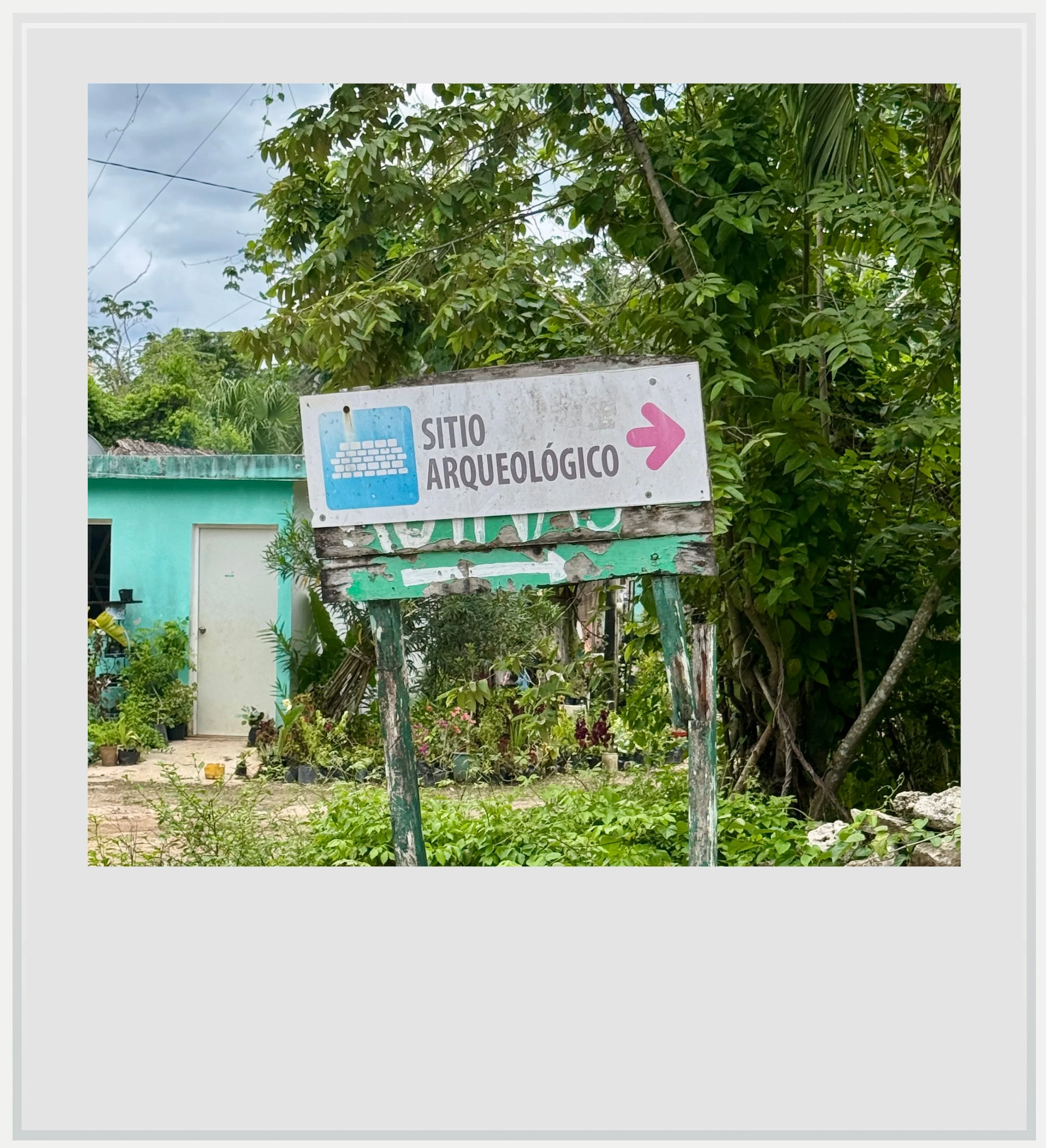
The one sign for the archeological zone in El Naranjal.
How to visit El Naranjal
El Naranjal is not currently an archaeological zone formally open to the public. The ruins lie in the forest around the community, and independent access should not be assumed. Visitors interested in seeing the site should arrange their visit locally and enter with a community guide rather than attempting to find the structures on their own.
Once in the village, check out the community museum by the church on the main square and ask for a local resident to show you the way. If the museum is closed, ask around. People will likely be happy to help you out. While it may be tempting to try to go at it alone, I strongly advise seeking a guide: the ruins aren’t very easy to find and the forest area can be treacherous if you don’t know your way around. I only saw monkeys while I was there but my guide reported seeing creatures much less friendly.
It is customary to tip your guide at the end of the visit.
When to go to El Naranjal
Weather-wise, the best time to visit El Naranjal is the dry season, from November to April. Given that the site isn’t officially open to visitors, you and your guide will likely be alone among the ruins.
How much does it cost to visit El Naranjal
There is no cost associated with a visit to El Naranjal except a generous tip for the local resident willing to show you around and, if you’re lucky, share a little of the history of the place.
How long should I plan to visit El Naranjal
The whole site is believed to be much bigger than the small area that one can visit from the village of El Naranjal, but what’s accessible is a fairly small area that can be toured in about 30 minutes.
Where to eat and drink near El Naranjal
The village of El Naranjal is tiny and there isn’t any obvious store I’d recommend to grab snacks, let alone food. Your best bet will be the village of Ignacio Zaragoza, 20 minutes to the north, on the old Highway 180, where you will be able to find snacks, drinks and gas.
Safety at El Naranjal
The Yucatan Peninsula is one of the safest areas in Mexico. The U.S. State Department currently classifies Quintana Roo as Level 2, meaning travelers should “exercise increased caution.” This is the same warning level as Mexico as a whole, and similar to the level assigned to several European countries such as France, Germany and Italy.
Quintana Roo, however, has been in the news because of a few highly publicized violent events in recent years, from a shooting at the Xcaret hotel in 2022 to the murder of a Canadian citizen in a Cancun gym in 2023.
In these highly publicized cases, it is understood that tourists weren’t targeted and foreigners involved in these incidents had, according to Mexican authorities, links to organized crime. It would be misleading to describe Quintana Roo as free of violence. The risk, however, is generally localized and extremely unlikely to affect an ordinary trip to the state.
The main risks at El Naranjal aren’t really the same as the ones listed above, which apply mostly to the urbanized coastal area. The village is fairly remote, with just one road coming in and out of it, and no cell service, so a flat tire or anything of the sort could quickly spiral (check local cell coverage here, and use the drop down menu to find your operator).
The second possible risk to be aware of is wildlife. While you are highly unlikely ever to see a puma this close to a village, the jungle is full of other, smaller species that could cause harm, all the way down to mosquitoes. I went into the forest after a spell without rain, and therefore mosquitoes weren’t an issue, but they usually are, so be prepared.
Keep in mind these travel tips
Sunscreen will be your best friend. The UV index may be lower in the morning and evening, but during the day, it gets pretty high. In the forest near the ruins, the canopy offers some protection from the sun, but once you’re out from under it, sun protection is recommended.
I wasn’t bothered by mosquitoes in El Naranjal, although I visited at the wettest time of the year (in August). That doesn’t mean you can forego insect repellent, which is always a good idea deep in the Yucatan Peninsula.
Do not forget to hydrate. OXXO and GoMart convenience stores aren’t present in this more rural part of the state, but small abarrotes (modest stores selling basic necessities) can be found in the villages along Highway 180. Plan accordingly. Make sure you always have water handy and drink regularly to make the heat more bearable.
Every photo caption appears when you hover over the image (on a computer) or click on it (on a smartphone).
All photos are mine and copyrighted.