Xamanha, Mexico.
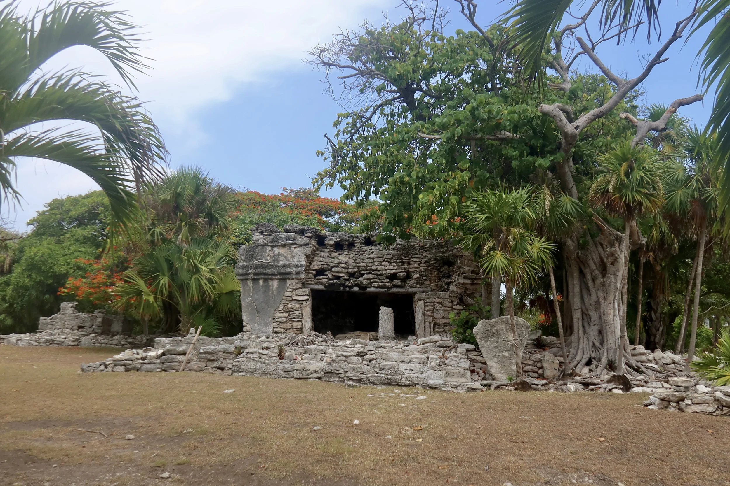
Fragments of a Maya city woven through Playacar.
Looking for directions or opening hours? Head straight to the Practical Information section.
I wasn’t exactly sure what I was going to find in Xamanha, a Maya archeological zone in Quintana Roo, Mexico. Reviews online were sparse: the area doesn’t get as much attention as other nearby sites like Tulum or Muyil. The actual ruins seemed to be inside a gated community, Playacar, which added to my hesitation. Were these real?
I got to find out pretty quickly. Following Google Maps directions to Playa del Carmen, I eventually turned right by a modern mall to get into Playacar, and was stopped by a barrier preventing further access. The guard explained I couldn’t get into the resort by car if I wasn’t a resident or a hotel guest, but could park nearby and walk in.
The Xamanha ruins are located a few minutes from downtown Playa del Carmen and the adjacent pier for ferries to Cozumel. There is plenty of parking for day trippers to the island. I picked the closest car park, left my car there and walked back into the resort.
I usually don’t like to read much about ancient Maya cities before getting to them. I like the idea of letting them reveal themselves in front of me, without expectations. It turned out it would be a mistake at Xamanha, but as I was walking towards the gated entrance, I didn’t know it yet
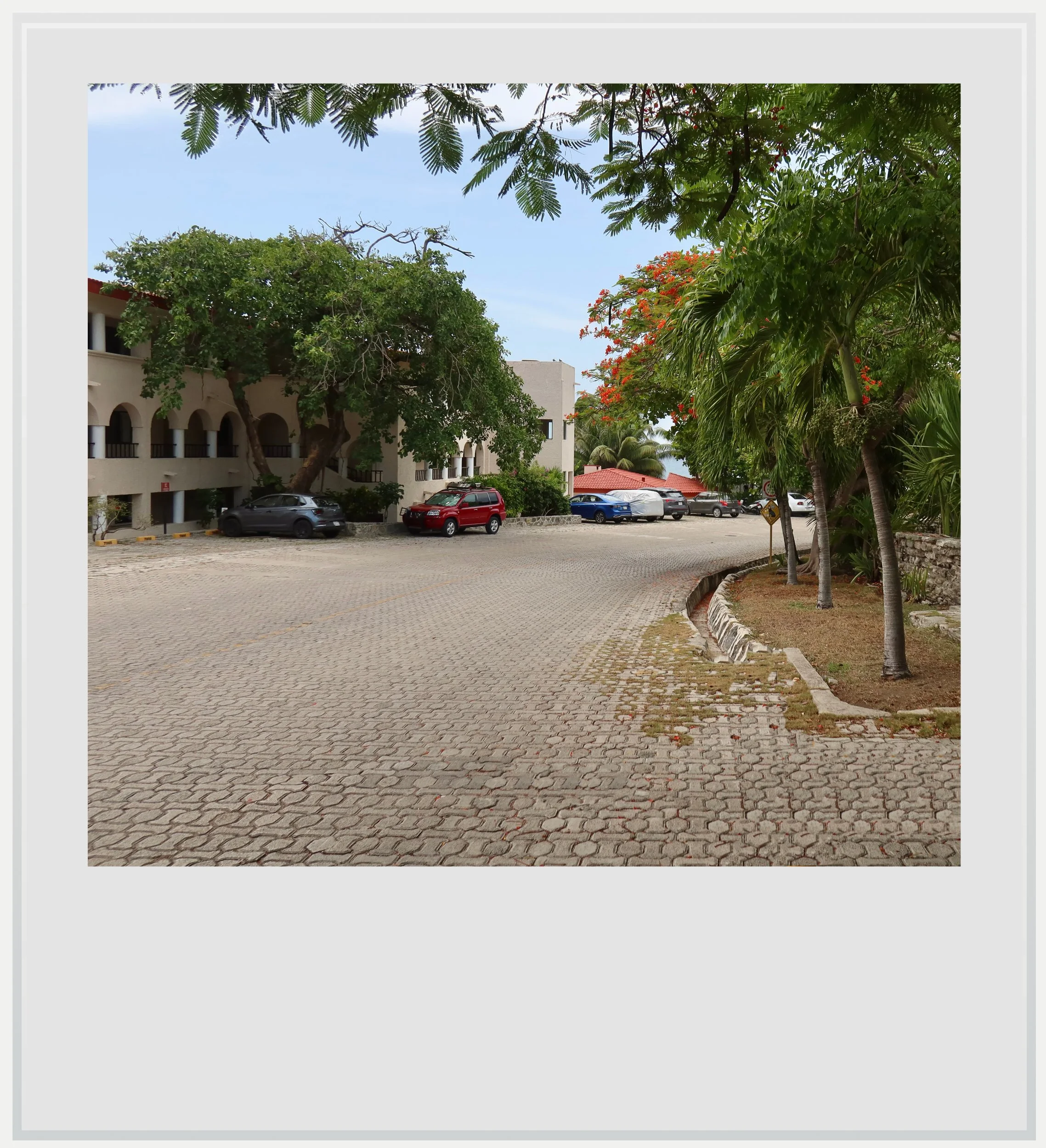
Inside Playacar on the way to Group C.
Walking along calle Bahia del Espiritu Santo, I felt a little bit of a disconnect. I was surrounded by elegant low-rise buildings set amid lush vegetation. Around me, people were leisurely walking to the nearby beach. I wasn’t expecting Maya structures to emerge from this postcard-perfect beach resort atmosphere.
And yet, as the street veered left, the first buildings appeared to my right, in an otherwise empty lot that contrasted with the hotels around it. I had visited Maya archeological zones in Cancun a few days earlier, and remembered feeling slightly oppressed by the towering, gleaming-white hotels pressing in just beyond them.
I was no longer looking at a small Maya outpost within a sprawling resort.
Here in the Playacar development, the cohabitation between old and new felt harmonious, as if the buildings around the Maya ruins had been designed to integrate with the landscape.
I had arrived at Group C. It turned out to be the most important group within the development, but at that moment, I had no idea. I passed the lot’s small stone wall and got closer. Structure C1 is the most impressive and, according to INAH (Mexico’s National Institute of Anthropology and History), the biggest building in the whole archeological zone.
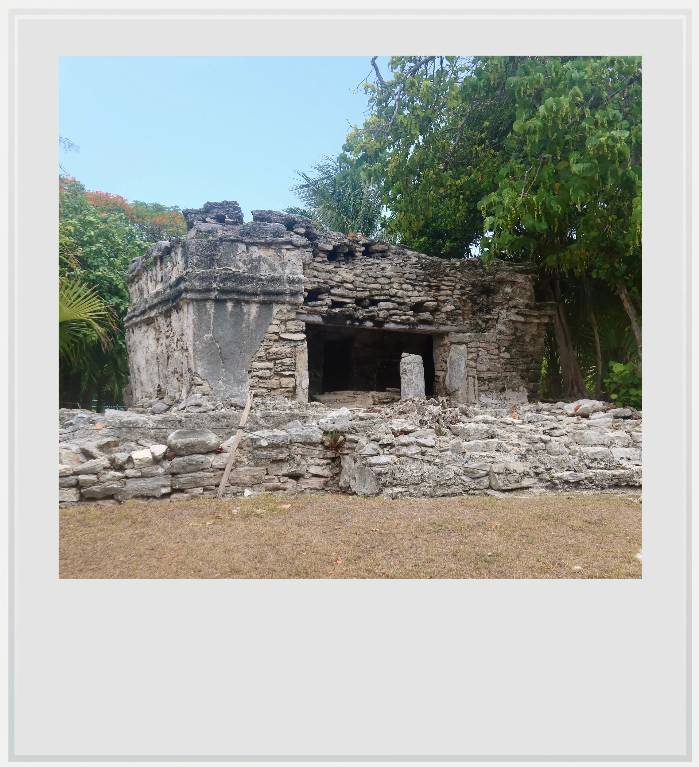
Structure C1.
Built in the Costa Oriental style seen in other sites on the Mexican Caribbean coast, C1 was a ritual temple. It shares the low, horizontal profile of many Costa Oriental buildings. We can distinguish the remnants of a column in front of its large door.
Like many Costa Oriental buildings, it didn’t resort to monumentality to showcase its importance, but its size suggests it played an important role in the life of the ancient city.
Group C initially looked self-contained. But the paths and archaeological markers made clear that it was only one part of a much larger site extending through Playacar. Suddenly, the picture changed. I was no longer looking at a small Maya outpost within a sprawling resort. It seemed like Maya occupation had extended into many other parts of what was now Playacar.
INAH records eight surviving groups of buildings at Xamanha, although only a handful stand out as substantial concentrations within modern Playacar. The four principal areas shown on the map above include the best-preserved groups and the ruins most readily encountered by visitors.
While evidence of occupation goes back to 100 BC, the ruins visible today date from the Late Postclassic period (1200-1550 AD). Xamanha was then a substantial coastal community with strong links to the nearby island of Cozumel. Archeologists infer Xamanha could have been the embarkation point to the island.

It looked like the Playacar development had swallowed it and only kept little Maya dots, silent witnesses to a much larger ancient city. Xamanha’s occupation declined progressively after the arrival of the Spanish conquistadores in the 16th century.
I could have walked on to check out the next group, another 10 minutes on foot, but the prospect of getting there and getting back under the unrelenting sun was daunting. Instead, I sat down in the shade with a view of the Caribbean Sea, absorbed by the comings and goings of vacationers and hotel personnel. I realized the street was now alive with activity.
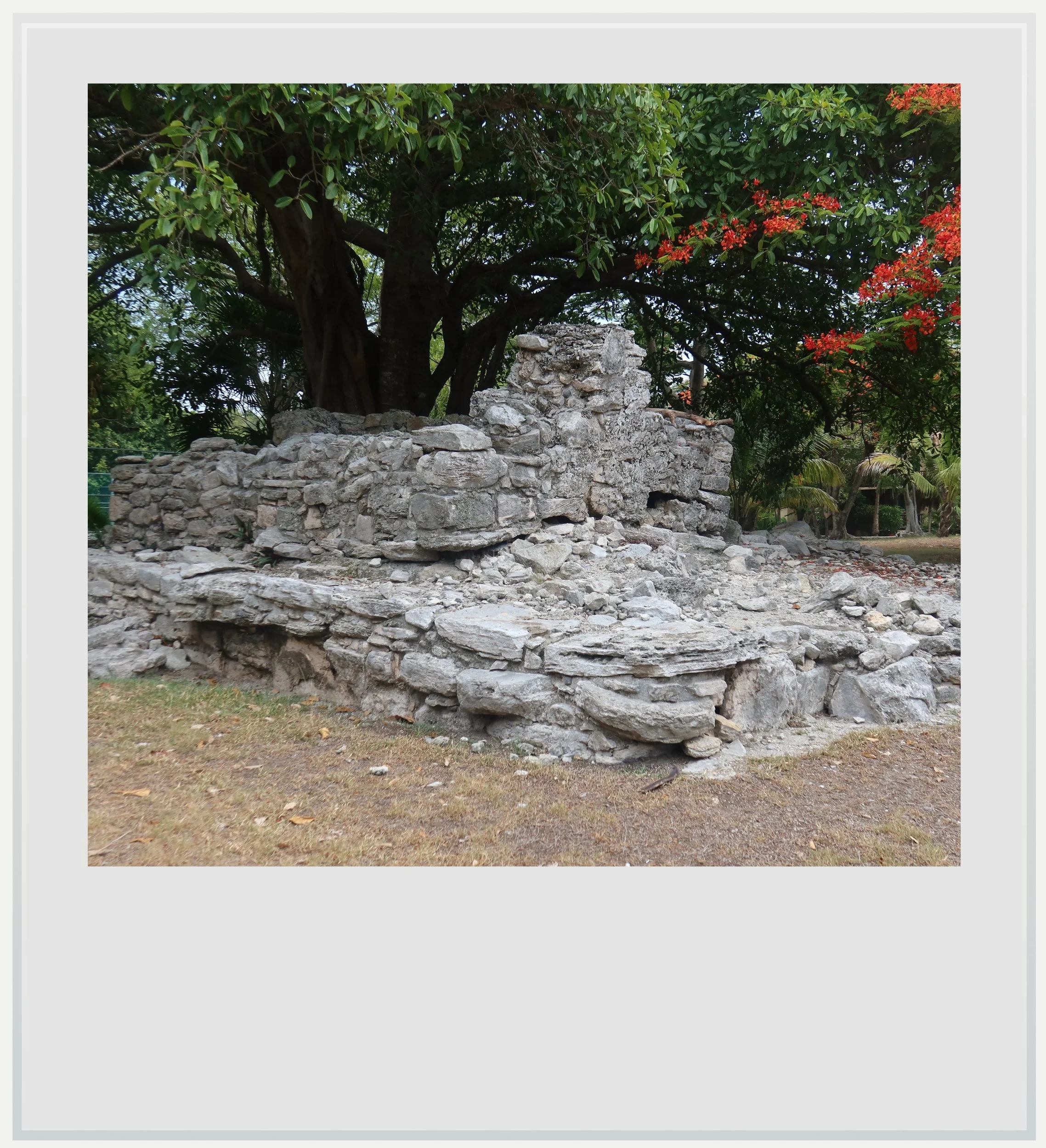
Structure C3.
It was odd to think that the resort, which seemed to live so well alongside the much older Maya ruins, had only been built about fifty years ago - barely a minute in comparison to the many centuries the Maya had lived there.
By the time tourism development began transforming this stretch of coast in the late 1970s, the old city of Xamanha had been documented by archeologists for decades. INAH launched a rescue project in 1978, just as construction in the area was accelerating. As such, it isn’t odd to see Maya structures standing within the Playacar gated community. I appreciated the sense of harmony between them and the rest of the resort.
On my way back, I missed Group B, located on a path along the Playacar Palace. I couldn’t fault INAH for failing to show visitors how to piece together all the Maya groups at Xamanha. There are no staff on site, after all.
Nonetheless, I left feeling I only had a partial view of what Xamanha was, and resolved to come back to see the rest of the ancient settlement the next time my travels brought me to Quintana Roo.
Practical information
(Everything you need to know about visiting Xamanha - updated September 2026)
In a nutshell
Xamanha can look at first like a handful of Maya ruins scattered through the Playacar resort. In fact, those surviving structures are fragments of a much larger coastal settlement that once occupied much of the area. Group C preserves the site’s most substantial building, while other architectural groups remain dispersed throughout the development.
Getting to Xamanha
How to get to Xamanha from the United States: Xamanha, located within a hotel development to the south of Playa del Carmen, is fairly easy to reach from the US. The closest international airport is Cancun (CUN), one hour to the north, which offers a lot of non-stop options from the US and Canada. On a typical day in November, 25 cities in the US and Canada have non-stop service to the famous Mexican resort.
How to get to Xamanha from Mexico City: Mexico City to Cancun is one of the busiest air routes in Mexico, with more than 20 daily flights. Flights take approximately 2 hours.
How to get to Xamanha from Cancun and Cancun airport: from the city, the Hotel Zone or the airport, follow directions for Chetumal or Playa del Carmen on the carretera Cancun-Chetumal (highway 307), and continue until you pass Playa del Carmen centro and reach the retorno (or turnaround), right when you see a Liverpool department store on the right. Drive a few miles towards Playa del Carmen until Calle 7 Sur Diagonal (a sign will say “Notaria 83). At the end of the road, you’ll have to make a left into Avenida 10 Sur. One of the many car parks available in the area will be directly on your left (here). Although the trip looks complicated, Google Maps directions are straightforward. The trip should last around one hour, depending on which area of Cancun you’re leaving from. The Playacar area is close to the ferry pier to Cozumel, and plenty of parking for day trippers is available nearby, along with a modern mall. See directions to access the gated community surrounding Xamanha below.
Taking a bus is also possible. Frequent ADO buses leave Cancun’s ADO station or Cancun Airport for Playa del Carmen’s Terminal Turistica bus station, conveniently located in the center of town. It’s a 10-minute walk from the station to the Xamanha ruins. The one-way ticket between Cancun and Playa del Carmen costs MXN 124 while leaving from any of the airports terminals will cost you MXN 270. It is feasible to buy a ticket to Playa del Carmen’s other ADO station, Terminal Alterna, but it is further from the ruins. See directions to access the gated community surrounding Xamanha below.
How to get to Xamanha from Tulum and Tulum airport: Follow directions for Cancun on highway 307 until Calle 7 Sur Diagonal at the edge of Playa del Carmen (a sign will say “Notaria 83”). At the end of the road, you’ll have to make a left into Avenida 10 Sur. One of the many car parks available in the area will be directly on your left (here). The trip should last about 50 minutes. The area is close to the ferry piers to Cozumel, and plenty of parking is available for day trippers to the island, along with a modern mall. See directions to access the gated community surrounding Xamanha below.
How to get to Xamanha from Playa del Carmen: Xamanha is located in the Playacar gated community which is part of Playa del Carmen, and very close to its urban core. It would take a 10-minute walk to get to the ruins from the Cozumel ferry pier or Plaza los Fundadores, and about the same time if arriving by ADO bus at the Terminal Turistica. See directions to access the gated community surrounding Xamanha below.
How to get access to the gated community surrounding Xamanha: the Maya ruins are located in the Playacar gated community which has strict access rules. Access by car is not allowed for non-residents and non-hotel guests and if coming by car, you will have to find parking in one of the many parking lots around, which serve day trippers going to Cozumel by ferry. I chose this lot, which was the closest and competitively priced but there are many other options. Entering on foot (or possibly by bike, which may be the most convenient option to tour all the Maya structures, scattered within the development) is allowed and fairly straightforward, but you may have to show ID. The main group is located here - accessing it requires walking on calle Abraira de Arriba from Avenida 10 Sur, all the way to the Playacar Palace, then making a right into calle Bahia del Espiritu Santo. You’ll pass a guardhouse with a barrier blocking the road, but the guards allow pedestrians through.
Can I visit Xamanha on a tour: I wasn’t able to find any tours with a stop in Xamanha. Given the location of the ruins within a hotel development requiring special access and quite a bit of walking, I am not surprised. Visiting Xamanha requires a bit of self-planning, unless you happen to stay at one of the Playacar hotels. See above on how to access the Playacar gated community surrounding the ruins.

A side view of Group C.
When to go to Xamanha
Weather-wise, the best time to visit Xamanha is the dry season, from November to April. This is also peak tourist season in Quintana Roo but the site is within a high-end gated community that never feels truly busy.
How much does it cost to visit Xamanha
There is currently no access fee to visit Xamanha (accessing the gated community by foot is allowed and free of charge as well).
How long should I plan to visit Xamanha
Plan to spend 60 to 90 minutes there if you want to see the four main building groups. While each group can be seen in 10 to 15 minutes, you have to account for walking time between them. If you’re only interested or able to see the Group C, arguably the most important one, 30 minutes will be enough.
What are the opening hours of Xamanha
Xamanha does not operate like a conventional staffed archeological zone with a ticket booth or controlled entrance. The ruins are scattered through the Playacar development and can be reached on foot from within the complex. INAH currently lists Xamanha as temporarily closed, while also publishing its normal operating hours as 8am to 5pm. Access conditions on the ground are unusual and can change, so check the current INAH listing before visiting.
I would limit any visit to daylight hours and respect any local access restrictions in place if any are posted at the time of your visit (there weren’t when I went to the site). Early morning or late afternoon are the most comfortable times to explore, especially in the hotter months.
Safety at Xamanha
The Yucatan peninsula is one of the safest areas in Mexico. The U.S. State Department currently classifies Quintana Roo as Level 2, meaning travelers should “exercise increased caution.” This is the same warning level as Mexico as a whole, and similar to the level assigned to several European countries such as France, Germany and Italy.
Quintana Roo, however, has been in the news because of a few highly publicized violent events in recent years, from a shooting at the Xcaret hotel in 2022 to the murder of a Canadian citizen in a Cancun gym in 2023.
In these highly publicized cases, it is understood tourists weren’t targeted and foreigners involved in these incidents had, according to Mexican authorities, links to organized crime. It would be misleading to describe Quintana Roo as free of violence. The risk, however, is generally localized and extremely unlikely to affect an ordinary trip to the state.
Xamanha itself felt perfectly safe to visit. The ruins sit within a gated resort community with regular pedestrian, residential and hotel activity.
Keep in mind these travel tips
Sunscreen will be your best friend. The UV index may be lower in the morning and evening, but during the day, it gets pretty high.
Do not forget to hydrate. OXXO and GoMart convenience stores are ubiquitous in Playa del Carmen and around, and always stock cold water and drinks. Make sure you always have water handy and drink regularly to make the heat more bearable.
Every photo caption appears when you hover over the image (on a computer) or click on it (on a smartphone).
All photos are mine and copyrighted