Beziers to Neussargues by Train: Along France’s Ligne des Causses.
A Railway Journey Against the Odds of History
Looking for schedules, ticket prices, or travel advice? Head straight to the Practical Information section.
As the regional train was slowly making its way along the winding single track, I found myself gazing at a landscape unlike any I had seen before. Through the tall windows, I could see wide plateaus and rolling hills scorched by a long, dry summer, sparsely dotted with modest homes. Closer to us, behind an old, weathered fence that seemed more symbolic than functional, cows were grazing placidly, oblivious to our passage.
There was something cinematic about the scenes unfolding before us, as though we were watching a documentary whose images and pacing had been carefully edited for our enjoyment.
That scene alone was worth the trip: it spoke to a part of France few visitors ever see, a timeless, rural France so remote that it seemed largely forgotten.
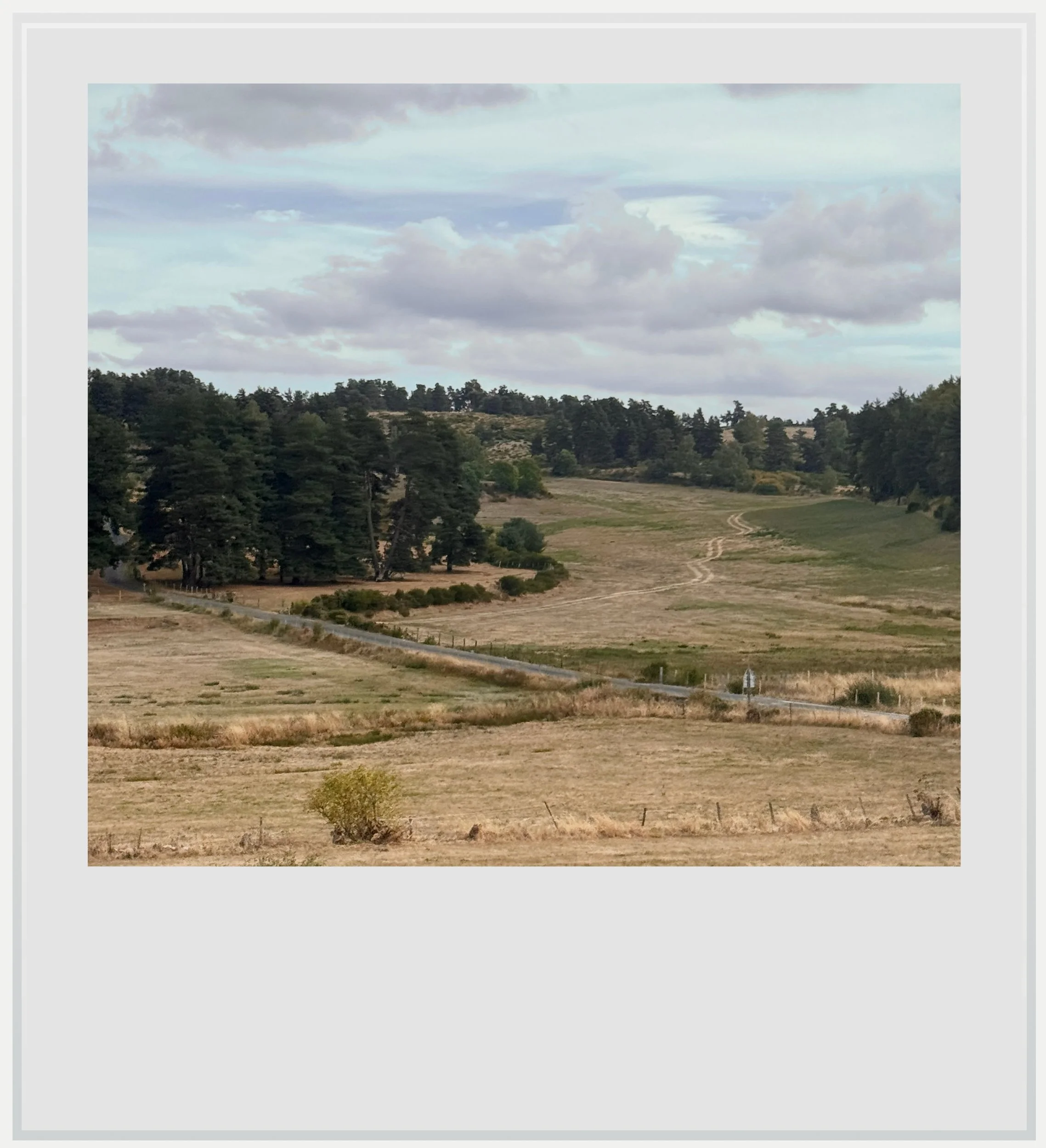
French countryside near Peyre-en-Aubrac.
I was riding l’Aubrac, an Intercity train service linking Béziers to Clermont-Ferrand. Between Béziers and Neussargues, it follows the 172-mile (277 km) Ligne des Causses, whose future is uncertain. The single-track line crosses some of the most isolated areas of France, through the Massif Central, France’s ancient mountainous heartland. The line had recently avoided permanent closure, after years of underinvestment made portions of the track practically unusable.
This trip is hardly on anyone’s bucket list, save for a few train enthusiasts like me and my friend Jacques, a fellow travel blogger who had joined me for the journey. We both knew we’d be headed to the south of France at the tail end of summer, and given the uncertainty surrounding whether the line would survive, we felt it was the right time to go.
The Ligne des Causses
On a sunny late September morning, we walked to the Béziers station, luggage in tow, and waited for our train to pull into the platform.
Béziers, a medium-size city a few miles inland from the Mediterranean, was a rather unlikely starting point for a railway intended to provide the shortest link between this sunny, wine-producing part of Occitanie and the French capital. The reason it came to be is fascinating. The first stretch of the line, between Béziers and Graissessac, was built in the second half of the 19th century to give the region’s coal mines access to the rail network. The line was subsequently bought by the much bigger Compagnie du Midi.
At that time, France was home to several private railway companies that competed fiercely for freight traffic. In 1863, the main protagonists agreed that freight traffic rights for a given itinerary would be awarded to the company offering the shortest route between the two points. Eager to capture the lucrative wine traffic between the Languedoc region and Paris, the Compagnie du Midi saw the potential in extending the Béziers–Graissessac line north across the Massif Central, to offer the shortest route between the vineyards of the Languedoc and the French capital. The route between Béziers and Paris via Neussargues measured 500 miles (804 km), compared with 525 miles (845 km) through Nîmes and the Ligne des Cévennes.
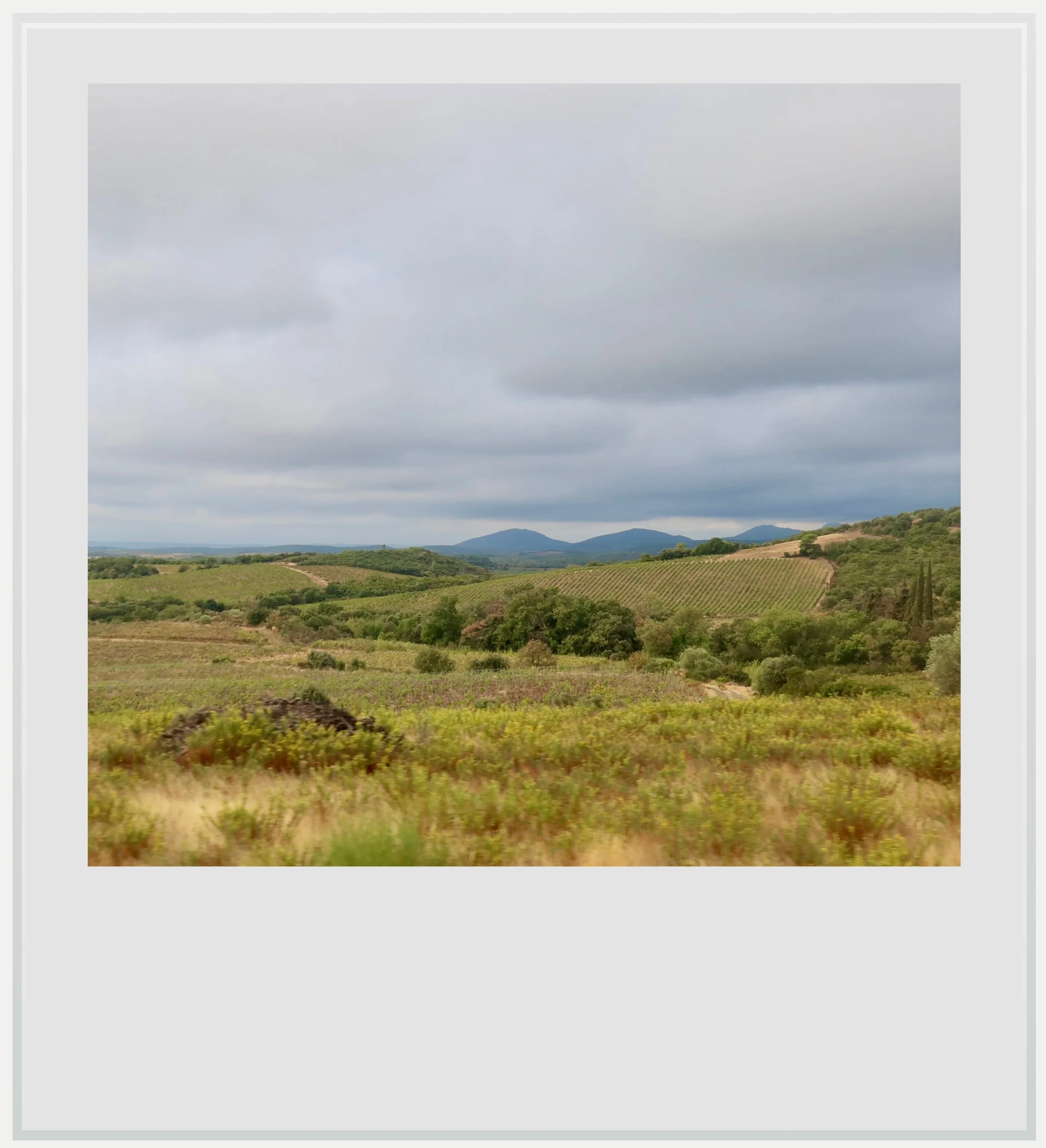
Landscape north of Béziers along the Ligne des Causses.
This small advantage allowed the Compagnie du Midi to secure the rights to transport wine between the Languedoc and Paris and made the Ligne des Causses a strategic investment. The paradox was that the line’s steep gradients made it impractical for the heavy wine trains it was intended to carry. By securing the shortest route to Paris, the Compagnie du Midi could collect compensation even when the wine traveled over other companies’ easier routes.
For now, I was happy to take in the view. We had left the Béziers station only minutes earlier, and I felt we could have been hundreds of miles away. The flat Mediterranean landscape was already fading, along with the closely packed, red-roofed houses of the city’s suburbs.
The journey was taking us among the causses, the high limestone plateaus typical of the southern part of the Massif Central.
Through the wide windows, we could see menacing clouds over the foothills of the Massif Central, which we would cross to reach Neussargues, at the northern end of the line.
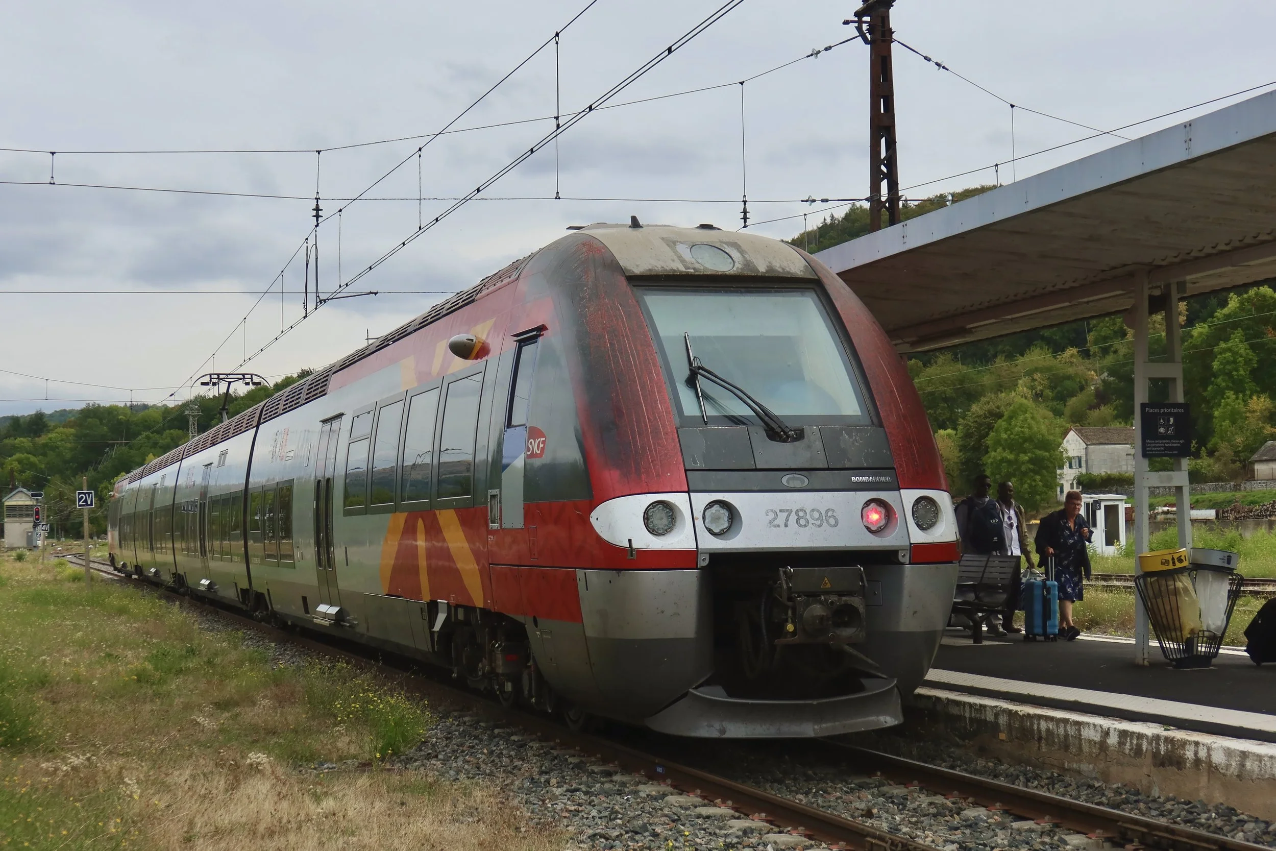
Our train was a Bombardier Z27500-series high-capacity electric unit belonging to the Occitanie region. Built in 2009, unit 27896 retained the distinctive red, gray and yellow livery of the former Languedoc-Roussillon region, supplemented by liO branding following the region's incorporation into Occitanie in 2016.
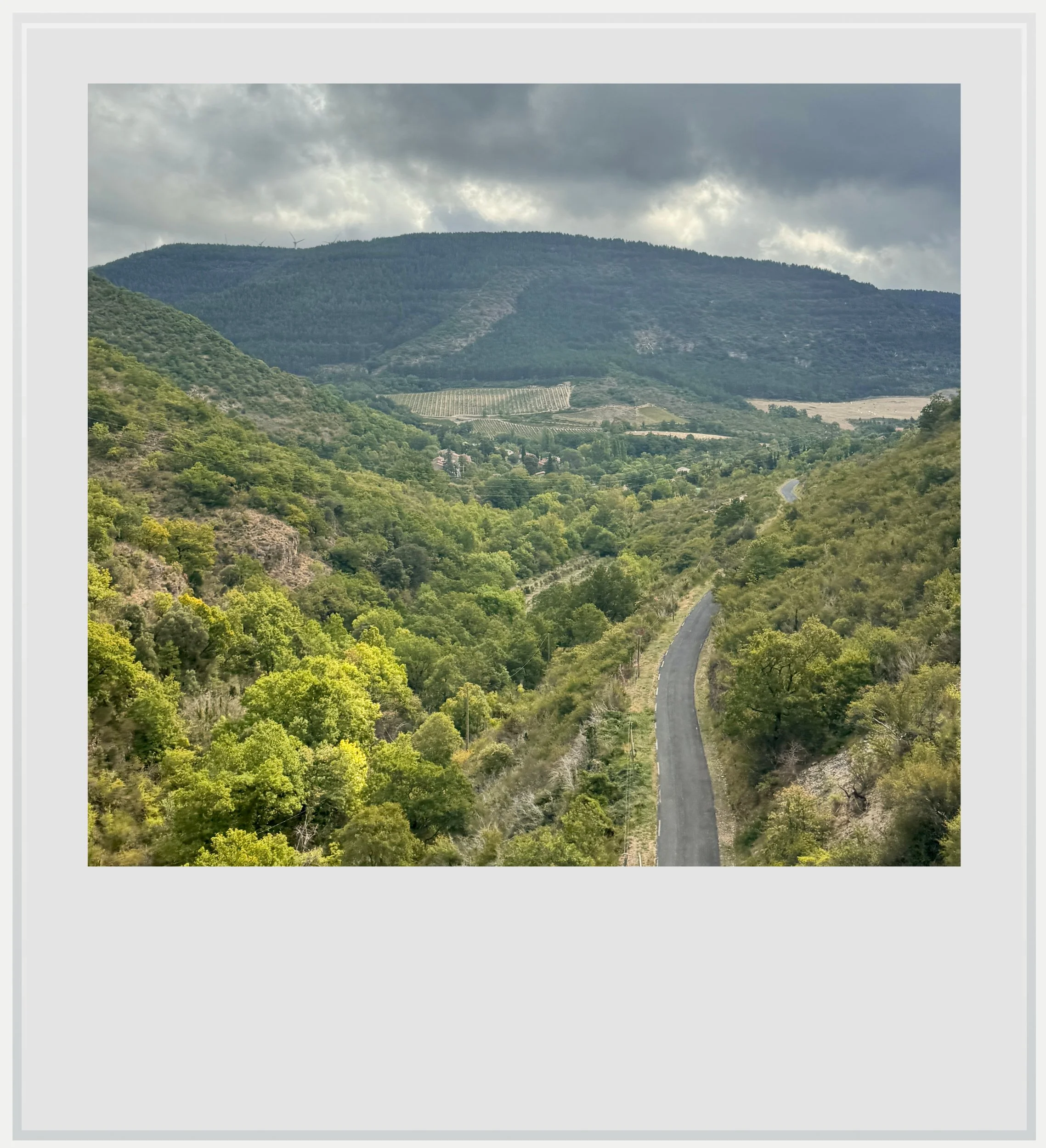
The Massif Central’s southern foothills near Joncels.
The four-car train set could seat 220 passengers, with 194 fixed seats and 26 folding ones, all in second class. Part of an early wave of new regional trains which entered service in the early 2000s, units in the Z27500 series feature air conditioning, panoramic windows, step-free platform access and a large restroom suitable for people with disabilities. At the time, this represented a major step forward in comfort for regional services.
Our Z27896 unit - pictured at the top of the article - looked weathered on the outside, although its interior was well-maintained. We had quickly found seats in the first coach and settled in to wait for departure.
Our train had now reached the first hills of the Massif Central, and the line’s notorious twists and turns were becoming obvious - not that it was an issue for our Bombardier unit, which could, on a straighter stretch of track, reach up to 100 miles per hour (160 km/h). We would cover most of the Ligne des Causses’ 172 miles (277 km) at a much slower pace of about 45 miles per hour (75 km/h), giving us ample time to enjoy the scenery.
The journey was taking us among the causses, the high limestone plateaus typical of the southern part of the Massif Central, remnants of a time, millions of years ago, when this part of France was covered by shallow seas.

The Peyrelevade Castle.
Erosion and tectonic activity left the area with gently undulating plateaus as well as deep gorges that rivers slowly carved into the rock. As a result, the view from the train alternated between narrow wooded valleys and panoramic vistas over long ridges topped by limestone escarpments.
Another characteristic of the landscape was its relative lack of human presence. As it crosses the Massif Central, the train serves only one town with more than 20,000 residents: Millau.
Millau, two hours into the trip, was a special stop on the line, and not only because quite a number of travelers boarded, making the ride a little livelier. It was just before Millau that we saw one of France’s greatest engineering feats of the 21st century, the Millau Viaduct.
Built to bypass Millau on the highway linking Béziers to Clermont-Ferrand, the bridge was stunning. We passed beneath it, admiring its slender lines and marveling at its scale. It is the world’s tallest bridge, with a structural height of 1,125 feet (343 m), surpassing the Eiffel Tower.
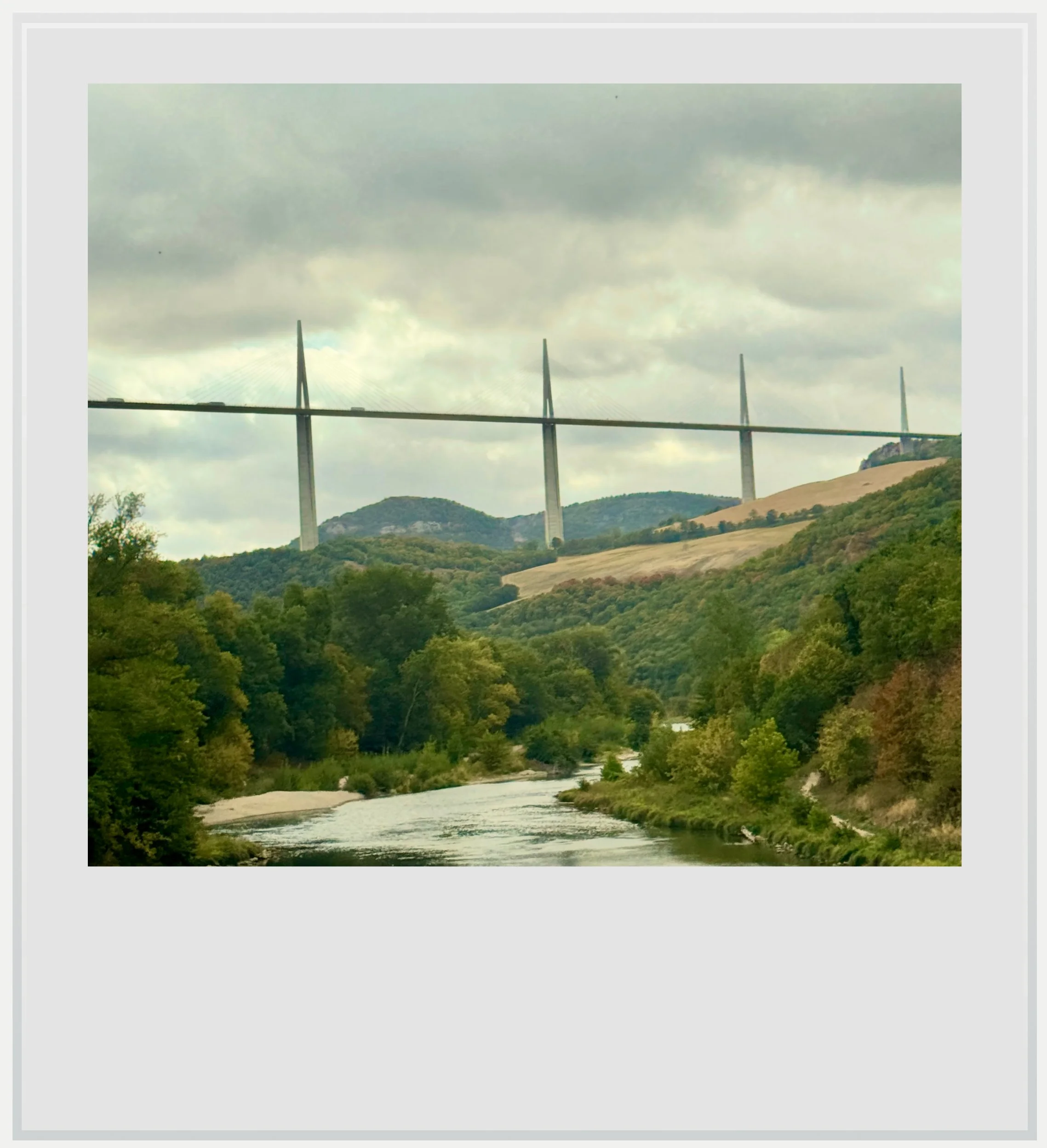
The Millau Viaduct.
Beyond its beauty, the bridge was a potent symbol of France’s efforts to make the area more accessible. Part of La Méridienne, as the A75 highway is officially called, the Millau Viaduct came to embody the nation’s efforts to make the southern Massif Central easier to reach.
We would see the highway run close to the railway a few more times along the route, and I couldn’t help but wonder how much traffic it had diverted from rail, but perhaps that was the wrong question. With cars so ubiquitous in France, opening a highway link through the Massif Central benefited far more people than the railway was serving. The Millau Viaduct carries roughly 7,000 vehicles per day in each direction, compared with what I estimate to be 250–300 daily passengers on l’Aubrac and the three additional Béziers–Millau services.
Today, the single daily train between Béziers and Neussargues takes close to 5 hours.
As tempting as it was to cast the A75 highway as the railway’s killer, the line’s fortunes had been deteriorating for decades. In 1910, the rival PLM company had opened a new connection between Saint-Flour and Brioude, creating an even shorter route to Paris. Yet 1934 marked the decisive turning point in the Ligne des Causses’ slow decline. That year, the Compagnie du Midi and the Compagnie Paris-Orléans, one of its biggest competitors, agreed to merge their operations. The Ligne des Causses had been central to the Midi’s ambitions to reach Paris. Within the larger PO-Midi network, which already had established routes to the capital, that strategic importance faded.
The line’s importance continued to diminish over the following decades, so much so that maintaining and modernizing the infrastructure became increasingly difficult to justify, given its lack of significant passenger or freight traffic.
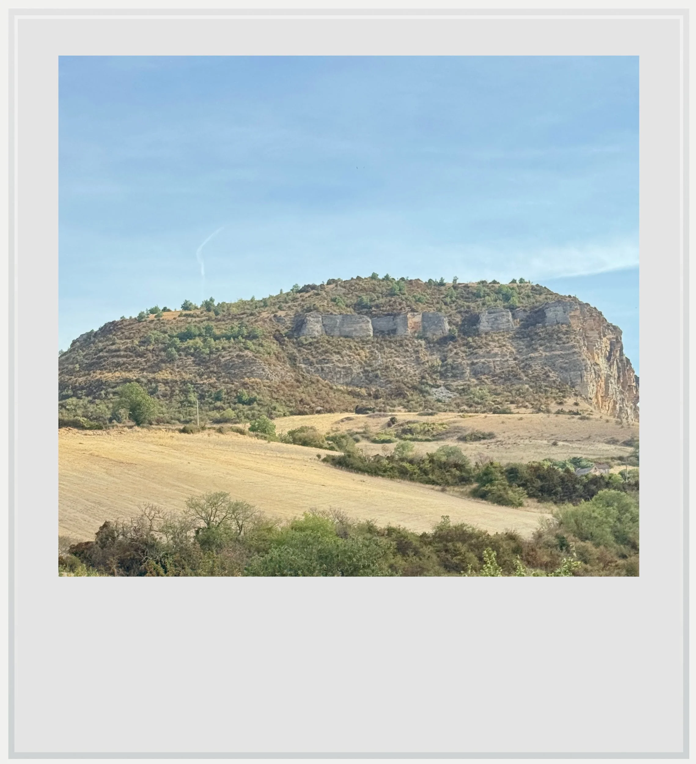
A limestone escarpment rises above the fields along the track.
This did not mean the line was abandoned: in 1982, political will brought renewed ambition to the railway with the creation of a special daytime train between Paris and Béziers via Neussargues to promote tourism in the region. Called l’Aubrac, it was the illustrious predecessor to our more modest regional service. At that time, l’Aubrac used modern Intercity coaches and featured a special car dedicated to onboard activities exploring the history of the regions along the route.
Although a media success, the train carried an average of forty travelers on the southern portion of its route, between Clermont-Ferrand and Béziers, according to a 1999 report by French television channel TF1 (link, in French).
In 2007, the service was shortened to cover only the Clermont-Ferrand to Béziers section. Although still listed as a direct intercity service, it is now operated using two regional trains: a diesel X73500 from the Auvergne-Rhône-Alpes region between Clermont-Ferrand and Neussargues, and an electric Z27500 from Occitanie between Neussargues and Béziers.
Today, the single daily train in each direction between Béziers and Neussargues takes close to 5 hours, while driving between the two towns can be done in less than 3 hours, on the mostly toll-free A75 highway.
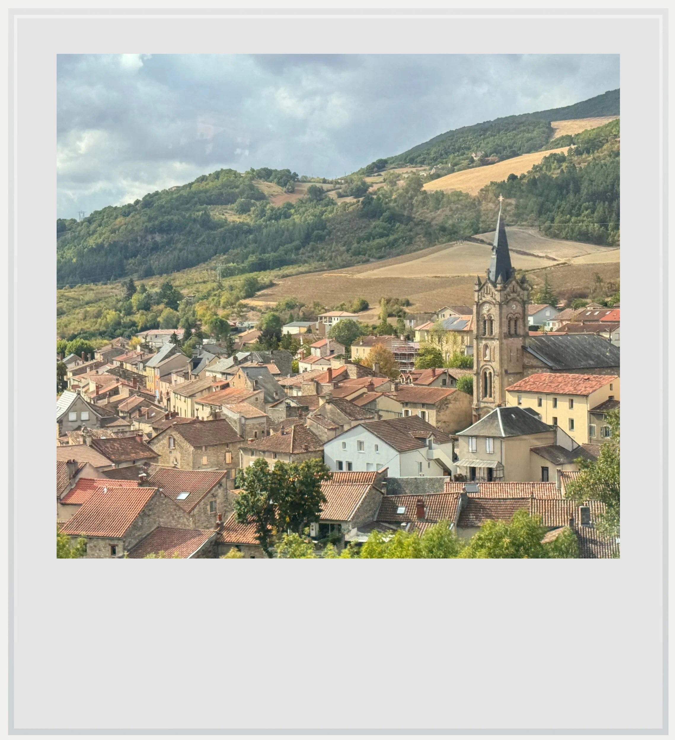
The village of Aguessac.
After Millau, we followed the Tarn valley upstream for a little while then left it behind to start climbing towards Séverac-le-Château. We passed Aguessac on the viaduct of the same name, built on an extraordinarily steep gradient for a rail track (3.33%), and arrived in Séverac about twenty minutes later, under the watchful eye of its imposing castle above the medieval town.
Leaving Séverac, the railway crossed higher ground before descending towards the Lot valley, and the limestone plateaus gradually gave way to greener hills. Then, the line climbed again to reach Marvejols. I was amazed at how it threaded through the hilly terrain and how smoothly we traveled along it, albeit at a slow pace.
I found Marvejols, a small market town in the Lozère department that used to be the seat of royal authority in the Gévaudan region, to be the prettiest town along the line. Perhaps this was because the railway ran above it, affording us a sweeping view over its compact center, where closely packed gray buildings and slate roofs gave the town a visual unity I found beautiful.
Marvejols, nestled where the Colagne valley widens, lies at the meeting point of three distinct geographical regions: the Aubrac mountains to the northwest, the Margeride mountains to the northeast, and the Grands Causses to the south.
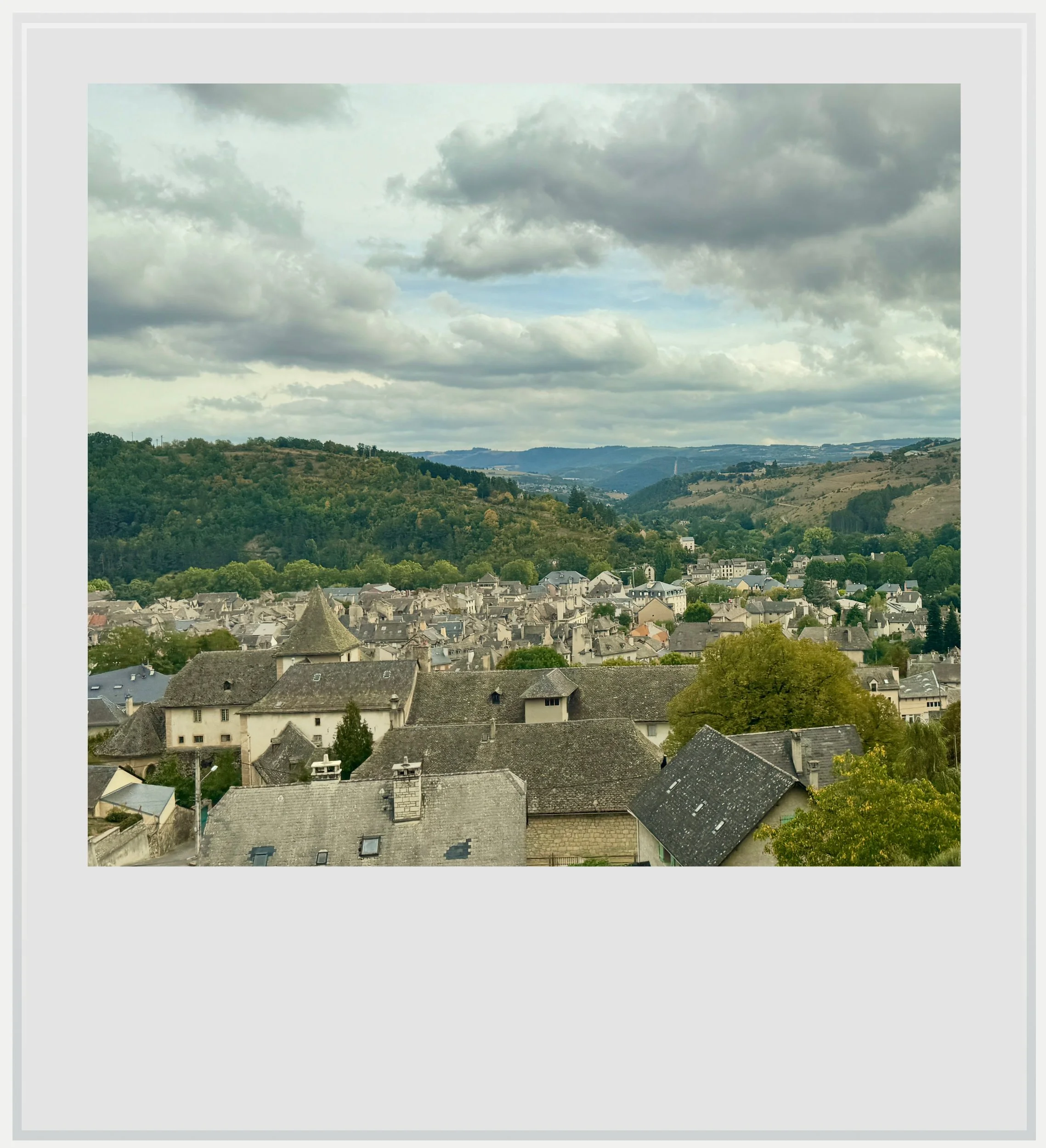
Marvejols.
From the train, the transition appeared gradual rather than abrupt, and the widening of the valley around Marvejols offered a moment of breathing room in the landscape, a sign that a new chapter in our trip was about to begin.
A few minutes later, we passed Rimeize and continued through the wooded valleys of western Margeride, at an altitude of about 3,000 feet (900 m). We kept climbing until reaching a more open area of gently rolling fields, their grass yellow and dry. We arrived at the Aumont-Aubrac station twenty-five minutes after leaving Marvejols, but the variety of landscapes made the short journey feel much longer.
Crossing the same difficult terrain called for very different solutions 120 years apart.
The open landscapes of the Margeride plateau stayed with us all the way to Saint-Chély-d’Apcher. There, the students attending the town’s hospitality vocational high school all got off, making the platform suddenly busy.
Saint-Chély is important to the northern section of the Ligne des Causses because its specialized ArcelorMittal steel factory receives all its incoming steel coils by rail, making the rail connection “critical to keep [its] operations running” (link, in French).
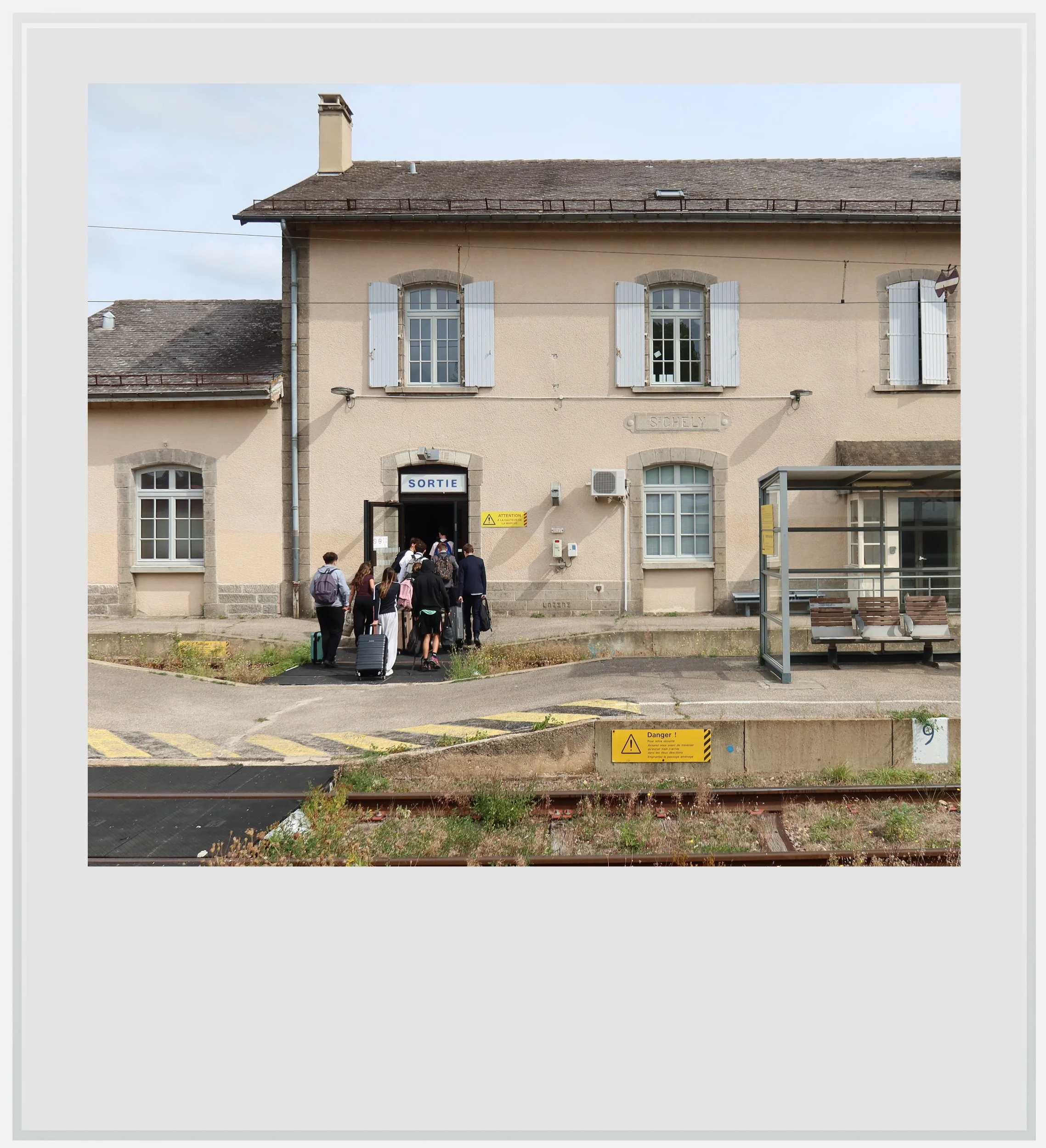
Students leaving the train in Saint-Chély-d’Apcher.
That dependence meant the railway's deteriorating infrastructure had consequences far beyond the inconvenience of delayed passenger trains. After decades of underinvestment, SNCF, France’s national railway company, suspended passenger and freight services on part of the line in 2020, arguing that its condition no longer allowed trains to operate safely. The closure threatened a railway connection on which the Saint-Chély factory depended.
Regional authorities and local campaigners mobilized to secure the funding needed to reopen the line. Emergency repairs began during the summer of 2021, allowing services to resume that November.
But the reprieve proved temporary. In January 2023, SNCF warned that the northern section between Saint-Chély-d'Apcher and Neussargues would have to close unless further investment was secured.
It is widely understood ArcelorMittal played a role in convincing the French government to release €50 million ($56 million) to upgrade the tracks in 2024. In fact, almost 90% of the funds for the renovation work undertaken that year were spent on the section serving the steel plant, between Saint-Chély and Neussargues.
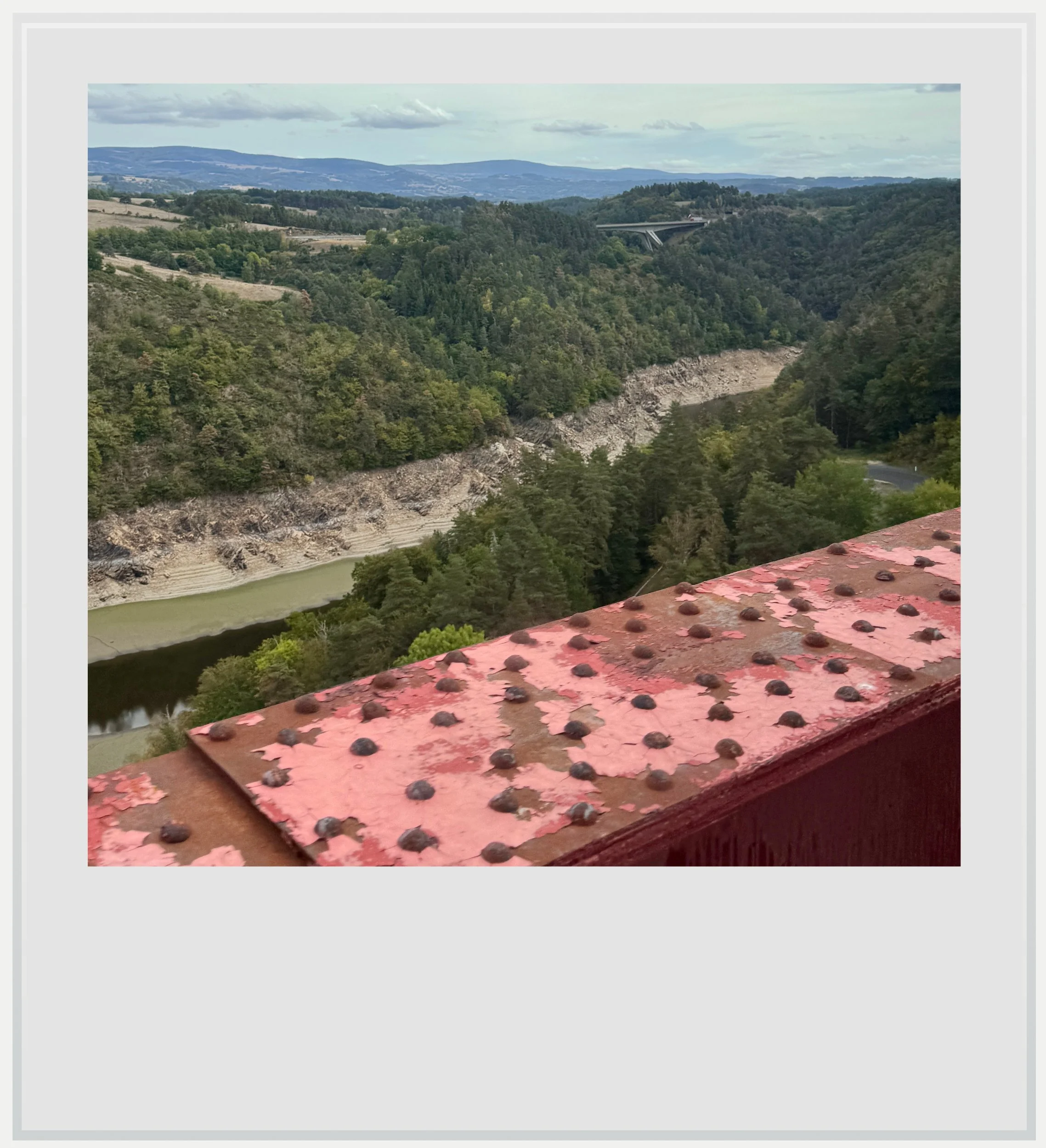
The Truyère river seen from the Garabit viaduct. A highway bridge is visible in the background.
That section of the line north of Saint-Chély is actually the most famous, thanks to its iconic bridge, the Garabit Viaduct. An engineering achievement that inspired such pride that our conductor made a special announcement as we approached, the viaduct was built in the late 19th century to cross the Truyère valley without losing hundreds of meters of elevation.
At the time, it was one of the most remarkable iron railway bridges ever constructed and although it is relatively short, at 1,854 feet (565 m), its then-record height of 400 feet (122 m) makes the river crossing breathtaking. It looked for a moment as if we were suspended in the air.
The experience of arriving in Neussargues was strangely anticlimactic.
The bridge was designed by Léon Boyer and built by Gustave Eiffel’s company, before the Eiffel Tower even existed. Its most iconic feature is its central arch: with a span of 541 feet (165 m), it was the largest of its kind in the world when constructed. Although we couldn’t see the arch from the train, I made a note to return to see it from below.
Shortly after crossing the Truyère river, among the volcanic landscapes of the Cantal department, the A75 highway reappeared, slicing a gorgeous sloping valley in two. A few minutes earlier, we had felt entirely alone, the railway the only connecting thread between remote mountain regions. The modern road was a reminder that the train was no longer the essential link to the outside world it had been a hundred years earlier.
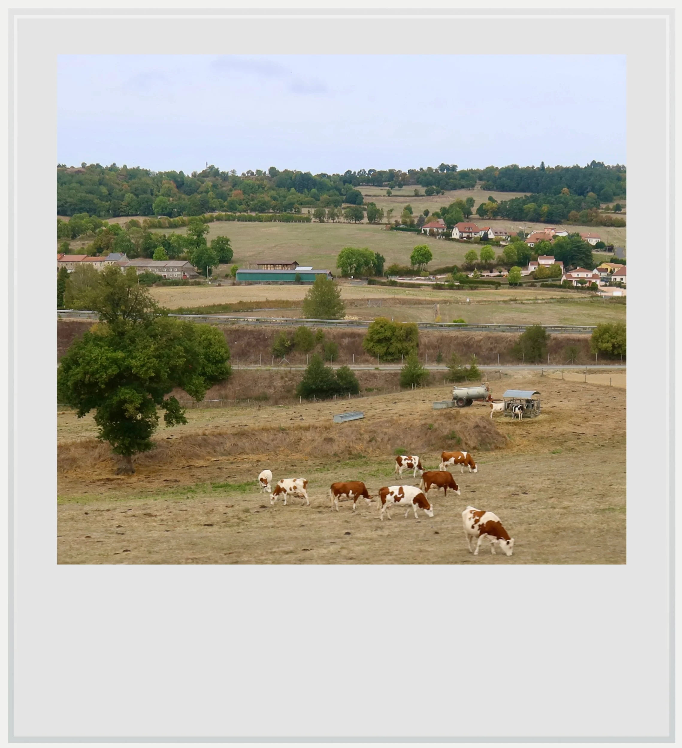
The A75 highway slicing the landscape south of Saint-Flour.
The contrast was telling: in the 19th century, France built a monumental rail bridge to cross the Truyère valley while in the 21st century, the signature achievement of French engineering was the Millau Viaduct on the A75 highway. Crossing the same difficult terrain called for very different solutions 120 years apart.
After Garabit, we passed Saint-Flour, a former capital of Cantal, built atop a basalt promontory that gave it a formidable defensive advantage against attackers. The train station was built in the newer town, at the base of the volcanic platform, making the fortified old city above look almost menacing.
It wasn’t long before we arrived in Neussargues, the northern endpoint of the Ligne des Causses. L'Aubrac service would continue on to Clermont-Ferrand, but the tracks were no longer electrified, so we had to change to another regional train, curiously bearing the same name and number, for the final portion of our trip.
The experience of arriving in Neussargues was strangely anticlimactic. For all its past strategic importance as the northernmost station of the old Midi rail network, Neussargues now sees only a few trains a day linking it to Clermont-Ferrand and Aurillac, beyond the daily Aubrac service (I wrote about a train trip between Brive-la-Gaillarde and Aurillac a few years ago here).
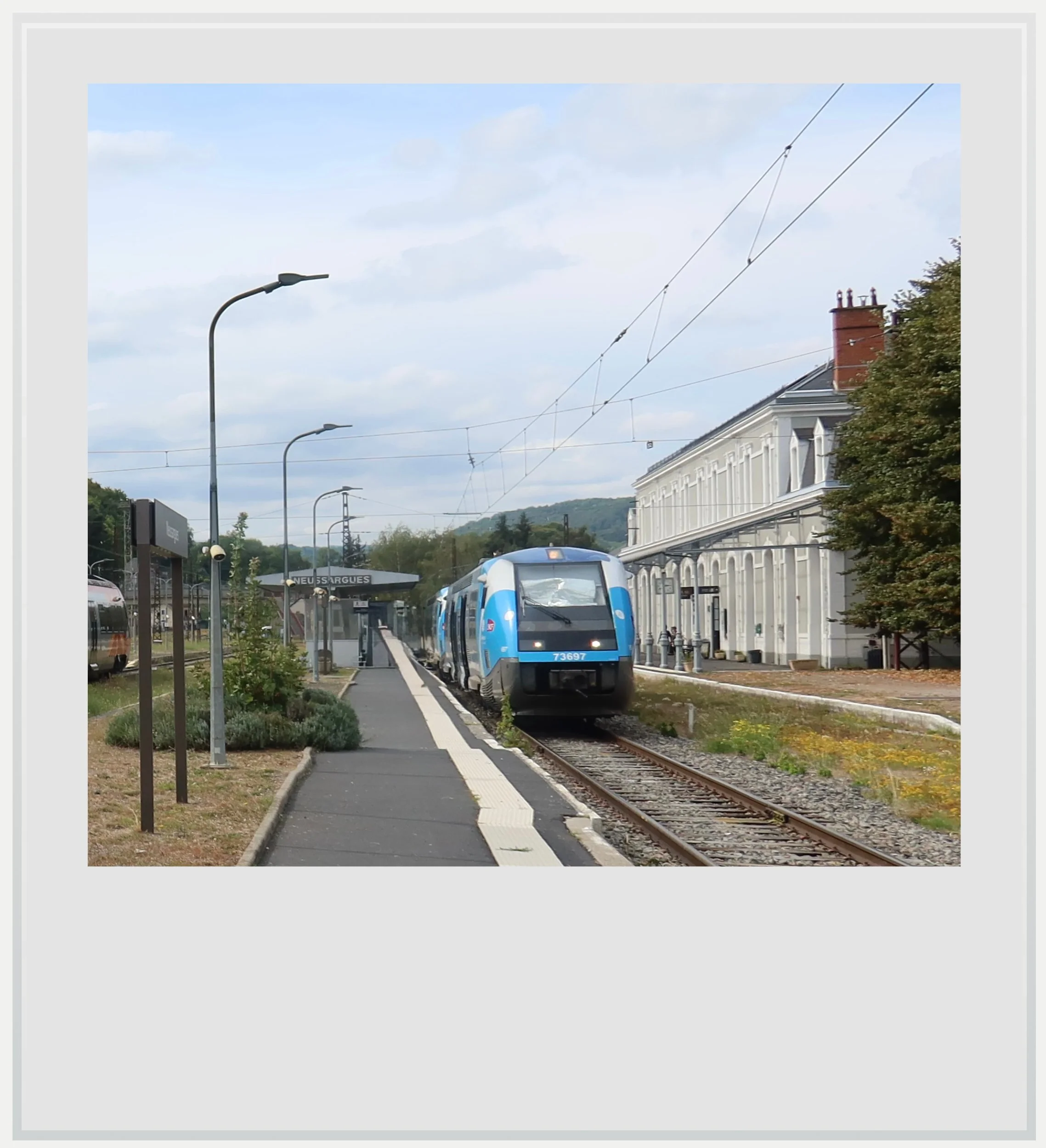
Our train to Clermont-Ferrand in Neussargues.
The station building and the length of the passenger platforms spoke to a time when the station played a much bigger role. Today, the main event is the arrival of the northbound Aubrac around the same time as a southbound service from Clermont-Ferrand, turning around to bring us there, while the Aubrac goes back south to reach Béziers in the evening.
At that moment, I could imagine what Neussargues might have looked like a century ago. The station seemed to come alive as passengers changed trains, some with heavy luggage suggesting a long trip behind or ahead of them.
We settled in the two coupled diesel railcars for the final leg of our trip to Clermont-Ferrand, leaving the Ligne des Causses behind. As we followed the Alagnon river, I kept thinking about the majestic landscapes we had crossed over the past few hours, and how lucky we were to have enjoyed them.
In many ways, the Ligne des Causses was a folly, a railway built only to take advantage of a fleeting commercial agreement, crossing an unforgiving landscape and serving a sparsely populated region. Its primary reason for existence disappeared in 1934 with the merger of the Midi and PO rail networks: if the new PO-Midi company didn’t need this sinuous link to Paris, how could anyone have expected the line to survive so long?
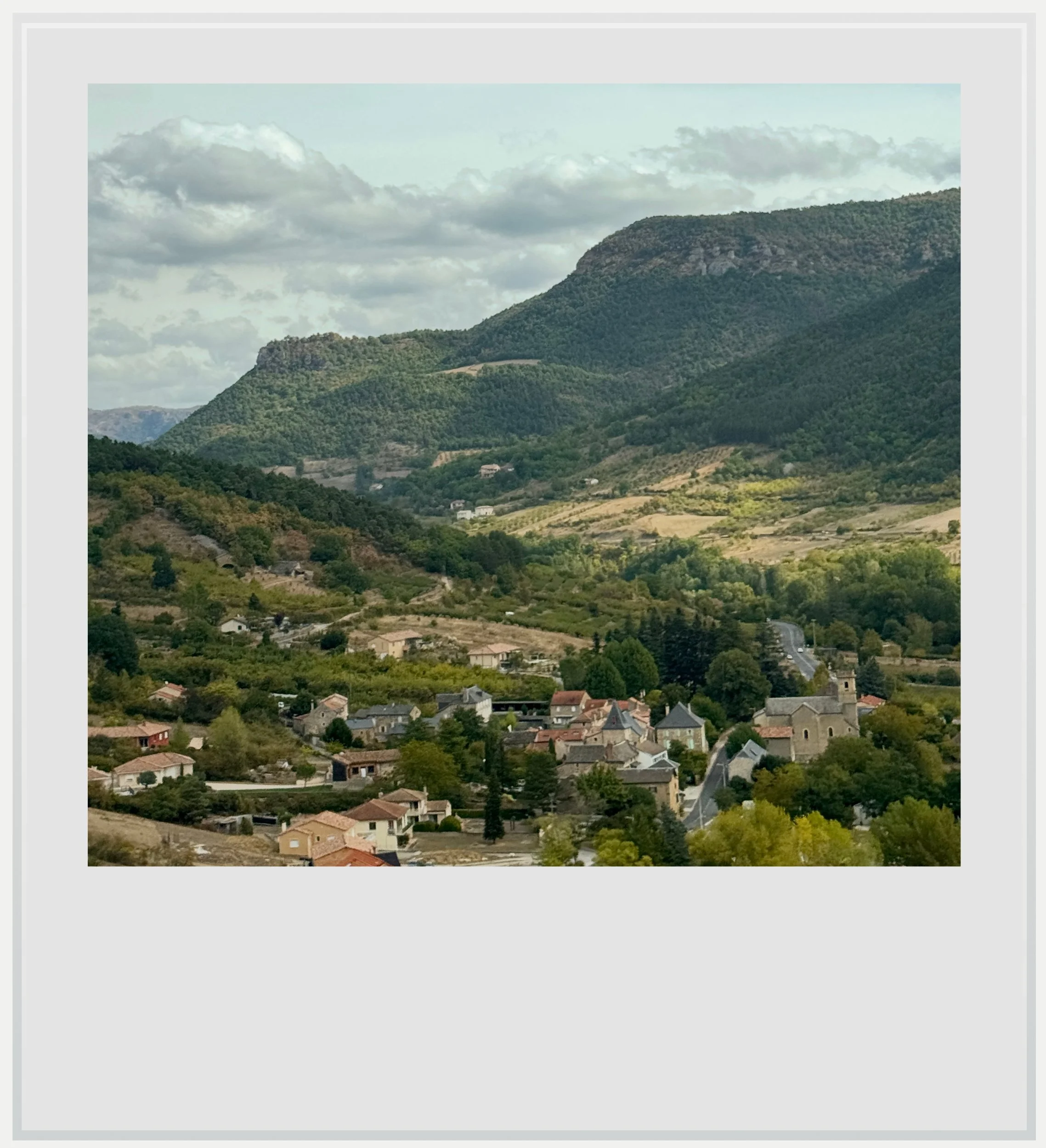
A typical landscape in the Grand Causses area.
A few years ago, it seemed like the line was doomed. Today, several rounds of emergency funding have given the line a new lease on life, but its survival is far from assured. In 2022, Alternatives Économiques reported a Transport Ministry estimate of €500 million ($560 million) to regenerate the line and secure its long-term future. To the French and regional governments, this might seem like money best used elsewhere. And perhaps it is.
Yet as we pulled away toward Clermont-Ferrand, leaving the southbound Aubrac train behind, I couldn’t help but feel a strange attachment to the line, hoping it would beat the odds and stay open for many years to come. For me, it wasn’t about the money. It was about its rugged beauty. It was about its role as a connecting link to parts of France rarely seen on the news. And above all, it was about rooting for the underdog, a railway that had every reason to disappear and somehow refused to.
Practical information
(Everything you need to know about the Ligne des Causses railway - updated October 2026)
In a nutshell
A scenic rail journey through France’s Massif Central mountains, the Ligne des Causses links Béziers and Neussargues in about five hours. Expect winding tracks, limestone plateaus, remote valleys, and landmark viaducts. Check the timetable and any planned track work before booking.
How to travel on the Ligne des Causses
Reaching Béziers, the southern departure point: Béziers is served by SNCF trains from many French cities, including Paris, and by Renfe’s international AVE service between Madrid and Marseille. A good website to check travel options is Trainline, which lists many operators, not just the French national company (SNCF).
Reaching Neussargues, the northern departure point: Neussargues is a small connecting station that is served by trains from Brive and Aurillac to the west, and Clermont-Ferrand to the northeast. It is possible to travel from Paris to Clermont-Ferrand on an Intercity train, then connect to a TER regional train to Neussargues, timed to arrive a few minutes before the daily departure to Béziers.
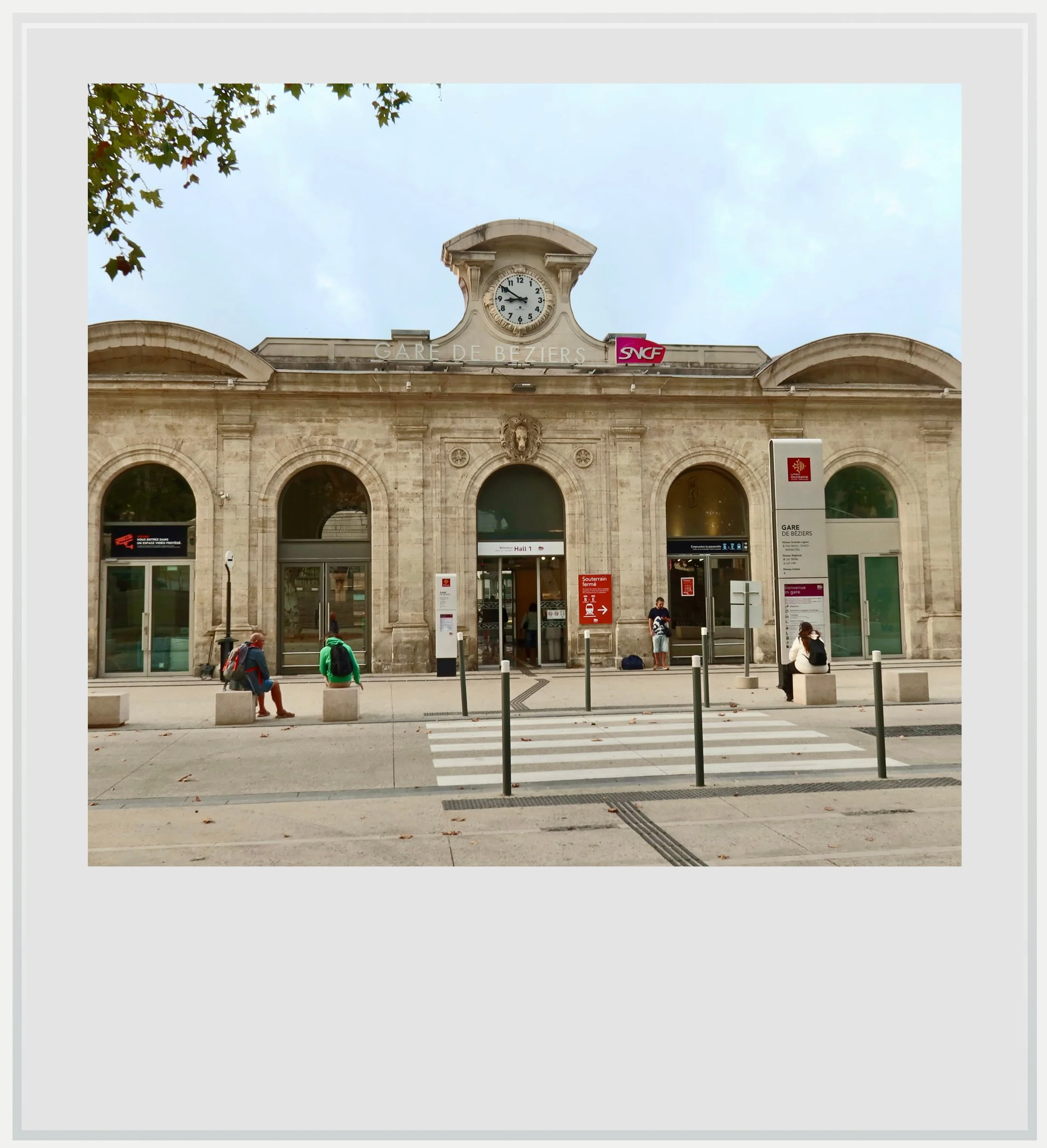
Béziers station, at the southern end of the Ligne des Causses.
When to travel on the Ligne des Causses
Late spring and early autumn are particularly rewarding times to travel on the Ligne des Causses, offering green pastures or fall colors. The line is open year-round, however, and summer travel offers longer days while a winter trip may reward the traveler with snowy landscapes, but daylight hours are much shorter.
Check for scheduled track work before booking, as renovation work may last several months and require replacement buses on parts of the route.
How much does it cost to travel on the Ligne des Causses
A full-fare, one-way ticket between Béziers and Neussargues costs €48 ($54) at the time of writing). More restrictive tickets are available from €24 if booked in advance.
Although the train is labeled an Intercity service, it is operated using a TER regional trainset offering only second-class seating. The seats are comfortable, so the lack of a first-class option is unlikely to be a major issue. Seat reservation isn’t possible but the train is hardly ever full, so finding available seats in Béziers should not be an issue.
Passengers continuing to Clermont-Ferrand must change trains at Neussargues, even though the service is listed under a single train number. Ample time is allowed for the connection.
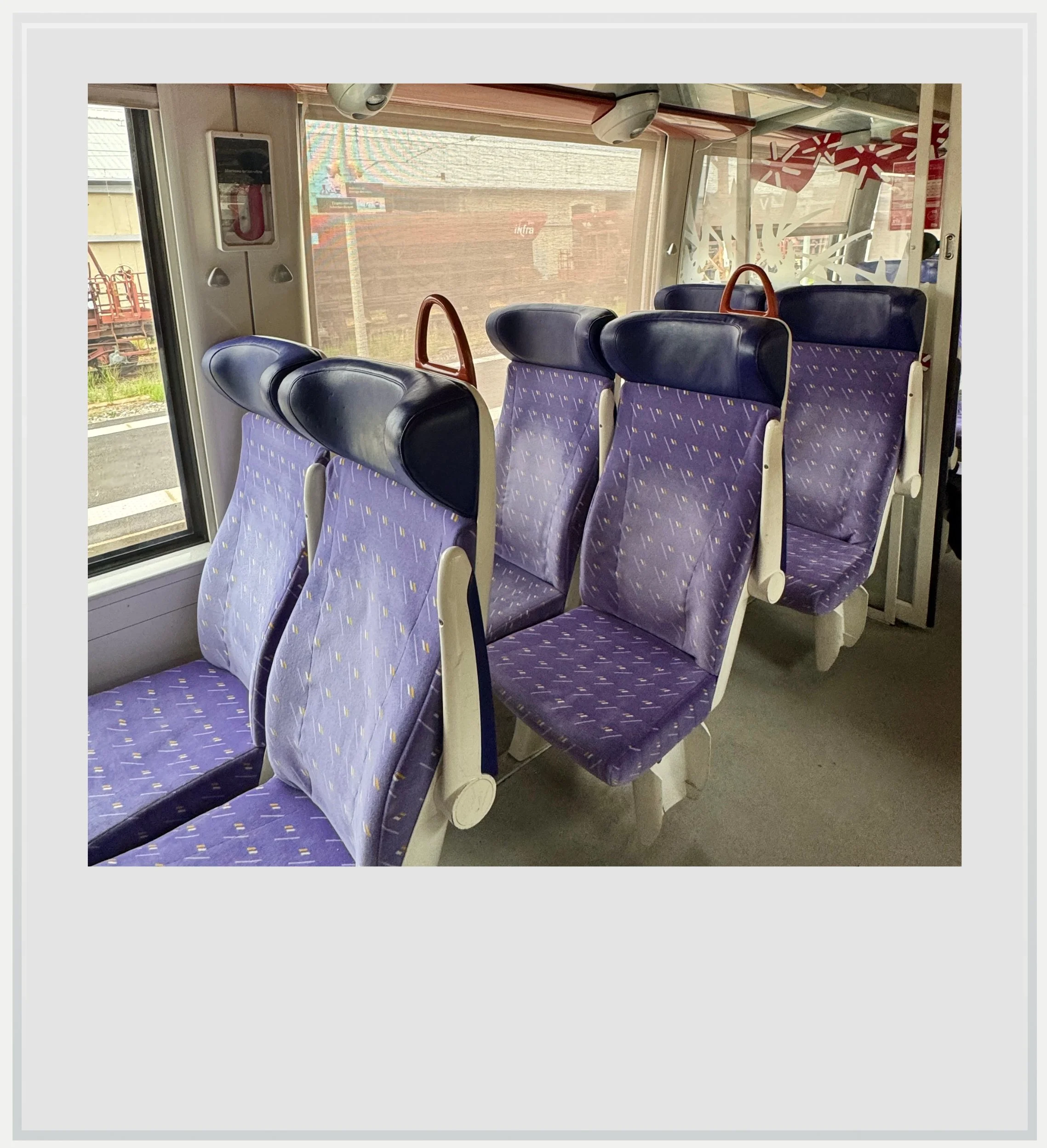
Seats on the Aubrac service between Béziers and Neussargues.
How much time should I allow for a trip on the Ligne des Causses
There are two ways to experience the line: either by traveling from one end to the other in a single day to take in the views, or by allowing more time for stops along the way. Suggested stops include Millau, Séverac-le-Château, Marvejols and Saint-Flour.
Which direction is best for traveling on the Ligne des Causses?
For a first journey, I recommend traveling from Béziers to Neussargues, especially outside of summer months: the morning departure allows you to enjoy the entire route in daylight, while the landscape gradually shifts from southern vineyards to the uplands of the Massif Central.
How crowded does the Ligne des Causses get?
Part of a longer itinerary between Paris and the south of France, the Ligne des Causses can’t compete on journey time with the much faster high-speed trains traveling via Lyons and the Rhône Valley. On my trip, passengers appeared to be mainly local residents traveling to towns along the route.
Note that on northbound trains on Mondays and southbound trains on Fridays, many high-school students from the hospitality vocational high-school located in St-Chély-d’Apcher use the train to get to and from school. I counted more than fifty students getting off the train in Saint-Chély, making it noticeably emptier for the rest of the journey. A trip on any other day of the week should be much quieter.
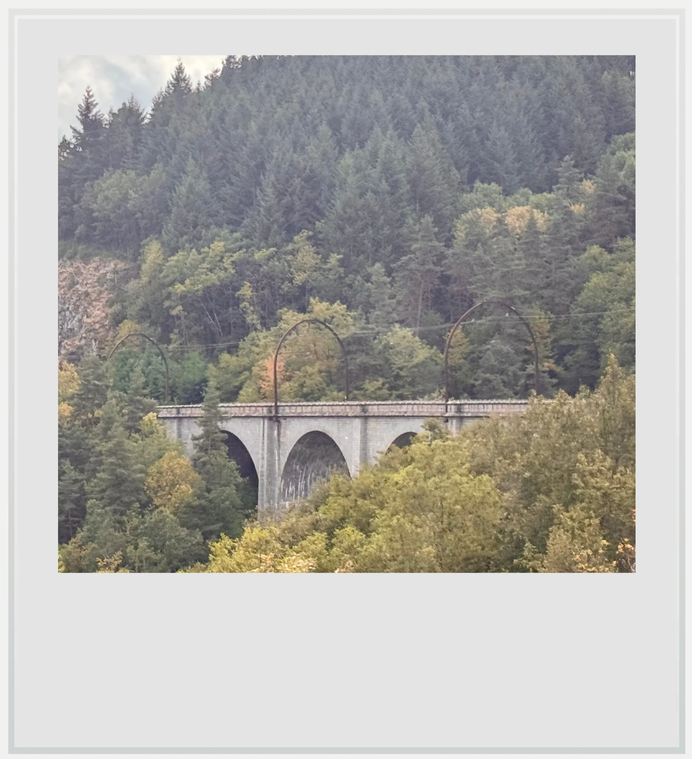
The Chanteperdix viaduct on the Ligne des Causses.
Where to eat along the Ligne des Causses
There is no food service on the train, so it is a good idea to pack lunch and snacks. A few stores in Béziers open early enough to shop before departure. One reliable option is Monoprix, on Béziers’ main avenue, about a 15-minute walk from the station. An alternative is the Relay/Chez Jean everyday store in the station. It opens before l’Aubrac departs.
For southbound travelers, food options in Neussargues are limited. If you start your trip in Clermont-Ferrand, several shops are within walking distance of the station, as well as a Chez Jean everyday store with to-go food options.
There may also be an opportunity for passengers on the northbound train to have a meal delivered to the platform at Campagnac–Saint-Geniez. Our conductor described ordering from the nearby Hôtel-Restaurant Rodier for delivery to the platform, with payment in cash. However, I have not yet received confirmation from the hotel that it still offers this service. Before relying on this option, contact the Rodier hotel directly to confirm availability for your train, ordering deadlines, prices, and payment arrangements.
Safety on and along the Ligne des Causses
France is considered a safe country by the US Department of State, which classifies it as Level 2, meaning travelers should “exercise increased caution”. This is the same warning level as other European countries like Germany, and shouldn’t be cause for concern. The trip along the Ligne des Causses crosses through remote areas with virtually no crime. I would be a little more attentive at the Béziers and Clermont-Ferrand stations - not that they are criminal hubs but bigger crowds in busy transit hubs are places where one should always be aware of their surroundings.
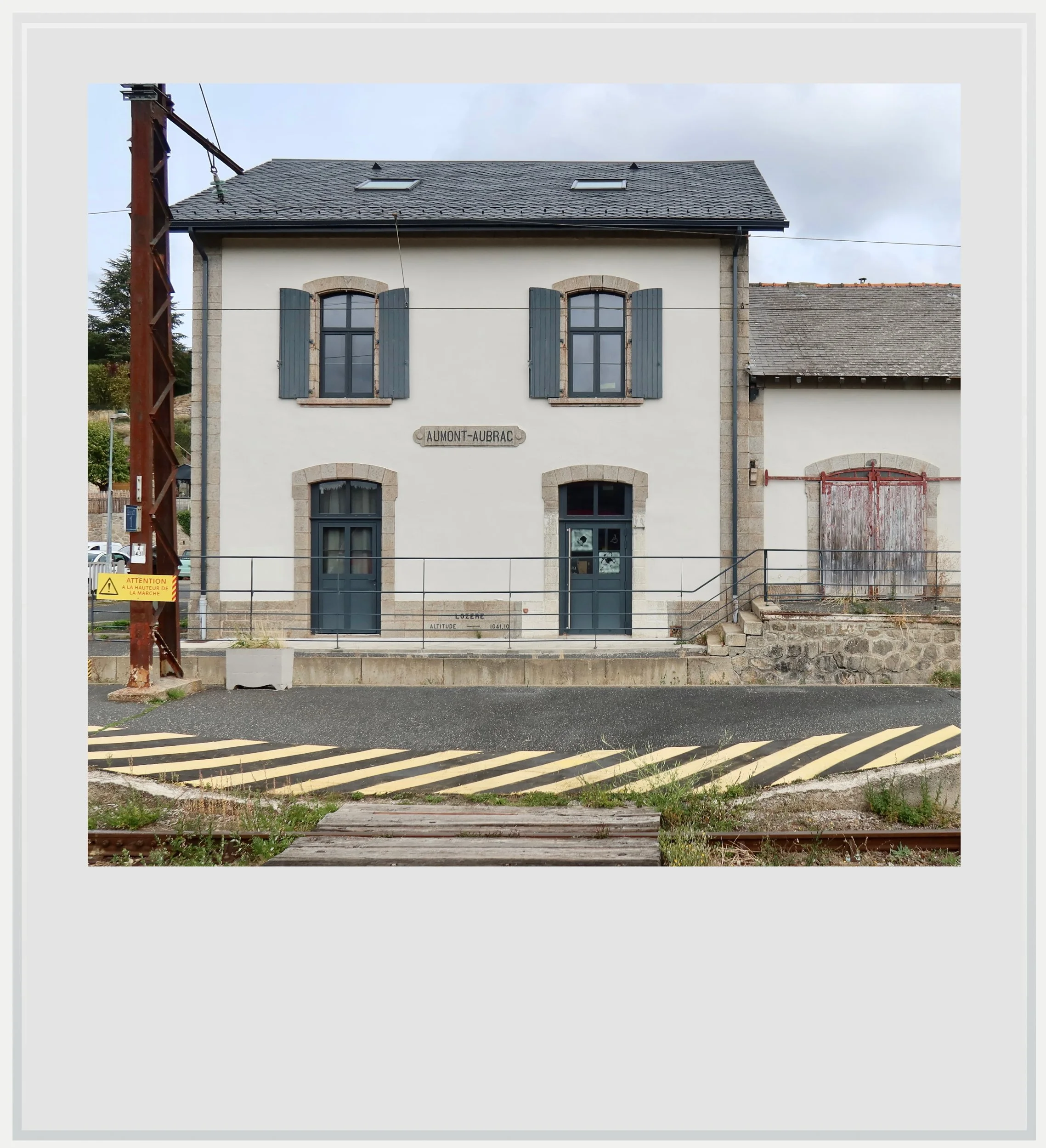
The Aumont-Aubrac station on the Ligne des Causses.
Cell service along the Ligne des Causses
Cell service in France is usually excellent, even in remote areas. In fact, I rarely lost 4G service during the trip, and enjoyed very fast 5G service at times. This isn’t the kind of trip that will have you offline for hours, unless you turn on airplane mode. You can check the coverage along the route here (the map defaults to the Orange network, the market leader, but you can use the dropdown menu to see the coverage map for other operators).
To see a photo caption, hover over the image on a computer or tap it on a smartphone.
The photograph at the top of this article shows the regional train used for the Aubrac service, stopped at Neussargues, the Ligne des Causses’ northern terminus.
All photographs are my own and are protected by copyright.