Muyil, Mexico.
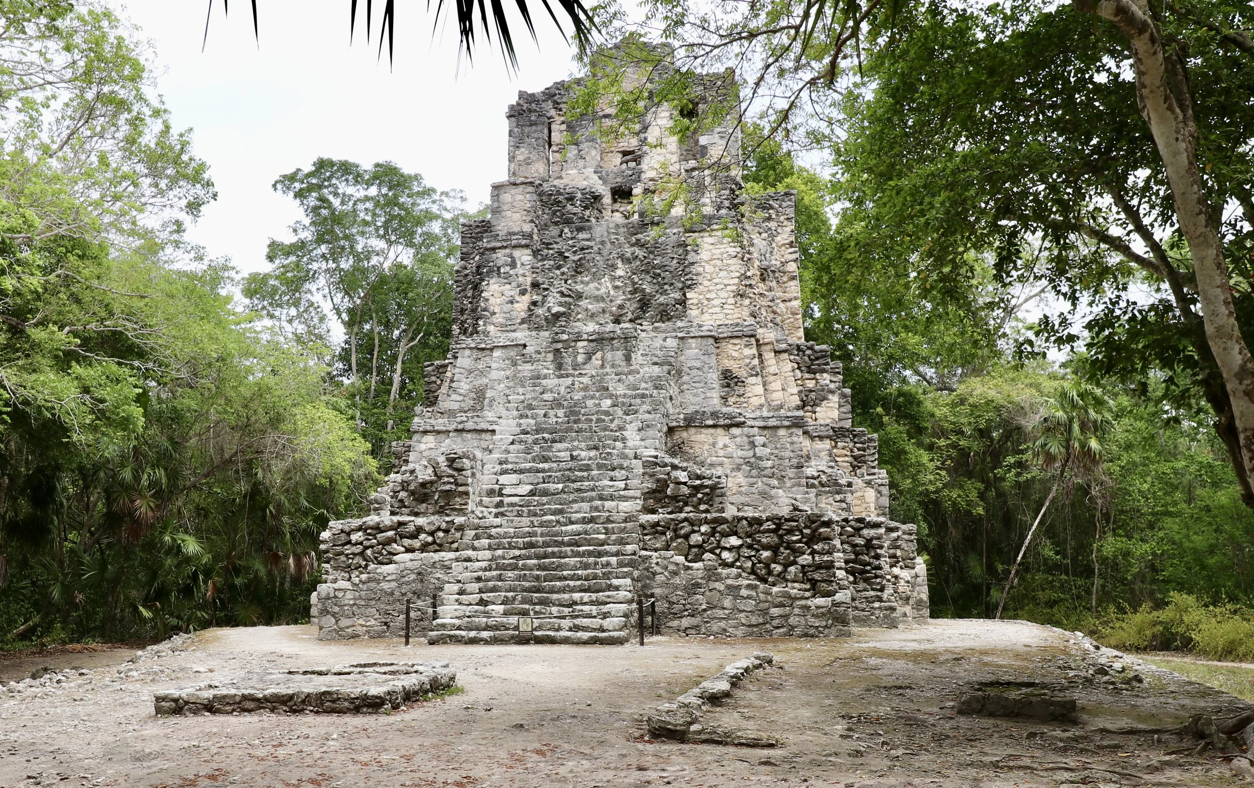
Peten Monumentality on the Caribbean Coast.
Looking for directions or opening hours? Head straight to the Practical Information section.
I had just left Xelha when I parked my car in the lot of the Muyil archeological zone (sometimes also referred to as Chunyaxche). I still had in mind the exceptional Early Classic murals I had seen there, in an old settlement that appeared relatively modest, where few grand buildings were left standing.
Muyil felt instantly different. Like Xelha, it had been recently renovated, and had only reopened a few months prior to my visit, but I could sense this wasn’t going to be the same kind of experience. There were several rental cars lined up next to mine. The visitor center, a beautiful round building with an inside patio, was on a different scale altogether. This clearly suggested a more important site for Mexico’s National Institute of Archeology and History (INAH).
Walking into the site only confirmed the impression. After a few steps, a clearing in the forest on my right revealed the Entrance Group of buildings. Considered the main square of the settlement, it featured several pyramidal temples arranged in a semi-circular area that was both welcoming and august. I had the feeling of being in a crowd of people who had just opened up to let me in, but were not yet sure if I was a friend or a foe. While not as massive as pyramids in Coba, the structures were definitely more imposing than anything I had seen at Xelha.
It took me a minute to realize that there was something a little strange about how the plaza edifices were laid out. In front of several pyramids sat smaller buildings that I recognized as typical of Costa Oriental architecture, a style from the Late Postclassic (1300–1550 AD) named in reference to the eastern coast of the Yucatan peninsula. The structures were smaller, one-story buildings with a flat roof and supporting columns and seemed to have been built after the pyramids, with no regard to how they blocked the bigger buildings.
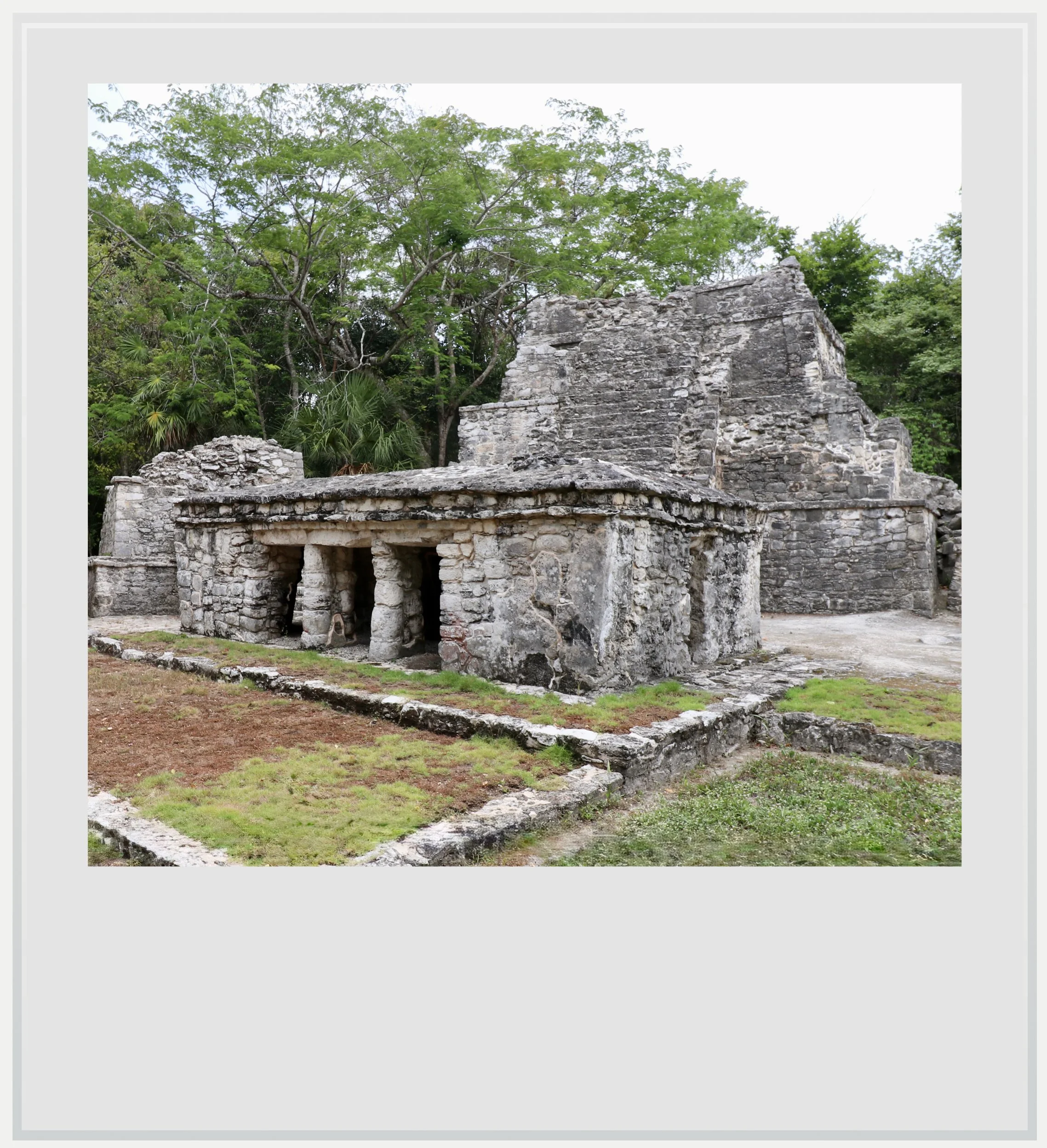
Structures in the Entrance Group.
In fact, these buildings were erected later than the pyramids, and this revealed one of the defining features of Muyil. The pyramidal temples recessed at the back of the square are thought to have been built much earlier in the life of the city - the exact date is still debated among archeologists. One thesis states that the pyramids as we see them today were built in the first part of the Early Postclassic period (950 to 1200 AD), while the smaller structures rose in the Late Postclassic. What was striking was how visually obvious the juxtaposition of architectural styles was in this plaza. It seemed like two different instant photographs of the city had been taken in different centuries and merged together.
The newer buildings, placed directly against the older ones in the Late Postclassic, were likely temples dedicated to the same deity as the ones behind them, which could explain the physical closeness.
Having witnessed right away the visual difference between Xelha and Muyil, I was left wondering how two coastal cities so close to each other could look so far apart.
A key factor can help explain the contrast: unlike Xelha, Muyil was one of the first Maya settlements on the eastern coast. Research by Walter Witschey supports the hypothesis that Muyil’s first settlers likely arrived by sea from the Peten lowlands around 400 BC.
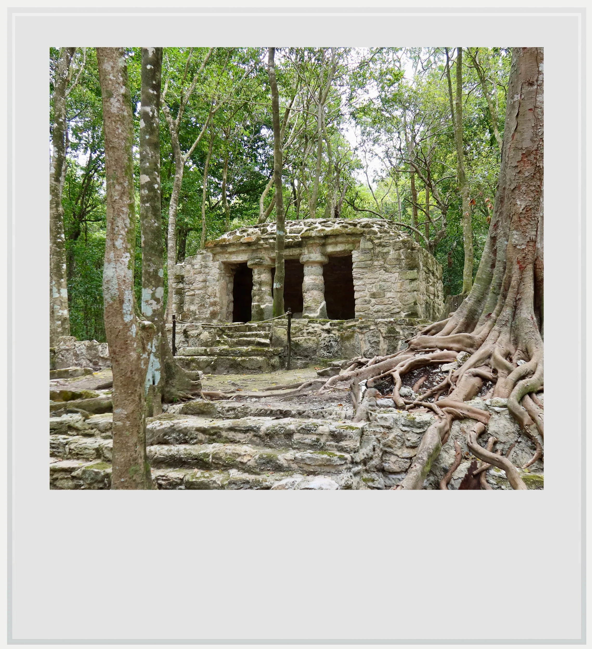
A Costa Oriental building in the Great Platform Group.
The site wasn’t chosen by mistake: Muyil is linked to the Caribbean Sea by a system of channels passing through lagoons, and sits on slightly elevated ground, making surveillance of incoming sea traffic very easy, a useful way to ensure the city’s protection.
Muyil was founded centuries before the great city of Coba, which later became the dominant regional power in northeastern Yucatan. Muyil had participated in Coba’s development, and stayed within its influence until Coba’s decline in the 10th century. At this point, Muyil didn’t disappear. Instead, it benefited from the increase in sea trade.
Topography contributed to Muyil’s prosperity as a city on water.
This resilience throughout history helps explain why it is one of a few major Maya cities to have been continuously occupied for almost 1,800 years, until the Spanish conquest. Nearby cities like Xelha were inhabited in several different periods, especially the Early Classic (250–600 AD) and the Postclassic.
I continued my walk along the forest paths linking the various building groups of the old city and quickly got to the Sacbe group (sacbe is a Maya word meaning “white path”). This section of the site had previously been off-limits and was incorporated into the visitor route when the site reopened.
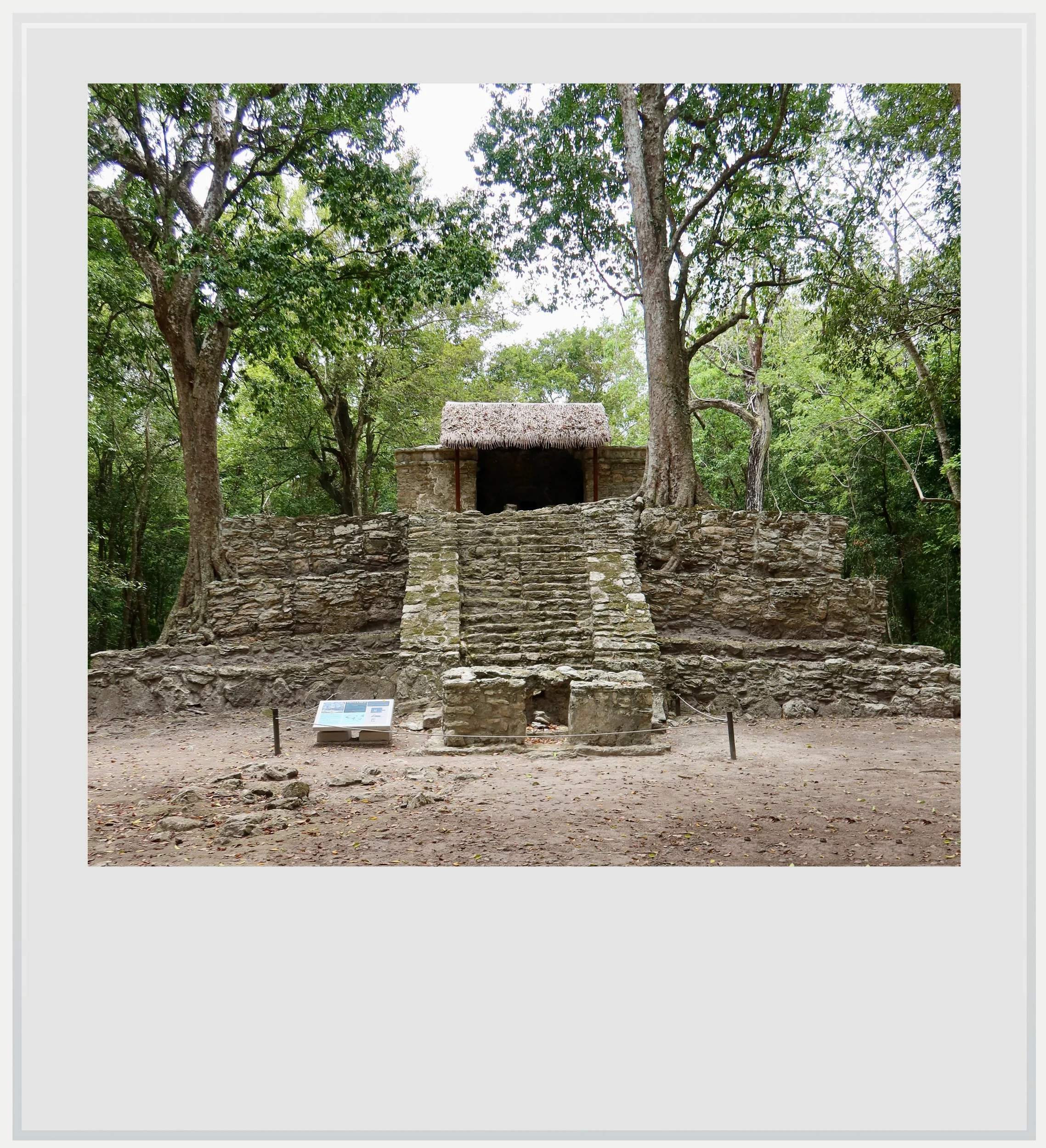
Temple 8 in the Pink Group.
Although the buildings are much less preserved than in the Entrance Group, it is believed that, in the Late Classic period (600–900 AD), this was the area considered the ceremonial heart of the city. Recent studies have suggested the destruction of some of the structures there may have been due to a conflict.
Continuing on the path, I entered a deeper, more silent part of the forest. The ground visibly rose by a few feet before I arrived at another group of buildings newly accessible to visitors: the Great Platform Group.
Recent archeological studies identify most of the buildings there as residential and administrative. Among the structures recently investigated there is a temazcal (an ancient sauna used for purification).
Next on the path was the Grupo Rosado, or Pink Group, dating to the Late Postclassic period (1300–1550 AD), a time of florescence on the eastern coast of Yucatan. Temple 8 immediately stood out: a pyramidal structure topped by a temple with clearly visible Costa Oriental elements.
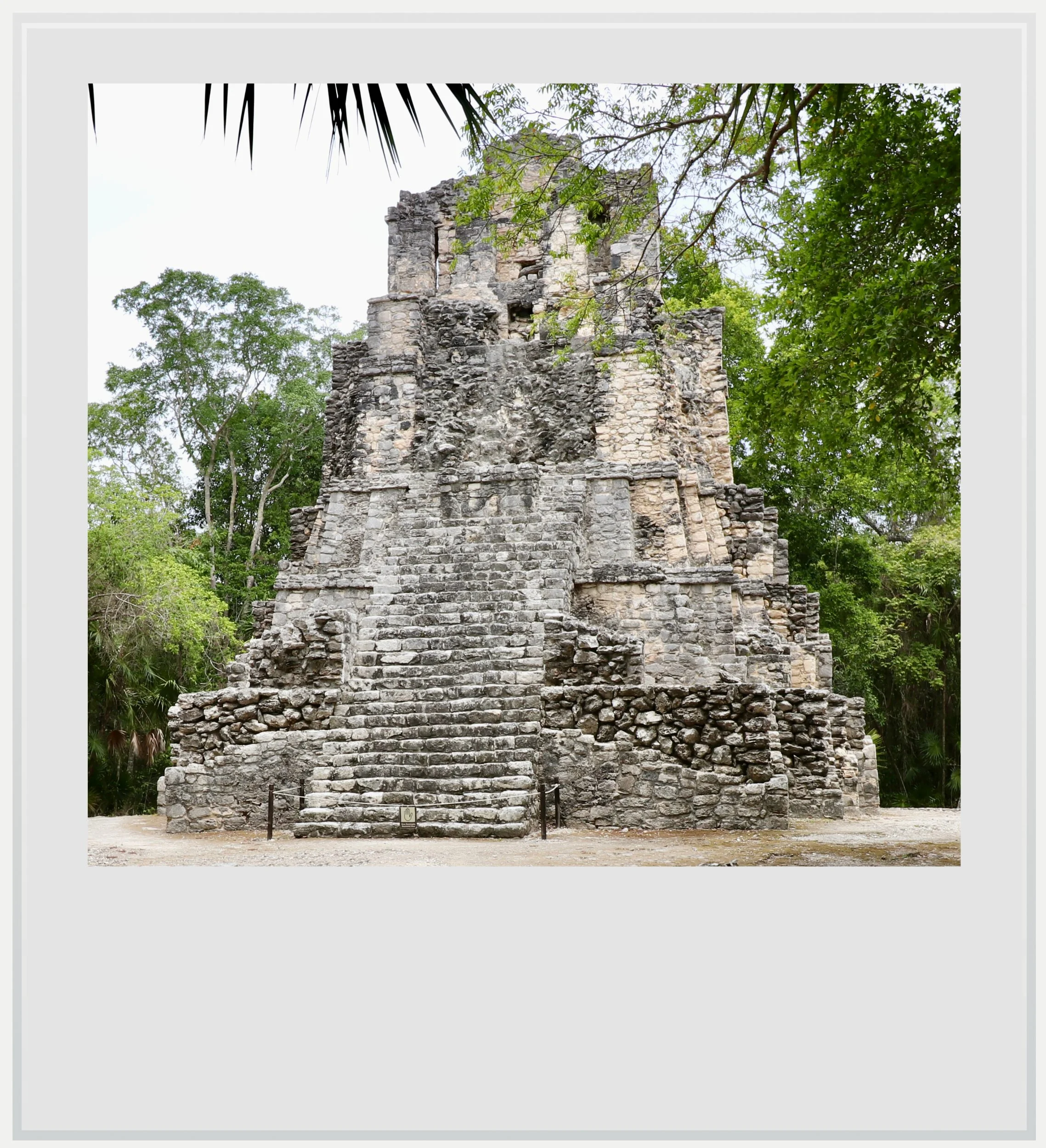
Muyil’s Castillo.
The site’s biggest visual surprise was next. I was about to reach El Castillo, Muyil’s most impressive building.
Having visited several sites with a castillo on the eastern Yucatan coast, I expected a similar shape: something close to Temple 8 in the Pink Group on a bigger scale. Instead, the structure in front of me looked nothing like it. Its presence was puzzling, until I remembered the beginning of my visit.
The Castillo at Muyil read like a smaller exercise in Peten architecture.
The Entrance Group had showcased buildings from different centuries standing close to each other, proof of Muyil’s long, continuous occupation. Here, the Castillo allowed me to visualize an earlier architectural tradition.
Initially built as a smaller, three-level pyramid, El Castillo was modified twice, each time adding a new, narrower pyramidal level. The latter modification also added a typical Costa Oriental temple at the top. Even with this change, the pyramid stayed visually faithful to its original Peten design.
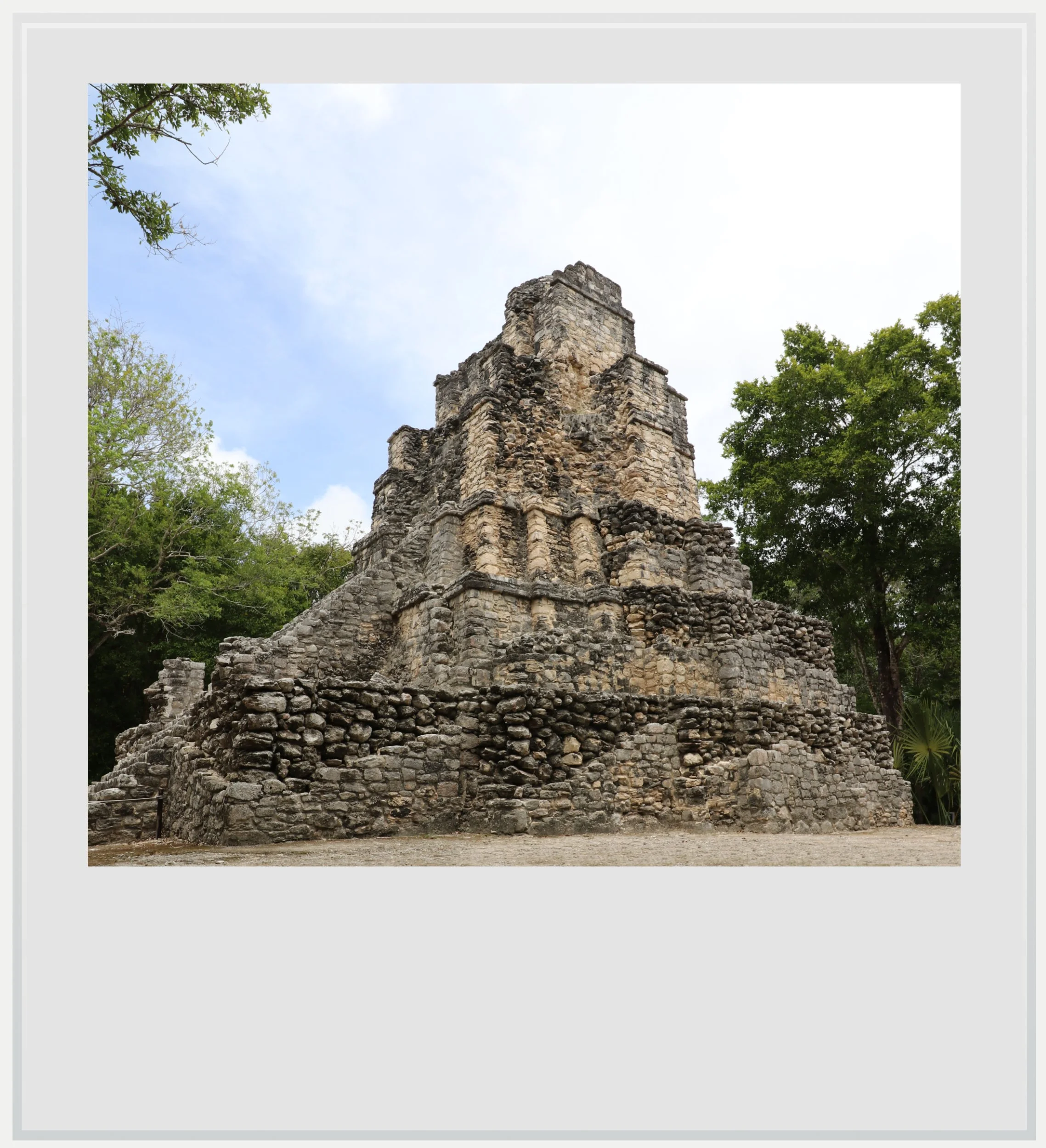
A side view of the Castillo.
Named after a region in Guatemala, Peten style is best represented by the great Maya capital of Tikal and its most famous structure, the Temple of the Great Jaguar. Peten temples were built to impress through vertical monumentality, with tall pyramidal basements, steep stairways and smaller temples at the top, accentuating the visual impact of the pyramid.
The Castillo at Muyil read like a smaller exercise in Peten architecture. While it may have been relatively small at 56 feet (17 meters), the building’s narrow shape was accentuated by the height of each individual pyramidal basement and the steepness of the stairways. This gave it a visual strength that commanded respect.

It was also the perfect distillation of what makes Muyil such an interesting site, a mix of a Peten-style pyramid topped by a Costa Oriental building, showing how successive architectural styles could blend in one stunning structure.
Four altars stood before the Castillo, while behind them a sacbe led back towards the site entrance. I thought my visit was over until I noticed a small sign in the opposite direction pointing toward the Muyil lagoon.
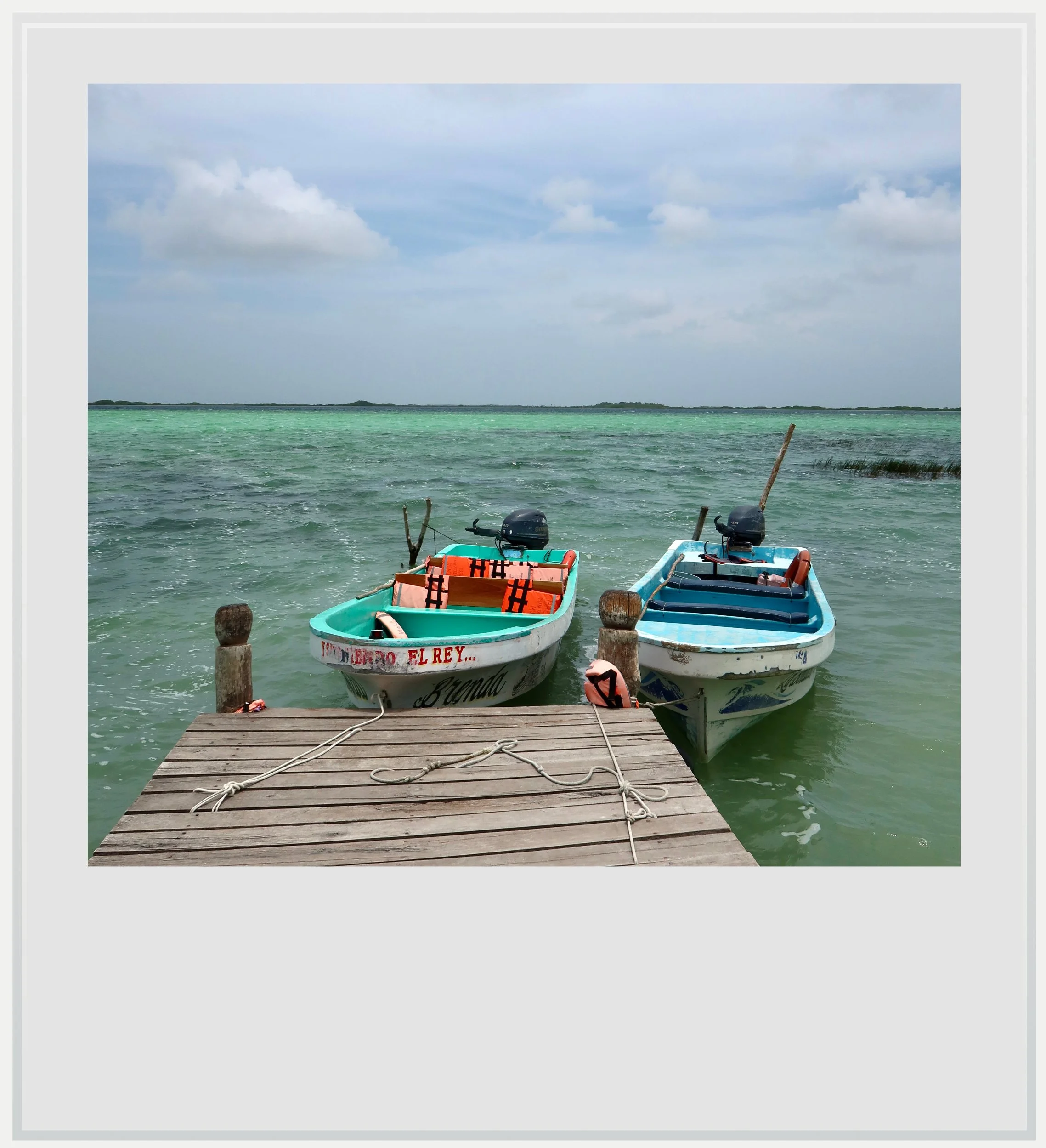
A pier on Muyil’s lagoon.
Technically outside the archeological zone, and subject to a modest entry fee, the walk to the lagoon followed a wooded path through dense tropical forest that, at times, felt oppressive. A few minutes later, I emerged from the forest and saw the lagoon open up ahead of me. Surprisingly, the area was rather busy with fishermen.
Beyond the lovely walk in the forest, seeing the Laguna de Muyil helped me fully understand why settlers had chosen this location to establish themselves. I knew the Muyil lagoon connected to another body of water and then to the Caribbean Sea through a system of navigable canals, allowing sea trade while making the site easier to defend. But until now, this geography had been entirely abstract: the dense tropical forest had hidden the water from view.
It was stunning to finally see with my own eyes how the topography contributed to Muyil’s prosperity as a city on water. I am glad I hiked to the lagoon: had I not seen it, my understanding of the settlement would have been incomplete.
I walked back towards the site entrance and got there much quicker than anticipated. The walk from the Castillo to the Entrance Group was short. I was thankful that the pathways through the site wound through the Sacbe and Platform groups before reaching the pyramid and the lagoon, gradually revealing the site.
I had left Xelha remembering its stunning Early Classic murals and later Costa Oriental structures. The walk through Muyil, by contrast, brought to life the experience of discovering many layers of Maya architecture one after the other.
Practical information
(Everything you need to know about visiting Muyil - updated September 2026)
In a nutshell
Muyil, sometimes also known as Chunyaxche, is a compact but unusually layered Maya site south of Tulum, where pyramidal monuments, later Costa Oriental temples and forest paths reveal different chapters of a city occupied for almost 1,800 years. A trail beyond El Castillo also leads to the lagoon system that once connected the settlement to the Caribbean.
Getting to Muyil
How to get to Muyil from the United States: Muyil, located 14 miles (23 km) southwest of Tulum on the main highway between Cancun and Chetumal, is easy to reach from the US. While the closest international airport, Tulum (TQO), is 15 minutes away by car, it only receives a few non-stop flights from the US per day (it is, however, the easiest option if flight times and prices work out). Cancun airport (CUN), 2h to the north, offers a lot more non-stop options from the US and Canada. On a typical day in November, 25 cities in the US and Canada have non-stop service to the famous Mexican resort.
How to get to Muyil from Mexico City: Mexico City to Cancun is one of the busiest air routes in Mexico, with more than 20 flights a day, while the Mexico City to Tulum route offers a few daily flights, depending on the season. Flights take approximately 2 hours.
How to get to Muyil from Cancun and Cancun airport: from the city, the Hotel Zone or the airport, follow directions for Chetumal or Playa del Carmen on the carretera Cancun-Chetumal (highway 307), and continue past Tulum until you see signs to the archeological zone, which sits on the left side of the highway going south (for clarity, the archeological zone is located before the turnoff towards Tulum airport). Google Maps directions are straightforward, and the site offers free parking. From the Cancun area, it should take around 2 hours depending on your starting point and traffic.
How to get to Muyil from Tulum: Muyil is fairly close to Tulum. Follow directions for Chetumal or Tulum airport on highway 307 and the ancient settlement of Muyil will be on your left, directly on the highway, in about 20 minutes.
How to get to Muyil from Tulum airport: Tulum airport is actually very close to Muyil. From the terminal to the parking lot, expect a quick 15-minute drive. Make a left towards Tulum on highway 307 and the archeological zone will be on your right a couple of miles later.
Can I visit Muyil on a tour: there are many options available, mostly from Tulum, the closest tourist base. Tours offering Muyil as a standalone outing are generally timed for a half day, while full-day tours usually include access to the Sian Ka’an biosphere. A lot of these are heavily marked up so if you have your own transport, that option will be more economical.
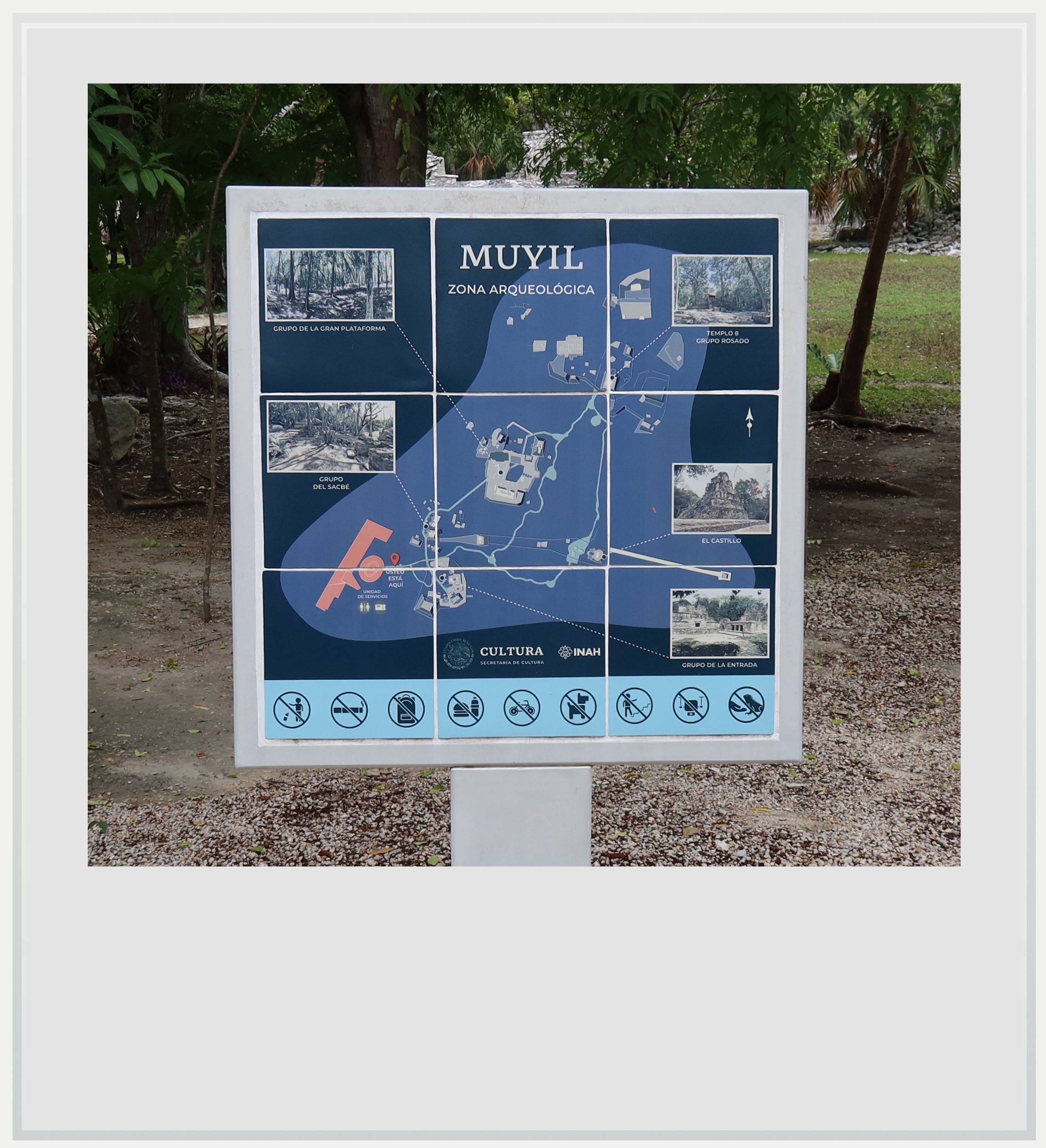
Muyil’s site map.
When to go to Muyil
Weather-wise, the best time to visit Muyil is the dry season, from November to April. This is also peak season but the site doesn’t see a lot of visitors, so it is unlikely to ever get crowded.
How much does it cost to visit Muyil
At the time of my visit, the entry price was MXN 145 for foreigners and MXN 80 for Mexican citizens and foreigners with residency in Mexico (with proof of residency).
How long should I plan to visit Muyil
Plan to spend 60-80 minutes there as the area is fairly big, and add another 30 minutes if you want to walk all the way to the Muyil lagoon (additional fee of MXN 50, cash only, entrance is signposted from the Castillo).
What are the opening hours of Muyil
The archeological zone is open every day from 8am to 5pm (last entry at 4.30pm).
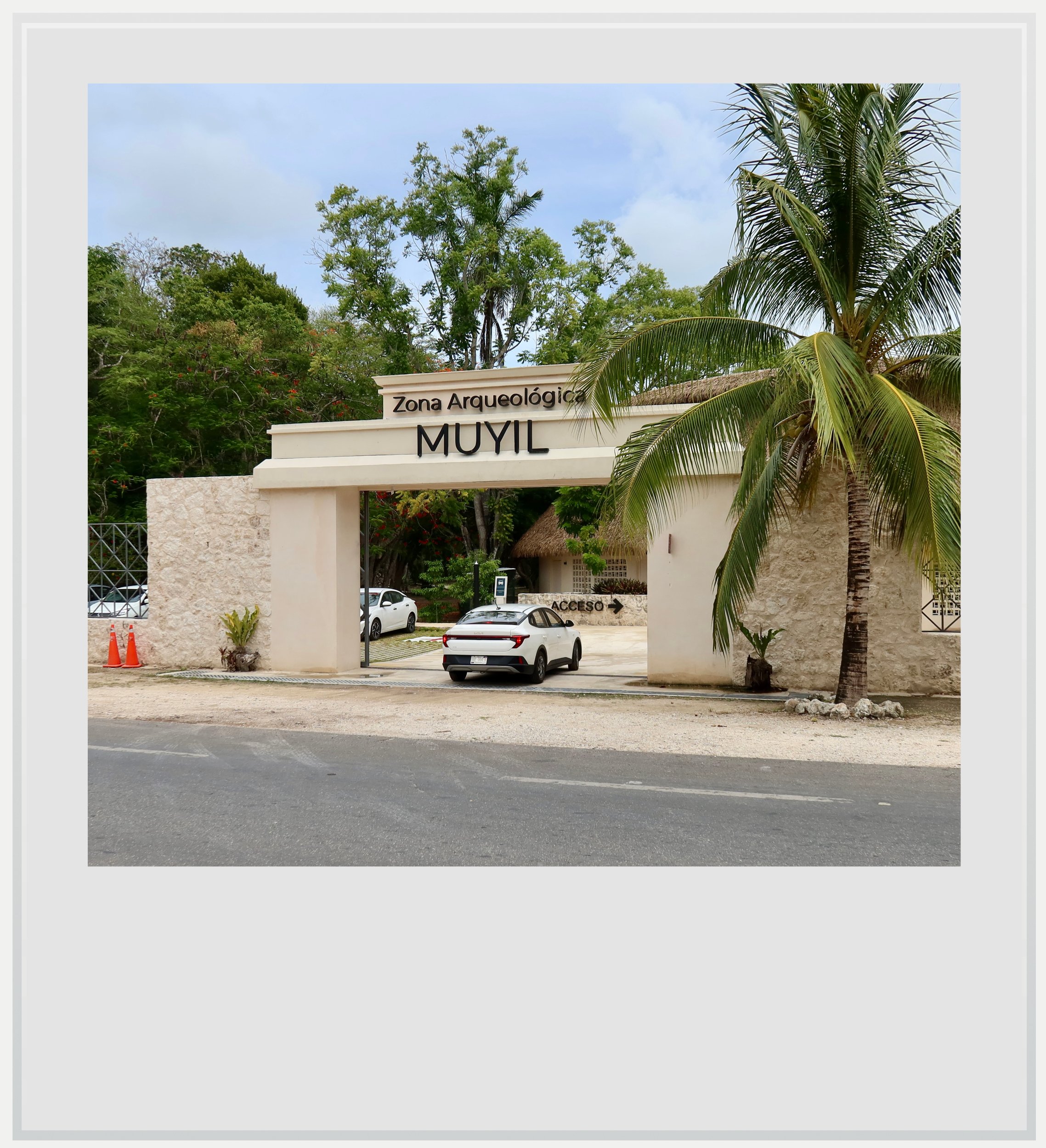
Muyil’s site entrance.
Safety at Muyil
The Yucatan peninsula is one of the safest areas in Mexico. The U.S. State Department currently classifies Quintana Roo as Level 2, meaning travelers should “exercise increased caution.” This is the same warning level as Mexico as a whole, and similar to the level assigned to several European countries such as France, Germany and Italy.
Quintana Roo, however, has been in the news because of a few highly publicized violent events in recent years, from a shooting at the Xcaret hotel in 2022 to the murder of a Canadian citizen in a Cancun gym in 2023.
In these highly publicized cases, it is understood tourists weren’t targeted and foreigners involved in these incidents had, according to Mexican authorities, links to organized crime. It would be misleading to describe Quintana Roo as free of violence. The risk, however, is generally localized and extremely unlikely to affect an ordinary trip to the state.
Muyil itself felt perfectly safe to visit. It sits beside the busy main road between Cancun and Chetumal and has an official INAH presence.
Keep in mind these travel tips
Sunscreen will be your best friend. The UV index may be lower in the morning and evening, but during the day, it gets pretty high.
Do not forget to hydrate. OXXO and GoMart convenience stores are ubiquitous in the area, and stock cold water and drinks. Make sure you always have water handy and drink regularly to make the heat more bearable.
Every photo caption appears when you hover over the image (on a computer) or click on it (on a smartphone).
All photos are mine and copyrighted.