Oxtankah, Mexico.

Overlooked by tourists, this Maya site near the bay of Chetumal feels like your own Indiana Jones adventure.
Looking for concrete details and tips? Go straight to the Practical Information section.
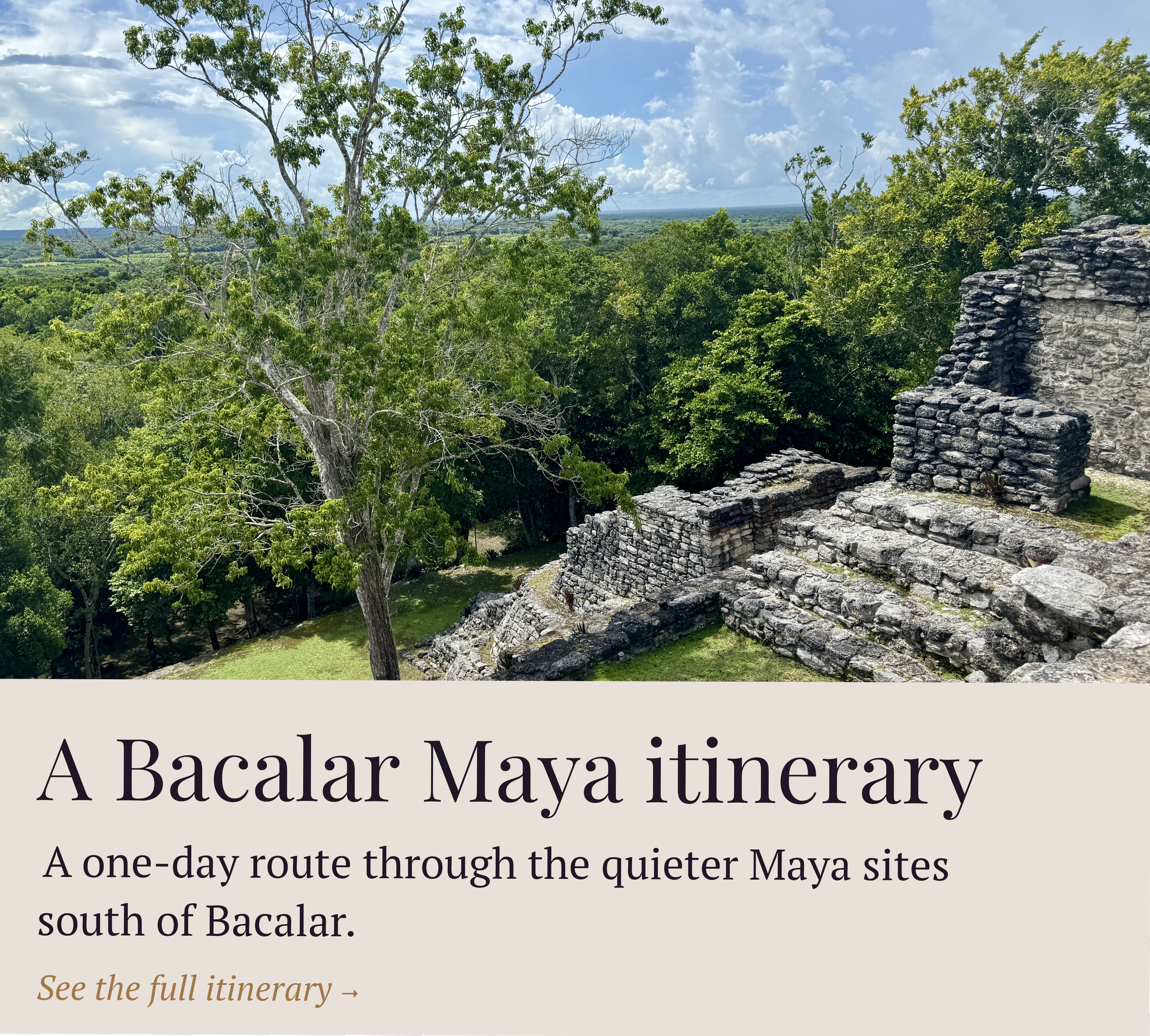
This article is part of a bigger trip through the seldom visited Mayan archeological sites of the southern Yucatan peninsula. See the full itinerary here. On the last day of my visit, I drove to the Mayan ruins of Oxtankah from Chetumal, after getting off the water taxi from Belize.
“Bienvenido” had said the stern Mexican immigration lady in the Chetumal ferry terminal, as she stamped an entry visa in my passport. I had left the country two days before, but my trip to Caye Caulker, Belize, had brought my stress level to new lows, and I was still somewhat in a state of dreamy daze.
It was my last day in Yucatán: I was going to catch a flight back to Mexico City in the afternoon, yet still had a few hours to kill around Chetumal. As luck would have it, there was one Maya site I hadn’t been able to visit in the days before my escapade to Belize, and I decided to check it out.
Oxtankah is one of the least visited archeological zones in the area. Located northeast of Chetumal, it suffers from its relative remoteness: if you’re based in Bacalar, like many tourists, there are closer sites to see, like Ichkabal, or sites that can be easily grouped as a day trip, like Dzibanché, Kinichná and Kohunlich.
Oxtankah, the lone site beyond Chetumal, is a destination in itself, and therefore, often overlooked. That was reason enough for me to want to see it for myself. I rented a car for the day in downtown Chetumal, and off I went.

One of the Maya pyramids in Oxtankah.
Chetumal is often referred to as Chetubar, for its lax drinking laws, but also, somewhat pejoratively, because locals say there is nothing else to do there but drink, drink and drink some more. I wasn’t about to find out, but I will say I found the capital of the Yucatán state to be more charming than bloggers give it credit for, especially on the Costera, the road hugging the coast, affording beautiful views of the bay.
Very soon, the wide avenue became a narrow street, and past Calderitas, a cute village where I would stop for lunch later, an even narrower road. The road to Oxtankah doesn’t technically go anywhere, stopped in its tracks by the bay to the north, and there was very little traffic on this tranquil October Tuesday.
Oxtankah is a destination in itself and therefore often overlooked.
I almost missed the turn off to the ruins, and got into an unpaved road flanked by two rows of trees, and very quickly parked by the visitor center. Like all other archeological zones in the area, this one had been recently spruced up with new amenities, in light of the Mexican government’s push to increase tourism in the region, with the arrival of the Maya train, whose closest station was located in Chetumal, right by the airport.
Oxtankah’s peak is believed to have happened in the early Classic Maya Period, from 200 to 600 CE. It was settled to help exploit the salt trade from the nearby bay of Chetumal and Caribbean Sea, an important source of commerce with inland cities like Dzibanché. It is, so far, the biggest site ever discovered on the bay of Chetumal, and must have been an important city, given the number of buildings scattered throughout the site.

The site map for Oxtankah.
First reported in 1912, the site was named Oxtankah, which, in modern Yucatec Maya, has two possible meanings: “Among three villages” or “Among the breadfruit trees”. The original Maya name is unknown. Serious archeological work on the site started in the 1990s, and is still ongoing.
Of the many plazas on the site, one of the biggest ones, the Plaza of the Bees, has been excavated and can be visited. It measures 330x200 feet (100x60 meters). Erected in the Early Classic Period, it is surrounded by six buildings, most of which had a residential function, and one of them being an altar. I especially appreciated that, on this site, 3D-renderings of how we believe the plazas looked like back in the day are shown alongside historical context, to help us imagine how the Mayas used to live.
Many others plazas are left to be discovered, as the map above attests.
There is one aspect of Oxtankah that made it stand out form other Southern Yucatán sites: its open-air chapel, which was built by the Spaniards in the middle of the 16th century with stones taken from some of the Maya buildings nearby, as was customary back then.
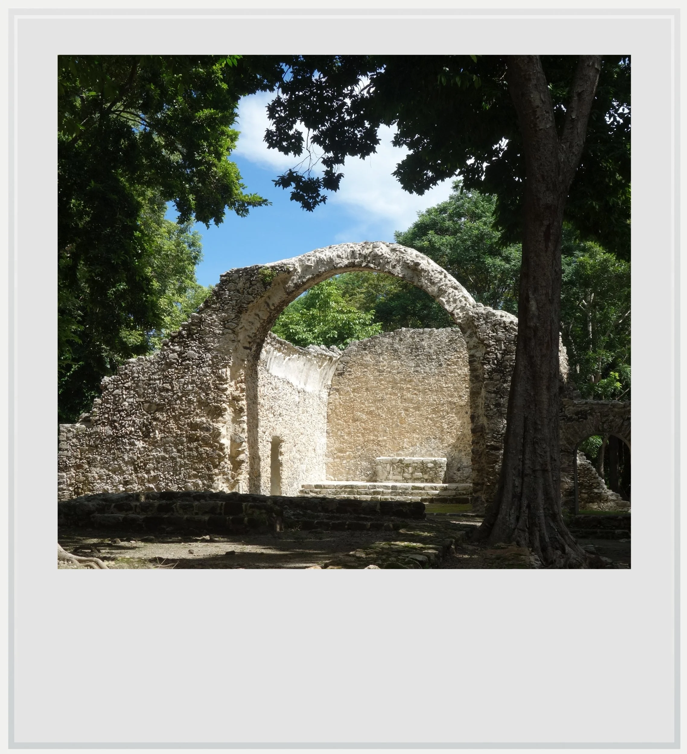
The Catholic chapel in Oxtankah.
Visiting Oxtankah can be a bit disappointing visually, as the site doesn’t feature any gigantic building like Dzibanché or Ichkabal. Do not get fooled by some of the Google image searches that showcase pyramids that are not found on the site. Instead, enjoy Oxtankah for its serene surroundings, and the magic feeling of walking in a jungle full of ruins. To me, more than any other site except maybe Calakmul, it felt like I was the first one stumbling onto the site, still hidden under a thick canopy of trees. It helped that I was the only visitor present for most of my visit - a Mexican couple joined me a bit later.

Practical information
(all you need to know about Oxtankah - updated as of November 2025)
In a nutshell
Isolated and harder to get to than other sites closer to Chetumal, Oxtankah is still worth a look for its ruins-amidst-the jungle vibe that will make you feel like an early 19th century explorer stumbling upon a hidden Maya site.
Entrance fee: MXN75 at time of writing
Opening hours: 8am to 5pm (last entry at 4pm)
Visit should last forty-five minutes to an hour.
Travel time is 65 minutes from Bacalar and 30 from Chetumal.

The turn off to Oxtankah coming from Chetumal.
Getting to Oxtankah
How to get to Oxtankah from the United States: this Maya site is located in southern Quintana Roo, Mexico, about 30 minutes from Chetumal and 1h from Bacalar. Assuming the site visit is part of a broader Yucatán itinerary, the closest airport to Oxtankah is Chetumal (CTM). It has no direct flights to and from the US, making a connection in Mexico City (MEX) indispensable. A rental car is most appropriate and can be picked up at the airport. Getting to archeological zones can be done easily with an organized tour, and most leave from either Chetumal or Bacalar, but any other mode of transportation will be complicated (regular buses do not serve the archeological zones, and a taxi, unless rented for the day, may not make sense).
Another option could be to fly into Tulum (TQO), if planning a trip spanning more of the Yucatán peninsula, as US and Canadian airlines fly non-stop to the new Tulum airport, but travel time from TQO to Oxtankah lasts almost 3h30. This option works more easily with a rental car, and makes sense if you’re planning to make your way to Bacalar or Chetumal before getting to Oxtankah.
How to get to Oxtankah from Mexico City: the best way to reach Oxtankah is to fly into Chetumal airport (CTM), from Mexico City’s main airport (MEX) or its secondary airport (NLU). Aeromexico, VivaAerobus and Volaris operate once a day between MEX and CTM while Mexicana and Viva fly several days a week from NLU to CTM, with one-way base prices starting around USD75. Car rentals are widely available at Chetumal airport, from a variety of Mexican and international companies. Oxtankah is 30mn away, driving mostly along the beautiful Costera road in Chetumal, and passing the town of Calderitas, where lunch options are available. As mentioned above, you other bet is to book a tour from Chetumal or Bacalar if you’re based there, but no colectivos or regular bus service will drop you at the ruins.
Can I visit more Maya sites than Oxtankah in a day?
Yes, you can and you absolutely should, although Oxtankah is probably the most out of the way of the sites around Bacalar, and the only one past Chetumal - others are easier to group together in a day trip, like Dzibanché, Kinichná and Kohunlich. Read about the best day trip to Maya sites near Bacalar here.

The Oxtankah visitor center.
Cost of entry to Oxtankah
The entrance fee was set at MXN75 at time of writing.
Opening times of Oxtankah
The archeological zone is open every day from 8am to 5pm, with the last entry allowed at 4pm.
When to go to Oxtankah
The best months weather-wise to enjoy the southern Yucatán region as a whole are during the dry season, between December and April, with January and February the (relatively) coolest months. This is also peak season so the sites may be a little crowded, but this is all relative. Oxtankah is very easily reached from Chetumal, yet it didn’t feel any more crowded than any other site in the region. On the day of my visit, there were 2 people on-site with me - it felt completely empty, to be honest.
I traveled to southern Yucatán in October, which is low season, as the combination of possible afternoon showers and intense heat can turn off travelers. I loved the lack of crowds, and the slightly overcast weather which made the heat more tolerable. Yes, it rained almost every day around 5pm for a few minutes to a couple of hours, but it was all pretty manageable.
Safety in Oxtankah
The Yucatán peninsula is one of the safest areas in Mexico, and Quintana Roo is considered fairly safe: it is labeled a level 2 “Exercise Increased Caution” state, just like Mexico City, or the UK as a whole. Digging deeper, busy cities like Cancún are more likely to be where crime happens, and the advisory shouldn’t, in theory, apply to the sleepy southern region. As such, it is not an area of Mexico where you would have to be a fairly experienced traveler to feel safe. As everywhere else in the country, keep in mind the following: know where you’re going, keep your wits about you, do not flash expensive clothes or phones, don’t do things you shouldn’t do, stay in touristy areas, avoid walking at night.
Food & lodging in Oxtankah
Hotels
There isn’t accommodation near the site, but Chetumal is close by (a 30-minute drive) and Bacalar, the one place I would recommend to picking as a base, only 1h away. Both towns offer plenty of hotels and Bnb options. I stayed at AmarBacalar, a lodging available on AirBnb, located in the northern part of the city, away from the most touristy area. I loved the clean room design and the effort made on landscaping - it felt like I was living in a well-maintained jungle.
Restaurants
There is no food available in Oxtankah, however there are a bunch of nice restaurants in the town just south of the ruins, Calderitas, some of them right on the water. Food options also available in Chetumal, further south.
I ate lunch at las Olas del Mar, on the recommendation of locals, and was happy with my seafood meal, eaten in full view of the bay of Chetumal and its clear waters. The restaurant is located on a plaza with ample parking, along with other restaurants, so I was spoiled for choice.
Keep in mind these travel tips
The Yucatán peninsula is one of the safest regions in Mexico, and its main roads are well maintained. This isn’t enough to forget the #1 driving advice in Mexico: do not drive at night. Driving at night, on poorly lit roads means you won’t see the motorcycles without lights, the potholes and the ubiquitous topes, these notoriously hard speed bumps that spring out of nowhere. You may encounter wildlife or, more prosaically street dogs crossing right in front of you (especially in Bacalar, where there are many). Plan your itinerary to be at your next destination before night fall. It’s important.
No matter the season, there will be bugs in Yucatán. While you may only see the gigantic Tarántula Yucateca spider on the roads leading to Calakmul, you’ll find mosquitoes pretty much everywhere, and especially in the shaded forests surrounding the Maya ruins. Be ready with repellent at any time of the day. It’s also a good idea to wear clothes that cover your limbs (pants, high socks, long sleeve t-shirts) while you’re in the jungle. Mosquito-borne diseases are fairly uncommon in the state of Quintana Roo, but not unheard of.
SPF will be your best friend. The UV index may be low in the morning and evening, but during the day, it gets pretty high.
Do not forget to hydrate. While OXXOs aren’t as ubiquitous in this rural region as in other ones, you’ll find plenty of abarrotes, these tiny stores selling cold water and sodas along the way (the last of which would be in the village of Calderitas in this specific instance). Make sure you always have water handy and drink to make the heat more bearable.
Cell service isn’t the best near Oxtankah, Telcel is the only provider with decent service in the broader region. If you’re roaming, check that you can roam on Telcel, or investigate a Mexican eSIM that uses this network. If not, think about downloading maps for offline use, it may prove very useful.
Every photo caption appears if you hover over it (on a computer) or click on it (on a smartphone).
All photos are mine and copyrighted.